
Where Flight Simulation Enthusiasts Gather from Around the World!
AVSIM Library - Search Results

| Category: Flight Simulator 2004 - Scenery | |
| Aitutaki Airport, Cook Islands NCAI |

|
File Description:
Welcome to Aitutaki Airport, in the beautiful Pacific Island paradise of the Cook Islands. The Cook Islands domestic air carrier is Air Rarotonga, serving all the islands in the group using Embraer EMB110 "Bandeirante" and Saab-340 aircraft. This scenery is designed and built to fit the RBE / Sim Pilot Experience "Cook Islands Scenery" (payware), by Christian Stock. It has not been tested in the freeware Cook Islands Mesh that is available, or in FS9 default. Requires some EZ Scenery Object Sets (see INSTALL instructions for details).
| Filename: | Aitutaki_Airport_Cook_Islands__NCAI.zip |
| License: | Freeware, limited distribution |
| Added: | 26th February 2009, 13:02:34 |
| Downloads: | 1,153 |
| Author: | Lawrie Roache |
| Size: | 1.7 MB |
| Category: Flight Simulator 2004 - Scenery | |
| San Antonio International Airport 'KSAT' |
|
File Description:
This scenery is built for FS2004. This scenery was created with Abacus EZ Scenery, but you do not need the EZS libraries. On the contrary you will need the RWY12 libraries installed. I have added a terminal replacement, airport vehicles, parking spots, GA hangars, and lights. The gates are designed for certain size planes. The gates are assigned as the airport's website (http://www.sanantonio.gov/aviation/) indicates. I used Google Earth Imagery to very accurately place the gates.
| Filename: | San_Antonio_International_Airport_KSAT.zip |
| License: | Freeware |
| Added: | 1st March 2007, 23:34:29 |
| Downloads: | 3,935 |
| Author: | Brandon DePalo / Watsup Sceneries |
| Size: | 2.25 MB |
| Category: Flight Simulator 2004 - Scenery Design | |
| Custom Buildings 2 for EZ-Scenery |
|
File Description:
FS9 custom buildings are scattered throughout various object libraries that are associated with specific cities. (For example Scenery/Namw/scenery/seattl.bgl.) These are most of the custom objects I could find in the Eure, Eurw and Asia scenery files. Almost all the objects in this library are either airport buildings (mostly hangers) or city buildings (offices, hotels, etc.) I labeled them AB and CB, respectively. A few of the buildings are specifically identified, including a fire station, two Martinair buildings and one Air France building.
| Filename: | Custom_Buildings_2_for_EZScenery.zip |
| License: | Freeware |
| Added: | 20th January 2006, 04:33:41 |
| Downloads: | 15,746 |
| Author: | Sidney Schwartz |
| Size: | 4.25 MB |
| Category: Flight Simulator X - Scenery | |
| 2016 Kigali Intl (HRYR) Rwanda |
|
Images related to this file:
File Description:
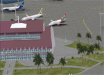
This sequel to the 2009 Kigali Intl (HRYR) Rwanda scenery (by Jacques Botha and Frits Beyer) brings it up to date with the current layout and enables full compliance with FTX Global/Vector and FSX. Buildings are added and adjusted to their real-world locations, and the new taxiway and south apron are added according to the May 2016 satellite imagery. In addition to real-world gate locations, custom apron markings are added along with apron lighting. The landclass around Kigali is also updated, and SRTMGL1 (30m) mesh is included. This scenery can be complemented by the Goma (FZNA) and Gisenyi (HRYG) scenery (FSX_FZNA-HRYG_CS.zip), and GA flightplans are included to supplement the commercial traffic at Kigali and provide more activity at FZNA and HRYG.
Updates were created or rebuilt in a manner which carefully aligns airport data with current satellite imagery. Scenery was created using Airport Design Editor X v1.70.6042, SBuilderX 3.13, and the FSX Object Placement Tool. Scenery objects were added and modified from stock FSX scenery to resemble as closely as possible the actual airports. The FSX apron lights included are from the set created by Jim Dhaenens.
| Filename: | 2016_Kigali_Intl_HRYR_Rwanda.zip |
| License: | Freeware |
| Added: | 4th August 2016, 21:10:09 |
| Downloads: | 3,385 |
| Author: | Carlyle Sharpe, Jacques Botha, and Frits Beyer |
| Size: | 17.12 MB |
| Category: Flight Simulator X - Scenery | |
| LGSK - Skiathos Airport, Greece |
|
Images related to this file:
File Description:
LGSK Skiathos Airport Greece.
Skiathos Island lies off the east coast of mainland Greece and is often referred to as 'Europe's St. Maarten' with landing aircraft skimming the beach and the nearby harbour. At 5341feet the runway is short and narrow and usually only captains are allowed to perform landings. Seasonal taffic includes Munich, Gatwick, Rome, Oslo and Stockholm, with scheduled flights to Athens.
This scenery has been designed to sit on the excellent photoreal scenery by Angelo Tassoglou, available here on Avsim, just search for 'Skiathos.zip'. Please note, it will not work with the default terrain. It also uses many objects from my LGKF Kefallinia scenery, also available here at Avsim.
The scenery features added vegetation, detailed airport buildings based on real photographs, animated windsocks, flags, road traffic, people, trees, waves, birds and air traffic. All the scenery files have been divided so they can be switched on or off according to user preference. It has been designed for and tested in DX9 and FSXA only.
Please enjoy and I hope you like my scenery as much as I enjoyed building it.
Required files:
skiathos.zip by Angelo Tassoglou
LGKF Kefallinia by George Keogh
| Filename: | LGSK__Skiathos_Airport_Greece.zip |
| License: | Freeware, limited distribution |
| Added: | 28th January 2013, 00:13:54 |
| Downloads: | 16,018 |
| Author: | George Keogh |
| Size: | 20.47 MB |
| Category: Flight Simulator X - Scenery Design | |
| (Version 2.0) KEFD -Ellington 2025 Refresh FSX (Circa 2006-2010)- Johnson Space Center Houston |
|
Images related to this file:
File Description:
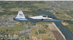
Version 2.0 covers landclass across the entire greater Houston area, with a large increase in LOD. This version significantly tightens up and improves the landclass from version 1.0, and adds a vast amount of scenery objects that brings the Bay Area-KEFD area into the modern era. This improves and adds a highly accurate runway 17 approach with accurate placement of buildings and scenery around the year 2011-modern day. In addition, includes several new files including a new airport/helipad via Houston Clear lake regional airport, T41 La Porte Municipal and surrounding shipping ports, Kemah Boardwalk, and a giant improvement to Johnson Space Center Houston. Rundway 35 and Runway 22 landclass is significantly increased, and more accurate as well. You can fly an accurate VFR approach or set up an ILS for any one of KEFD's runways with ease with this improvement.List of Version 2.0 additions and changes: - I added a ton of scenery objects and tightened up the landclass at Johnson Space Center Houston- NASA Control Center--- Added Talon Park with T38s (via static objects)--- Added Gemeni V rocket and 747 for the shuttle transporter--- And a whole bunch of vegetation, new buildings, and tour buses.- Added Kemah boardwalk and several boat docks- Removed a TON of highrise textures and replaced with medium and large city suburb landclass.- Added Clear Lake regional Hospital with helipad and surrounding scenery by Walter Reed Park- Added El Jardin or "Bayport Container port" with several scenery objects and significantly tightened up landclass.-- Looks great when setting up ILS approach for RWY 22- Tightened up Bay Area BLVD landclass, "adding" University of Houston Clear Lake"-- UHCL was semi already present, just made it more pronounced.- Made Red Bluff road landclass super recognizable!-- Red Bluff road is used to set up VFR approach and or field break for RWY 22 and RWY 17 R.----- Its common to see private jets and the USAF doing a break along Red Bluff road.- Added First Baptist Church, and water tower to Pasadena Convention center- Made Fairmont Parkway pronounced with landclass- Added Houston Port Authority at Morgan's Point--- Another Landmark for the RWY 22 ILS approach, NASA religiously uses this to line up the 10 mile ILS.- Tightened up landclass at Village Grove East and along Fairmont Parkway- Added a TON of scenery objects and landclass corrections for approach of RWY 17 L and 17 R.---- Added Home Depot, Lowes, Walmart Super center, Guitar center etc.---- added South Main Baptist Church--- Bondy Jr High, Turner Elementary, and Pasadena Memorial High School--- Added Saint Luke's Hospital--- Added Hampton Inn Suites and HCA rehab hospital--- Added a ton to the container facility behind best buy and storage facility--- Added smaller churches on RWY 17 approach--- Added a ton of scenery at the base of RWY 17 R, i.e., concrete plant, containers, trucks-- Added gas stations on the corner of beltway 8 and genoa red bluff-- Significantly changed and tightened up landclass at the base of RWY 22 and RWY 17 L and 17 R-- Made several roads and Beltway pronounced------ This decision looks AWESOME at night, really adds demarcation to the roads.**All of this makes the RWY 17 approach super recognizable** RWY 22 approach landclass is much more accurate.- Significantly changed and tightened up landclass near southbelt ellington and interstate 45.- Added Grace Church-- I wanted to do San Jacinto College south, but seemed over kill at that point.- SIGNIFICANTLY tightened up landclass for RWY 35 approach and near baybrook mall.-- Along I45- Added TDECU stadium at the University of Houston Main Campus---- So you can practice flybys for Cougar games!- Added the Battleship at San Jacinto Monument- I also "borrowed" T41 La Porte Municipal's tower camera to make a SWEET view of KEFD.- I included landclass for Sealy Texas this time, as well as my significant enhancements of Austin, Texas greater area as well (optional, but recommended!)---------------------------------------------------------------------------Version 1.0 originally added:- Added the Johnson Space Center Houston, which is now greatly enhanced and blended.- San Jacinto Community College-Central- Pasadena Convention Center- Pasadena Water Treatment Facility- NASA Bouncy Lab- Pasadena Shopping center, now greatly enhanced and blended.- Baybrook Mall and other shopping spots.- Significant Landclass improvements across the entire greater Houston Area File also includes landclass and scenery improvements for the greater Austin, Texas Area (optional), KIAH, KDWH, and Sealy, Texas. Each of these projects combined covers roughly 15,000 square miles of landclass improvement. Allowing you to fly entirely from Houston to Austin, or Houston to San Antonio in accurate landclass. -Enjoy!DJN
| Filename: | Version_20_KEFD_Ellington_2025_Refresh_FSX_Circa_2.zip |
| License: | Freeware |
| Added: | 12th October 2025, 16:15:47 |
| Downloads: | 70 |
| Author: | Dan Nelson |
| Size: | 277.28 MB |
| Category: Flight Simulator 2004 - Scenery | |
| ISD LIML - Milano Linate - Update 2009 |
|
File Description:
Right ILS frequency (109.55) and identifier (ILNT), new AFCAD for a better parkings positioning, stopbars T4, E1, B1, D1, F1, updated vertical and horizontal parkings/taxiways/holding point signs, right runway designators signs 36/18 35/17 instead of 36R/18L 36L/18R, added taxiway closed signs on "H".
| Filename: | ISD_LIML__Milano_Linate__Update_2009.zip |
| License: | Freeware |
| Added: | 27th April 2010, 03:24:14 |
| Downloads: | 8,996 |
| Author: | Simone Simone |
| Size: | 442.49 KB |
| Category: Flight Simulator X - Scenery | |
| Henry's Lake U53, Idaho High Detail |
|
Images related to this file:
File Description:
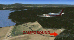
Just west over the mountain from
KWYS Yellowstone.The added detail
covers 25 sq mi of Henry's
Lake area. Added ATIS, ILS and
special bad weather instructions
for approach.Campgrounds,
campers, fishing in streams,
many things to look for as you
fly or boat around this lake.
jimmy R martin
| Filename: | Henrys_Lake_U53_Idaho_High_Detail.zip |
| License: | Freeware |
| Added: | 12th July 2010, 00:35:50 |
| Downloads: | 708 |
| Author: | jimmy R martin |
| Size: | 1.55 MB |
| Category: Flight Simulator 2002 - Utilities | |
| EasyNavs 2000/2002 version 4.00 |
|
File Description:
Extract and edit ILS, VOR, NDB and markers from FS2000 and FS2002 BGL files.
Compile navaids databases to stand-alone BGL's.
New 4.00 version (FS2002 and Windows XP compatible).
Runway information module included.
Requires VB5 runtime files and Adobe Acrobat reader to read and print the enclosd pdf documentation.
| Filename: | EasyNavs_20002002_version_400.zip |
| License: | Freeware, limited distribution |
| Added: | 6th July 2002, 14:12:04 |
| Downloads: | 4,423 |
| Author: | Hervé Sors |
| Size: | 264.25 KB |
| Category: Flight Simulator 2002 - Adventures | |
| IFR Adventure - Approach to EHAM RWY 19R |
|
File Description:
Real ATC adventure of an approach to
Schiphol RWY 19R, recorded by ATC
enthusiast Mark van Kimmanaede. Flight
begins over the NICKY VOR and you can expect
vectors for a right-circuit, RWY19R ILS
approach. Re-release of the FS2000
version (klm19302.zip) By fsadventures.net
team member Fermin Fernandez.
| Filename: | IFR_Adventure__Approach_to_EHAM_RWY_19R.zip |
| License: | Freeware, limited distribution |
| Added: | 19th May 2003, 02:33:12 |
| Downloads: | 2,300 |
| Author: | Fermin Fernandez |
| Size: | 2.39 MB |


© 2001-2026 AVSIM Online
All Rights Reserved
Privacy Policy |