
Where Flight Simulation Enthusiasts Gather from Around the World!
AVSIM Library - Search Results

| Category: Flight Simulator 2004 - Flight Plans | |
| RTW-K4-06 |

|
File Description:
An FS2K4 GPS flight and plan by the Ancient Brit and the RTW-K4 Team for the FS2K4 default aircraft (B737-400) and scenery. Depart Leirin (ENFB), runway 15, Fagerness, Norway and arrive 1 hour 9 minutes later at Lista (ENLI) runway 14, Lista, Norway. The plan is fully flight briefed with Word and text briefings and kneeboard in-flight briefing. A start-up flight that loads the plan, weather and kneeboard flight briefing is included; also a short Finals tryout flight is included. The flight goes over mountains before descending to 500 ft for a trip along a fjord. It then climbs to approach level for an ILS finals.
| Filename: | RTWK406.zip |
| License: | Freeware |
| Added: | 11th October 2003, 02:12:15 |
| Downloads: | 724 |
| Author: | Denis Egan |
| Size: | 98.44 KB |
| Category: Flight Simulator 2004 - Miscellaneous Files | |
| Active APProach - EHAM (Amsterdam - Schiphol Airport) |
|
File Description:
This file is for any 3rd party payware or freeware scenery that renumbered the runways at EHAM. The EHAM_APP_3rd bgl file list all ILS runways correctly (no blanks) within the ATC menu. Included are all the Waypoints for making 18R/36L a Precision Instrument Runway both VMC and IMC. The file also renames runways 01 Left and Right, 19 Left and Right to the current 18L/36R, 18C/36C so ATC and ATIS will use the right voice verbage for these runways. Each STAR is represented (ARTIP, RIVER, SUGOL) and can be flown with or without the default ATC. See the readme for all the details.
| Filename: | Active_APProach__EHAM_Amsterdam__Schiphol_Airport.zip |
| License: | Freeware, limited distribution |
| Added: | 12th September 2006, 02:32:38 |
| Downloads: | 3,580 |
| Author: | Jim Vile |
| Size: | 8.45 KB |
| Category: Flight Simulator X - Scenery | |
| MYAM - Marsh Harbour, Andros, The Bahamas |
|
Images related to this file:
File Description:

Marsh Harbour is the third busiest airport in the Bahamas, and now has a new runway, a new terminal, and the addition of a control tower and fire station. Completion of scenery for Marsh Harbour has been delayed since beginning work on the Bahamas' airports due to construction and a long delay in opening the new facilities, which occurred on May 27, 2014. There are currently no plans for opening the control tower, and it is not operational in this scenery. The scenery includes custom scenery objects, placement of library objects and landclass changes. Scenery is based on Google Earth and photos taken locally, and it is optimized for use with UTX-TAC. Some scenery details have changed from what is shown in screenshots included with the installation package.
| Filename: | MYAM__Marsh_Harbour_Andros_The_Bahamas.zip |
| License: | Freeware |
| Added: | 28th June 2014, 05:54:38 |
| Downloads: | 890 |
| Author: | Art Poole |
| Size: | 2.5 MB |
| Category: Flight Simulator X - Scenery | |
| USCG Air Station Sitka PASI Scenery Package with AI Aircraft |
|
Images related to this file:
File Description:

Thanks to Airport Design Editor(ADE), Military AI Works (MAIW) scenery and aircraft, along with AI Flight Planner3 (AIFP3), I did my best to re-create USCG Air Station Sitka for FSX. Creating this airport scenery (along with Kodiak PADQ) was my first attempt at a BIG (for me) scenery project in ADE, but thanks to MAIW and their Global Scenery Library Objects, I think I've succeeded in re-creating the airbase. You'll need to go to MAIW's website and download that "Global Scenery" file for any of this to work, so I've copied that website link below (in STEP 1). I also added Sitka markings to all the AI helicopters for added realism.
And just for fun, I placed a USCG Cutter and a "fishing boat in distress" (complete with green smoke) out in the harbor as a "Practice Rescue Scenario". The Cutter has a "hard deck" to land on and I've also illuminated both it and the Fishing boat for DUSK and NIGHT practice.
*SPECIAL NOTE* THE AI C-130 in the pictures is from my Kodiak scenery package, there are only Helicopters based at Sitka...but I have it "fly in" from my Kodiak scenery package. So if you're interested in that, you can find the "USGC Air Station Kodiak AK PADQ Scenery Package with AI Aircraft" on AVSIM as well.
| Filename: | USCG_Air_Station_Sitka_PASI_Scenery_Package_with_A.zip |
| License: | Freeware |
| Added: | 31st January 2021, 06:43:13 |
| Downloads: | 1,089 |
| Author: | Daniel W Gregory |
| Size: | 16.58 MB |
| Category: Flight Simulator 2004 - Scenery | |
| Lanseria International Airport (FALA), Johannesburg, South Africa |
|
Images related to this file:
File Description:
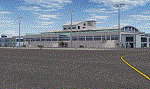
Lanseria international airport is Johannesburg's second international airport and mostly cater to private jets, low cost airlines and many private general aviation and flightschool aircraft. It is a privately owned airport and can accomodate aircraft up to the size of a Boeing 757-300. This airport has seen John Travolta use it with his Boeing 707, the Hilton family with a private Boeing 757 and even the USAF have landed their C-17 Globemasters at the airport when Air Force one came here in the past with the latter landing at AFB Waterkloof.
This package started out as a conversion of the wonderfull FSX scenery of the airport by Lee Hall and converted with permission from the original author. It quickly expanded however to a project that now additionally includes photoreal ground textures that changes with seasons, many added fences and gates around the airport, inclusion of the shaded parking areas with parked cars, static airplanes (RWY12 and EZ scenery libraries needed to see this) as well as numerous objects around the airport and apron made by myself in Gmax to give the airport some FS9 life.
Also included is the wonderfull "apron light splashes" by Hans Günther Schnell who kindly gave me permission to use it for the night times.
I have also included a local mesh for the area for users of FSGlobal 2010 to eliminate the extreme elevation anomoly around the airport.
| Filename: | Lanseria_International_Airport_FALA_Johannesburg_S.zip |
| License: | Freeware, limited distribution |
| Added: | 11th August 2023, 16:03:37 |
| Downloads: | 277 |
| Author: | Kobus van Wyk, Lee Hall |
| Size: | 37.64 MB |
| Category: Flight Simulator X - Scenery Design | |
| (Version 2.0) KEFD -Ellington 2025 Refresh FSX (Circa 2006-2010)- Johnson Space Center Houston |
|
Images related to this file:
File Description:
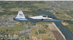
Version 2.0 covers landclass across the entire greater Houston area, with a large increase in LOD. This version significantly tightens up and improves the landclass from version 1.0, and adds a vast amount of scenery objects that brings the Bay Area-KEFD area into the modern era. This improves and adds a highly accurate runway 17 approach with accurate placement of buildings and scenery around the year 2011-modern day. In addition, includes several new files including a new airport/helipad via Houston Clear lake regional airport, T41 La Porte Municipal and surrounding shipping ports, Kemah Boardwalk, and a giant improvement to Johnson Space Center Houston. Rundway 35 and Runway 22 landclass is significantly increased, and more accurate as well. You can fly an accurate VFR approach or set up an ILS for any one of KEFD's runways with ease with this improvement.List of Version 2.0 additions and changes: - I added a ton of scenery objects and tightened up the landclass at Johnson Space Center Houston- NASA Control Center--- Added Talon Park with T38s (via static objects)--- Added Gemeni V rocket and 747 for the shuttle transporter--- And a whole bunch of vegetation, new buildings, and tour buses.- Added Kemah boardwalk and several boat docks- Removed a TON of highrise textures and replaced with medium and large city suburb landclass.- Added Clear Lake regional Hospital with helipad and surrounding scenery by Walter Reed Park- Added El Jardin or "Bayport Container port" with several scenery objects and significantly tightened up landclass.-- Looks great when setting up ILS approach for RWY 22- Tightened up Bay Area BLVD landclass, "adding" University of Houston Clear Lake"-- UHCL was semi already present, just made it more pronounced.- Made Red Bluff road landclass super recognizable!-- Red Bluff road is used to set up VFR approach and or field break for RWY 22 and RWY 17 R.----- Its common to see private jets and the USAF doing a break along Red Bluff road.- Added First Baptist Church, and water tower to Pasadena Convention center- Made Fairmont Parkway pronounced with landclass- Added Houston Port Authority at Morgan's Point--- Another Landmark for the RWY 22 ILS approach, NASA religiously uses this to line up the 10 mile ILS.- Tightened up landclass at Village Grove East and along Fairmont Parkway- Added a TON of scenery objects and landclass corrections for approach of RWY 17 L and 17 R.---- Added Home Depot, Lowes, Walmart Super center, Guitar center etc.---- added South Main Baptist Church--- Bondy Jr High, Turner Elementary, and Pasadena Memorial High School--- Added Saint Luke's Hospital--- Added Hampton Inn Suites and HCA rehab hospital--- Added a ton to the container facility behind best buy and storage facility--- Added smaller churches on RWY 17 approach--- Added a ton of scenery at the base of RWY 17 R, i.e., concrete plant, containers, trucks-- Added gas stations on the corner of beltway 8 and genoa red bluff-- Significantly changed and tightened up landclass at the base of RWY 22 and RWY 17 L and 17 R-- Made several roads and Beltway pronounced------ This decision looks AWESOME at night, really adds demarcation to the roads.**All of this makes the RWY 17 approach super recognizable** RWY 22 approach landclass is much more accurate.- Significantly changed and tightened up landclass near southbelt ellington and interstate 45.- Added Grace Church-- I wanted to do San Jacinto College south, but seemed over kill at that point.- SIGNIFICANTLY tightened up landclass for RWY 35 approach and near baybrook mall.-- Along I45- Added TDECU stadium at the University of Houston Main Campus---- So you can practice flybys for Cougar games!- Added the Battleship at San Jacinto Monument- I also "borrowed" T41 La Porte Municipal's tower camera to make a SWEET view of KEFD.- I included landclass for Sealy Texas this time, as well as my significant enhancements of Austin, Texas greater area as well (optional, but recommended!)---------------------------------------------------------------------------Version 1.0 originally added:- Added the Johnson Space Center Houston, which is now greatly enhanced and blended.- San Jacinto Community College-Central- Pasadena Convention Center- Pasadena Water Treatment Facility- NASA Bouncy Lab- Pasadena Shopping center, now greatly enhanced and blended.- Baybrook Mall and other shopping spots.- Significant Landclass improvements across the entire greater Houston Area File also includes landclass and scenery improvements for the greater Austin, Texas Area (optional), KIAH, KDWH, and Sealy, Texas. Each of these projects combined covers roughly 15,000 square miles of landclass improvement. Allowing you to fly entirely from Houston to Austin, or Houston to San Antonio in accurate landclass. -Enjoy!DJN
| Filename: | Version_20_KEFD_Ellington_2025_Refresh_FSX_Circa_2.zip |
| License: | Freeware |
| Added: | 12th October 2025, 16:15:47 |
| Downloads: | 70 |
| Author: | Dan Nelson |
| Size: | 277.28 MB |
| Category: Flight Simulator X - Scenery | |
| Agrinio-Itea |
|
Images related to this file:
File Description:
AS REAL AS IT GETS.
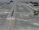
This is a detailed photorealistic scenery of Agrinio and the area from Ionio Pelagos in the West, to Itea in the East.
This scenery borders the south part of the Chalkida- Oinoi photoscenery.
See bellow for scenery choices.
Default FSX airports of Agrinio AB (LGAG) and Agrinio (GX01) were completely redone, positioned to their exact location, many buildings and objects were added in the airport compounds.
New aprons with commercial and military parking and 2 aircraft traffic files included.
| Filename: | AgrinioItea.zip |
| License: | Freeware |
| Added: | 13th August 2011, 17:05:04 |
| Downloads: | 2,183 |
| Author: | Angelo Tassoglou |
| Size: | 241.81 MB |
| Category: Flight Simulator X - Scenery | |
| France Vendee (86) - LF8523 Atlantic Airpark |
|
Images related to this file:
File Description:
A french scenery just for fun = Atlantic Aeropark near Chasnais and Lucon towns in Vendee country in France.
There are few aeropark in France. I created airport and some houses with planes for 4.75 precision mesh. Perhaps it would be fun for all mesh.
See http://www.atlanticairpark.com/ for map and details on real world.
For installation, you just unzip in addon scenery path and you have to declare in parameters of fsx the scenery repertory (as usual).
Vladimir Corre, contact:
| Filename: | France_Vendee_86__LF8523_Atlantic_Airpark.zip |
| License: | Freeware |
| Added: | 10th September 2015, 23:35:32 |
| Downloads: | 290 |
| Author: | Vladimir Corre |
| Size: | 1.41 MB |
| Category: Flight Simulator X - Scenery | |
| HMP Research Station Airstrip |
|
File Description:
This scenery adds the HMP(Haughton Mars Project) Research Station Airstrip located in the Arctic on Devon Island, Nunavut, Canada. In addition to the airstrip, some buildings, roads, and other objects are included to better represent the actual area. Researchers travel to this site every summer to study how to live and work in an environment similar to that of the planet Mars. This scenery was created using the awesome scenery tool Airport Design Editor by Scruffyduck Software. Please see the Readme file for more details.
| Filename: | HMP_Research_Station_Airstrip.zip |
| License: | Freeware |
| Added: | 3rd November 2016, 14:46:27 |
| Downloads: | 249 |
| Author: | David Midgett |
| Size: | 1.91 MB |
| Category: Flight Simulator X - Scenery | |
| Crete West - Greece |
|
File Description:
Crete West Dn
AS REAL AS IT GETS.
This is a detailed photorealistic scenery of the western half of the
Island of Crete WITH NIGHT TEXTURES.
See bellow for scenery choices.
Default FSX airports of Chania (LGSA) and Tympaki (LG54) were
completely redone, positioned to their exact location, and many
buildings and objects were added in the airport compounds.
New aprons, taxi signs and plenty of aircraft parking.
The scenery contains plenty of autogen objects, buildings, vegetation.
I have also included 2 aircraft traffic files.
| Filename: | Crete_West__Greece.zip |
| License: | Freeware |
| Added: | 24th November 2016, 17:42:58 |
| Downloads: | 1,566 |
| Author: | Angelo Tassoglou |
| Size: | 222.37 MB |


© 2001-2026 AVSIM Online
All Rights Reserved
Privacy Policy |