
Where Flight Simulation Enthusiasts Gather from Around the World!
AVSIM Library - Search Results

| Category: Prepar3D V1-4 - Scenery | |
| LTCC DIYARBAKIR AIRPORT 2020V1 |

|
File Description:
DIYARBAKIR Airport LTCC in the southeast of Turkey. DIYARBAKIR airport was opened 1952. Diyarbakır Airport is also one of the most important bases of the Turkish Air Force.. Added to before version orijinal civil Main Terminal, ARFF Rescue Buildings and others. All of the Main Terminal and other buildings model have been designed using Sketcup 2018. ADE has been used parking, aprons and taxiway and taxi sign and some objects. This also places a few objects from the default P3D scenery library. Compiled using Airport Design Editor. LTCC2020V1. By Hakan DAGHAN
| Filename: | LTCC_DIYARBAKIR_AIRPORT_2020V1.zip |
| License: | Freeware, limited distribution |
| Added: | 17th June 2020, 19:18:55 |
| Downloads: | 676 |
| Author: | Hakan DAGHAN |
| Size: | 56.57 MB |
| Category: Flight Simulator X - AFCAD Files | |
| Lhasa Gonggar (ZULS) Update 1.1 - Tibet, China |
|
Images related to this file:
File Description:
This update to the ZULS airport I created using the freeware Airport Design Editor X (v1.47.07) includes:
- a vehicle taxi network for the fuel truck and other FSX vehicles
- additional stationary airport vehicles and light aircrafts
- touch up on some objects' appearance and/or position
with FSX object libraries. Some new objects (lightposts and car parking lots) from the Acceleration pack are added for more realism, but may not be visible for the FSX RTM users.
This scenery is designed based on photos taken from Google Maps and other sites about the Lhasa Gonggar Airport.
| Filename: | Lhasa_Gonggar_ZULS_Update_11__Tibet_China.zip |
| License: | Freeware |
| Added: | 25th June 2010, 02:10:26 |
| Downloads: | 500 |
| Author: | Harry Sung |
| Size: | 7.87 KB |
| Category: Flight Simulator X - Scenery | |
| Frankfurt Main Airport v3.2 (EDDF) |
|
Images related to this file:
File Description:

This is a minor update to the previous airport package (Frankfurt Airport v3.1) using ADE 1.47 and represents the layout of the airport prior to the expansion of new taxiways, terminals and runways etc.
This update opens previously closed taxiways and adds additional taxiway signs (see readme file for more details). Many other features from the previous packages are still included.
Due to the expansion of the airport, I will be updating the scenery to the new taxiway configuration shortly hence this update is the last planned with the original taxiway designations in place.
| Filename: | Frankfurt_Main_Airport_v32_EDDF.zip |
| License: | Freeware |
| Added: | 5th May 2011, 20:40:54 |
| Downloads: | 2,193 |
| Author: | Mark Aldridge |
| Size: | 2.94 MB |
| Category: Prepar3D V1-4 - Scenery | |
| YDGU Degrussa Airport + Mine |
|
Images related to this file:
File Description:
Degrussa Airport is a Fly in Fly out Airport servicing the Sandfire Degrussa Copper-Gold Mine, located 900km north of Perth in Western Australia. Not only does this scenery contain the Airport, Camp site + photo imagery of the mine itself but includes the Degrussa Solar Project Covering a total area of over 20 hectares, it is the largest integrated off-grid solar and battery storage facility in Australia. The Airport is serviced by Network Aviation a subsidiary of the Qantas group using F100 from Perth International painted in Qantaslink Colours.
| Filename: | YDGU_Degrussa_Airport__Mine.zip |
| License: | Freeware |
| Added: | 11th July 2019, 17:06:15 |
| Downloads: | 635 |
| Author: | Robert Fluke |
| Size: | 33.74 MB |
| Category: Flight Simulator X - AFCAD Files | |
| Eagles Nest Airport (31E), NJ |
|
File Description:
Located 02 miles N of West Creek, New Jersey on 80 acres of land, Eagles Nest Airport is a small single strip that hosts several single engine aircraft. No services are provided to transient aircraft, tie down spots are available on the tarmac adjacent to Runway 14. AI paths have been added to this airport in case you would like to direct any GA AI there. Trees are summer ONLY.
Scenery constructed with use of satellite images/streetview, the author has not been there in person.
This scenery is meant to be used in conjunction with MegaScenery Earth New Jersey/Delaware 003. It is not required, but apron use is minimized to allow satellite scenery to show through as much as possible, and objects are placed based on the MSE textures - lack of it may make scenery look out of place.
| Filename: | Eagles_Nest_Airport_31E_NJ.zip |
| License: | Freeware |
| Added: | 15th October 2010, 20:43:02 |
| Downloads: | 345 |
| Author: | Drew Sikora |
| Size: | 496.59 KB |
| Category: Flight Simulator X - AFCAD Files | |
| Pemberton Airport (3N7), NJ |
|
File Description:
Located 01 miles NW of Pemberton, New Jersey on 14 acres of land, Pemberton Airport is a private airstrip. Tie down areas are available at the Runway 22 end. The single parking space is a tie down - do not use if your aircraft's wingspan is greater than 50 feet. Note that the actual listing for this airport in real world databases is 3NJ1. Trees are summertime ONLY.
Scenery constructed with use of satellite images/streetview, the author has not been there in person.
This scenery is meant to be used in conjunction with MegaScenery Earth New Jersey/Delaware 002. It is not required, but apron use is minimized to allow satellite scenery to show through as much as possible, and objects are placed based on the MSE textures - lack of it may make scenery look out of place.
| Filename: | Pemberton_Airport_3N7_NJ.zip |
| License: | Freeware |
| Added: | 23rd November 2010, 22:32:59 |
| Downloads: | 184 |
| Author: | Drew Sikora |
| Size: | 1.12 MB |
| Category: Flight Simulator 2004 - Miscellaneous Files | |
| Descent Rate Calculator |
|
File Description:
Here is something I developed for calculating the correct descent rate during non-precision approaches. Ever fly KSAN rwy 27, TNCM rwy 9, or any approach where ILS just wasn't available? Just plug in your parameters in the yellow fields and let the formula calculate away. Guaranteed to work with FSX, FS9, FS8 with any altitude, airspeed and distance from the airport. No VASI or PAPI required to hit those aiming point bars! Smooth landings, however, are up to you! This is the same type of calculator that modern aircraft derive from their FMC everyday. Enjoy and have fun!
| Filename: | Descent_Rate_Calculator.zip |
| License: | Freeware |
| Added: | 4th December 2008, 22:34:59 |
| Downloads: | 2,220 |
| Author: | Roman Dolinsky |
| Size: | 2.63 KB |
| Category: Flight Simulator 2002 - Scenery | |
| Green Lake Allen Field |
|
File Description:
Named after a very good friend of mine, this fictional airport (WA10) is located just north of Seattle on one of Seattle's most beloved lakes; Green Lake.
Its runway is 2500' long and 60' wide. The airport is adjacent to a small lake (Green Lake), where it operates its sea plane service. As seen in the picture(s), this airport is very suitable for small GA planes or better Bush planes and some STOL planes. Since it is equipped with tower and parking spots, TTools users can add their own wheel or float AI traffic to it.
To view fence and other very few scenery objects, Lago's FS Scenery Enhancer is required. I could not add custom fence to the scenery due to the loss of surrounding autogen if I did.
Recommended for use with default mesh but is also compatible with Seattle mesh by Steve Greenwood.
| Filename: | Green_Lake_Allen_Field.zip |
| License: | Freeware |
| Added: | 21st March 2003, 18:22:35 |
| Downloads: | 863 |
| Author: | Naresh Gurung |
| Size: | 1.28 MB |
| Category: Flight Simulator X - Scenery | |
| Thomas Hudner AFB |
|
File Description:
Thomas Hudner AFB is a fictitious Air Force Base located at Henderson Island, a member of the Pitcairn Islands in the Pacific. Located in a sheltered bay on the east side of the island, the airport features a 7500' x 120' paved runway, several hangars, barracks, and a fire dept. This airport also features a Delta V rocket and launch pad, a container ship being unloaded offshore by hovercrafts, and a small military ship. The default FSX scenery at this island has been completely replaced with custom scenery and terrain based on satellite photos.
This scenery requires the FSX Acceleration expansion pack for all of the objects to show up properly. Also, for some reason, Ground Environment X causes the sand textures to show up as rain forest. This is purely a visual quirk and the airport will still work, but it is up to you. This airport is not designed for FS2004, but you may try it at your own risk. Special thanks to Ashton Lawson for his invaluable help on this project.
| Filename: | Thomas_Hudner_AFB.zip |
| License: | Freeware, limited distribution |
| Added: | 31st January 2009, 01:29:20 |
| Downloads: | 541 |
| Author: | Daniel Otto |
| Size: | 1.57 MB |
| Category: Flight Simulator X - Scenery | |
| 52F North West Regional Airport (DFW TX) |
|
Images related to this file:
File Description:
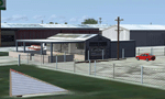
This airport scenery does not require any other software other than Microsoft Flight Sim X SP1 (minimum) - SP2 required for mission and display of some of the scenery items. However, it could help with performance on your PC if you install any accurate photo scenery for DFW. One such scenery is MEGASCENERY DFW photo scenery from http://www.megascenery.com/.
This is a custom developed scenery for airport, 52F - Northwest Regional, Roanoke, TX. 52F is next to Fort Worth Alliance in the Dallas Fort Worth Metroplex. It's a nice little airport.
This scenery package also includes a Mission called "52Foxtrot - Approach to Rwy 35 - Thermals". It is more of a free flight than the traditional FSX missions. The ones who fly for real at 52F-Northwest regional knows the quirks when coming into land at runway 35 on a hot day. The thermals at the cleared land and the sinking feeling when flying over the wooded area nearing the approach to 35. These thermal lifts and sinks have been modeled here. However, the only way to experience these thermals in FSX is via Missions. Once you select the mission "52Foxtrot - Approach to Rwy 35 - Thermals" and by selecting option "Enable changes in selected Mission", you could fly around like you would under "free flight". Except this time, you would have these thermal effects around 52F and get to experience what it's really like to fly and land at 52F.
| Filename: | 52F_North_West_Regional_Airport_DFW_TX.zip |
| License: | Freeware, limited distribution |
| Added: | 24th March 2010, 01:23:59 |
| Downloads: | 3,335 |
| Author: | Manny Mahadevan |
| Size: | 19.06 MB |


© 2001-2026 AVSIM Online
All Rights Reserved
Privacy Policy |