
Where Flight Simulation Enthusiasts Gather from Around the World!
AVSIM Library - Search Results

| Category: Flight Simulator X - Scenery | |
| Carora Airport (SVCO) - Venezuela |

|
File Description:
Regional airport located in the city of Carora, the second city of the Lara state after Barquisimeto, in western Venezuela. With photo-terrain scenery from satellite imagery in Google Earth.
Not compatible with versions prior to FSX.
This scenery includes terminal building and hangars with realistic
textures from images obtained from Internet. Also includes a friendly Auto-Install.
| Filename: | Carora_Airport_SVCO__Venezuela.zip |
| License: | Freeware |
| Added: | 12th March 2012, 16:41:17 |
| Downloads: | 1,401 |
| Author: | David Maldonado |
| Size: | 80.7 MB |
| Category: Flight Simulator 2004 - Miscellaneous Files | |
| Scotflight Scenery FS2004 AI Fix |
|
Images related to this file:
File Description:
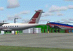
Additional information to address the issues of "hovering" or "sunken" AI traffic with the add-on airport scenery by Scotflight when used with FS2004. This documentation should be used in conjunction with the file scflAFD1.zip. However, the instructions apply equally well to other add-on scenery with the same problems.
[File re-uploaded at request of AVSIM]
| Filename: | Scotflight_Scenery_FS2004_AI_Fix.zip |
| License: | Freeware |
| Added: | 15th May 2010, 01:19:59 |
| Downloads: | 806 |
| Author: | John Hinson |
| Size: | 269.58 KB |
| Category: Flight Simulator 2004 - Scenery | |
| Bauerfeild-Port Vila International Airport, Vanuatu. NVVV. |
|
File Description:
Welcome to Bauerfield-Port Vila International Airport, in the Pacific Island paradise of Vanuatu.
The scenery also contains the small airports of NVVQ Quoin Hill, and NVVJ Forari, on the same island.
Included is a GA Traffic file for those with the HTAI Cessna's (Payware) light AI aircraft package.
Requires EZ Scenery Object sets (see INSTALL instructions for details).
| Filename: | BauerfeildPort_Vila_International_Airport_Vanuatu_.zip |
| License: | Freeware, limited distribution |
| Added: | 26th July 2008, 15:54:58 |
| Downloads: | 2,279 |
| Author: | Lawrie Roache |
| Size: | 2.34 MB |
| Category: Flight Simulator 2004 - Scenery | |
| Nantucket Memorial Airport Fix |
|
File Description:
FS2004 Nantucket Memorial Airport - KACK Scenery Fix. My original Kack.zip Scenery has a chainlink fence which, together with the complicated terminal, can creates bad framerates. If you are having a problem with KACK framerates then this is the fix. This new kack.bgl file has had the chainlink fencing removed from around the runways giving acceptable framerates.
| Filename: | Nantucket_Memorial_Airport_Fix.zip |
| License: | Freeware |
| Added: | 19th June 2004, 18:06:09 |
| Downloads: | 3,412 |
| Author: | William Shea |
| Size: | 84.06 KB |
| Category: Flight Simulator 2004 - Scenery | |
| Dumaguete Scenery Landclass and Coastline Modification ver.2.0 |
|
File Description:
This is the version 2.0 of my Dumaguete Scenery modification.This file complements Manny Tecson's Dumaguete Scenery for FS2002 and adapted for FS2004.This will improve the following:
1.Landclass from sparsely populated houses to densely populated coconut trees at runway 09 approach.
2.Modifies the present coastline of Dumaguete City to make the runway 27 end of the airport extend out to the sea.
3.Modifies the city landclass of Dumaguete City to promote realism.
4.Modifies rocky reclamation at runway 27 tip of Dumaguete Airport.
5.Modifies the national highway from perpendicular to runway 09 to diagonal.
6.Excludes the crash detection activated electric post at runway 09 tip.
To download Manny Tecson's Dumaguete scenery,go to www.philskies.net then click the Scenery section and click the Visayas sub-menu.
| Filename: | Dumaguete_Scenery_Landclass_and_Coastline_Modifica.zip |
| License: | Freeware |
| Added: | 12th January 2004, 18:44:14 |
| Downloads: | 2,375 |
| Author: | Ver Walter L. Gulfan |
| Size: | 635.96 KB |
| Category: Flight Simulator X - Scenery | |
| KFHR Friday Harbor Photoreal |
|
Images related to this file:
File Description:
This Scenery consists of the FSX default airport of Friday Harbor, set on photorealistic terrain. Although the scenery has been compiled with night masks, night terrain has been excluded to reduce the file size. It has been designed for Megasceneryearth photorealistic scenery of the San Juan Islands but will also work with the default terrain. Seasonal variations are not included. The main scenery file has been subdivided into several smaller files, which can be switched off according to user preference. Full night textures are included with wash lighting in the terminal and carpark areas. All buildings have been custom modelled using real photographs, and include open hangers with interiors.
Next to the fuel station you will find Ernie's Cafe, much loved by resident and visiting pilots. Close to the airport you will find US style houses modelled on real photographs from the San Juan island. Surfaced airport taxiways and aprons have been kept to a minimum to allow the photoreal textures to show through. The scenery also includes sound effects and high definition people, these can be switched off if they place too much strain on your system. Please enjoy, and I hope you like my scenery as much as I enjoyed making it.
| Filename: | KFHR_Friday_Harbor_Photoreal.zip |
| License: | Freeware, limited distribution |
| Added: | 9th January 2012, 00:46:11 |
| Downloads: | 4,080 |
| Author: | George Keogh |
| Size: | 65.88 MB |
| Category: Flight Simulator 2004 - Scenery | |
| CNU8 - Toronto - Markham Airport (2008), Ontario, Canada |
|
Images related to this file:
File Description:
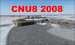
CNU8 - Toronto - Markham Airport (2008) - Markham v1. The airport is owned and operated by Markham Airport Inc., and is not part of the Greater Toronto Airport Authority.
The airport consists of a single 2,000 foot runway for small and private aircraft only (with night flying capabilities). The Royal Canadian Air Cadets Gliding Program uses the north side or the runway 09/27 for glider operations in the spring and fall months, and use a northern traffic pattern. This airport may disappear with the establishment of a planned Pickering Airport or re-location of Toronto/Buttonville Municipal Airport.
(This is a re-upload of the scenery to replace the original that was lost in the AVSIM hack. No changes have been made)
| Filename: | CNU8__Toronto__Markham_Airport_2008_Ontario_Canada.zip |
| License: | Freeware, limited distribution |
| Added: | 16th May 2010, 10:06:40 |
| Downloads: | 1,594 |
| Author: | Keith Murphy |
| Size: | 5.24 MB |
| Category: Flight Simulator 2004 - Scenery | |
| Yuba Co-Oroville Muni |
|
File Description:
FS2004 Scenery - Yuba County Airport (IATA: MYV, ICAO: KMYV) is a public airport located three miles (4.8 km) southeast of Marysville, serving Yuba County, California, USA. The airport has two runways and is mostly used for general aviation. Oroville Municipal Airport (IATA: OVE, ICAO: KOVE) is a public airport located 3 miles (5 km) southwest of the city of Oroville in Butte County, California, USA. Oroville Municipal Airport covers 920 acres and has two runways. This airport is about 23nm NW of Yuba Co. An 18 hole golf course is located right next to the facility for you "Fly-in Golfers". EZ Scenry libraries require, some are included. By John B. Loney, Jr. and Robert Lacy.
| Filename: | Yuba_CoOroville_Muni.zip |
| License: | Freeware, limited distribution |
| Added: | 28th August 2007, 03:37:55 |
| Downloads: | 735 |
| Author: | John B. Loney, Jr. and Robert Lacy |
| Size: | 2.61 MB |
| Category: Flight Simulator X - Scenery | |
| Yuba Co-Oroville Muni |
|
File Description:
FSX Scenery - Yuba County Airport (IATA: MYV, ICAO: KMYV) is a public airport located three miles (4.8 km) southeast of Marysville, serving Yuba County, California, USA. The airport has two runways and is mostly used for general aviation. Oroville Municipal Airport (IATA: OVE, ICAO: KOVE) is a public airport located 3 miles (5 km) southwest of the city of Oroville in Butte County, California, USA. Oroville Municipal Airport covers 920 acres and has two runways. This airport is about 23nm NW of Yuba Co. An 18 hole golf course is located right next to the facility for you "Fly-in Golfers". EZ Scenry libraries require, some are included. By John B. Loney, Jr. and Robert Lacy.
| Filename: | Yuba_CoOroville_Muni.zip |
| License: | Freeware, limited distribution |
| Added: | 11th May 2010, 21:36:46 |
| Downloads: | 1,307 |
| Author: | John B. Loney, Jr. |
| Size: | 9.77 MB |
| Category: Flight Simulator X - Scenery | |
| Greater Kankakee KIKK |
|
Images related to this file:
File Description:
FSX Scenery - Greater Kankakee Airport (IATA: IKK, ICAO: KIKK, FAA LID: IKK) is a public airport located three miles (5 km) south of the central business district of Kankakee, in Kankakee County, Illinois, United States. The airport was opened in 1962 and continues to operate as a general aviation facility serving the Kankakee area and South Chicago. It is 60 miles (97 km) south of Chicago and 75 miles (121 km) north of Champaign, Illinois. It is the largest Airport between the Chicago Midway Airport and the Champaign Airport. Greater Kankakee is a general aviation airport, consisting of mostly private aircraft with a mix of corporate and business aircraft usage. Created by John B Loney Jr.
| Filename: | Greater_Kankakee_KIKK.zip |
| License: | Freeware, limited distribution |
| Added: | 20th March 2012, 01:36:22 |
| Downloads: | 647 |
| Author: | John B. Loney, Jr. |
| Size: | 4.09 MB |


© 2001-2026 AVSIM Online
All Rights Reserved
Privacy Policy |