
Where Flight Simulation Enthusiasts Gather from Around the World!
AVSIM Library - Search Results

| Category: Flight Simulator 2004 - Scenery | |
| Burns Lake CYPZ in British Columbia, Canada |

|
Images related to this file:
File Description:
Burns Lake is 90 miles east of Terrace and 130 miles west of Prince George, on the eastern side of the Coast Mountains. The airfield is at 2343' ASL and the 11/29 runway is just over 7,000' of 75' wide asphalt. There are buildings, some of them new, around the apron at the west end of the runway and both JetA and 1100LL are available. There is also a weather station in a fenced area west of the apron. All apron buildings were modeled specifically for this scenery; there may be some missing if new construction has continued in the last three years.
| Filename: | Burns_Lake_CYPZ_in_British_Columbia_Canada.zip |
| License: | Freeware, limited distribution |
| Added: | 11th May 2011, 16:57:44 |
| Downloads: | 467 |
| Author: | Roger Wensley |
| Size: | 4.57 MB |
| Category: Flight Simulator 2002 - Flight Plans | |
| 39RTWest |
|
File Description:
An FS2002 GPS flight Plan. The 39th in a series of Round the World flight plans for the FS2002 default scenery. Depart Kabul (OAKB) runway 29, Afghanistan and arrive 1 hour 10 minutes later at Herat (OAHR) runway 19, Afghanistan. A flight entirely within Afghanistan that skims mountain tops and travels through valleys. Set January textures and see for yourself the wild and rugged nature of this country. A VFR finals is featured (hand holding instructions given). The flight briefing (Word and text) is for a B737-400, it contains climb, cruise, top of descent and fuel loading details, waypoint timings and destination details.
| Filename: | 39RTWest.zip |
| License: | Freeware |
| Added: | 18th August 2002, 21:02:44 |
| Downloads: | 737 |
| Author: | The Ancient Brit |
| Size: | 25.02 KB |
| Category: Flight Simulator 2002 - Flight Plans | |
| 37RTWest |
|
File Description:
An FS2002 GPS flight Plan. The 37th in a series of Round the World flight plans for the FS2002 default scenery. Depart Nepalgunj (VNNG) runway 27, Nepal and arrive 1 hour 41 minutes later at Thoise (Z13Q) runway 29, India. Soon after takeoff you will be heading towards the hills and a climb into the snow capped peaks of the Himalayas. Vertical clearances are minimal; parts of this flight still scare me! A VFR finals is featured (hand holding instructions given). The flight briefing (Word and text) is for a B737-400, it contains climb, cruise, top of descent and fuel loading details, waypoint timings and destination details.
| Filename: | 37RTWest.zip |
| License: | Freeware |
| Added: | 30th July 2002, 21:50:57 |
| Downloads: | 808 |
| Author: | The Ancient Brit |
| Size: | 29.29 KB |
| Category: Flight Simulator 2004 - Utilities | |
| Servinfo Update 5(Nov 01, 2010) |
|
File Description:
Thank you for downloading this 5th update of Servinfo 2.02.
This update actualised with logos and data the following Airlines and Air Forces:Air Zimbabwe, Basler Flight Service, Bristow Helicopters, British International Helicopters,RAF Barkston Heath, Braniff International Airways, BQB LÃ�ÂÂneas A�©reas, China Northern Airlines,China Southern Airlines, Canadian Western Airlines, Centurion Air Cargo, Air Comores International,Dominicana de Aviaci�³n, DAS Air Cargo, Ecuatoriana De Aviaci�³n, Georgian National Airlines,Caribbean Star Airlines, Ghana International Airlines, Royal Tongan Airlines, Turkish Air Force,Ju-Air, RAF Leuchars, Albanian Airlines, South African Air Force, 32th Squadron RAF,USAF 100th Air Refuelling Wing, RAF(Support Helicopter Force),RAF Scampton, RAF St Athan,RAF Topcliffe Flying Training Unit, Vladivostok Air and RAF Valley Flying Training Unit.
The following aircrafts are now identified by Servinfo in all his flights:
Antonov An-2,Antonov An-8,Antonov An-12,Antonov An-22,Antonov An-24,Antonov An-26,Antonov An-28,Antonov An-30,Antonov An-32 Sutley/Firekiller,Antonov An-38,Antonov An-70,Antonov An-72,Antonov An-74-100/200, Antonov A124 Ruslan ,Antonov A140,Antonov A148,Antonov A225 Mriya,Antonov An-74-300,Avro Lancaster,Avro Lancastrian,Boeing B-17 Flying Fortress,Boeing B-29 Superfortress,Bristol Blenheim,B�¼cker B�¼ 131 Jungmann,B�¼cker B�¼ 131 Jungmeister,Consolidated B-24 Liberator,Curtiss P-40 Warhawk/Kittyhawk
Curtiss SNC-1 Falcon,De Havilland DH.98 Mosquito,Douglas AD Skyraider,
Douglas A-20 Havoc/Boston/P-70/DB-7,Douglas B-26 Invader,Douglas SBD Dauntless
Fairey Swordfish,Grumman F4F Wildcat,Grumman F6F Hellcat,Grumman F7F Tigercat,
Grumman F8F Bearcat,Grumman TBF Avenger,Grumman F9F Panther,Grumman S-2/S-2F Tracker,Grumman S-2 Turbo Tracker,Hawker Hurricane/Sea Hurricane, Hawker Fury-Sea Fury,Hawker Hunter,Hawker Hind,Heinkel He-111,Ilyushin A-50,Ilyushin IL-103,Ilyushin IL-114,Ilyushin IL-2M3,Ilyushin IL-4,Ilyushin IL-10,Ilyushin IL-12,Ilyushin IL-14,Ilyushin IL-18/IL-20/IL-22"Coot"/IL-22 Zebra/IL-24,Ilyushin IL-28,Ilyushin IL-38,Ilyushin IL-62,Ilyushin IL-76/IL-78/IL-82/IL-76 Gajaraj
Ilyushin IL-86/IL-87,Ilyushin IL-96,Kamov Ka-25 "Hormone",Kamov Ka-27"Helix"
Martin B-26B Marauder,Messerschmitt 109,Messerschmitt 262 Schwalbe,MiG-15,
MiG-17,MiG-19,MiG-21,MiG-25,MiG-27,MiG-29,MiG-31,Mitsubishi A6M Rei-Sen"Zero",
North American F-82 Twin Mustang,Northrop P-61 Black Widow,Vought F4U Corsair,
Short S-25 Sandringham,SIAI Marchetti SF.260,Sukhoi Su-7,Sukhoi Su-15,Sukhoi Su-17/Su-20/Su-22,Sukhoi Su-24,Sukhoi Su-25/Su-28/Su-39,Sukhoi Su-26,Sukhoi Su-29,Sukhoi Su-31,Sukhoi Su-38,Sukhoi Su-47 Berkut,Sukhoi Su-80,Sukhoi Superjet 100-95,Tupolev Tu-2,Tupolev Tu-4,Tupolev Tu-14,Tupolev Tu-16,Tupolev Tu-20/95/142,Tupolev Tu-22,Tupolev Tu-22M,Tupolev Tu-114,Tupolev Tu-124, Tupolev Tu-134,Tupolev Tu-144,Tupolev Tu-154,Tupolev Tu-160,Tupolev Tu-204/214/224/234,Tupolev Tu-334 and Vickers Supermarine Spitfire/SeaFire.
| Filename: | Servinfo_Update_5Nov_01_2010.zip |
| License: | Freeware |
| Added: | 2nd November 2010, 01:43:39 |
| Downloads: | 938 |
| Author: | Daniel Nole |
| Size: | 1.44 MB |
| Category: Flight Simulator 2004 - Scenery | |
| WASF Fak-Fak |
|
Images related to this file:
File Description:
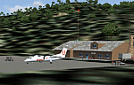
Googly scenery for WASF Fak-Fak, in Irian Jaya (Western New Gunea),
Indonesia - a small domestic airport that Microsoft managed to omit from Flight
Simulator 2004. These scenery files add the runway, apron, taxiways, buildings
and other airport features so that you and your "AI" traffic can land, taxi,
park and take off in a realistic manner.
Little information is available on the services operated - flight plans are
available for Lion Airlines showing two flights per week operated on their behalf
by Wings Abadi Dash 8 aircraft. But it is known that Merpati Nusentara also serve
the airport with Twin Otters. If you are using the Lion Airlines flight plans
for Winter 2006, you must change the airport's co-ordinates as detailed in the readme.txt file
because the co-ordinates given there will cause the aircraft to aim for a point
on the wrong side of the equator in the middle of the sea!
There is no lighting at this airport, and few navigational aids. However, I have
added a missing NDB nearby (FA, 380.0).
The scenery does not purport to be ultra-accurate. The quality of the satellite
imagery at Google Earth is poor, but a number of photographs and other information
has enabled this airport to be depicted reasonably accurately. However the added
airport features, such as buildings, are built from default Microsoft objects
and add-on libraries so will not look exactly like the real thing.
You are not obliged to download and install any additional scenery libraries,
but to enjoy this scenery in its entirety, you may wish to. It will work fine,
with or without.
An editvoicepack file has been included for the airport to help you embarrass
yourself in front of others when flying.
[File re-uploaded at request of AVSIM]
| Filename: | WASF_FakFak.zip |
| License: | Freeware |
| Added: | 7th May 2010, 22:30:22 |
| Downloads: | 1,904 |
| Author: | John Hinson |
| Size: | 72.51 KB |
| Category: Flight Simulator X - Scenery | |
| KAFW Fort Worth Alliance Airport - Texas, US |
|
Images related to this file:
File Description:
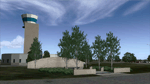
Ft. Worth Alliance Airport opened in 1989 and was billed as the world's first purely industrial airport. It is located around 14 miles North of the central business district of Ft. Worth and is also nearby the Dallas/Ft. Worth International Airport (KDFW). The airport serves general aviation, corporate jet, cargo, and military air traffic on a daily basis and it's proximity to the Texas Motor Speedway (only a few miles) brings extra dense traffic on race weekends. The airport is home to the American Airlines 777 and 767 maintenance base, FedEx Southwest Regional Sort Hub, Bell-Helicopter Training Center, DEA Air Operations Center and DynCorp International. Sadly the American Airlines maintenance base is set to close at the end of 2012 but is being kept alive in FSX!
This scenery features custom 3d buildings and objects bringing you a very accurate rendition of Ft. Worth Alliance Airport. Requires FSX Acceleration for the all scenery objects to display correctly.
Note: These files MUST be installed for the scenery to work correctly (otherwise there will be missing scenery objects at the airport):
-Filename: fsx_lts.zip - Ramp Lighting for FSX by Jim Dhaenens
-Filename: dlfcorelibraries2fsx.zip - Dan French Core Library Vol. 2
-Filename: lightstoo.zip - Jim Dhaenens Airfield Lighting
-Filename: objlib-jgse-fsx.zip - John Stinstrom JGSE Yellow Objects - this newer file replaces the older FS9 libraries with FSX versions
-Filename: objlib-ggse-fsx.zip - John Stinstrom GGSE Green Objects - this file also replaces FS9 libraries with FSX versions
| Filename: | KAFW_Fort_Worth_Alliance_Airport__Texas_US.zip |
| License: | Freeware, limited distribution |
| Added: | 12th December 2012, 16:56:36 |
| Downloads: | 2,940 |
| Author: | Brandon Thetford |
| Size: | 439.24 MB |
| Category: Flight Simulator 2004 - Scenery | |
| Presidente Perón (SAZN) - Argentina |
|
File Description:
This is very operative Presidente Perón Airport (SAZN), in Neuquen, Provincia de Neuquén, Republica Argentina, with all navaids and his objects in the correct place. This scenery fix the problem with the NEU VOR. This is not photorealistic scenery. ONLY FOR FS2004. Building with SceneGenX version 1.0 Build 54 By Tom Hiscox and some objects of RWY12.
| Filename: | Presidente_Pern_SAZN__Argentina.zip |
| License: | Freeware |
| Added: | 2nd May 2006, 02:28:15 |
| Downloads: | 2,285 |
| Author: | carlos maida |
| Size: | 532.84 KB |
| Category: Flight Simulator 2004 - Scenery | |
| Bar Harbor Airport (KBHB) Maine |
|
File Description:
A detailed scenery of the airport that is aligned to the default surrounding scenery and optionally to Flight1's Ultimate Terrain USA. Alternative Unicom and Towered AFCAD2 files and optional static aircraft file that can be used with the selected AFCAD2 file. Photorealstic and full seasonal textures. With thanks to Douglas McMullin for supplying photographs and other reference information.
| Filename: | Bar_Harbor_Airport_KBHB_Maine.zip |
| License: | Freeware, limited distribution |
| Added: | 28th May 2006, 18:12:10 |
| Downloads: | 2,605 |
| Author: | John Young |
| Size: | 5.73 MB |
| Category: Flight Simulator 2004 - Scenery | |
| A39 Phoenix Regional Airport - "Saddlebrook" |
|
File Description:
FS2004+
A39 Phoenix Regional Airport - "Saddlebrook" FSX compatable.
This scenery works with both LAGO registered version and
objects from EZ Scenery FREE library available this web site.
PRA is an innovative aviation community featuring a 5,000-foot paved runway and fully automated 100LL fuel system. For homebuyers, PRA offers some unique alternatives to conventional airpark living.
| Filename: | A39_Phoenix_Regional_Airport__Saddlebrook.zip |
| License: | Freeware |
| Added: | 17th June 2006, 18:17:28 |
| Downloads: | 1,213 |
| Author: | Jimmy R. Martin |
| Size: | 623.3 KB |
| Category: Flight Simulator 2004 - Scenery | |
| St Clair Regional K39 |
|
Images related to this file:
File Description:
FS2004 Scenery - St Clair Regional Airport (K39) serves St Clair and Franklin County and is owned by the City Of St Clair, Missouri, USA. The paved runway extends for 3200 feet. The facility is at an elevation of 654 feet at a distance of about 2 miles from St Clair. Created with Instant Scenery by John B. Loney, Jr.
| Filename: | St_Clair_Regional_K39.zip |
| License: | Freeware, limited distribution |
| Added: | 2nd November 2009, 19:56:50 |
| Downloads: | 187 |
| Author: | John B. Loney, Jr. |
| Size: | 9.51 MB |


© 2001-2026 AVSIM Online
All Rights Reserved
Privacy Policy |