
Where Flight Simulation Enthusiasts Gather from Around the World!
AVSIM Library - Search Results

| Category: Prepar3D V1-4 - AFCAD Files | |
| Perpignan Rivesaltes LFMP P3D v4 |

|
File Description:
This airport update/custom AFCAD is made for P3D v4. It is an improvement over the default P3D airport. The main runway 15/33 was improved. Runway 13/31 was repositioned with correct dimensions and GA aprons/parking spots/helipad added to the west and to the north, along with a few enhancements all around the airport such as nearby roads, etc.....
7 parking spots are available on the main apron in front of the terminal. In total, 30 parking spots and 2 helipads are available in the scenery. Generally, the airport layout is accurate and the scenery gives you a feel for the place. Happy takeoffs and landings in Perpignan. Enjoy!
| Filename: | Perpignan_Rivesaltes_LFMP_P3D_v4.zip |
| License: | Freeware, limited distribution |
| Added: | 5th August 2020, 19:18:22 |
| Downloads: | 424 |
| Author: | Frederic Navarro |
| Size: | 1.36 MB |
| Category: X-Plane - Scenery | |
| BR ES SNGA - Guarapari Airfield v1.0.0 |
|
Images related to this file:
File Description:

This is an X-Plane 11 and X-Plane 10 scenery package for Guarapari Airport (IATA: GUZ, ICAO: SNGA), which is the airport located at Praia do Morro, serving the city of Guarapari, EspÃrito Santo, in Brazil.
It includes corrected aprons, ramps, gates, taxiways, lighting system, city buildings, ortho-photoscenery for the airfield area, and (XP11 only) airport ground services (like push back).
The airport is dedicated to general aviation.
This scenery was tested and is operational (as of January 14, 2018) in "X-Plane 11.11 64 bit", Windows 10 Home. It was also tested and is also operational (as of January 13, 2018) in "X-Plane 10.51 64 bit", Windows 10 Home.
| Filename: | BR_ES_SNGA__Guarapari_Airfield_v100.zip |
| License: | Freeware |
| Added: | 2nd February 2018, 00:11:04 |
| Downloads: | 46 |
| Author: | Rui Mesquita |
| Size: | 8.53 MB |
| Category: X-Plane - Scenery | |
| BR AL SNAL - Arapiraca Airport v1.0.0 |
|
Images related to this file:
File Description:
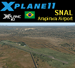
This is an X-Plane 11 and X-Plane 10 scenery package for Arapiraca Airport (ICAO: APQ - IATA: SNAL), which is a public airport servining Arapiraca, Alagoas, in Brazil.
It includes corrected aprons, ramps, gates, taxiways, lighting system, city buildings, ortho-photoscenery for the airfield area, and (XP11 only) airport ground services (like push back).
The airport is dedicated to general aviation, and servers as a local flight school and aeroclube.
This scenery was tested and is operational (as of January 14, 2018) in "X-Plane 11.11 64 bit", Windows 10 Home. It was also tested and is also operational (as of January 14, 2018) in "X-Plane 10.51 64 bit", Windows 10 Home.
| Filename: | BR_AL_SNAL__Arapiraca_Airport_v100.zip |
| License: | Freeware |
| Added: | 2nd February 2018, 00:11:15 |
| Downloads: | 63 |
| Author: | Rui Mesquita |
| Size: | 9.08 MB |
| Category: Flight Simulator X - Scenery | |
| LIMC - Malpensa Intl Airport - Milan, Italy |
|
Images related to this file:
File Description:
*** Dedicated in memory to Tom Allensworth, RIP my friend ***
This scenery is a very accurate rendition of Malpensa Intl airport and made only for FSX users, do not use in P3D: Both terminal's have been completely replaced with something better than the default airport terminals, new control tower, assigned parking as per their website with extra parking including gates for the A380, one is at Terminal 1 (Gate 401), extra fuel trucks, taxiways and taxi signs updated to the latest charts, support vehicle roads rebuilt and many other scenery improvements and objects added to further enhance this airport, airport views are from the roof of the new control tower (when in tower view) please view the readme before installation.
| Filename: | LIMC__Malpensa_Intl_Airport__Milan_Italy.zip |
| License: | Freeware, limited distribution |
| Added: | 30th November 2018, 02:30:28 |
| Downloads: | 45,170 |
| Author: | Ray Smith |
| Size: | 2.76 MB |
| Category: X-Plane - Scenery | |
| BR AL SBMO - Zumbi dos Palmares Intl v1.0.0 |
|
Images related to this file:
File Description:
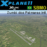
This is an X-Plane 11 and X-Plane 10 scenery package for Maceió/Zumbi dos Palmares International Airport (IATA: MCZ, ICAO: SBMO), formerly called Campo dos Palmares Airport, which the airport serving Maceió, in Brazil. It includes corrected aprons, ramps, gates, taxiways, lighting system, and (XP11 only) airport ground services (like push back). This scenery was tested and is operational (as of February 24, 2017) in "X-Plane 11 Public Beta #12 64 bit", Windows 10 Home. It was also tested and is also operational (as of February 24, 2017) in "X-Plane 10.51 64 bit", Windows 10 Home. Only the default X-Plane 11 libraries, by Laminar Research, are needed. No third party libraries are used.
| Filename: | BR_AL_SBMO__Zumbi_dos_Palmares_Intl_v100.zip |
| License: | Freeware |
| Added: | 25th February 2017, 07:18:23 |
| Downloads: | 119 |
| Author: | Rui Mesquita |
| Size: | 6.33 MB |
| Category: Flight Simulator 2004 - AFCAD Files | |
| UK2000 East Midlands |
|
File Description:
A high quality AFCAD2 file for the UK2000 East Midlands Airport. Built from scratch, using the latest CAA charts, this AFCAD2 compliments the addon scenery perfectly. This file gives you the current real life taxiway names and gate numbers at this airport. Airlines are allocated to the gates and all gates that can be included are used. This file gives you 79 usable parking positions at this airport, comprising 23 gates, 25 Cargo ramps and 31 GA ramps. The UPS, DHL and TNT cargo hubs are all included here. This file has been fully tested with no problems found. Requires payware 'UK2000' scenery by G. Summons. This file is not compatible with the default FS2004 East Midlands airport.
| Filename: | UK2000_East_Midlands.zip |
| License: | Freeware |
| Added: | 19th February 2005, 16:01:18 |
| Downloads: | 1,199 |
| Author: | Lee Brompton |
| Size: | 62.13 KB |
| Category: Flight Simulator 2004 - Scenery | |
| Craig Municipal Airport v1.5 |
|
File Description:
FS2004 Scenery-Craig Municipal Airport v1.5 (IATA: CRG, ICAO: KCRG) is a mid-sized facility for personal aircraft and small commuter planes located 8 mi (12.9 km) east of Jacksonville, Florida, United States. The airport has a control tower and handles 400-500 aircraft operations daily. Craig Municipal Airport serves Jacksonville and Duval County and is owned by Jacksonville Port Auth. The airport has more than one runway. The longest is a paved runway extending 4007 feet. The facility is at an elevation of 42 feet. THIS DOWNLOAD CORRECTS ALL REPORTED ERRORS FROM VERSION 1. Created with EZ Scenery whose libraries are required. The readme file is REQUIRED READING. By John B. Loney, Jr.
| Filename: | Craig_Municipal_Airport_v15.zip |
| License: | Freeware, limited distribution |
| Added: | 29th April 2007, 21:42:44 |
| Downloads: | 1,081 |
| Author: | John B. Loney, Jr. |
| Size: | 1.21 MB |
| Category: Flight Simulator X - Scenery | |
| Aurora Muni - Greater Kankakee |
|
File Description:
FSX Scenery - Aurora Municipal Airport serves Chicago/Aurora and Kane County and is owned by the City Of Aurora. The airport has more than one runway. The longest is a paved runway extending 6500 feet. The facility is at an elevation of 706 feet at a distance of about 38 miles from Chicago. Greater Kankakee Airport serves Kankakee and Kankakee County and is owned by Kankakee Valley Arpt Auth. The airport has more than one runway. The longest is a paved runway extending 5979 feet. The facility is at an elevation of 629 feet at a distance of about 3 miles from Kankakee. Created with Instant Scenery. By John B. Loney, Jr.
| Filename: | Aurora_Muni__Greater_Kankakee.zip |
| License: | Freeware, limited distribution |
| Added: | 2nd November 2009, 20:05:32 |
| Downloads: | 500 |
| Author: | John B. Loney, Jr. |
| Size: | 1.11 MB |
| Category: Flight Simulator X - Scenery | |
| Tonopah - KTPH |
|
File Description:
This file contains several BGL's which enhance the default FSX Tonopah, Nevada airport (KTPH).
Additional parking, scenery objects, and roads are added to the bland stock airport.
The "mesa" created by the stock airport backgound flatten is blended into the
surrounding terrain using "sloped flattens".
This scenery is not intended to re-create a perfect match to the real world but
to enhance the visual experience of flying into and out of the airport.
The files were tested with FSX-Acceleration\SP2 on WinXP Pro, DX9.
I used 10M mesh from the "FSX Usa 10 M terrains Project" when blending
the altitude data but the files should provide good results with the default FSX terrain.
| Filename: | Tonopah__KTPH.zip |
| License: | Freeware |
| Added: | 21st December 2007, 04:29:50 |
| Downloads: | 1,172 |
| Author: | Paul Strogen |
| Size: | 812.46 KB |
| Category: Flight Simulator 2004 - Scenery | |
| Nanjing Dajiaochang Z08T - Chinese Airports From Yesteryear No.1 |
|
Images related to this file:
File Description:

Built with ADE with satellite aligning. Reqiures EZ scenery library: https://www.flightsim.com/files/file/143843-fs2004-ez-scenery-librarys-exe/.
This is the first airport in this series, focusing on old airports in China that now only lives in memory. Nanjing Dajiaochang Airport (NKG/Z08T) was an airport that served Nanjing, the capital of East China's Jiangsu province. It is located 6.2 kilometres (3.9 mi) south of Xinjiekou, the center of Nanjing, and is surrounded on three sides by the Qinhuai River. Opened in 1934, it was an important Chinese airbase during WWII. Civil aviation moved to the new Lukou International Airport in 1997, and then the airforce moved out in 2015 when Dajiaochang finally closed.
| Filename: | Nanjing_Dajiaochang_Z08T__Chinese_Airports_From_Ye.zip |
| License: | Freeware |
| Added: | 23rd July 2024, 00:59:47 |
| Downloads: | 47 |
| Author: | Yue Pan |
| Size: | 101.1 KB |


© 2001-2026 AVSIM Online
All Rights Reserved
Privacy Policy |