
Where Flight Simulation Enthusiasts Gather from Around the World!
AVSIM Library - Search Results

| Category: Flight Simulator X - Scenery | |
| East Midlands Xtreme |

|
Images related to this file:
File Description:
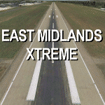
Extremely accurate scenery for East Midlands airport,UK. Includes night lighting, animation vehicles, replacement AFCAD file, High resolution base image, static and museum aircraft. All textures
made to the highest standard based on actual photographs.
| Filename: | East_Midlands_Xtreme.zip |
| License: | Commercial demo |
| Added: | 10th February 2012, 23:57:06 |
| Downloads: | 2,084 |
| Author: | Gary Summons/UK2000 Scenery |
| Size: | 89.66 MB |
| Category: Flight Simulator 2004 - Scenery | |
| Hellas Scenery Project (HSP), Greece - FIX for Istanbul Marmara sea scenery |
|
Images related to this file:
File Description:
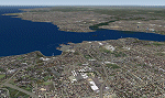
Istanbul Marmara sea FS2004 add on scenery's coastline in Turkey gets affected by HSP base scenery of Greece. With this add on file you fix the affected coastline errors.
The Marmara sea scenery for FS9 may be found as marmara.zip or Marmara%20VFR.rar in various sites. This fix is ONLY for cases where you have also installed Greece BASE package scenery from Hellas Scenery Project (HSP). If you do not have this scenery installed you do not need this fix for the Marmara sea scenery.
| Filename: | Hellas_Scenery_Project_HSP_Greece__FIX_for_Istanbu.zip |
| License: | Freeware |
| Added: | 1st April 2012, 16:56:24 |
| Downloads: | 6,190 |
| Author: | Hellas Scenery Team (HST) |
| Size: | 754.13 KB |
| Category: Flight Simulator X - Scenery | |
| Slovenia - LOD11 (19 meters resolution) Mesh |
|
Images related to this file:
File Description:
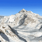
Slovenia, no matter how small, is a country with wide variety of landscapes.
From flat lands in the North-Eastern part one can see lovely rolling hills in
southern regions and razor sharp edges of 8500 ft peaks of the Alps in the
North-Western region.
SRTM elevation data that was used and is provided as default FS X terrain simply
can't cope with the task of representing our terrain in at least a little close
to reality manner, shapes and altitudes of some of our nicest peaks are deformed
beyond recognition, our highest mt. Triglav is with 38 meters SRTM mesh falling
short by almost 3000 ft!
So Slovenia Scenery Team developed this 19 meters resolution using FSX compatible
tools for it's payware scenery, but after development of even finer mesh with 10
meters resolution, we decided to offer the original 19 meters mesh to general
fligt simulation public. Mesh is FS X only and is not compatible with FS9.
Even if released as freeware, this files were uploaded to only some selected
flight simulation sites and redistribution of this scenery is not allowed without
written permission from the authors.
File is packed into a convenient installer that should perform all of the actions
automatically, but, please, do read the License agreement and "Read me" file
included in the installation.
| Filename: | Slovenia__LOD11_19_meters_resolution_Mesh.zip |
| License: | Freeware, limited distribution |
| Added: | 15th May 2012, 19:03:19 |
| Downloads: | 2,216 |
| Author: | SST - Slovenia Scenery Team |
| Size: | 45.15 MB |
| Category: Flight Simulator X - Scenery | |
| Cardiff Xtreme Demo |
|
Images related to this file:
File Description:
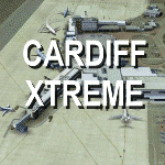
Extremely accurate scenery for Cardiff airport (Welsh: Maes Awyr Caerdydd). Includes night
lighting, animation vehicles, replacement AFCAD file and high resolution ground images. All textures made to the highest standard based on actual photographs.
DEMO version of payware product - fully funtional but has 'demo signs'
| Filename: | Cardiff_Xtreme_Demo.zip |
| License: | Commercial demo |
| Added: | 20th May 2012, 17:17:08 |
| Downloads: | 867 |
| Author: | Gary Summons, UK2000 Scenery |
| Size: | 74.96 MB |
| Category: Flight Simulator X - Scenery | |
| Cardiff Free |
|
Images related to this file:
File Description:
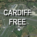
Accurate scenery for Cardiff airport.Includes night
lighting,replacement AFCAD file. All textures
made to the highest standard based on actual photographs.
This scenery is a basic and reduced free version of Cardiff Xtreme.
| Filename: | Cardiff_Free.zip |
| License: | Freeware |
| Added: | 8th June 2012, 20:19:54 |
| Downloads: | 1,969 |
| Author: | Gary Summons/UK2000 Scenery |
| Size: | 24.92 MB |
| Category: Flight Simulator X - Scenery | |
| Doncaster Xtreme |
|
Images related to this file:
File Description:
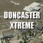
Extremely accurate scenery for Doncaster-sheffield airport (robin hood airport).Includes night lighting, animation vehicles,replacement AFCAD file, XH558 Vulcan aircraft. All textures made to the highest standard based on actual photographs. This is a DEMO version only, for full version please see authors website
| Filename: | Doncaster_Xtreme.zip |
| License: | Commercial demo |
| Added: | 27th October 2012, 20:52:51 |
| Downloads: | 1,043 |
| Author: | Gary Summons - UK2000 Scenery |
| Size: | 97.18 MB |
| Category: Flight Simulator 2004 - Scenery | |
| Doncaster Xtreme |
|
Images related to this file:
File Description:
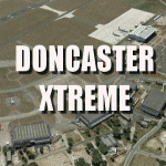
Extremely accurate scenery for Doncaster-sheffield airport (robin hood airport).Includes night lighting, animation vehicles,replacement AFCAD file, XH558 Vulcan aircraft. All textures made to the highest standard based on actual photographs. This is a DEMO version only, for full version please see authors website
| Filename: | Doncaster_Xtreme.zip |
| License: | Commercial demo |
| Added: | 27th October 2012, 20:53:02 |
| Downloads: | 951 |
| Author: | Gary Summons - UK2000 Scenery |
| Size: | 90.75 MB |
| Category: Flight Simulator X - Scenery | |
| Denmark V1.4 |
|
Images related to this file:
File Description: FSX Denmark Scenery v1.4 Part Two. The scenery includes a number of airports,
airfields and VFR landmarks throughout the country, with special attention to
the cities Copenhagen and Aalborg. This scenery is compatible with photo
sceneries, "Denmark Map x" and default FSX.
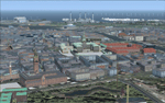
It is recommended to read the wiki:
http://www.fsonline.dk/en/index.php?title=Denmark_Scenery
before installing this package.
| Filename: | Denmark_V14.zip |
| License: | Freeware |
| Added: | 10th November 2012, 16:21:42 |
| Downloads: | 8,888 |
| Author: | The Denmark Scenery Team |
| Size: | 246.75 MB |
| Category: Flight Simulator 2002 - Scenery | |
| Palisades SRTM Altitude Mesh |
|
File Description:
Ever wanted to fly down the VFR corridor over the Hudson River and gawk at all the skyscrapers in New York City? ... in your dreams! The Department of Fatherland Security has closed it down.
But, we still have Flight Simulator. Unfortunately, the altitude mesh for this area is somewhat lacking in detail.
This Palisades altitude mesh remedies that. Covers the Palisades cliffs, of course (but no Amusement Park, sniff), and also Riverside, Morningside, and Washington Heights, and Fort Tryon. In fact, all 5 Boroughs of New York City are covered, as well as most of central and northern New Jersey (visit beautiful downtown Hoboken!), and the larger part of Long Island. Also Rockland, Westchester, Orange, Putnam counties and more. And even Bear Mountain State Park.
Approximate coverage: N40* to N42* and W73* to W75*.
Made from NASA Shuttle Radar Topography Mission data (3 arc-second resampled to LOD9 - horizontal resolution of 76.4 meters) using SRTM to BGL by Matthew Styles (available in the AvSim library.) Very easy to use - give it a try.
BONUS: includes simple instructions so that anyone can make altitude mesh for their area from SRTM data using SRTM to BGL by Matthew Styles. Sorry, SRTM data only available for the Americas at the moment. The rest of the world coming soon. Check inside for more details.
No support of any kind is offered for this package - very sorry.
| Filename: | Palisades_SRTM_Altitude_Mesh.zip |
| License: | Freeware |
| Added: | 12th June 2003, 16:09:26 |
| Downloads: | 2,165 |
| Author: | Luis, scenery design forum |
| Size: | 3.48 MB |
| Category: Flight Simulator 2002 - Scenery Design | |
| Ground2K for Beginners |
|
File Description:
Newly revised for Ground2K version 4
Ground2K version 4 by Christian Fumey is a very easy to use design tool for Flight Simulator terrain scenery. With it, you can create and modify coasts, roads, rivers, lakes, islands, land and water class, altitude mesh, and textured ground polygons.
This short user guide is meant for beginners, and presents some basic concepts concerning Flight Simulator terrain, and a step-by-step explanation of some of the principal functions of Ground2K.
No technical terms are used here, for ease of comprehension.
An HTML document for universal compatibility.
New sections include:
- expanded coverage of basic concepts and functions;
- common problems and errors with solutions;
- glossary of terms
Very sorry - no support is offered for this guide. For any questions, please consult the AvSim forum dedicated to Flight Simulator scenery design.
| Filename: | Ground2K_for_Beginners.zip |
| License: | Freeware |
| Added: | 24th July 2003, 15:24:13 |
| Downloads: | 5,660 |
| Author: | Luis, Scenery Design Fourm |
| Size: | 1.3 MB |


© 2001-2026 AVSIM Online
All Rights Reserved
Privacy Policy |