
Where Flight Simulation Enthusiasts Gather from Around the World!
AVSIM Library - Search Results

| Category: Flight Simulator 2004 - Aircraft Repaints, Textures and Modifications | |
| Swiss and Swiss "10 Years Anniversary" Boeing 767-400ER |

|
Images related to this file:
File Description:
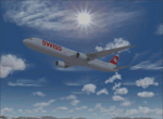
Swiss International Air Lines AG is the flag carrier airline of Switzerland operating scheduled services in Europe and to North America, South America, Africa and Asia. Its main hub is Zurich Airport. The airline was formed after the 2002 bankruptcy of Swissair, Switzerland's former flag carrier.. This Package contains a Swiss and a Swiss "10 Years Anniversary" Livery for the wonderful 767-400ER made by SkySpirit2010. Liveries are fictional and use Reg HB-JHL. Model is not included, repaint made for FS2004 (not tested in FSX). Happy Landings and Thanks for Downloading!
| Filename: | Swiss_and_Swiss_10_Years_Anniversary_Boeing_767400ER.zip |
| License: | Freeware |
| Added: | 14th February 2014, 22:52:13 |
| Downloads: | 209 |
| Author: | Pascal Disch |
| Size: | 15.57 MB |
| Category: Flight Simulator 2004 - Scenery | |
| Gsteigwiler Heliport (LSXG) |
|
File Description:
A small very accurate heliport of BOHAG near Interlaken in the Bernese Oberland (Switzerland) with surrounding trees, cars, dynamic wind sail and smoke effects. It's also a base of the Swiss Rescue Team REGA. All textures are made with digital photographs and some are with spectacular night lightning. It’s the start of a new generation of sceneries with new features like: blended ground textures, electric power cables, detailed fences etc. AFCAD2-File for an entry in the airport library and in the GPS is available. It's our fifth heliport of the SWISS HELICOPTER DESIGN GROUP.
| Filename: | Gsteigwiler_Heliport_LSXG.zip |
| License: | Freeware, limited distribution |
| Added: | 18th May 2004, 23:02:49 |
| Downloads: | 6,837 |
| Author: | Andreas Hegi |
| Size: | 4.25 MB |
| Category: Flight Simulator 2004 - Scenery | |
| FS9 Fort St John CYXJ in BC Canada |
|
File Description:
Fort St John is close to the border between British Columbia and Alberta, around 40 miles north-northwest of Dawson Creek. The airport was originally a Royal Canadian Air Force base, associated with the wartime construction of the Alaska Highway. The airfield was part of this construction effort and the wartime ferrying of planes to Russia. It is currently named "North Peace Regional Airport", or "North Peace Airport"; apparently there has been no final decision?
The date for this scenery is around 2006. I was given an old video tape cassette which was filmed on an uncertain date, but which had to be before the terminal building was renovated in 2007 and totally changed in appearance. The only way to view the video was to play it in the camera and watch it on a small screen. After I had completed everything except the buildings I started to view the video to establish the building appearances and within an hour or so the camera died. It was so old there was no way to repair it, so I then made some new buildings from memory of the video and what was available online. I also used some that I had already made for other scenery but which were similar. I may replace the terminal building that is in this version with a build of the new one, as I know this one is not a very accurate reproduction. The replacement, if I do it, will be towards the end of this year.
The AI included here is for GA, Air Canada Jazz, and two helicopter companies that were (and still are?) based there. One is at the western end of the apron and the other is at the eastern end but separated from the apron. To gain access to the taxiways and runways (so that all airport users follow the same procedures, for safety reasons) the eastern end helicopters just taxi across the grass. The helicopters are used for maintenance trips to the oil and gas fields in the surrounding area. My screenshots show Westjet at the terminal; this is because I have later Canadian AI installed, while the AI included here is only for the time around 2000 to 2010, when Westjet were not flying to Fort St John.
The airport is square in plan, with the apron running along the northern side and two runways forming diagonals. The two runways are 11-29 (6,882 feet long and 200 feet wide, with ILS at the 29 end and PAPI at the other) and 02-20 (6,684 feet long and 200 feet wide, and with PAPI at each end). The eastern side taxiway that runs north-south is not used. The western side taxiway is in use but only as a race track for cars.
Please email me if you find faults, such as a plane without textures.
| Filename: | FS9_Fort_St_John_CYXJ_in_BC_Canada.zip |
| License: | Freeware, limited distribution |
| Added: | 10th October 2022, 14:03:38 |
| Downloads: | 216 |
| Author: | Roger Wensley |
| Size: | 37.49 MB |
| Category: Flight Simulator 2004 - Scenery | |
| Messina, Sicily, Italy, Photo Real |
|
Images related to this file:
File Description:
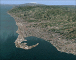
This file contains the photoreal scenery of the province of Messina (northeast corner of Sicily, Italy).The airport of Reggio Calabria (ICAO code LICR) is found near to the scenery. Otherwise the airports of Palermo (LICJ) and Catania (LICC) can be used. The Photo Real Scenery is wide for around 3000 squared Kms.
| Filename: | Messina_Sicily_Italy_Photo_Real.zip |
| License: | Freeware |
| Added: | 1st June 2010, 20:51:24 |
| Downloads: | 15,911 |
| Author: | Fulvio Mazzokan |
| Size: | 78.35 MB |
| Category: Flight Simulator 2002 - Scenery | |
| Rarotonga, Cook Islands, South Pacific |
|
File Description:
Rarotonga - Cook Islands, South Pacific. Version 6 for FS2002/FS2000
This scenery has been designed specifically to replace and enhance the basic scenery in Flight Simulator 2002, for the whole island of Rarotonga.
It is also compatible with FS2000.
Scenery objects are quite extensive both at the airport and throughout the island.
| Filename: | Rarotonga_Cook_Islands_South_Pacific.zip |
| License: | Freeware |
| Added: | 18th January 2003, 21:39:46 |
| Downloads: | 1,230 |
| Author: | Frank Foreman |
| Size: | 1.15 MB |
| Category: Flight Simulator 2002 - Scenery | |
| Bursa LTBE (Fix) |
|
File Description:
Bursa LTBE addon scenery fix. The runway distence signs put the correct locations and added runway ID at start locations. This packace has only the correted scenery files, not included texture and other necessery files. Need original scenery file (Bursa.zip).AFCAD file and airport auto installer including. See readme file for install.
| Filename: | Bursa_LTBE_Fix.zip |
| License: | Freeware |
| Added: | 15th June 2003, 17:14:59 |
| Downloads: | 1,631 |
| Author: | Salim Unuver |
| Size: | 165.13 KB |
| Category: Flight Simulator 2004 - Scenery | |
| Lajes AB, Azores Portugal |
|
Images related to this file:
File Description:
FS2004 scenery for the Lajes Airbase/Airport located in the Azores. Custom scenery and AI included. Scenery is a fully functional stand alone package but can benefit from addtional downloads (see readme in package). Special thanks to Jake Burrus for his P-3 aircraft and Graham King for his eye-popping repaints.
| Filename: | Lajes_AB_Azores_Portugal.zip |
| License: | Freeware, limited distribution |
| Added: | 20th December 2010, 08:43:25 |
| Downloads: | 5,716 |
| Author: | John Stinstrom |
| Size: | 8.1 MB |
| Category: X-Plane - Scenery | |
| KOGD - Ogden-Hinkley - Ogden, Utah |
|
Images related to this file:
File Description:
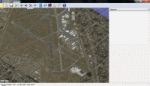
This scenery is to celebrate the return of commercial air service to Ogden-Hinkley. Allegiant now offers service IWA-OGD-IWA! This scenery takes some creative liberty but matches the airport as closely as possible. No substantial frame-rate hit. Enjoy!
| Filename: | KOGD__OgdenHinkley__Ogden_Utah.zip |
| License: | Freeware |
| Added: | 2nd December 2012, 22:36:18 |
| Downloads: | 122 |
| Author: | Aaron Cook |
| Size: | 339.79 KB |
| Category: Flight Simulator 2004 - Scenery | |
| RPMO - Ozamiz Labo Airport v1.0 |
|
File Description:
My very first scenery design for FS2004. Ozamiz is one of the cities in the southern part of the Philippines. The scenery was created using Google Sketchup, GMAX and Airport Design Editor. For FS2004 only. Created by Paulo Zosa/PFSG.
| Filename: | RPMO__Ozamiz_Labo_Airport_v10.zip |
| License: | Freeware |
| Added: | 30th April 2013, 18:52:52 |
| Downloads: | 265 |
| Author: | Paulo Zosa/PFSG |
| Size: | 3.1 MB |
| Category: Prepar3D V1-4 - AFCAD Files | |
| DTTA Carthage Tunis Altitude |
|
File Description:
This file corrects the airport altitude for DTTA Tunis Carthage (in FSX the aircraft sinks about 40 cm down the pavement).
To install, simply copy/past the .BGL file into C:\Program Files (x86)\Lockheed Martin\Prepar3D v3\Scenery\World\scenery.
| Filename: | DTTA_Carthage_Tunis_Altitude.zip |
| License: | Freeware |
| Added: | 21st February 2017, 21:30:22 |
| Downloads: | 403 |
| Author: | John Pereira |
| Size: | 1.16 KB |


© 2001-2026 AVSIM Online
All Rights Reserved
Privacy Policy |