
Where Flight Simulation Enthusiasts Gather from Around the World!
AVSIM Library - Search Results

| Category: Flight Simulator X - AFCAD Files | |
| MSLP - El Salvador/Comalapa International Airport / San Salvador, El Salvador |

|
Images related to this file:
File Description:
MSLP - El Salvador/Comalapa International Airport / San Salvador, El Salvador
This airport update was made with the latest version of ADE (Airport Design Editor) and made for FSX as a replacement for the stock (default) airport. I've made several changes to the airport which are listed below. All these enchancements are as close to the real airport as I can get with stock library objects. I've used satellite images, terminal photos and maps throughout the whole process so building locations are as accurate as possible. Happy landings in the sunny El Salvador!
Features:
*Fixed parking apron
*Main terminal building with its jetways
*Seperate parking apron for GA traffic
*Hangars and other airport buildings added
*Airport vehicles and objects throughout the airport
*Military cargo apron
*Parking lots with static vehicles
*Airport fire station with fire trucks
*Cargo area
*ILS heading error in stock file corrected
*Runway 18/36 closed as in the real world
| Filename: | MSLP__El_SalvadorComalapa_International_Airport__S.zip |
| License: | Freeware |
| Added: | 28th July 2012, 08:42:46 |
| Downloads: | 888 |
| Author: | Jaison Diaz / Endeavour ai |
| Size: | 128.88 KB |
| Category: Flight Simulator 2004 - Scenery | |
| Flying Cloud Airport KFCM |
|
File Description:
FS2004 Scenery-Flying Cloud Airport (KFCM) serves Minneapolis and Hennepin County and is owned by Metropolitan Airport Cmsn. The airport has more than one runway. The longest is a paved runway extending 3909 feet. The facility is at an elevation of 906 feet at a distance of about 11 miles from Minneapolis. This scenery was created using FSDS3, EZ Scenery, Rwy12, Lago's FSE and AFCAD2 and Traffic Tools.Objects placed with slightly different method. Please read readme file. Some textures included.
| Filename: | Flying_Cloud_Airport_KFCM.zip |
| License: | Freeware |
| Added: | 7th January 2006, 20:59:06 |
| Downloads: | 1,203 |
| Author: | John B. Loney, Jr. |
| Size: | 2.17 MB |
| Category: Flight Simulator 2004 - Scenery | |
| Corpus Christi International Airport - KCRP |
|
File Description:
This scenery is built for FS2004. This scenery was created with Abacus EZ Scenery, but you do not need the EZS libraries. On the contrary you will need the RWY12 libraries installed. I have added a terminal replacement, airport vehicles, parking spots, and lights. The gates are designed for certain planes. The gates are assigned as the airport's website (http://www.cctexas.com/airport/) indicates. I used Google Earth Imagery to very accurately place the gates.
| Filename: | Corpus_Christi_International_Airport__KCRP.zip |
| License: | Freeware |
| Added: | 18th February 2007, 10:59:06 |
| Downloads: | 3,534 |
| Author: | Brandon DePalo / Watsup Sceneries |
| Size: | 1.39 MB |
| Category: Flight Simulator 2002 - Scenery | |
| Fish Lake Fix |
|
File Description:
This is a fix for the FS2002 default scenery that surrounds the airport at fish lake USFS in Idaho. It also works with Denney's mesh (originally created for FS2000, but works fine in FS2002). The default scenery has fish lake that is situated at the approach end of of runway 21 elevated about fifty feet above the elevation of the airport. This scenery .bgl flattens the lake area to make the approach to runway 21 as it is at the real airport.
| Filename: | Fish_Lake_Fix.zip |
| License: | Freeware |
| Added: | 22nd May 2003, 21:18:32 |
| Downloads: | 362 |
| Author: | Tim Slanczka |
| Size: | 209.95 KB |
| Category: Flight Simulator 2004 - Scenery | |
| DBWsim: Hickam AFB 2004 |
|
File Description:
The second DBWsim scenery pack for the Hawaiian island of Oahu follows up on DBWsim’s Pearl Harbour 2004 with DBWsim Hickam AFB 2004. This scenery pack covers primarily Hickam AFB in the west of the Honolulu International airport region, as well as a significant overhaul of the Honolulu International Airport area. This scenery is designed to complement DBWsim Pearl Harbour 2004 and is intended for use with (but will operate independant of) Bill Melichar’s ‘FS2004, Honolulu International Airport, Version 5’.
| Filename: | DBWsim_Hickam_AFB_2004.zip |
| License: | Freeware |
| Added: | 14th November 2004, 20:19:05 |
| Downloads: | 9,024 |
| Author: | Derek and Brendan Webb |
| Size: | 2.64 MB |
| Category: Flight Simulator X - AFCAD Files | |
| KPSO - Stevens Field, Pagosa Springs, Colorado, USA - V2.0 |
|
Images related to this file:
File Description:
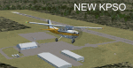
Updated scenery of Stevens Field, Pagosa Springs Airport nested in the high-altitude Rocky Mountains of Colorado. This scenery includes the airport and land class for surrounding areas to include the many small lakes, the city of Pagosa, and nearby inhabited areas. Airport features runway distance markers, new taxiways, taxiway signs, realistic parking, scenery objects, hangars, and FBO. How is your high-altitude flying? Enjoy! Version 2 includes updated taxiway structure circa 2013, signage, major roads added, and land class tweaks.
| Filename: | KPSO__Stevens_Field_Pagosa_Springs_Colorado_USA__V.zip |
| License: | Freeware |
| Added: | 30th May 2013, 06:10:06 |
| Downloads: | 536 |
| Author: | AJ Cook |
| Size: | 17.21 KB |
| Category: Flight Simulator 2004 - Scenery | |
| WION Ranai, Indonesia |
|
File Description:
Googly scenery for Ranai, a domestic airport located on Natuna Besar,
the main island of the 272 islands comprising the Natuna archipeligo in
Indonesia. The airport is served by daily flights of Riau Airlines using
Fokker 50 turboprop aircraft.
Flight Simulator 2004 has only provided a runway at this airport and this scenery
seeks to redress the situation so that you and your "AI" traffic can use the
airport.
The scenery does not purport to be ultra-accurate. Based on high quality
satellite imagery from Google Earth, the layout is proportionally correct but the
added airport features, such as buildings, are built from default Microsoft objects
and add-on libraries so will not look exactly like the real thing.
You are not obliged to download and install any additional scenery libraries,
but to enjoy this scenery in its entirety, you may wish to. It will work fine,
with or without.
| Filename: | WION_Ranai_Indonesia.zip |
| License: | Freeware |
| Added: | 11th October 2008, 13:12:55 |
| Downloads: | 1,242 |
| Author: | John Hinson |
| Size: | 60.07 KB |
| Category: Flight Simulator 2004 - Scenery | |
| HSMK Rumbek, Sudan |
|
File Description:
Googly scenery for HSMK Rumbek, a small airport serving the city of the same
name, capital of the Buhayrat (or Lakes) state in southern Sudan. The airport
is served daily by Beech 1900 aircraft operating for Delta Connection, a
Kenyan airline.
Flight Simulator 2004 has completely omitted this airport and this scenery
seeks to redress the situation so that you and your "AI" traffic can use the
airport.
The scenery does not purport to be ultra-accurate. Based on high quality
satellite imagery from Google Earth, the layout is proportionally correct but the
added airport features, such as buildings, are built from default Microsoft objects
and add-on libraries so will not look exactly like the real thing.
You are not obliged to download and install any additional scenery libraries,
but to enjoy this scenery in its entirety, you may wish to. It will work fine,
with or without.
| Filename: | HSMK_Rumbek_Sudan.zip |
| License: | Freeware |
| Added: | 19th April 2008, 20:33:09 |
| Downloads: | 754 |
| Author: | John Hinson |
| Size: | 78 KB |
| Category: Flight Simulator 2004 - Scenery | |
| OP0C Bandari, Pakistan |
|
File Description:
Googly scenery for Bandari, a minor airport in Palistan served once weekly by
Metroliner turboprops of Royal Airlines. The airport has neither ICAO not IATA
status, but Microsoft have given it an unofficial ICAO code of OP0C.
Flight Simulator 2004 has only provided a runway at this airport and this scenery
seeks to redress the situation so that you and your "AI" traffic can use the
airport.
The scenery does not purport to be ultra-accurate. Based on high quality
satellite imagery from Google Earth, the layout is proportionally correct but the
added airport features, such as buildings, are built from default Microsoft objects
and add-on libraries so will not look exactly like the real thing.
You are not obliged to download and install any additional scenery libraries,
but to enjoy this scenery in its entirety, you may wish to. It will work fine,
with or without.
| Filename: | OP0C_Bandari_Pakistan.zip |
| License: | Freeware |
| Added: | 20th April 2008, 17:04:59 |
| Downloads: | 556 |
| Author: | John Hinson |
| Size: | 74.99 KB |
| Category: Flight Simulator 2004 - Scenery | |
| Queensland2 Soaring Scenery |
|
File Description:
FS2004 Queensland2 Soaring Scenery
These files adds some thermals to default Microsoft Scenery ,over below Regions:
1.Nebo Airstrip
Coordinates:
S 21* 42´ 14´´ - E 148* 41´138´´ - Elevation - 655ft
2.Ilbilbie City -
Coordinates:
S 21* 42´19´´ - E 149* 21´27´´ - Elevation - 120ft
3.Eungella Hang Glider Site
Coordinates:
S 21* 7´52´´ - W 148* 29´36´´ - Elevation - 2,200ft
4.Flights for 3 above sites are found at option: Tool Bar(Screen Top of FS9) - choose Flights and Select a Flight(Soaring over Nebo,Ilbilbie or Eungella).
It is freeware.
Goods flights and better landings
By Francisco Vargas.
E-mail:[email protected]
| Filename: | Queensland2_Soaring_Scenery.zip |
| License: | Freeware |
| Added: | 13th November 2005, 23:14:33 |
| Downloads: | 243 |
| Author: | Francisco Augusto Vargas Carneiro |
| Size: | 204.84 KB |


© 2001-2026 AVSIM Online
All Rights Reserved
Privacy Policy |