
Where Flight Simulation Enthusiasts Gather from Around the World!
AVSIM Library - Search Results

| Category: Flight Simulator 2004 - Scenery | |
| Rabah Bitat Airport (DAAB) Algeria - Scenery |

|
File Description:
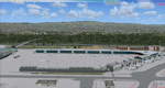
Formerly known as Les Salines Airport, and popularly as El Mellah Airport is an international airport located 9 km south of Annaba, a city in Algeria. It is named after Rabah Bitat a president of Algeria (1978-1979). During World
War II the airport was known as Bone Airfield, and was used by the German Luftwaffe. Later captured by the United States Army, the USAAF Twelfth Air Force in the Western Desert Campaign in 1942-1943.
| Filename: | Rabah_Bitat_Airport_DAAB_Algeria__Scenery.zip |
| License: | Freeware |
| Added: | 7th July 2010, 14:55:28 |
| Downloads: | 1,968 |
| Author: | Emad Qtiefan |
| Size: | 5.58 MB |
| Category: Flight Simulator 2004 - Scenery | |
| Tel Aviv Lod Airport Scenery 1961 |
|
File Description:
Lod Airport, now called Ben Gurion International Airport started out in 1936 as Lydda Airport, an airstrip of four concrete runways on the outskirts of the Arab town of Lydda. By the mid-1960s, 14 international airlines were landing at Lod Airport.
I have backdated Lod airport back to 1961, when it was much smaller than today. Lod was and is Tel Aviv's major airport, used for all airline flights in 1961, and most international flights today. I have used GMAX to create the terminal and many of the hangars and other buildings at the airport, and have also used many library objects to increase the detail around the airport. Landclass files are included to reduce the city area back to their sizes in the 1960's. I have also backdated 4 other airports: Eilath (LLET), Sde Dov (LLSD), Mahanaim (LLIB), and Beer Sheeba (Teyman LLBS). These use library objects to increase the airport detail as well. These cities constituted the entire route network of Arkia, the local airline of Israel, in 1961.
| Filename: | Tel_Aviv_Lod_Airport_Scenery_1961.zip |
| License: | Freeware, limited distribution |
| Added: | 30th October 2008, 20:30:22 |
| Downloads: | 2,850 |
| Author: | Mike Stevens |
| Size: | 699.82 KB |
| Category: Flight Simulator 2002 - Scenery | |
| Lyon - St Exupery |
|
File Description:
FS2002 Scenery Lyon - St Exupery Airport
Realistic freeware scenery for the main
Lyon's airport. Saint Exupery is one of
the biggest airport in France, located
in the south-east of the country.
| Filename: | Lyon__St_Exupery.zip |
| License: | Freeware |
| Added: | 26th July 2002, 15:38:25 |
| Downloads: | 3,504 |
| Author: | Yannick Mille |
| Size: | 1.23 MB |
| Category: Flight Simulator X - Scenery | |
| Frankfurt Main Airport v6 (EDDF) scenery auto install |
|
Images related to this file:
File Description:
This major update for Frankfurt Main Airport supersedes v5.3 and includes an installer to simplify the process of installing the standard texture and scenery files This update now includes the new A-plus terminal with 7 gates (4xA380) complete with real-world textures and night lighting, a new lighted control tower model plus a whole new set of custom built Gmax models of airport buildings which help add realism to the airport. Also modelled is the extended G Apron on the south side now with x parking spots and night lighting, the Rwy 18 blast fence and A380 engine blast wall. Also included in this package are the latest airport runways/taxiway designations including latest updates to taxiway Sierra, ILS frequencies and navaids including the new VOR as per May 2012. Default FSX scenery is required.
Also includes updated airline codes for gate parking and other minor defect fixes.
See readme/help file for more details.
| Filename: | Frankfurt_Main_Airport_v6_EDDF_scenery_auto_instal.zip |
| License: | Freeware |
| Added: | 27th May 2012, 23:05:35 |
| Downloads: | 1,006 |
| Author: | Mark Aldridge |
| Size: | 7.27 MB |
| Category: Flight Simulator 2004 - Scenery | |
| Calcinate del Pesce, Italy |
|
Images related to this file:
File Description:
Calcinate del Pesce is a small gliders airport placed on Varese lake, approx 25 miles north-west Milan Italy, closed to the Prealpi hills. North of the hills around you can find towers and observer of Campo dei Fiori meteo station. The airport is also base of Elilombarda, helicopter-rescue. Contents: Grass runway placed approx on the real coordinates, with ILS and taxi ways; five different hangars and fast food on the entrance; 10 gliders parked on the ground, several glider boxes all around the airport; a lot of trees around the scenery and lights on parking, gliders and road areas; wind sign, static Cessna, fuel station, people and cars; bird storm floating in the air; complete fences on all the airport perimeter with opening gate; two helicopters on ground and a Coca Cola balloon; small pier in the lake with dinghy; Varese open footbal stadium, close sport building and cathedral (fiction); Campo dei Fiori fantasy scenery with observe and comunication towers
| Filename: | Calcinate_del_Pesce_Italy.zip |
| License: | Freeware |
| Added: | 16th February 2011, 15:34:22 |
| Downloads: | 767 |
| Author: | Aldo Della Vedova |
| Size: | 12.28 MB |
| Category: Prepar3D V1-4 - Scenery | |
| CYYC - Calgary International Airport - Alberta, Canada |
|
File Description:
Prepar3D Scenery--Calgary International Airport (CYYC), Alberta, Canada. This is Ray Smith's file CYYC_RS_FSX.ZIP, modified with his permission. This airport update is for CYYC with two optional files made only for Prepar3D, one version with the crosswind runways operating where all four runways will be used for takeoff and landing and one version as the default runway operation. Assigned parking as per their website with extra parking. The Calgary Airport Authority will be implementing concourse name and gate number changes, these are now updated to this plan, the new IFP international concourse under construction with many of the buildings added, the new runway 17L/35R now included with ILS also added for it, taxiways and taxi signs updated to the latest charts, Barlow Trail NE removed, lighted helipad, extra fuel trucks, support vehicle roads rebuilt and many other scenery improvements, airport views are from inside the new control tower (when in tower view) and the old control tower dismantled. By Robert Catherall.
| Filename: | CYYC__Calgary_International_Airport__Alberta_Canad.zip |
| License: | Freeware |
| Added: | 8th October 2015, 21:56:51 |
| Downloads: | 1,289 |
| Author: | Robert Catherall |
| Size: | 900.21 KB |
| Category: Flight Simulator X - AFCAD Files | |
| Ionian Airports - Greece |
|
File Description:
The four airports in this upload were all designed using Airport Design Editor(ADE). I decided to put all four in this upload as between them they service the whole of the Ionian coastline and the islands, and are vital to the tourist industry in this area.
With the exception of LGPZ, (which has ILS in the real world), I have included an ILS option in each airport folder.
You should download the fabulous Lights package by Jim Dhaenens and the brilliant Car Park package by Sidney Schwartz, as modified by Martin Gossman at Owl's Nest, because two airports use one oe more of these great designs.
| Filename: | Ionian_Airports__Greece.zip |
| License: | Freeware |
| Added: | 23rd February 2013, 12:29:09 |
| Downloads: | 420 |
| Author: | Mike Major |
| Size: | 52.38 KB |
| Category: Flight Simulator 2004 - Gauges | |
| FS2004 GPS Map View Gauge v2.0 |
|
File Description:
The ultimate gauge. The Map will show: Airports details (Runways ID's, length & ILS), VOR's and NDB's frequencies,
Intersections and waypoints, Airspaces, Approaches and flight routes. You can toggle the view
you require for your flight. Also you can zoom in/out to see the nearest airports, vor's and
ndb's. The map will indicate A/C heading flightplan title and waypoints ID's.
Version 2 includes more enhancements such as the ability to input the ICAO code of any airport and the map will show all the frequencies of that airport including ATIS, ILS, AND COM. In addition, the map will show the active runway designations, length and width.
| Filename: | FS2004_GPS_Map_View_Gauge_v20.zip |
| License: | Freeware, limited distribution |
| Added: | 18th August 2005, 22:15:05 |
| Downloads: | 5,158 |
| Author: | Talal Alhaj |
| Size: | 372.12 KB |
| Category: Flight Simulator 2002 - AFCAD Files | |
| Full ILS for San Diego's Lindbergh International, Rwy 27 |
|
File Description:
A 'somewhat' fictional ILS/GS for runway 27 at San Diego's Lindbergh International Airport for FS2002. Requires AFCAD and a small bit of Windows Explorer work. Created with AFCAD (Lee Swordy) and NAV Aids (Hervé Sors). Many thanks to both authors for their excellent utilities.
| Filename: | Full_ILS_for_San_Diegos_Lindbergh_International_Rw.zip |
| License: | Freeware |
| Added: | 21st May 2003, 03:04:17 |
| Downloads: | 335 |
| Author: | Greg Gott |
| Size: | 90 KB |
| Category: Flight Simulator 2004 - AFCAD Files | |
| Mobile Downtown (KBFM) |
|
File Description:
Mobile Downtown with gates, parking, cargo and GA. Taxiway system has also been modified and a ILS has been added to rw 14. No attempt to render a realistic facility was made, the modifications allow more traffic to use the airport should you wish.
| Filename: | Mobile_Downtown_KBFM.zip |
| License: | Freeware |
| Added: | 14th March 2004, 17:35:11 |
| Downloads: | 505 |
| Author: | Don Janusz |
| Size: | 5.04 KB |


© 2001-2026 AVSIM Online
All Rights Reserved
Privacy Policy |