
Where Flight Simulation Enthusiasts Gather from Around the World!
AVSIM Library - Search Results

| Category: Flight Simulator 2004 - Scenery | |
| ZBSN - Tangshan Sannvhe Airport |

|
Images related to this file:
File Description:
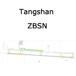
A basic google-earthed scenery for the new Tangshan airport which is missing in FS9 stock version.
All features accurately placed/shaped according to sat imagery. Navaids valid as AIRAC 1110.
Features basic default terminal, tower, and taxisigns.
Tower frequency, taxiway & parking designators are fictionnal, as ILS 28 approach coded for AI & UI.
Scheduled operators at ZBSN: Shanghai Airlines, Hainan Airlines, Lucky Air, Beijing Capital Airlines.
| Filename: | ZBSN__Tangshan_Sannvhe_Airport.zip |
| License: | Freeware, limited distribution |
| Added: | 10th January 2012, 14:19:18 |
| Downloads: | 607 |
| Author: | Yohann Baptiste |
| Size: | 395.03 KB |
| Category: Flight Simulator 2004 - Scenery | |
| ZBYC - Yuncheng Zhangxiao Airport |
|
Images related to this file:
File Description:
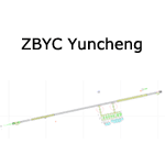
A google-earthed scenery for the Yuncheng civil airport which is missing in FS9 stock version, with basic default terminal, tower, and taxisigns.
All features accurately placed/shaped according to sat imagery. Navaids valid as AIRAC 1110.
Tower frequency, taxiway & parking designators are fictionnal.
ILS 26 & VOR 08 approaches coded for AI & UI.
Current scheduled operators at ZBYC: Air China, China Eastern, Shanghai Airlines, Shenzhen Airlines, Hainan Airlines, Tianjin Airlines, China Express Airlines.
| Filename: | ZBYC__Yuncheng_Zhangxiao_Airport.zip |
| License: | Freeware, limited distribution |
| Added: | 13th January 2012, 00:33:38 |
| Downloads: | 742 |
| Author: | Yohann Baptiste |
| Size: | 340.49 KB |
| Category: Flight Simulator X - Scenery | |
| VOBL - Bengaluru International Airport |
|
File Description:
Bengaluru International Aiport, Bangalore, India. This is a very accurate scenery as of 2012. Features whole airport (not included by default in FSX), gates equiped to handle A380 traffic. Hope you enjoy!!
| Filename: | VOBL__Bengaluru_International_Airport.zip |
| License: | Freeware |
| Added: | 4th May 2012, 15:53:58 |
| Downloads: | 2,491 |
| Author: | Rj Gill |
| Size: | 5.38 KB |
| Category: Flight Simulator X - Scenery | |
| Saratoga County Airport Fix |
|
Images related to this file:
File Description:
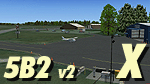
Saratoga County Airport (5B2) v2.0 ADE fix. Reworked ADE file to fix bad parking spot links. AI traffic navigate to and from parking spots correctly with this release. Requires 5B2_X_v2.zip
| Filename: | Saratoga_County_Airport_Fix.zip |
| License: | Freeware, limited distribution |
| Added: | 8th May 2012, 02:44:34 |
| Downloads: | 796 |
| Author: | EdGeneer Cox |
| Size: | 6.11 KB |
| Category: Flight Simulator 2004 - Sounds | |
| Hachijojima Airport ICAO RJTH |
|
Images related to this file:
File Description:

FS2004/FSX EditVoicepack Callsign file for Hachijojima Airport, RJTH/HAC, Japan. This is part of our 11th round of EditVoicepack files. Our goal is to provide accurate ATC calls in order to provide Microsoft Flight Simulator traffic with quality ATC. These sounds are the best that we have been able to compile and are accurate as of release date and to the extent that our data and the limitations of the EditVoicepack allow. Visit us at www.alpha-india.net for more information.
| Filename: | Hachijojima_Airport_ICAO_RJTH.zip |
| License: | Freeware, limited distribution |
| Added: | 18th May 2012, 17:40:28 |
| Downloads: | 222 |
| Author: | Bruce Nicholson & Alpha India Group |
| Size: | 2.64 KB |
| Category: Flight Simulator X - AFCAD Files | |
| Lakewood Airport (N12), NJ |
|
File Description:
See ReadMe file for details. Scenery constructed with use of satellite images/streetview/aerial photos - the author has not been there in person. This scenery is meant to be used in conjunction with MegaScenery Earth New Jersey/Delaware 002. It is not required, but apron use is minimized to allow satellite scenery to show through as much as possible, and objects are placed based on the MSE textures - lack of it may make scenery look out of place.
| Filename: | Lakewood_Airport_N12_NJ.zip |
| License: | Freeware |
| Added: | 13th July 2012, 05:52:11 |
| Downloads: | 192 |
| Author: | Drew Sikora |
| Size: | 3.39 MB |
| Category: Flight Simulator X - Flight Plans | |
| Rocky Mountain Airport Tour |
|
File Description:
Rocky Mountain Airport Tour:
A very hard flight plan in common GA Aircraft. I flew this with a Carenado B58. VFR Flight with wild swings in Altitudes. Maintain 16000 (One Six Thousand) feet for most of the flight to and from the airports. You will have to fly around mountains on approaches with steep short field finals. GPS flight plan is just a guide. You will have to follow the mountain passes from some airports in order to attain sufficient altitude (in some cases). Don't wimp out! Max load your plane.
Country: USA
State: Cololorado
Start: KDRO (Make sure you start from a parking spot)
End: KHDN
Most difficult: Taking off at Buckhorn Ranch (8000+ feet ALT, 4000 FT Runway)
Toughest area between airports:
KASE to KEGE
Time to compleat: about 3 hours
Good Luck.
Questions Contact me at AVSIM
Avsim ID: hawkDsl
To Install: Copy "Rocky Mountain Airport Tour.pln" and paste it into you FSX flight plan file
Win7 : userfiles/my document/Flight Simulator X Files
| Filename: | Rocky_Mountain_Airport_Tour.zip |
| License: | Freeware |
| Added: | 21st July 2012, 13:26:52 |
| Downloads: | 473 |
| Author: | Henry Oeser |
| Size: | 1.94 KB |
| Category: Flight Simulator X - Scenery | |
| 3U2 Johnson Creek Airport |
|
File Description:
"Johnson Creek Airport (FAA LID: 3U2) is a grass airstrip located in Central Idaho three miles (5 km) south of Yellow Pine, a village in Valley County, Idaho, United States. It is managed by the Idaho Division of Aeronautics of the Idaho Transportation Department. A caretaker resides at the field, and as a result, the turf runway is well cared for. Johnson Creek is in the category of backcountry airstrips, and is popular with pilots who enjoy airplane camping." - Wikipedia
This FSX rendition includes volumetric grass, static aircraft, 1 meter/pixel photoscenery, 10 meter mesh, full autogen annotation, and is color corrected and blended into the surrounding scenery.
| Filename: | 3U2_Johnson_Creek_Airport.zip |
| License: | Freeware, limited distribution |
| Added: | 22nd July 2012, 20:11:57 |
| Downloads: | 899 |
| Author: | Orion Lyau |
| Size: | 12.69 MB |
| Category: Flight Simulator X - Scenery | |
| Knoxville Municipal Airport KOXV |
|
Images related to this file:
File Description:
FSX Scenery - The Knoxville Municipal Airport, (KOXV) renamed Jim Bellamy Field, serves the greater Knoxville community and the surrounding areas of Marion County, Iowa. The airport is comprised of 120 acres, and is located at the southern edge of Knoxville, adjacent to the Highway 14 & Highway 5/92 interchange. The 4,000 foot (by 75 foot) single runway is constructed of concrete, with parallel taxiway. The facility is at an elevation of 928 feet at a distance of about 2 miles from Knoxville. Created for your flying pleasure by John B Loney, Jr.
| Filename: | Knoxville_Municipal_Airport_KOXV.zip |
| License: | Freeware, limited distribution |
| Added: | 13th October 2012, 17:18:20 |
| Downloads: | 541 |
| Author: | John B. Loney, Jr. |
| Size: | 31.45 MB |
| Category: Flight Simulator X - AFCAD Files | |
| LGKR Corfu Airport, Greece |
|
File Description:
This re-design was made using ADE (Airport Design Editor). As this is my first attempt to re-design an airport I need to thank scruffyduck and other simmers who helped me get over a few problems. I have enlarged the parking apron and the terminal building and corrected the parking allocations. Although this re-design is not totally accurate I have got as close as I can using Google Earth and a Jeppessen chart and my local knowledge. LGKR has no ILS system but I have added one for simmers who prefer to use it.
| Filename: | LGKR_Corfu_Airport_Greece.zip |
| License: | Freeware |
| Added: | 1st January 2013, 14:19:44 |
| Downloads: | 683 |
| Author: | Mike Major |
| Size: | 5.83 KB |


© 2001-2026 AVSIM Online
All Rights Reserved
Privacy Policy |