
Where Flight Simulation Enthusiasts Gather from Around the World!
AVSIM Library - Search Results

| Category: Flight Simulator 2002 - Scenery Design | |
| Macros for Airport Windows 2 Buildings |

|
File Description:
Macros Airport 2.60 Embassy Suites and Linda's Overboard Club. Building fronts by John Langstrin, night and logo textures & apis by jimmy. Created with FSDSA, MS Paint, and Paint Shop Pro 7.04. FOR DESIGNERS ONLY. by jimmy R martin.
| Filename: | Macros_for_Airport__Windows_2_Buildings.zip |
| License: | Freeware |
| Added: | 1st December 2002, 20:52:01 |
| Downloads: | 717 |
| Author: | jimmy R martin |
| Size: | 87.25 KB |
| Category: Flight Simulator X - AFCAD Files | |
| YBWW - Brisbane West Wellcamp - Queensland, Australia |
|
Images related to this file:
File Description:

AFCAD for the newly built Brisbane West Wellcamp airport (YBWW).
Aerodrome was recreated as accurately as possible based on Jeppesen and Airservices Australia data.
Includes terminal waypoints and RNAV Approaches for the default FSX map, GPS and ATC.
| Filename: | YBWW__Brisbane_West_Wellcamp__Queensland_Australia.zip |
| License: | Freeware |
| Added: | 8th December 2014, 13:55:39 |
| Downloads: | 393 |
| Author: | Nick Langley |
| Size: | 1.17 MB |
| Category: Flight Simulator 2004 - Scenery | |
| Camarillo, CA - (KCMA) - Update |
|
File Description:
Camarillo, CA Airport (KCMA) - UPDATE. This update adds AI Ultra-lite aircraft to the beautifully detailed airport by John B. Loney Jr. The excellent Sky Seeker Ultra-lite (included in this package) by Fern Marques has been repainted by John Burford in 5 colorful textures and is used with permission from the author. Use the Zip-Dive option to see more screenshots. A proper installation of KCMA is required (kcma_v1.zip.zip - available here). This update package also includes two minor visual corrections to the Camarillo airport property. Please unzip to a temporary folder and follow the easy installation instructions. Project compiled for your flying enjoyment by David "Opa" Marshall.
| Filename: | Camarillo_CA__KCMA__Update.zip |
| License: | Freeware |
| Added: | 29th May 2007, 14:46:15 |
| Downloads: | 1,298 |
| Author: | David "Opa" Marshall and John B. Loney Jr. |
| Size: | 3.35 MB |
| Category: Flight Simulator X - Scenery | |
| TNCA - Queen Beatrix Intl. Airport (Aruba) |
|
File Description:
Queen Beatrix International Airport (IATA: AUA, ICAO: TNCA), in Oranjestad, Aruba, is a fairly large aviation facility that has
flight services to the United States, most countries in the Caribbean, the northern coastal countries of South America and some parts
of Europe, notably the Netherlands. It was named after Queen Beatrix of the Netherlands, the head of state of Aruba.
This airport used to serve as the hub for bankrupt airline Air Aruba, which was for many years an international airline.
Before Aruba's separation from the Netherlands Antilles in 1986 it was also one of three hubs for Air ALM. The airport has
a new airline, Tiara Air and Aruba Airlines.
| Filename: | TNCA__Queen_Beatrix_Intl_Airport__Aruba.zip |
| License: | Freeware |
| Added: | 22nd April 2009, 07:15:26 |
| Downloads: | 2,311 |
| Author: | Daniel Louvet |
| Size: | 1.8 MB |
| Category: Flight Simulator 2004 - AFCAD Files | |
| Santa Barbara Mun (KSBA) California |
|
File Description:
This file is a version for the default airport (a big thanks to Lee Swordy's latest version of AFCAD2 which i used here) with extra gates/parking airport views are from the roof of the control tower (only when you are in TOWER view) for those with afcad2 can lower the tower height by 30ft you will then be inside the control tower but may find the tinted glass to dark to see clearly especially at night time asphalt areas around the airport realigned with the buildings and all runways/taxiways/aprons now have improved lighting and for the heli pilots i have added a helipad which also has lighting
| Filename: | Santa_Barbara_Mun_KSBA_California.zip |
| License: | Freeware |
| Added: | 8th December 2003, 19:29:10 |
| Downloads: | 975 |
| Author: | Ray Smith |
| Size: | 6.15 KB |
| Category: Flight Simulator 2004 - Scenery | |
| Scenic Airport Series First Release- Tuweep, AZ (L50) |
|
File Description:
I am proud to announce the first release in my series of AFCAD2 Scenic airports. This series takes advantage of the AFCAD program and makes it a scenery tool as well as a facility tool. In addition, traffic has been added to the airport to make it more realistic, along with one historic aircraft doing touch and goes from 7 AM to 7 PM. This first release is of the Tuweep Airport in Tuweep, Arizona (L50). Nestled next to the Grand Canyon, this airport offers a great place for scenic VFR flying. Enjoy! NOTE: It is very important that you read the readme file enclosed.
| Filename: | Scenic_Airport_Series_First_Release_Tuweep_AZ_L50.zip |
| License: | Freeware, limited distribution |
| Added: | 11th November 2003, 06:00:59 |
| Downloads: | 1,634 |
| Author: | Jesse Elliott |
| Size: | 386.62 KB |
| Category: Flight Simulator X - Scenery | |
| Port Allen airport Scenery, Hawaii - PAK |
|
File Description:
Aloha! -
This is a fictitious rendition of the actual airport at Port Allen, Hawaii USA - PAK.
Port Allen Airport is approx. one mile southwest of the town on Hanapepe on the south shore of Kauai.
Virtual improvements have finally come to the beautiful garden paradise. Come see for yourself! Stay at the new virtual Hanapepe resort.
I took a boring airport and added some "eye-candy" in order to have something nice to look at in addition to the spectacular ocean front properties.
Designed with the FS X Sdk Scenery function of the Mission builder and the Abacus Scenery shortcut tool.
This scenery is frame rate friendly.
| Filename: | Port_Allen_airport_Scenery_Hawaii__PAK.zip |
| License: | Freeware |
| Added: | 26th January 2007, 18:45:14 |
| Downloads: | 1,881 |
| Author: | Bob Caparoula |
| Size: | 7.74 MB |
| Category: Flight Simulator X - Scenery | |
| LOLO - Linz-Ost Flugplatz, Austria |
|
Images related to this file:
File Description:
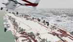
The Airfield Linz-Ost located ca. 12 km eastern from Airport Linz-Hoersching (blue danube Airport Linz / LOWL) in Upper Austria. He located in the industry site of the town Linz direct Danube River. He has a grass runway with 940 m length and was used from April - October from glider and GA. -----
Der Flugplatz Linz-Ost liegt ca. 12 km oestlich vom Flughafen Linz-Hoersching (blue danube Airport Linz / LOWL) in Oberoesterreich und liegt im Industriegelaende der Stadt Linz direkt an der Donau. Er besitzt eine Gras Landebahn mit einer Laenge von 940m und wird in den Monaten April bis Oktober von Motor- und Segelflugzeugen genutzt.
| Filename: | LOLO__LinzOst_Flugplatz_Austria.zip |
| License: | Freeware |
| Added: | 30th January 2013, 19:42:57 |
| Downloads: | 3,057 |
| Author: | Oliver Brandl |
| Size: | 159.32 MB |
| Category: Prepar3D V1-4 - Scenery | |
| Cocos Islands Australia N5.31.46 W87.03.28 and Island sharks S11.48.79 E96.46.90 |
|
File Description:
Cocos Islands Australia N5.31.46 W87.03.28 Islands on the Pacific Ocean off the coast of Central America were
discovered by the Scottish captain John Clunies-Ross landed in the Cocos Islands in 1825, Today they are under the
Australian domination. The archipelago has ICAO YPCC airport, in the scenario were added airport infrastructure
and the Islands sharks S11.48.79 E96.46.90 have a seairport and is a island only occasionally lived by scuba divers to
visit the seabed that is particularly inhabited by sharks. Important VFR point for approaching airport YPCC.
Within the downloaded package you will find readme files for scenery installation. Good fly VFR. Pasquale Marrulli.
| Filename: | Cocos_Islands_Australia_N53146_W870328_and_Island_.zip |
| License: | Freeware |
| Added: | 21st May 2018, 22:36:15 |
| Downloads: | 361 |
| Author: | Pasquale Marrulli |
| Size: | 1.48 MB |
| Category: Flight Simulator 2004 - Scenery | |
| Ft Collins-Loveland Muni 'KFNL' |
|
File Description:
FS2004 Scenery-Fort Collins-Loveland Municipal Airport, Colorado (KFNL) serves Fort Collins/Loveland and Larimer County and is owned by Fort Collins & Loveland. The airport has more than one runway. The longest is a paved runway extending 8500 feet. The facility is at an elevation of 5016 feet at a distance of about 9 miles from Fort Collins/Loveland. Fort Collins-Loveland Municipal Airport is mostly used for general aviation but is also served by one commercial airline, Allegiant Air. This scenery is not an attempt to be picture accurate. Requires the EZ scenery libraries. Read the readme file for list. Lago's FSE optional. By John B. Loney, Jr.
| Filename: | Ft_CollinsLoveland_Muni_KFNL.zip |
| License: | Freeware |
| Added: | 4th December 2006, 20:21:25 |
| Downloads: | 1,286 |
| Author: | John B. Loney, Jr. |
| Size: | 835.37 KB |


© 2001-2026 AVSIM Online
All Rights Reserved
Privacy Policy |