
Where Flight Simulation Enthusiasts Gather from Around the World!
AVSIM Library - Search Results

| Category: Flight Simulator X - Scenery | |
| FSX SCENERY for KXNA Northwest Arkansas National Airport |

|
Images related to this file:
File Description:
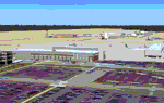
Custom made terminal, hangars, Regional Jet Center with interiors and night lighting
for this regional airport for Fayetteville and Bentonville Arkansas area.
Gates coded for American, Allegiant, Frontier, Delta.
by Dan French
| Filename: | FSX_SCENERY_for_KXNA_Northwest_Arkansas_National_A.zip |
| License: | Freeware, limited distribution |
| Added: | 11th March 2023, 02:25:42 |
| Downloads: | 184 |
| Author: | Dan French |
| Size: | 15.66 MB |
| Category: Flight Simulator 2004 - AFCAD Files | |
| KMTV - Blue Ridge Airport - Martinsville, Virginia |
|
File Description:
AFCAD for Blue Ridge Airport (KMTV), Martinsville, Virginia. This is primarily a general aviation airport although during NASCAR racing seasons it accommodates several business jets as well as a large influx of traffic on race weekends. I have placed the parking with the aid of satellite imagery, and made some minor corrections to the general layout.
| Filename: | KMTV__Blue_Ridge_Airport__Martinsville_Virginia.zip |
| License: | Freeware |
| Added: | 14th October 2005, 17:57:25 |
| Downloads: | 385 |
| Author: | Ross Aldrich |
| Size: | 38.51 KB |
| Category: Flight Simulator 2004 - AFCAD Files | |
| KVUJ - Stanly County Airport, Albemarle, North Carolina |
|
File Description:
AFCAD for KVUJ - Stanly County Airport in Albemarle, North Carolina. This is a general aviation Airport roughly 40nm northeast of Charlotte (KCLT). There are over 45 parking spaces placed here (including the ramp used by National Guard C-130s), using Satellite Imagery for guidance, and I made some minor corrections to the general layout of the ramp. Please enjoy!
| Filename: | KVUJ__Stanly_County_Airport_Albemarle_North_Caroli.zip |
| License: | Freeware |
| Added: | 17th October 2005, 01:26:49 |
| Downloads: | 411 |
| Author: | Ross Aldrich |
| Size: | 4.08 KB |
| Category: Flight Simulator 2004 - AFCAD Files | |
| Nagasaki (RJFU) |
|
File Description:
The first time I came to this airport, I noticed that there was no connection between the two parts of Nagasaki Airport. So, I decided to get out my "virtual heavy equipment" and pave myself a new taxiway. There is now, with this file, a greatly extended Taxiway T2 that runs along the land bridge between the two sections.
| Filename: | Nagasaki_RJFU.zip |
| License: | Freeware |
| Added: | 17th June 2007, 08:47:43 |
| Downloads: | 497 |
| Author: | Tom Clayton Jr |
| Size: | 68.13 KB |
| Category: Flight Simulator X - AFCAD Files | |
| ENGM Oslo Gardermoen International Airport for FSX |
|
File Description:
Airport layout file (AFCAD) for ENGM Oslo Gardermoen International Airport.
Added missing gates and corrected numbering. Taxiways curvature is incorrect in FSX default, but has not been corrected due to limitations of the design tool. Gate assignments are based on actual usage on 18 January 2008. Limted assignments only to fit WoAI traffic.
Tested with WoAI AI only.
| Filename: | ENGM_Oslo_Gardermoen_International_Airport_for_FSX.zip |
| License: | Freeware, limited distribution |
| Added: | 19th January 2008, 14:17:04 |
| Downloads: | 2,507 |
| Author: | Marten Weber |
| Size: | 192.27 KB |
| Category: Flight Simulator X - Scenery | |
| 2KL_Sunrise_Beach_Texas |
|
File Description:
This is a grass strip located by a lake in Central Texas named Sunrise Beach Village. I placed the buildings where they were on the overhead picture found at airnav.com. The airport description says there are several obstacles around the airport runway and I have placed them as close as possible by looking at the overhead picture of 2KL.
| Filename: | 2KL_Sunrise_Beach_Texas.zip |
| License: | Freeware |
| Added: | 20th January 2008, 04:05:27 |
| Downloads: | 1,014 |
| Author: | Bob Smith |
| Size: | 1.41 MB |
| Category: Flight Simulator X - AFCAD Files | |
| ENBR Bergen Flesland Airport |
|
File Description:
This is an airport layout file (AFCAD) for the default FSX ENBR Bergen Flesland International Airport in Norway. Added missing gates and corrected numbering. Part of the many real-life helicopter parking spaces have been converted to conventional parking spots for AI. Gate assignments are incomplete to allow for individual AI solutions. Tested with WoAI only.
| Filename: | ENBR_Bergen_Flesland_Airport.zip |
| License: | Freeware, limited distribution |
| Added: | 20th January 2008, 14:56:05 |
| Downloads: | 2,094 |
| Author: | Marten Weber |
| Size: | 194.42 KB |
| Category: Flight Simulator X - Scenery | |
| FSX EKRK-Copenhagen Airport Roskilde UPDATE 2 |
|
File Description:
This update will Correct some items after Microsofts FSX-SP2. Further it will add the New Royal Danish Airforce SAR-terminal and two new Hangars just innagurated at the Airport. I have also added some new eye-candy. After MS-SP2 FSX are facing no FPS hits running compleks addons like EKRK-Copenhagen Airport Roskilde. Enjoy !.
| Filename: | FSX_EKRKCopenhagen_Airport_Roskilde_UPDATE_2.zip |
| License: | Freeware |
| Added: | 3rd February 2008, 16:45:57 |
| Downloads: | 1,528 |
| Author: | Jens Peter Bruun-Hansen |
| Size: | 1.69 MB |
| Category: Flight Simulator 2004 - Scenery | |
| NZNP- New Plymouth Airport, New Zealand. |
|
File Description:
Welcome to New Plymouth, a medium sized domestic airport in the Taranaki district, on the central west coast of the North Island of New Zealand. The airport is nestled below the foothills of Mount Taranaki (Mount Egmont), a dormant volcano that domonates the landscape.
Requires some Runway-12 and EZ Scenery object libraries (see INSTALL instructions for details).
| Filename: | NZNP_New_Plymouth_Airport_New_Zealand.zip |
| License: | Freeware, limited distribution |
| Added: | 21st February 2008, 01:20:20 |
| Downloads: | 1,205 |
| Author: | Lawrie Roache |
| Size: | 2.28 MB |
| Category: Flight Simulator 2004 - Scenery | |
| St Charles County (Smartt) |
|
File Description:
FS2004 Scenery - St Charles County (Smartt Field) KSET is a public owned airport lovated in St Charles, MO, USA. The airport has two asphalt runways 9/27 running 2000 ft and 18/36 running 3800 ft. This is a companion scenery for my recently released St Charles Municipal (3sq_v1.zip). Created with Instant Scenery. By John B. Loney, Jr.
| Filename: | St_Charles_County_Smartt.zip |
| License: | Freeware, limited distribution |
| Added: | 3rd April 2009, 18:57:54 |
| Downloads: | 388 |
| Author: | John B. Loney, Jr. |
| Size: | 6.4 MB |


© 2001-2026 AVSIM Online
All Rights Reserved
Privacy Policy |