
Where Flight Simulation Enthusiasts Gather from Around the World!
AVSIM Library - Search Results

| Category: Flight Simulator 2004 - AFCAD Files | |
| Hartsfield - Jackson Atlanta International Airport, Atlanta, Georgia (KATL) |

|
File Description:
This is a AFCAD2 file for the Hartsfield-Jackson Atlanta International Airport (KATL). I tried to make the airport as realistic as possable with what is given to me with FS9. I included all gates at the airport including airline designators with the airlines that use the gates. Ample room is given to Delta (Concourse T,A,B,D amd International flts at ConcourseE) and Airtran (Concourse C), and all International airlines are assigned to their gates in Concourse E. In addition to that, all Cargo areas are alloted for in both the north and aSouth Cargo areas and are alloted to one cargo company (UPS, FedEx, Airborne Express, DHL, or USPS) Please let me know if you need an airport done, or have any questions.
| Filename: | Hartsfield__Jackson_Atlanta_International_Airport_.zip |
| License: | Freeware |
| Added: | 3rd October 2004, 17:06:20 |
| Downloads: | 5,135 |
| Author: | Jason Landuyt |
| Size: | 26.64 KB |
| Category: X-Plane - Scenery | |
| BR PA SBEK - Jacareacanga Airport v1.0.0 |
|
Images related to this file:
File Description:

This is an X-Plane 11 and X-Plane 10 scenery package for Jacareacanga-Rio Tapajos Municipal Airport (IATA: JCR, ICAO: SBEK), which is the airport serving Jacareacanga, Para, in Brazil. This airport is lost into the deep Amazon Rainforest, by the Tapajos River, in the state of Para, in Brazil. It includes corrected aprons, ramps, gates, taxiways, lighting system, city buildings, ortho-photoscenery for the airfield area, and (XP11 only) airport ground services (like push back). This scenery was tested and is operational (as of June 04, 2017) in "X-Plane 11.02b1 64 bit", Windows 10 Home. It was also tested and is also operational (as of June 04, 2017) in "X-Plane 10.51 64 bit", Windows 10 Home.
| Filename: | BR_PA_SBEK__Jacareacanga_Airport_v100.zip |
| License: | Freeware |
| Added: | 5th June 2017, 13:58:34 |
| Downloads: | 73 |
| Author: | Rui Mesquita |
| Size: | 10.28 MB |
| Category: X-Plane - Scenery | |
| BR MG SBJF - Juiz de Fora Airport v1.0.0 |
|
Images related to this file:
File Description:
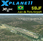
This is an X-Plane 11 and X-Plane 10 scenery package for Francisco Ãlvares de Assis Airport (IATA: JDF, ICAO: SBJF), popularly called Serrinha Airport, which is an airport in Juiz de Fora, Minas Gerais, Brazil. It includes corrected aprons, ramps, gates, taxiways, lighting system, city buildings, ortho-photoscenery for the airfield area, and (XP11 only) airport ground services (like push back). This scenery was tested and is operational (as of December 13, 2017) in "X-Plane 11.1 64 bit", Windows 10 Home. It was also tested and is also operational (as of December 13, 2017) in "X-Plane 10.51 64 bit", Windows 10 Home. Only the default X-Plane 11 libraries, by Laminar Research, are needed. No third party libraries are used.
| Filename: | BR_MG_SBJF__Juiz_de_Fora_Airport_v100.zip |
| License: | Freeware |
| Added: | 14th December 2017, 16:49:11 |
| Downloads: | 66 |
| Author: | Rui Mesquita |
| Size: | 13.5 MB |
| Category: Flight Simulator 2004 - Scenery | |
| ZSNT - Nantong Xingdong Airport |
|
Images related to this file:
File Description:

Skysoft Simulation ZSNT Nantong Xingdong Airport Scenery. The civilian airport is located in Tongzhou District, Nantong, Jiangsu Province. There are various destinations with flights commenced from ZSNT, such as Beijing Capital, Guangzhou and Kunming. As the airport is only 120 kilometers from Shanghai, China Eastern Airlines and Shanghai Airlines made ZSNT as their training base for new pilots. Due to frequent military air traffic movement in adjacent airports, the airspace is highly restricted. Departing and arriving planes must strictly follow the ATC's instructions.
Please refer to the readme file before installing, and read the manuals once they are extracted. We wish you a pleasant flight!
**Require removal of the ZSNT files in China Airport Scenery Package made by ai-china, if applicable**
| Filename: | ZSNT__Nantong_Xingdong_Airport.zip |
| License: | Freeware, limited distribution |
| Added: | 3rd January 2013, 01:41:48 |
| Downloads: | 2,902 |
| Author: | Alex Chao, Skysoft Simulation |
| Size: | 43 MB |
| Category: Flight Simulator X - Scenery | |
| KHAF - Half Moon Bay Airport - San Mateo County, California - USA |
|
Images related to this file:
File Description:
FSX Scenery - Half Moon Bay Airport (IATA: HAF, ICAO: KHAF, FAA LID: HAF) is a county-owned public use airport in San Mateo County, California, United States. It is located five nautical miles (9 km) northwest of the central business district of Half Moon Bay, California. The airport is on the Pacific Coast, south of San Francisco. The Half Moon Bay Airport is located approximately 20 miles south of San Francisco. It was constructed by the California State Highway Department for the U.S. Army in 1942 as an auxiliary airfield for Salinas Army Air Base. Following the end of World War II, San Mateo County acquired the airport from the Navy in 1947. The airport has served a variety of roles over the years and is currently an important business, transportation and emergency service asset to the community. For your flying pleasure by John B. Loney, Jr.
| Filename: | KHAF__Half_Moon_Bay_Airport__San_Mateo_County_Cali.zip |
| License: | Freeware, limited distribution |
| Added: | 5th August 2015, 18:57:47 |
| Downloads: | 918 |
| Author: | John B. Loney, Jr. |
| Size: | 10.69 MB |
| Category: Flight Simulator 2004 - Scenery | |
| KHAF - Half Moon Bay Airport - San Mateo County, California - USA |
|
Images related to this file:
File Description:
FS2004 Scenery - Half Moon Bay Airport (IATA: HAF, ICAO: KHAF, FAA LID: HAF) is a county-owned public use airport in San Mateo County, California, United States. It is located five nautical miles (9 km) northwest of the central business district of Half Moon Bay, California. The airport is on the Pacific Coast, south of San Francisco. The Half Moon Bay Airport is located approximately 20 miles south of San Francisco. It was constructed by the California State Highway Department for the U.S. Army in 1942 as an auxiliary airfield for Salinas Army Air Base. Following the end of World War II, San Mateo County acquired the airport from the Navy in 1947. The airport has served a variety of roles over the years and is currently an important business, transportation and emergency service asset to the community. For your flying pleasure by John B. Loney, Jr.
| Filename: | KHAF__Half_Moon_Bay_Airport__San_Mateo_County_Cali.zip |
| License: | Freeware, limited distribution |
| Added: | 5th August 2015, 18:58:17 |
| Downloads: | 318 |
| Author: | John B. Loney, Jr. |
| Size: | 11.87 MB |
| Category: Flight Simulator X - Scenery | |
| KCLL Easterwood Airport College Station Texas USA |
|
Images related to this file:
File Description:
Easterwood College Station Texas Airport for FSX. Several improvements have been made to the default airport. The default terminal building has been replaced with one created in FSDS; aircraft gates have been correctly coded using Airport Design Editor 1.70.6042; a new airport vehicle network has been built to prevent airport vehicles from entering the taxiways; extra fuel trucks have been added throughout the airport; the tower view has been changed to display from the roof of the control tower; all taxiway signs are correctly placed and all taxiway designators are correctly named; there is the option to open all runways to AI traffic; optionally, a set of GA flight plans is included using all default FSX aircraft to liven up the GA area; and Jim Dhaenen's excellent ramp lights are also included. Please refer to the README.txt file to insure proper installation of all files.
| Filename: | KCLL_Easterwood_Airport_College_Station_Texas_USA.zip |
| License: | Freeware, limited distribution |
| Added: | 25th November 2017, 16:08:22 |
| Downloads: | 445 |
| Author: | Patrick Finch |
| Size: | 1.09 MB |
| Category: Flight Simulator X - AFCAD Files | |
| RPLL - Ninoy Aquino International, Manila, Philippines |
|
File Description:
This file was produced in ADE v1.35 and is an updated and enhanced version of Ray Smith's crosswind AFCAD for the airport - improved with Ray Smith's kind permission. It also owes a great deal to the help I have had from Jim Vile and Jon Masterson at fsdeveloper.com. This new version updates airline codings, increases parking at the domestic terminal for Cebu Pacific Air, Asian Spirit and South East Asia Air and improves the flow of traffic around the airport. Some buildings have been added to create a little more of the feel of the real airport. The overall impact is significantly increased traffic. Tested with WOAI and custom AI traffic. For other changes made, please see the Readme. (Re-upload.) There is a more up to date version of this airport by me with Terminal 3 open and in use: aig_rpll_nino_aquino_manila_fsx_default_v2.zip
| Filename: | RPLL__Ninoy_Aquino_International_Manila_Philippine.zip |
| License: | Freeware |
| Added: | 23rd May 2010, 01:46:11 |
| Downloads: | 3,368 |
| Author: | Matthew Brooks - Ray Smith |
| Size: | 20.26 KB |
| Category: Flight Simulator X - Scenery | |
| Seattle Tacoma Intl (KSEA) Asbuilt Scenery |
|
File Description:
Seattle-Tacoma Intl Airport (KSEA) for FSX, update for default scenery.
Provides current runway numbering (16R/34L changed to 16C/34C). All runways
and taxiways are placed at correct geographic coordinates. Shoulders along
the runways and taxiways have been added and surfaces changed to present
an appearance that looks a little more realistic than the default airport.
Default scenery for terminals and buildings are reused, parking and jetways
have been adjusted to match current assignments. All runway and ILS holds
placed as they are. Localizer, glideslope, DME and PAPI coordinates are
asbuilt. A current copy of the FAA Airport Diagram is provided for reference.
| Filename: | Seattle_Tacoma_Intl_KSEA_Asbuilt_Scenery.zip |
| License: | Freeware, limited distribution |
| Added: | 1st January 2008, 16:48:54 |
| Downloads: | 3,207 |
| Author: | Dan Downs |
| Size: | 264.09 KB |
| Category: Flight Simulator X - Scenery | |
| CYOW - Macdonald-Cartier Intl, Ottawa, Ontario, Canada |
|
Images related to this file:
File Description:
This airport was designed only for FSX with 2 optional files: one version with the Crosswind runways activated and in full operation where all three runways will be used for takeoff and landing and one version as the default airport runway operation: airlines assigned to their correct gates as per their website, a complete rebuild for the new terminal and the gates numbered in the correct order, the cargo apron and its buildings updated, taxiways and taxi signs updated to the latest charts, helipad, extra fuel trucks and many other scenery objects included, airport views are from inside the control tower (when in tower view) please view the readme before installation.
| Filename: | CYOW__MacdonaldCartier_Intl_Ottawa_Ontario_Canada.zip |
| License: | Freeware, limited distribution |
| Added: | 17th October 2016, 04:39:12 |
| Downloads: | 26,238 |
| Author: | Craig Scott |
| Size: | 1.87 MB |


© 2001-2026 AVSIM Online
All Rights Reserved
Privacy Policy |