
Where Flight Simulation Enthusiasts Gather from Around the World!
AVSIM Library - Search Results

| Category: Flight Simulator X - Scenery | |
| Inagua - The Bahamas (MYIG) |

|
Images related to this file:
File Description:
MYIG is the southernmost airport in the Bahamas. At nearby Matthew Town is the Morton Salt Company's main facility - Inagua's main industry. The scenery includes custom scenery objects; placement of library objects and landclass changes. The airport is also moved to it's proper location. Scenery is based on Google Earth and Microsoft Bing imagery and photos taken locally, and it is optimized for use with or without UTX-TAC.
| Filename: | Inagua__The_Bahamas_MYIG.zip |
| License: | Freeware |
| Added: | 21st December 2012, 18:12:48 |
| Downloads: | 1,257 |
| Author: | Art Poole |
| Size: | 365.77 KB |
| Category: Flight Simulator 2004 - Scenery | |
| Whitsundays Water & Landclass Scenery Missing Texture |
|
File Description:
It appears that I made a boo boo. Here is the missing grass texture that I forgot to add which leaves a big white block around Whitsunday Airport in my FS2004 Whitsundays Water & Landclass Scenery package . Sincere apologies.
| Filename: | Whitsundays_Water__Landclass_Scenery_Missing_Textu.zip |
| License: | Freeware |
| Added: | 11th March 2004, 04:05:22 |
| Downloads: | 1,851 |
| Author: | Darren Jackson |
| Size: | 82.04 KB |
| Category: Flight Simulator 2004 - Scenery | |
| (CSS3) Les Cedres, Quebec, Canada |
|
File Description:
Situated just 20 miles southwest of Montreal international airport (CYUL), it is the home of Laurentide aviation school. Gmax buildings, Landclass of the area, AI trafic and AFCAD file included. With buildings in Vaudreuil: Cite des jeunes and the Future complex. Most of the textures are from photographs. My first contribution.
| Filename: | CSS3_Les_Cedres_Quebec_Canada.zip |
| License: | Freeware, limited distribution |
| Added: | 27th February 2005, 20:41:24 |
| Downloads: | 3,935 |
| Author: | Jacques Bellavance |
| Size: | 590.72 KB |
| Category: Flight Simulator X - Missions | |
| IsleofManVFRTour.zip |
|
File Description:
Intermediate helicopter mission. A helicopter company located at (EGNS) airport provides tour services. Take tourists out to visit various sites in the southern region of the Isle of Man. This mission will require one additional download for scenery. (See zip.file).
| Filename: | IsleofManVFRTourzip.zip |
| License: | Freeware |
| Added: | 24th September 2021, 21:07:40 |
| Downloads: | 57 |
| Author: | helomissionman |
| Size: | 18.82 MB |
| Category: Flight Simulator 2004 - Sounds | |
| ATC Chatter for Zurich Radar (Switzerland) |
|
File Description:
Real ATC chatter for Zurich Radar, for use with Radar Contact 4. Can be used with any other Flightsim with any other ATC chatter software.
The chatter was recorded on 8th February 2006 from liveatc.net.
| Filename: | ATC_Chatter_for_Zurich_Radar_Switzerland.zip |
| License: | Freeware |
| Added: | 12th February 2006, 21:58:49 |
| Downloads: | 3,328 |
| Author: | Patrick Buser |
| Size: | 22.09 MB |
| Category: Flight Simulator 2004 - Scenery | |
| Perth Region V1.0, Australia Soaring Scenery |
|
File Description:
FS2004 Perth Region V1.0,Australia Soaring Scenery
This file adds some thermals to default Microsoft Scenery to Perth Region,Australia
It is freeware.
Volta Redonda City,Brazil - 05-06-2006.
Design:Francisco Vargas.
E-mail:[email protected]
| Filename: | Perth_Region_V10_Australia_Soaring_Scenery.zip |
| License: | Freeware |
| Added: | 7th May 2006, 03:17:07 |
| Downloads: | 427 |
| Author: | Francisco Augusto Vargas Carneiro |
| Size: | 1.13 MB |
| Category: Civil Flight Simulators - Looking Glass Flight Unlimited 3 | |
| Caves Challenge for the Seattle Region. |
|
File Description:
In this chalange you can fly under the grouwnd and explor caves and caverns.
There are allso meny hoops to fined douwn there that do things.
But be cairfall, you might not get out alive.
| Filename: | Caves_Challenge_for_the_Seattle_Region.zip |
| License: | Freeware |
| Added: | 15th September 2010, 11:46:51 |
| Downloads: | 55 |
| Author: | John Lewis and Robert Driscoll |
| Size: | 3.54 MB |
| Category: Flight Simulator 2004 - Scenery | |
| Falkland Islands |
|
File Description:
Replacement scenery for the Falkland Islands (Islas Malvinas), off the tip of South America. This includes mesh, coastlines, rivers and lakes, adjusted airports and new landclass which is a significant improvement on the default.
This is an update, with a few corrected lakes and fixed landclass for Port Stanley.
| Filename: | Falkland_Islands.zip |
| License: | Freeware, limited distribution |
| Added: | 28th June 2004, 18:00:38 |
| Downloads: | 7,141 |
| Author: | Jim Keir |
| Size: | 2.32 MB |
| Category: Flight Simulator X - Scenery | |
| Crooked & Acklins Islands (MYCI-MYAP) - The Bahamas |
|
Images related to this file:
File Description:
These islands are sparsely populated, but FSX with UTX-TAC has Crooked Island containing cities with high-rise buildings instead of settlements. This has been adjusted somewhat in this scenery. Bahamasair has flights twice weekly to these islands with the landing at MYCI being one of the more challenging due to rising terrain at the east end of the short and narrow runway. Parking has been provided to accommodate those AI flights in this package. The scenery includes custom scenery objects, placement of library objects and landclass changes. Scenery is based on Google Earth, Bing Maps and photos taken locally, and it is optimized for use with UTX-TAC.
| Filename: | Crooked__Acklins_Islands_MYCIMYAP__The_Bahamas.zip |
| License: | Freeware |
| Added: | 27th September 2013, 20:39:10 |
| Downloads: | 1,159 |
| Author: | Art Poole |
| Size: | 4.4 MB |
| Category: Flight Simulator 2004 - Scenery | |
| Hakkari-Yuksekova(Turkey) Airport (LTCW/YKO) scenery 2017 |
|
Images related to this file:
File Description:
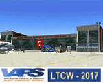
Turkey/Hakkari/Yuksekova-Selahaddin Eyyubi Airport(LTCW/YKO) scenery (2017) for Flight Simulator 2004 (Fs9). It is the civil airport on the border in Turkey's South-East region. The airport, built for 5 years and opened in 2015, cost 102 million TL. It entered full service in September 2016. We are writing to you on the subject at VAPS about your problems with this scenery. Thank you for using it. Design by VAPS (vaps.hooxs.com)-2017.
| Filename: | HakkariYuksekovaTurkey_Airport_LTCWYKO_scenery_201.zip |
| License: | Freeware |
| Added: | 30th April 2017, 20:51:41 |
| Downloads: | 545 |
| Author: | Pilot Hoca (VAPS) |
| Size: | 1.9 MB |


© 2001-2026 AVSIM Online
All Rights Reserved
Privacy Policy |