
Where Flight Simulation Enthusiasts Gather from Around the World!
AVSIM Library - Search Results

| Category: Flight Simulator 2004 - Scenery | |
| Buena Vista, Central Colorado Reg. (KAEJ form. 7V1), Colorado, Photo-Scenery (FS9 & FSX) |

|
Images related to this file:
File Description:
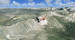
This region covers the area around Buena Vista and Central Colorado Reg. (KAEJ form. 7V1). It extends
my Leadville scenery to the south and brings you another 3.500 sq km of beautiful Colorado in 4.7m/pix quality. High resolution versions of this scenery for FS9 and FSX (much sharper, but larger and multiple downloads) are available at www.blueskyscenery.com/GNB_South3West.html . The screenies are taken from the high-res versions, so expect this version to be slightly more blurry. YourDonation@Work: Dedicated to Matias and Markus.
| Filename: | Buena_Vista_Central_Colorado_Reg_KAEJ_form_7V1_Col.zip |
| License: | Freeware, limited distribution |
| Added: | 7th February 2010, 11:31:14 |
| Downloads: | 1,578 |
| Author: | Gottfried Razek - blueskyscenery.com |
| Size: | 93.89 MB |
| Category: Flight Simulator 2002 - Flight Plans | |
| Val-U-Prop VA: KATL to KBMG |
|
File Description:
Leave the gate at Atlanta Hartsfield, take off and head toward Bloominton, IN - home base of Val-U-Prop Airline. The route takes you through northern Georgia, over Chatanooga and the mountains of southern Tennessee and into the beautiful lake district of central Tennessee, then flies you over the Bluegrass region of Kentucky and on to the hill country of southern Indiana. Use any aircraft you choose. FS98 and FS2002 users can simply fly the route by flying VOR to VOR (as can any user).
| Filename: | ValUProp_VA_KATL_to_KBMG.zip |
| License: | Freeware |
| Added: | 8th March 2003, 00:58:30 |
| Downloads: | 266 |
| Author: | James Underwood |
| Size: | 2.38 KB |
| Category: Flight Simulator X - Scenery | |
| Ghat HLGT Libya |
|
Images related to this file:
File Description:
Ghat is a medium-sized airport located in the south-west of Libya, near Algerian border, and 10 miles north of the city of Ghat. In early 2010s Ghat was undergoing major renovatios, but civil war in Libya has put these plans on hold. While all runways and taxiways were recently repaved, new passenger terminal is still unfinished, and air traffic is almost non-existent. Except from military and cargo planes, the only regular passenger flight to Ghat nowadays is Air Libyan from Tripoli: their A320 is visiting this place twice a week. This scenery has super-accurate layout, precise marking, and correct navaids according to the latest satellite images and charts. Photo background blends perfectly with ORBX Global. Unfinished new terminal with the construction site. Taxi signs were added for convenience. Enhanced city of Ghat and surrounding landclass. Made for P3Dv3, tested on P3Dv4 and FSX:SE. Made by Dmitriy Kozyrev.
| Filename: | Ghat_HLGT_Libya.zip |
| License: | Freeware |
| Added: | 27th September 2017, 06:18:00 |
| Downloads: | 1,227 |
| Author: | Dmitriy Kozyrev |
| Size: | 31.43 MB |
| Category: Flight Simulator X - Scenery | |
| CYFB - Iqaluit Airport - Nunavut, Canada |
|
Images related to this file:
File Description:
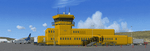
Iqaluit is the capital of Nunavut, a vast northern region that covers almost all of the Canadian North. The airport is of critical importance to the community, especially when ice makes boat travel impossible.
The scenery includes all airport buildings with custom designed and generic buildings nearby. Several typical airlines are represented, both by their flights by their facilities, including First Air, Canadian North, Air Greenland, Ken Borek Air and Keewatin. The Airbus A380 was in Iqaluit in February 2006 for flight testing in cold weather, as do other manufacturers. Airbus will also carry out the same tests for its new A350.
CYFB is also a Canadian Force base. Several units are parked in the military area, in addition to the C- 177 and his escort on ramp 2. A Twin Otter from the RCMP, and some general aviation aircrafts complement the fleet. Six ships are in the scenery: four static and two mobile (AI). Zodiacs and a balloon tourist flow into the bay. These, and the ships AI, start their movements 1100Z. The weather station launches a weather balloon regularly. Three small caribou herds are in the vicinity.
| Filename: | CYFB__Iqaluit_Airport__Nunavut_Canada.zip |
| License: | Freeware, limited distribution |
| Added: | 5th April 2014, 14:37:23 |
| Downloads: | 3,974 |
| Author: | Jean-Pierre Fillion, Pierre Gallant |
| Size: | 16.88 MB |
| Category: Flight Simulator 2002 - Scenery Design | |
| CellGrid2 |
|
File Description:
CellGrid2 replaces the original CellGrid. CellGrid2 is a collection of BGLC Macros that allow the creation of a visual grid within FS2002 and CFS2, that covers an entire LOD8 TDF Cell. Very useful for designers working with BGLC and the New FS2002 Terrain SDK. Also included are TDFCalc.exe ( a useful locational calculator for Terrain Data File design ). LandCalc ( a useful tool for the creation of CUSTOM textures, for use in landclass BGLs ).
| Filename: | CellGrid2.zip |
| License: | Freeware |
| Added: | 15th November 2002, 18:49:45 |
| Downloads: | 1,944 |
| Author: | Richard Ludowise |
| Size: | 967.86 KB |
| Category: Flight Simulator 2004 - Aircraft Repaints, Textures and Modifications | |
| Cega Beech 200 G-CEGP & G-CEGR Package for AI |
|
File Description:
AI package for the two Beech 200 Super King Airs operated by Cega Aviation from Goodwood in southern England. The package contains repaints and representative flightplans for the two aircraft as well as an AFCAD2 file for EGHR and a Landclass file to clear some autogen for the AFCAD. The package was previously released in November 2004 using Mike Hill's AI Beech 200. This updated packege requires Henry Tomkiewicz's AI Beech 200.
| Filename: | Cega_Beech_200_GCEGP__GCEGR_Package_for_AI.zip |
| License: | Freeware |
| Added: | 27th December 2004, 16:54:45 |
| Downloads: | 721 |
| Author: | Ismet Mustafic, Chris Evans & Henry Tomkiewicz |
| Size: | 330.2 KB |
| Category: Flight Simulator 2004 - Scenery | |
| Ohio Lakes (Wizarddz Neighborhood) v.1 |
|
File Description:
Default scenery modifications for FS2004 including 11 new and redrawn default lakes and reservoirs in north-central Ohio. Some landclass changes are included. An optional fictitious grass airstrip is provided near Wizardd's home on Apple Valley Lake east of Mount Vernon, Ohio. Coordinates for the lakes are provided in the included text file. This scenery is best viewed using USARoads. No modifications were made to
the default road system and some roads will cross lakes, etc.
| Filename: | Ohio_Lakes_Wizarddz_Neighborhood_v1.zip |
| License: | Freeware, limited distribution |
| Added: | 7th June 2006, 03:31:09 |
| Downloads: | 468 |
| Author: | Wil Husted |
| Size: | 341.16 KB |
| Category: Flight Simulator X - Scenery | |
| German Airfields Northeast Vol2 Update |
|
File Description:
Update for the airfields in Northeast Germany
EDAD, EDAG, EDAI, EDAM, EDAN, EDBD, EDBF, EDBK, EDBO, EDBP,
EDBU, EDCA, EDCK, EDCN, EDCQ, EDCS, EDCU, EDCW, EDGE, EDOB,
EDOD, EDOE, EDOI, EDOJ, EDOP, EDOQ, EDOW, EDOX, EDUF, EDUO,
EDUT, EDUT, EDUB, EDUZ, Gransee.
This update is for use with the standard landclass textures.
| Filename: | German_Airfields_Northeast_Vol2_Update.zip |
| License: | Freeware |
| Added: | 3rd February 2016, 19:05:09 |
| Downloads: | 587 |
| Author: | Juergen Wolf |
| Size: | 255.19 KB |
| Category: Flight Simulator X - Scenery | |
| German Airfield Southwest Vol2 Update |
|
File Description:
Update for the airfields in Soutwest Germany
EDEH, EDEW, EDFX, EDGH, EDGI, EDGM, EDGU, EDGX, EDGZ, EDMC,
EDMI, EDNL, EDNU, EDNW, EDPM, EDRD, EDRG, EDRH, EDRI, EDRL,
EDRM, EDRN, EDRS, EDSA, EDSH, EDSI, EDTB, EDTC, EDTN, EDTP,
EDTU, Bald Waldsee-Reute, Karlstadt-Saupurzel.
This update is for use with the standard landclass textures.
| Filename: | German_Airfield_Southwest_Vol2_Update.zip |
| License: | Freeware |
| Added: | 3rd February 2016, 19:12:49 |
| Downloads: | 657 |
| Author: | Juergen Wolf |
| Size: | 401.38 KB |
| Category: Prepar3D V1-4 - Aircraft Repaints, Textures and Modifications | |
| Pantanal Linhas Aereas 1998 AI Package |
|
File Description:
Pantanal Linhas Aereas was based in CGH and in 1998 was operating a small fleet of ATR-42s adding good variety to the region as the only ATR operator at the time in Brazil. Flightplans by Raphael Rodriguez and textures for the OPS ATR 42-300 by Jonathan Alba included. Part of the 1998 Flight Simulator Project. Follow us on Facebook at facebook.com/flightsim98 and on instagram as @bayviationsim. For more Retro AI, check out the forums at: http://retroai.proboards.com/
| Filename: | Pantanal_Linhas_Aereas_1998_AI_Package.zip |
| License: | Freeware, limited distribution |
| Added: | 5th November 2019, 06:13:09 |
| Downloads: | 108 |
| Author: | Jonathan Alba, Raphael Rodrigues\Bayviation |
| Size: | 793.84 KB |


© 2001-2026 AVSIM Online
All Rights Reserved
Privacy Policy |