
Where Flight Simulation Enthusiasts Gather from Around the World!
AVSIM Library - Search Results

| Category: Flight Simulator X - Missions | |
| BourgogneTour2.zip |

|
File Description:
Intermediate helicopter mission. Take passengers on an aerial tour of the Bourgogne (Burgundy) region of France. This is tour two of two. Additional scenery downloads required for the mission to work. (See the download.txt file in the zip package. If you downloaded the scenery from the first mission, you don't have to do it again.
| Filename: | BourgogneTour2zip.zip |
| License: | Freeware |
| Added: | 18th September 2020, 19:16:00 |
| Downloads: | 82 |
| Author: | helomissionman |
| Size: | 9.93 MB |
| Category: Flight Simulator X - Missions | |
| PoitouTour2.zip |
|
File Description:
Intermediate helicopter mission. Take passengers on an aerial tour of the Poitou region of France. Mission requires one additional download of scenery for Poitou. (Note: if you downloaded the scenery for tour 1 you don't have to do it again.) See download instructions in the zip file. This is tour two (2) of two.
| Filename: | PoitouTour2zip.zip |
| License: | Freeware |
| Added: | 22nd October 2020, 22:58:11 |
| Downloads: | 84 |
| Author: | HeloMissionMan |
| Size: | 12.37 MB |
| Category: Flight Simulator X - Missions | |
| NormandieTour1.zip |
|
File Description:
Intermediate helicopter mission. Take passengers on a tour of the Normandy region of France. This is tour 1 of 3. Will require an additional download of the Normandy scenery as detailed in the zip file. Once you download the scenery pack, you will not have to do it again for the next two missions.
| Filename: | NormandieTour1zip.zip |
| License: | Freeware |
| Added: | 28th August 2020, 19:41:01 |
| Downloads: | 114 |
| Author: | helomissionman |
| Size: | 11.29 MB |
| Category: Flight Simulator 2004 - Scenery | |
| Alaska North Slope 5 - Nuiqsut PAQT |
|
Images related to this file:
File Description:
The town of Barrow is in the far north of Alaska, and these are coastal villages or radar installations to the west, south, and now east of Barrow. There will be further additions. Nuiqsut is a mainly Inuit community on the west side of the Colville River, around 20 miles south of the coast, and with a slowly declining population of around 420 or so. The airfield is just south of the town and has a gravel runway 5,000 feet long and aligned 04-22 in FS9. The airfield is the only year-round contact route to the rest of the world, though there are plans for a permanent road. The AI includes daily passenger flights early and late in the day, cargo deliveries, and some GA. It seems that the only photos I had of the airport were either of the old building or were not of Nuiqsut at all. The only pic I have seen (recently, which is why I now have doubts) of the new building is insufficient to model it, so I am sticking with the old or maybe incorrect version.
| Filename: | Alaska_North_Slope_5__Nuiqsut_PAQT.zip |
| License: | Freeware, limited distribution |
| Added: | 21st June 2016, 21:45:32 |
| Downloads: | 245 |
| Author: | Roger Wensley |
| Size: | 4.37 MB |
| Category: Flight Simulator 2004 - AFCAD Files | |
| Southwestern British Columbia Airport Corrections |
|
File Description:
As shorelines, water bodies, roads, railways and other features become more accurate in addon scenery, inaccuracies in airport placement become apparent. Although Microsoft did an excellent job of using published data to place airports, the published information is not always accurate. Some airports in the area of interest were misplaced by as much as 850m, thus conflicting with water and/or roadways. This release corrects Canadian airports in South-western British Columbia, in LOD5 cell 15x14 (915140). This area covers a portion of Vancouver Island from Duncan to Victoria, and the BC Mainland as far east as Douglas Lake and north of Pemberton. In this region CAK3, CAL3, CBT6, CYHE, CYLY, and CYPS are corrected, and Bruce Ellison has kindly modified his CAM3 for inclusion; see separate readme document for details. All these airports have been activated for AI use. A few buildings that may conflict from roads have been removed from CYNJ. The unrealistically large flatten and airport polygon at CYYJ is reduced in size. Airport features that end up in the water have been removed from CYVR and the overly large flatten there reduced. Some Rwy12 goodies have been tossed in as well, but if these are not important to the user, it is not necessary to have Rwy12 installed. Ultimate Terrain or similar accurate hydrology and roads recommended. FSGenesis 38m mesh or other high quality terrain mesh recommended.
| Filename: | Southwestern_British_Columbia_Airport_Corrections.zip |
| License: | Check within download |
| Added: | 30th May 2005, 07:31:45 |
| Downloads: | 3,002 |
| Author: | Jon Patch, Bruce Ellison |
| Size: | 1.53 MB |
| Category: Flight Simulator 2004 - Scenery | |
| 5B2 - Saratoga County Airport |
|
Images related to this file:
File Description:
5B2 - Saratoga County Airport v1.0

Located in the foothills of the Adirondack Mountains in upstate NY USA. This facility is owned by Saratoga County, formerly housed Rich Air and currently houses North American Aviation. 5B2 is a non-controlled airfield catering to small engine a/c up to a few private jet daily traffic serving 'The Northcountry' and Saratoga Springs, New York.
All Objects fully designed and completely redone in GMAX using high resolution 32bit photo-real textures. Optional DXT3 textures included. Also includes new AFCAD file, more accurate airport grounds perimeter, satellite photo-real grounds, custom taxiways, taxi-signs and taxi lights, area roads, animated hangar doors, and near area landclass. Some GA AI traffic tracks included with this release, afcad also designed to support general AI. Rwy12 objects (Lars Extra Object Library) required for a few static parking lot cars. All textures mipmapped for performance. By EdGeneer Cox.
| Filename: | 5B2__Saratoga_County_Airport.zip |
| License: | Freeware, limited distribution |
| Added: | 24th February 2012, 19:24:19 |
| Downloads: | 1,537 |
| Author: | EdGeneer Cox |
| Size: | 103.26 MB |
| Category: Flight Simulator X - Scenery | |
| Castle of Bran the Vampire |
|
File Description:
This scenario is the small Castle of Bran in Romania better known as the castle of the Vampire in the Transylvania region. to facilitate the location of the castle will carry coordinates N45.30.53 E25.22.02
To install the scenario copy the file Castlello di Bran.bgl in addon scenery subfolder scenery of FSX and will be automatically added to the scenario. It does not require consistency because the plot is the default.
| Filename: | Castle_of_Bran_the_Vampire.zip |
| License: | Freeware |
| Added: | 25th June 2015, 08:01:16 |
| Downloads: | 419 |
| Author: | Pasquale Marrulli |
| Size: | 1.23 KB |
| Category: Flight Simulator X - Scenery | |
| 2016 Kigali Intl (HRYR) Rwanda |
|
Images related to this file:
File Description:
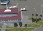
This sequel to the 2009 Kigali Intl (HRYR) Rwanda scenery (by Jacques Botha and Frits Beyer) brings it up to date with the current layout and enables full compliance with FTX Global/Vector and FSX. Buildings are added and adjusted to their real-world locations, and the new taxiway and south apron are added according to the May 2016 satellite imagery. In addition to real-world gate locations, custom apron markings are added along with apron lighting. The landclass around Kigali is also updated, and SRTMGL1 (30m) mesh is included. This scenery can be complemented by the Goma (FZNA) and Gisenyi (HRYG) scenery (FSX_FZNA-HRYG_CS.zip), and GA flightplans are included to supplement the commercial traffic at Kigali and provide more activity at FZNA and HRYG.
Updates were created or rebuilt in a manner which carefully aligns airport data with current satellite imagery. Scenery was created using Airport Design Editor X v1.70.6042, SBuilderX 3.13, and the FSX Object Placement Tool. Scenery objects were added and modified from stock FSX scenery to resemble as closely as possible the actual airports. The FSX apron lights included are from the set created by Jim Dhaenens.
| Filename: | 2016_Kigali_Intl_HRYR_Rwanda.zip |
| License: | Freeware |
| Added: | 4th August 2016, 21:10:09 |
| Downloads: | 3,382 |
| Author: | Carlyle Sharpe, Jacques Botha, and Frits Beyer |
| Size: | 17.12 MB |
| Category: Flight Simulator 2004 - Scenery | |
| Beaverton CBV2 and Beaverton North fields near Lake Simcoe, Ontario, Canada |
|
File Description:
The town of Beaverton is on the east shore of Lake Simcoe. Just a bit over three miles to the east of the town is Beaverton airfield CBV2, with a grass runway 12/30 that appears to be 2,100 feet long, rather than the listed 2,400 feet. The field is new enough to be omitted from FS9, and though there are plans to build hangars I don't know if anything has been built in the year since I last saw it, so the only buildings here are farm-related. The second field to the northwest is Beaverton North, which is privately owned. It has 2,000 feet or so of grass runway and a large hangar (or storage shed?) and that about sums up all I know about it. There are two airfield scenery folders, two landclass files to provide the grass airfield areas, and a third landclass folder that modifies the terrain around Beaverton CBV2.
| Filename: | Beaverton_CBV2_and_Beaverton_North_fields_near_Lak.zip |
| License: | Freeware |
| Added: | 3rd February 2010, 02:16:36 |
| Downloads: | 324 |
| Author: | Roger Wensley |
| Size: | 1.05 MB |
| Category: Flight Simulator 2004 - Scenery | |
| Bonneville Salt Flats |
|
File Description:
FS2004 Bonneville Salt Flats
(works probably in FS2002 too)
A small landclass addon for Bonneville
Salt Flats near Salt Lake City in Utah.
The old lake bed is covered by a flat
layer of salt. Very flat, very white,
this is a place where land speed records
are set.
| Filename: | Bonneville_Salt_Flats.zip |
| License: | Freeware |
| Added: | 10th October 2005, 15:52:58 |
| Downloads: | 1,909 |
| Author: | Per Kruuse |
| Size: | 62.9 KB |


© 2001-2026 AVSIM Online
All Rights Reserved
Privacy Policy |