
Where Flight Simulation Enthusiasts Gather from Around the World!
AVSIM Library - Search Results

| Category: Flight Simulator 2004 - AI Flight Plans | |
| Ukraine International Airlines - Summer 2010 |

|
Images related to this file:
File Description:

Ukraine International is operating domestic flights between Donetsk, Kharkiv, Kiev, Lviv, Odessa, Simferopol and Zaporizhia, international scheduled services to Abu Dhabi, Almaty, Amsterdam, Barcelona, Berlin, Dubai, Frankfurt, Geneva, Helsinki, Lisbon, London, Madrid, Milan, Nice, Paris, Rome, Tbilisi, Tel Aviv, Vienna and Zurich as well as charter flights to Antalya, Bodrum, Burgas, Dalaman, Dubrovnik, Heraklion, Hurghada, Monastir, Palma de Mallorca, Pula, Rhodes, Sharm el-Sheikh, Split, Taba and Varna using a fleet of several Boeing 737. All flights are included. Have fun!
| Filename: | Ukraine_International_Airlines__Summer_2010.zip |
| License: | Freeware |
| Added: | 26th September 2010, 14:29:47 |
| Downloads: | 633 |
| Author: | Christian Hegewald |
| Size: | 12.8 KB |
| Category: Flight Simulator 2004 - Scenery | |
| Mexicali airport V2 |
|
File Description:
This is a NEW version of my scenery for Mexicali airport (ICAO code: MMML; IATA code: MXL). There are several improvements: the main one is a new landclass which makes the surrounding terrain of the airport (and Mexicali city as well) more similar to the real thing. This scenery is an improvement of the default FS2004 scenery (the latter being a strip into the nothing). I have used the default library objects as well as the library created by Sidney Schwartz (fs9 custom buildings vol.1) and Bill Leaming (ramp light); therefore I explicitly thank both of them for their great work, and for making it freeware for all the AVSIM community.
| Filename: | Mexicali_airport_V2.zip |
| License: | Freeware |
| Added: | 9th November 2008, 00:03:37 |
| Downloads: | 1,779 |
| Author: | Marco Ruggieri |
| Size: | 6.05 MB |
| Category: Flight Simulator X - Scenery | |
| USA Landclass AddOn - Vegetation Part I update 1.1 |
|
Images related to this file:
File Description:
USA Landclass AddOn - Vegetation Part I update 1.1
is a complete update, please delete the old scenery folders.
UPDATE:
Wyoming-KJAC, KFCA to CYGE
| Filename: | USA_Landclass_AddOn__Vegetation_Part_I_update_11.zip |
| License: | Freeware |
| Added: | 17th February 2015, 23:59:23 |
| Downloads: | 446 |
| Author: | Markus Balz |
| Size: | 4.57 MB |
| Category: Flight Simulator 2004 - Scenery | |
| USA Landclass AddOn - Vegetation Part I update 1.1 |
|
Images related to this file:
File Description:
USA Landclass AddOn - Vegetation Part I update 1.1
is a complete update, please delete the old scenery folders.
UPDATE:
Wyoming- KJAC, CYXC to CYGE
| Filename: | USA_Landclass_AddOn__Vegetation_Part_I_update_11.zip |
| License: | Freeware |
| Added: | 17th February 2015, 23:59:40 |
| Downloads: | 323 |
| Author: | Markus Balz |
| Size: | 4.58 MB |
| Category: Flight Simulator 2004 - Scenery | |
| CYKF Version 2.1 Full Package |
|
File Description:
I have now overhauled the CYKF Airport and made it the lively place it is today. I used the Canada Flight Supplement and my real life knowledge of the airport as this is where I do my flight training.
--Extended runway 25/07 and added the new taxiway and renamed the others
--Changed the landclass for the runway 25/07 extension
--Updated the airport in AFCAD for AI to use the runway 25/07 extension
--Added 6 AI flightplans to the 3 already there. AI will model real life training and commercial operations of the airport
--AI use proper Canadian registration codes
--Tested the files to make sure it operates correctly including AI
--2.1 Revisions
I updated the Traffic_CYKF file to use UTC times instead of local which I did by mistake. The AI will now fly at the proper times. ---**NOTE for those who have version 2.0 a separate upgrade only file is available **---
| Filename: | CYKF_Version_21_Full_Package.zip |
| License: | Freeware, limited distribution |
| Added: | 7th November 2003, 20:03:42 |
| Downloads: | 1,338 |
| Author: | David Voogd |
| Size: | 630.19 KB |
| Category: Flight Simulator X - Scenery | |
| Cat Island - The Bahamas (MYCB) |
|
Images related to this file:
File Description:
This scenery adds runway and taxi paths and parking to accommodate AI traffic. It also includes custom scenery objects; placement of library objects and landclass changes. It is based on Google Earth imagery and photos taken by Harrington Mallory and is optimized for use with UTX-TAC.
| Filename: | Cat_Island__The_Bahamas_MYCB.zip |
| License: | Freeware |
| Added: | 3rd December 2012, 14:29:49 |
| Downloads: | 1,180 |
| Author: | Art Poole |
| Size: | 1.16 MB |
| Category: Flight Simulator 2004 - Aircraft Repaints, Textures and Modifications | |
| JAT Yugoslav Airlines Douglas DC-10-30 'YU-AMA' (1980's Colors) |
|
File Description:
TEXTURES ONLY for the wonderful SGA DC-10! This is a repaint of JAT's first DC-10 (YU-AMA) named "Nikola Tesla". This aircraft is delivered to JAT at 1979 and was in service till early '90, till the break down of Yugoslavia (SFRJ)! In that period this plane was seen plenty of times at most of the world airports (Zurich, New York, Los Angeles, Sidney, Frankfurt, Moscow, London). Thank you for flying JAT!
| Filename: | JAT_Yugoslav_Airlines_Douglas_DC1030_YUAMA_1980s_C.zip |
| License: | Freeware |
| Added: | 21st March 2006, 23:49:42 |
| Downloads: | 335 |
| Author: | Vladimir Frenc / SGA |
| Size: | 1.64 MB |
| Category: Flight Simulator 2004 - Scenery | |
| DTTG Gabes, Tunisia |
|
File Description:
Googly scenery for Gabes (ICAO: DTTG), a somewhat nondescript airport
shoe-horned into one of Tunisia's largest industrial cities. Famed for
its beaches, the city hosts cement, chemical and brick factories and an
oil refinery, resulting in poor levels of air pollution. The airport is
a joint military and civilian operation although military traffic appears
to be mostly helicopter activity and the civilian traffic consists of an
ATR of Sevenair calling in once in a blue moon.
Microsoft have only provided a runway at this airport in Flight Simulator
2004 and this scenery seeks to redress the situation so that you and your
"AI" traffic can use the airport realistically.
The scenery does not purport to be ultra-accurate. Based on high quality
satellite imagery from Google Earth, the layout is proportionally correct but the
added airport features, such as buildings, are built from default Microsoft objects
and add-on libraries so will not look exactly like the real thing.
You are not obliged to download and install any additional scenery libraries,
but to enjoy this scenery in its entirety, you may wish to. It will work fine,
with or without.
| Filename: | DTTG_Gabes_Tunisia.zip |
| License: | Freeware |
| Added: | 14th October 2008, 13:18:33 |
| Downloads: | 757 |
| Author: | John Hinson |
| Size: | 83.15 KB |
| Category: Flight Simulator 2004 - Aircraft Repaints, Textures and Modifications | |
| SATENA Douglas C-47A-10-DK FAC-687 |
|
File Description:
SATENA Douglas C-47A-10-DK FAC-687,C/N 12446,ex 42-92643,latter registred as FAC-1120,last reported derelict Bogotá-Madrid AB w/o 20/11/77.SATENA(Servicio de Aeronavegación a Territorios Nacionales)was founded in 1961 to performs service flights to many small villages and settlements with few links to the
outside world,operating services uneconomical to normal comercial operators.His main base is located a Bogota El Dorado Intl.
| Filename: | SATENA_Douglas_C47A10DK_FAC687.zip |
| License: | Freeware |
| Added: | 12th June 2004, 04:53:36 |
| Downloads: | 113 |
| Author: | Daniel Nole |
| Size: | 289.74 KB |
| Category: Flight Simulator X - Scenery | |
| HALA - Hawassa Intl. - Hawassa, Ethiopia |
|
Images related to this file:
File Description:
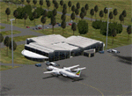
This project adds the booming city of Hawassa, Ethiopia, creates the new international airport (HALA), moves (and rebuilds) the downtown airport (recoded to HALX), and includes AI flight plans for the Ethiopian Airlines service that began April 2016. Tested in both the default FSX: Acceleration and with FTX Global/Vector, accurate coastlines, lakes, road data, and SRTMGL1 (30m) mesh, as well as corrected landclass are provided based on the latest available satellite imagery. The Hawassa International Airport was created using information from the current satellite footprint and the promotional video from Ethiopian Airports Enterprise (EAE). Although there is still very little published data on the airport, it is fully functional.
Updates were created or rebuilt in a manner which carefully aligns airport data with current satellite imagery. Scenery was created using Airport Design Editor X v1.70.6042, SBuilderX 3.13, and the FSX Object Placement Tool. Scenery objects were added and modified from stock FSX scenery to resemble as closely as possible the actual airports. The FSX apron lights included are from the set created by Jim Dhaenens. Thanks to Ron Blehm for bringing this part of the world to my attention.
| Filename: | HALA__Hawassa_Intl___Hawassa_Ethiopia.zip |
| License: | Freeware |
| Added: | 20th July 2016, 09:06:40 |
| Downloads: | 1,020 |
| Author: | Carlyle Sharpe |
| Size: | 10.41 MB |


© 2001-2026 AVSIM Online
All Rights Reserved
Privacy Policy |