
Where Flight Simulation Enthusiasts Gather from Around the World!
AVSIM Library - Search Results

| Category: Flight Simulator 2004 - Scenery | |
| PAUT - Akun Island - Alaska, USA |

|
Images related to this file:
File Description:
Akun Island is close to Akutan, only 7 miles away from the village and the Trident fish processing plant that is just west of the village. Unfortunately those 7 miles are over the sea, as the airport has been built on a different island where there are fewer hills. The link is by hovercraft, which is included as AI in this post along with a "seaport" that boasts only an apron down by the beach. PAUT has a single runway aligned 09-27 which is 4,500 feet long and has a surrounding gravel base. There are daily flights from Dutch Harbor by Grant Aviation, more than one if more are required. The Ai contains these flights, plus a late afternoon Coastguard helicopter flight is added to the revised St Paul Island AI included here. Adjacent to the airport there is a camp for housing labour who were employed on the airport construction, and this is now available for wildlife survey teams or whoever else needs to find accommodation while working on Akun Island.
| Filename: | PAUT__Akun_Island__Alaska_USA.zip |
| License: | Freeware, limited distribution |
| Added: | 27th January 2015, 23:11:43 |
| Downloads: | 475 |
| Author: | Roger Wensley |
| Size: | 4.13 MB |
| Category: Flight Simulator 2004 - Scenery | |
| OPDB Dalbandin, Pakistan |
|
Images related to this file:
File Description:
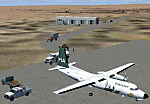
Googly scenery for OPDB Dalbandin, Pakistan - a quiet domestic airport for
which no operational facilities are provided in Flight Simulator 2004. These
scenery files add/correct the runways, apron, taxiways, buildings and other
airport features so that you and your "AI" traffic can land, taxi, park
and take off in a realistic manner.
The airport appears to be served all of once per week by ATRs of Pakistan
International Airways so will hardly buzz with activity, but you will be
assured of a friendly welcome when you arrive.
The scenery does not purport to be ultra-accurate. Based on high-detail satellite
imagery from Google Earth, the layout is proportionally correct but the added
airport features, such as buildings, are built from default Microsoft objects
and add-on libraries so will not look like the real thing.
You are not obliged to download and install any additional scenery libraries,
but to enjoy this scenery in its entirety, you may wish to. It will work fine,
with or without.
[File re-uploaded at the request of AVSIM]
| Filename: | OPDB_Dalbandin_Pakistan.zip |
| License: | Freeware |
| Added: | 5th May 2010, 22:32:37 |
| Downloads: | 1,017 |
| Author: | John Hinson |
| Size: | 65.99 KB |
| Category: Flight Simulator 2004 - Scenery | |
| Thames Estuary Airport - Version 2 |
|
Images related to this file:
File Description: This is the long awaited update to our original Thames Estuary scenery.
Version 1 is still available, but this is also 'stand alone' (version 1 not
needed)
Works with both FS9 and FSX. Seperate FSX version to follow.

Thames estuary airport is a possible new feature to the compilation of UK
airports. Using the concept images on the net, we have made the airport for FS9.
Please note that this is a very large airport and may not be suitable for slower
computers.
There have been plans since 1943 to build a new airport for London at various
locations around the Thames Estuary. The proposal was revived in 2008 by the
Mayor of London, Boris Johnson, and has acquired the nickname "Boris Island".
| Filename: | Thames_Estuary_Airport__Version_2.zip |
| License: | Freeware |
| Added: | 28th August 2013, 01:14:08 |
| Downloads: | 1,161 |
| Author: | Mark Piccolo - Soarfly Concepts |
| Size: | 903.4 KB |
| Category: Flight Simulator 2004 - Scenery | |
| Kona at Keahole International Airport PHKO |
|
File Description:
This is a completely new Kona, which is now more correctly laid out and very detailed. This is one of the most unique and beautiful airports in the world. It resembles a Hawaiian Village and Botanic garden combined, and is completey open air. The airport is built on old lava flows, and the terminal area is full of lava rock walls, which was probably mined while constructing the taxiways, tarmacs, and terminal itself. This scenery redoes the entire airport, and includes details like baggage carrousels, benches at the gate areas, check-in counters, parking lot shelters, and some purple baggage carts to go with the Island atmosphere. Since this airport has no jetways, I have created some new lower impact air stairs, and have positioned them around the two main gate areas. There is also a large air stair at each gate area to accommodate heavy jetliners. The unique ramp lights found at this airport are also included as well as some interesting night lit ramp textures. It has not been tested in FS2002.
| Filename: | Kona_at_Keahole_International_Airport______PHKO.zip |
| License: | Freeware |
| Added: | 16th January 2004, 14:14:35 |
| Downloads: | 6,781 |
| Author: | Bill Melichar |
| Size: | 5.52 MB |
| Category: Flight Simulator 2004 - Scenery | |
| SPHZ Anta/Comandante German Arias Grazz, Peru |
|
Images related to this file:
File Description:
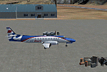
Googly scenery for SPHZ Anta/Comandante German Arias Grazz, Peru - a small
domestic airport for which nothing more than a runway is provided in Flight
Simulator 2004. These scenery files add the apron, taxiways, buildings and
other airport features so that you and your "AI" traffic can land, taxi, park
and take off in a realistic manner.
The airport is served daily by domestic operator L C Busre and perhaps also
others using small aircraft, but little information has been found on activity
in this area.
The scenery does not purport to be ultra-accurate. Based on high-detail satellite
imagery from Google Earth, the layout is proportionally correct but the added
airport features, such as buildings, are built from default Microsoft objects
and add-on libraries so will not look like the real thing.
You are not obliged to download and install any additional scenery libraries,
but to enjoy this scenery in its entirety, you may wish to. It will work fine,
with or without.
[File re-uploaded at request of AVSIM]
| Filename: | SPHZ_AntaComandante_German_Arias_Grazz_Peru.zip |
| License: | Freeware |
| Added: | 23rd May 2010, 01:24:24 |
| Downloads: | 1,225 |
| Author: | John Hinson |
| Size: | 65.15 KB |
| Category: Flight Simulator 2002 - Original Aircraft | |
| Nordair Douglas DC-3 CF-HTH |
|
File Description:
This Nordair DC-3 for FS2002 is dedicated and done in tribute to all the men and women involved with the DEW Line in Canada, whom Nordair supplied for many years. Based on Jan Visser's legendary DC-3 model for FS2000, updated for FS2002, this model includes transparent cabin windows, nightlighting, lit 3D interior with opening passenger door, boarding ladder and other details. Includes FS2002 lights fix by Paul Pridmore. Repaint by Mark Beaumont.
| Filename: | Nordair_Douglas_DC3_CFHTH.zip |
| License: | Freeware |
| Added: | 17th July 2003, 06:03:38 |
| Downloads: | 938 |
| Author: | Jan Visser, Mark Beaumont |
| Size: | 2.81 MB |
| Category: Flight Simulator X - Scenery | |
| LYPG Podgorica Airport, Montenegro |
|
File Description:
Podgorica Airport (IATA: TGD, ICAO: LYPG) is an international airport located 11 km (6.8 mi) south of Podgorica, Montenegro. It is the main hub for Montenegro Airlines.
It is one of two public airports in Montenegro, the other being Tivat Airport. Both are operated by the state-owned company Airports of Montenegro. The airport is sometimes called Golubovci Airport by the locals, as the town of
Golubovci is in close proximity. Airports Council International awarded Podgorica the best airport under 1 million passengers in 2007.
The IATA code of the airport is still TGD because Podgorica was named Titograd (after Josip Broz Tito) from 1946 to 1992, during which time the airport opened.
The airport handles domestic flights within Montenegro as well as international flights. As Montenegro's two main airports are merely 80 km apart, there are no regular passenger domestic flights. Domestic flights have been reduced to
charter flights and general aviation, and all scheduled traffic is international.
There are daily scheduled flights to various European destinations. During the summer season, there are many charter flights and air connections to various major cities in the world. The flight to Belgrade airport has traditionally
accounted for majority of the traffic at the airport, but the percentage is decreasing.
VIP and taxi airlines Vektra Aviation, Di Air and OKI Air are based at the airport. Serbian VIP airlines Air Pink and Prince Aviation also use the airport.
Podgorica Airport served 538,477 passengers in 2008. However, due to global economic downturn, passenger numbers declined to 450,504 in 2009. In 2010, strong growth was recorded, so numbers passed the 600,000 mark.
Thanks to Serbia And Montenegro Virtual Area Control Center for the airport charts.
This file has the right coordinates, with the apron and characteristics of the airport, airport vehicles and buildings, also it is set to the correct altitude of 126 feet or 38 meters.
| Filename: | LYPG_Podgorica_Airport_Montenegro.zip |
| License: | Freeware |
| Added: | 29th October 2012, 21:41:37 |
| Downloads: | 4,673 |
| Author: | Anwar Gonzalez |
| Size: | 10.52 MB |
| Category: X-Plane - Scenery | |
| BR RJ SBME - Macae Airport v1.0.0 |
|
Images related to this file:
File Description:
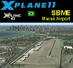
This is an X-Plane 11 and X-Plane 10 scenery package for Benedito Lacerda Airport (IATA: MEA, ICAO: SBME) is the airport serving Macaé, RJ, in Brazil. It includes corrected aprons, ramps, gates, taxiways, lighting system, city buildings, ortho-photoscenery for the airfield area, and (XP11 only) airport ground services (like push back). The airport was established in the 1960s as an airfield for general aviation and a Flying club. In the 1980s the runway was paved and an apron and a terminal with 941 m² were constructed, enabling Macaé Airport to fully support the operations related to the Campos basin (off shore oil platform in the costal area of the state of Rio de Janeiro). In fact, most of its movement (98%) is related to helicopter flights to/from offshore oil platforms of the Campos basin. It features a lot of apron positions for rotorcrafts. This scenery was tested and is operational (as of March 26, 2017) in "X-Plane 11 Public Beta #17 64 bit", Windows 10 Home. It was also tested and is also operational (as of March 26, 2017) in "X-Plane 10.51 64 bit", Windows 10 Home. Only the default X-Plane 11 libraries, by Laminar Research, are needed. No third party libraries are used.
| Filename: | BR_RJ_SBME__Macae_Airport_v100.zip |
| License: | Freeware |
| Added: | 29th March 2017, 03:50:00 |
| Downloads: | 80 |
| Author: | Rui Mesquita |
| Size: | 14.62 MB |
| Category: Flight Simulator X - Scenery | |
| Lelystad airport_EHLE_FSX_new_layout |
|
File Description:
Because the Netherlands 2000 Scenery Design Team no longer releases a new version for the FSX,
this version has been compiled based on nl2k_v4_EHLE_5 with the permission of the the Netherlands 2000 Scenery Design Team.
- Various buildings have been modelled and items from various sources have been added to the airport.
- The EHLElib.BGL file contains all the items that have been used and the textures are complete.
As a result, the airport can be installed without the use of the installation of the Netherlands 2000 Scenery Design Team.
- The airport is surrounded by more trees than the version nl2k_v4_EHLE_5.
- Lampposts have been added to the highway of the approach path of Runway 23 and parking places.
- By means of Airport Design Editor the airport can be changed.
- In the Effects folder, there are effects that should be added to the FSX (SE) folder.
- In the selection folder you will find two options. One is the choice where the new section is active and two where it is inactive.
By placing a copy of one of these in the scenery folder and deleting it already in the scenery.
It will become active after you restart the flight sim.
Enjoy and Happy flying
Jan Zijlstra from the Netherlands
| Filename: | Lelystad_airport_EHLE_FSX_new_layout.zip |
| License: | Freeware |
| Added: | 20th March 2024, 23:09:06 |
| Downloads: | 173 |
| Author: | Jan Zijlstra |
| Size: | 255.22 MB |
| Category: Flight Simulator 2004 - Scenery | |
| HCMI Berbera, Somalia |
|
Images related to this file:
File Description:
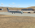
Googly scenery for HCMI Berbera, Somalia - an airport largely overlooked in
Flight Simulator 2004 with just a runway and tower provided at what is actually
the country's largest airport. At one time it had two active runways and a
strong military presence but today activity is limited to occasional
civilian flights. These scenery files add taxiways, aprons, buildings and
other airport features (and remove the non-existent tower that Microsoft
put there) so that you and your "AI" traffic can land, taxi, park and take
off in a realistic manner. This desert-surrounded airport is served three times per week by Douglas DC-9 jets of Kenyan airline African Express Airways.
The scenery does not purport to be ultra-accurate. Based on high-detail satellite
imagery from Google Earth, the layout is proportionally correct but the added
airport features, such as buildings, are built from default Microsoft objects
and add-on libraries so will not look like the real thing.
You are not obliged to download and install any additional scenery libraries,
but to enjoy this scenery in its entirety, you may wish to. It will work fine,
with or without. [File re-uploaded at request of AVSIM]
| Filename: | HCMI_Berbera_Somalia.zip |
| License: | Freeware |
| Added: | 29th May 2010, 09:26:33 |
| Downloads: | 1,319 |
| Author: | John Hinson |
| Size: | 62.07 KB |


© 2001-2026 AVSIM Online
All Rights Reserved
Privacy Policy |