
Where Flight Simulation Enthusiasts Gather from Around the World!
AVSIM Library - Search Results

| Category: Flight Simulator 2004 - Scenery | |
| EVVA Ventspils International, Latvia |

|
Images related to this file:
File Description:
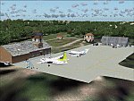
Googly scenery for Ventspils International - Latvia's third largest commercial airport
(try not to laugh!) although no facilities other than a runway are provided in Flight
Simulator 2004. These scenery files add taxiways, aprons, buildings and other airport
features, so that you and your "AI" traffic can land, taxi, park and take off in a
realistic manner.
The airport serves the city of Ventspils in northwest Latvia and opened as recently
as 1975. Owing to changes in the political situation, operations ceased in 1983 but
it re-opened in 2000. At present, it is unclear which operators serve the airport
- Air Baltic is the claimed contender but there is no evidence in their advertised
schedules. It is believed that occasional flights are operated to St Petersburg and
Moscow by Russian operators but information is hard to come by. Nevertheless, the
airport's own web site (http://www.airport.ventspils.lv/) has figures showing the
increasing numbers of passengers passing through the airport, so something must
call here! The airport also sees a respectable amount of General Aviation activity
and AVGAS has recently been made available.
The scenery does not purport to be ultra-accurate. Based on high-detail satellite
imagery from Google Earth, the layout is proportionally correct but the added
airport features, such as buildings, are built from default Microsoft objects
and add-on libraries so will not look like the real thing. [File re-uploaded at request of AVSIM]
| Filename: | EVVA_Ventspils_International_Latvia.zip |
| License: | Freeware |
| Added: | 15th June 2010, 00:59:50 |
| Downloads: | 1,596 |
| Author: | John Hinson |
| Size: | 89.79 KB |
| Category: Microsoft Flight Simulator (2020) - Scenery | |
| UGAM Ambrolauri Airport, Georgia [MSFS] |
|
Images related to this file:
File Description:
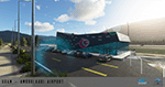
Ambrolauri Ambrolauri (Georgian: áƒáƒ›áƒ‘რáƒáƒšáƒáƒ£áƒ ი) is a city in Georgia, located in the western part of the country, on both banks of the Rioni river, at the elevation of 550 m above sea level. It is a self-governing city. At the same time, the city serves as the seat of the Racha-Lechkhumi and Kvemo Svaneti regional administration and the Ambrolauri Municipality. According to the 2014 census, the city had a population of 2,047. Its area is 1.6 km². Ambrolauri is first recorded in the 17th century as a place, where one of the palaces of the kings of Imereti was located. It acquired the city status in 1966 and became a self-governing city with its own municipal government in 2014. The Airport The airport is nestled into the Caucasus mountains right at the bank of the river Rioni. It has a single runway of 1100 m length and caters small propeller aeroplanes. The apron has space for two planes at a time and caters up to 50 passengers at one time. In the Simulator The virtual airport is very close to its real-world counterpart. All the buildings at and near the airport are modelled and the terminal even has an interior that can be seen from outside. The look and feel from a trip to the Racha region is definitely there. In real life, only small planes fly to the airport but that shouldn't stop you to bring planes from the size of the Dash 8.
| Filename: | UGAM_Ambrolauri_Airport_Georgia_MSFS.zip |
| License: | Freeware, limited distribution |
| Added: | 30th December 2020, 18:16:07 |
| Downloads: | 179 |
| Author: | David Hilker |
| Size: | 72.32 MB |
| Category: Prepar3D V1-4 - Scenery | |
| Telluride United States N37 56'21 W107 48'59 |
|
File Description:
Telluride United States N37 56'21 W107 48'59 Telluride is the county seat of the county and the most populous city of San Miguel County in the southwestern part of the US state of Colorado at the end of a gigantic canyon located Telluride, Colorado (8,750ft), a national historical landmark surrounded by the highest concentration of 13,000 'and 14,000' peaks in the United States. The city is a former silver mining camp on the San Miguel River in the western mountains of San Juan, a major center for winter sports. Telluride is more accessible than ever, as more flight options have been added for the 2017-18 winter season. Charlotte Douglas International is the last airport added to the list of direct flights to the Montrose-Telluride Regional Airport (MTJ) which brings the total of 15 non-stop flights (16 during the holiday season) from 12 major hubs to the 2017 - 18 winter. In the scenery you will find the city of Telluride and the airport infrastructure of the Charlotte Douglas International airport.
| Filename: | Telluride_United_States_N37_5621_W107_4859.zip |
| License: | Freeware |
| Added: | 11th March 2018, 00:23:20 |
| Downloads: | 152 |
| Author: | Pasquale Marrulli |
| Size: | 407.63 KB |
| Category: Flight Simulator X - Scenery | |
| YBLT - Ballarat Aerodrome - Victoria, Australia |
|
Images related to this file:
File Description:
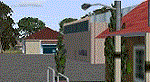
YBLT (Ballarat Aerodrome) is a regional 'airport' in the central west of the State of Victoria, Australia and utilises infrastructure from the days of RAAF operations which lasted till the early 1960's. Thus the buildings are now a bit outdated but this file does not reflect that as I have not done any custom texturing so everything in this package tends to look a bit new and crispy.
Note the name of this 'airport'. The locals are adamant it is an aerodrome, not an airport. I have not found any freeware or commercial offerings for an alternative to the default and so I have put one together.
This is a reasonable approximation of the airport /aerodrome but is not entirely accurate as the hangars/buildings I have modelled myself are generic ones I have done and do not look exactly like the ones at that facility. The connecting road is not in true alignment as I have created it so as it blends into the surrounding default scenery.
| Filename: | YBLT__Ballarat_Aerodrome__Victoria_Australia.zip |
| License: | Freeware |
| Added: | 21st October 2014, 01:51:16 |
| Downloads: | 838 |
| Author: | Robert Budd |
| Size: | 4.43 MB |
| Category: Navigation and ATC - Navigation | |
| LSZS - Samedan visual approach chart v3 |
|
Images related to this file:
File Description:
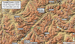
Custom made visual approach chart and pilot's briefing for Engadin (St. Moritz) Samedan LSZS airport in Switzerland, Europe's highest elevation airport (5,600 ft.) situated in the Swiss Alps. This airport is a day VFR operations only and has no instrument approach due to extreme terrain around it. A demanding visual descent into a canyon, in between steep rising terrain, is required to make the visual approaches for both runways with a steep 4.4* degrees final approach portion guided by the PAPI's. Still, executive jets up to Boeing 737(BBJ) size approach the airport often in the winter peak season VFR with these procedures. It is designed as per real operators' pilot briefing for Samedan. Real airport's full pilot briefing document also included. The real airport's excellent briefing (included) intentionally does not contain the maneuvers needed for the approach of jets through the mountains but only reporting points for all and maneuvers for light aircraft only. This gap is what this chart covers. Version 2 chart included better graphics and refined visual procedure for jets and version 3 now includes real pilot's briefing guide.
| Filename: | LSZS__Samedan_visual_approach_chart_v3.zip |
| License: | Freeware, limited distribution |
| Added: | 20th March 2015, 23:35:11 |
| Downloads: | 2,026 |
| Author: | Kyprianos Biris |
| Size: | 7.1 MB |
| Category: Flight Simulator X - Scenery | |
| Gold Coast Airport (YBCG) |
|
File Description:
The Gold Coast Airport (formerly known as Coolangatta) is a busy international airport located some 100 ks south of Brisbane and 850 ks north of Sydney. This scenery contains and accurate depiction of the terminal, control tower, hangers and the very distinctive lighthouse at Coolangatta (with beacon) plus night lighting of the apron. In addition many buildings have been added to Coolangatta and Surfers some of which are original but many are stock buildings. The scenery has been reduced in complexity to attempt to be reasonably frame rate friendly. All models are GMAX or FSDS3.0. Extensive coastline changes has added beaches as far south as Byron Bay and the canal network behind Surfers Paradise, Bond Uni, Currumbin and Coolangatta. Recent upgrades of the airport to a 2500 metre runway have been reflected as well as a widened apron. Therefore it may look a little different from the current Google Earth image but it is accurate. The airport will now handle direct flights from Asia and typical planes landing might include Airbus 343 or similar wide bodied aircraft.
| Filename: | Gold_Coast_Airport_YBCG.zip |
| License: | Freeware |
| Added: | 12th July 2007, 15:08:44 |
| Downloads: | 6,175 |
| Author: | John Ross |
| Size: | 12.16 MB |
| Category: Flight Simulator X - AFCAD Files | |
| EIDW - Dublin Intl - Dublin, Ireland v1.1 |
|
Images related to this file:
File Description:
With enhanced jetway appearance depending on your scenery complexity settings!
EIDW - Dublin Intl - Dublin, Ireland Dublin Airport is the headquarters of Ireland's flag carrier (Aer Lingus), Europe's largest low-cost carrier (Ryanair) and Ireland's regional airline (Aer Arann). Ireland's fourth airline, CityJet, operates flights from the airport. The current Terminal 1 building originally opened in 1972, and was initially designed to handle five million passengers per year. In October 2007, a new pier was opened to the north of terminal 1. This pier caters for the majority of Ryanair flights. In 2009, a new extension featuring new food and retail outlets was added to the side of Terminal 1. Terminal 2 is a 75,000 m2 (810,000 sq ft) terminal and pier (pier E) which provides 19 air bridges for aircraft and is capable of handling 15 million passengers annually, thereby allowing the airport to handle 35 million passengers a year. Using ADEx 1.50, aeronautical maps and Google Earth (2009) all these changes have been built into the default FSX airport.
| Filename: | EIDW__Dublin_Intl__Dublin_Ireland_v11.zip |
| License: | Freeware |
| Added: | 18th October 2012, 15:17:06 |
| Downloads: | 3,267 |
| Author: | Menno C. Robert |
| Size: | 5 MB |
| Category: Flight Simulator 2004 - Aircraft Repaints, Textures and Modifications | |
| Pacific Coastal Shorts 360 |
|
File Description:
GMAX aircraft Shorts 360 in Pacific Coastal's colors.
| Filename: | Pacific_Coastal_Shorts_360.zip |
| License: | Check within download |
| Added: | 1st September 2004, 00:41:57 |
| Downloads: | 917 |
| Author: | Claudio A. Dobre, SkyColors Team, Mike Stone |
| Size: | 1.61 MB |
| Category: Flight Simulator 2004 - AI Flight Plans | |
| Leck AG52 - Retro Package |
|
Images related to this file:
File Description:
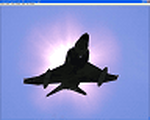
Retro AI package for Leck AB (EDXK), home of the Luftwaffe reconnaissance wing AG52, flying the RF-4C situated in the 1990's.
Package includes weekly flightplans and repaints for all Phantoms. As well as scenery files for Leck AB (EDXK) and those other Afcads required for the attached flightplans. Also included are voicepacks for the waypoints and the AG52 callsign.
Requires RF-4 model from Nick Black
| Filename: | Leck_AG52__Retro_Package.zip |
| License: | Freeware |
| Added: | 23rd February 2012, 19:01:53 |
| Downloads: | 621 |
| Author: | Chris A Brown, Menno van den Boogaard |
| Size: | 9.15 MB |
| Category: Flight Simulator 2004 - AI Flight Plans | |
| Luftwaffe test wing WTD61 - Retro Package |
|
Images related to this file:
File Description:
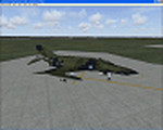
Retro AI package for the Luftwaffe test wing WTD61, flying both the RF-4 and the F-4F situated in the 1990's based at Manching Ingolstadt AB (ETSI).
Package includes weekly flightplans and repaints for all Phantoms.
Requires F-4F and RF-4 models from Nick Black.
| Filename: | Luftwaffe_test_wing_WTD61__Retro_Package.zip |
| License: | Freeware |
| Added: | 23rd February 2012, 19:04:53 |
| Downloads: | 539 |
| Author: | Chris A Brown, Menno van den Boogaard |
| Size: | 1.62 MB |


© 2001-2026 AVSIM Online
All Rights Reserved
Privacy Policy |