
Where Flight Simulation Enthusiasts Gather from Around the World!
AVSIM Library - Search Results

| Category: Flight Simulator 2004 - Miscellaneous Files | |
| Active ILS - KDEN |

|
File Description:
As most know initiating the ILS at certain airports for AI Traffic is not a function at this time when using AFCAD2. If you add a new ILS runway to an airport such as KDEN (Denver International Airport 16R/34L) only the user aircraft can use this runway when visibility falls below 3 miles. ATC will no longer use this runway for AI Traffic because FS9 sees it as a visual runway and will now vector your AI Traffic to a FS9 stock ILS runway. This file adds all NAVAIDS for making 16R/34L a Precision Instrument Runway by adding all the radar fixes for both the ILS approach portion and the proper missed approach procedures, altitudes and intersections as per current published plates. All AI Aircraft will now continue to use 16R/34L when Airport conditions are less than 3 miles.
| Filename: | Active_ILS__KDEN.zip |
| License: | Freeware, limited distribution |
| Added: | 17th June 2004, 16:17:08 |
| Downloads: | 1,589 |
| Author: | Jim Vile |
| Size: | 50.28 KB |
| Category: Flight Simulator X - Scenery | |
| Polish Airports VOL. 2 X DEMO |
|
Images related to this file:
File Description:

POLISH AIRPORTS VOL. 2 X DEMO is a package of detailed sceneries of EPSC Szczecin, EPLL Lodz and EPZG Zielona Gora airports in Poland, fully compatible with FSX, P3Dv1, P3Dv2 (till v2.1).
This product is a fully functional DEMO version of the commercial payware product. It features same airports layout as in the full version but with limited 3D objects and low resolution textures. Using this free demo ensures no problems with online (VATSIM, IVAO, multiplayer etc.) flying in case some users use the payware scenery and some don't.
Szczecin-Goleniow "Solidarnosc" (SZZ/EPSC) is the main domestic and international airport serving the city of Szczecin in Poland. Lodz Wladyslaw Reymont (LCJ/EPLL), formerly known as Lodz-Lublinek Airport, is a regional airport in central Poland. Zielona Gora-Babimost (IEG/EPZG) is a regional post-military airport located within the greater Zielona Gora agglomeration and is the 11th busiest airport in Poland.
The product is equipped with an automatic installer, which means that the scenery will be automatically added to the Flight Simulator Scenery Library. Please uninstall all previous versions of this airport you may have installed before. Please make also sure that no duplicate AFCAD files are installed.
Enjoy your virtual flying with Drzewiecki Design!
| Filename: | Polish_Airports_VOL_2_X_DEMO.zip |
| License: | Commercial demo |
| Added: | 2nd September 2015, 22:20:07 |
| Downloads: | 677 |
| Author: | Drzewiecki Design |
| Size: | 17.1 MB |
| Category: X-Plane - Scenery | |
| TMA Fortaleza XP11 Package SBFZ SJCM SJDS SNFF v1.0.0 |
|
Images related to this file:
File Description:

This is an X-Plane 11 scenery package for Fortaleza, Ceara, Brazil. It includes four airfields located in the metropolitan area of Fortaleza: (1) SBFZ FOR - Pinto Martins International Airport, (2) SJCM - Catuleve Aeronautical and Sports Airfield, (3) SJDS - Fabrica Fortaleza Private Airport, (4) SNFF - Feijo Flight School and Private Airfield. SBFZ/FOR scenery was tested and is operational (as of January 27, 2017) in "X-Plane 11 Public Beta #8 64 bit", Windows 10 Home. It was also tested but is NOT operational (as of January 27, 2017) in "X-Plane 10.51 64 bit", Windows 10 Home. This happens for two reasons: (a) preparation of a near future update release of this airport with ground traffic/services enabled for SBFZ/FOR ground, a feature compatible only with XP11, and (b) the use of some internal Laminar Research made libraries for XP11 only, not present in XP10 libraries. The new SBFZ version with XP11 ground traffic/services will be released after X-Plane's WED v1.6 is stable, outside of beta version for XP11. If you want a great SBFZ airport scenery compatible with XP10, please download it from here: "SBFZ - Pinto Martins International Airport - Fortaleza Ceará (Brazil) 1.6", By Rafasax, found at: http://forums.x-plane.org/index.php?/files/file/21401-sbfz-pinto-martins-international-airport-fortaleza-cear%C3%A1-brazil/
| Filename: | TMA_Fortaleza_XP11_Package_SBFZ_SJCM_SJDS_SNFF_v10.zip |
| License: | Freeware |
| Added: | 28th January 2017, 07:20:20 |
| Downloads: | 172 |
| Author: | Rui Mesquita |
| Size: | 16.99 MB |
| Category: Flight Simulator 2004 - Scenery Design | |
| WBGT/WBTM Long Banga, Tanjung Manis, Malaysia |
|
Images related to this file:
File Description:
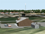
Googly scenery for WBGT Long Banga, Tanjung Manis (sometimes also referred to
under the ICAO code WBTM) - a small domestic airport in Malaysia that it seems
Microsoft forgot to provide in in Flight Simulator 2004. These scenery
files create the airport and add taxiways, aprons, buildings and other airport
features, so that you and your "AI" traffic can land, taxi, park and take off in
a realistic manner. Also added is the missing TMS non-directional beacon at
this airport (on frequency 264.0).
The airport serves the township of Sarikei, capital of the Sarekei district in
the Sarekei Division (are you following this?) of Sarawak in Eastern Malaysia.
Flights are provided by MASwings, a subsidiary of Malaysian Airlines, with De
Havilland Twin Otter aircraft calling here a few times per week.
The scenery does not purport to be ultra-accurate. Based on high-detail satellite
imagery from Google Earth, the layout is proportionally correct but the added
airport features, such as buildings, are built from default Microsoft objects
and add-on libraries so will not look exactly like the real thing.
You are not obliged to download and install any additional scenery libraries,
but to enjoy this scenery in its entirety, you may wish to. It will work fine,
with or without.
[File re-uploaded at request of AVSIM]
| Filename: | WBGTWBTM_Long_Banga_Tanjung_Manis_Malaysia.zip |
| License: | Freeware |
| Added: | 23rd May 2010, 01:23:38 |
| Downloads: | 965 |
| Author: | John Hinson |
| Size: | 51.04 KB |
| Category: Flight Simulator 2004 - Scenery | |
| Coffs Harbour (YSCH), NSW, Australia |
|
File Description:
Coffs Harbour Regional Airport (YSCH) FS2004
********************************************
Coffs Harbour airport, located roughly halfway between Sydney and Brisbane on the East coast of Australia, is owned and operated by Coffs Harbour Council. They took over the airport in the early nineties and after a massive expansion plan including widening the runway to handle jets up to a Boeing 767 and building a new terminal at a cost of $4 million dollars. This terminal was opened in November 2000 and should handle the expanding traffic for the next 10 years. At present over 200,000 passengers pass through the terminal.
The scenery re-creates the entire airport for FS2004 including the new terminal, old terminal, all of the ga hangars, flying school, airport tower and many more structures. All modelling was carried out using textures from photographs taken on site to ensure an authentic result. In addition the harbour at Coffs Harbour has been modelled as well as Mutton Bird Island that was missing completely in the default. To conserve frame rates the harbour has not been fully detailed but is accurate in placement and looks realistic on an approach to runway 21.
AFCAD file and traffic tools file is included to populate the airport with additional AI traffic. Also contains three sample flights, which can be selected from the flight simulator select flight menu.
| Filename: | Coffs_Harbour_YSCH_NSW_Australia.zip |
| License: | Freeware |
| Added: | 2nd July 2004, 20:08:19 |
| Downloads: | 5,003 |
| Author: | John Ross |
| Size: | 8.17 MB |
| Category: Flight Simulator X - AFCAD Files | |
| MGTK / MGMM - Mundo Maya International Airport - Santa Elena, Guatemala |
|
Images related to this file:
File Description:
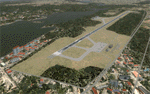
This file adds the airport background that was missing from the default airport and corrects the placement of the taxiways, runway, and buildings for Mundo Maya International Airport (MGMM), formerly Anacleto Maza Castellanos International Airport (MGTK). As of January 2012, the ICAO airport identifier for Mundo Maya International Airport has been changed from MGTK to MGMM. Both versions are included in this package to more easily accomodate AI traffic programs that still use the MGTK identifier. Scenery was created using Airport Design Editor X v1.50.4402 and SBuilderX 3.13.
| Filename: | MGTK__MGMM__Mundo_Maya_International_Airport__Sant.zip |
| License: | Freeware |
| Added: | 5th October 2013, 18:03:31 |
| Downloads: | 548 |
| Author: | Carlyle Sharpe |
| Size: | 535.89 KB |
| Category: Flight Simulator X - Scenery | |
| GVNP Praia International Airport |
|
Images related to this file:
File Description:
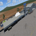
Praia International Airport (IATA: RAI, ICAO: GVNP) is an airport located on Santiago Island in Cape Verde. It was opened in late 2005,
replacing the old Francisco Mendes International Airport. It is located about 3 km northeast of central Praia in the southeastern
part of the island of Santiago.
The first flight to the new airport was on October 23, 2005. Even though the airport serves the capital and largest city, Praia,
Cape Verde's main international airport is AmiÂlcar Cabral International Airport located on the smaller island of Sal.
| Filename: | GVNP_Praia_International_Airport.zip |
| License: | Freeware |
| Added: | 24th August 2011, 12:59:06 |
| Downloads: | 3,442 |
| Author: | Miguel Diaz |
| Size: | 58.43 MB |
| Category: Flight Simulator X - Scenery | |
| Gustavo Rojas Pinilla International Airport (SKPS) 2011 |
|
File Description:
Gustavo Rojas Pinilla International Airport (IATA: ADZ, ICAO: SKSP) is the leading airport in the archipelago of San Andres, Providencia and Santa Catalina, which has enough capacity to receive large aircraft, due to a number of
charter flights and seasonal in different parts of America and Europe.
This file has the right coordinates, with the apron and characteristics of the airport. The runways were reoriented to the correct direction, runway were re-sized the gates placed on correct location and number, FAC was placed
(Colombian Air force and Colombian National Army) all the airport charts required to navigate in and out of this airport can be found at www.aerocivil.gov.co/ under Informacion Aeronautica click AIP; on AIP
click Aerodromos then click at SKSP.
| Filename: | Gustavo_Rojas_Pinilla_International_Airport_SKPS_2.zip |
| License: | Freeware |
| Added: | 23rd August 2011, 02:26:49 |
| Downloads: | 1,678 |
| Author: | Anwar Gonzalez |
| Size: | 10.03 KB |
| Category: Flight Simulator 2004 - Scenery | |
| Gustavo Rojas Pinilla International Airport (SKPS) 2011 |
|
File Description:
Gustavo Rojas Pinilla International Airport (IATA: ADZ, ICAO: SKSP) is the leading airport in the archipelago of San Andres, Providencia and Santa Catalina, which has enough capacity to receive large aircraft, due to a number of
charter flights and seasonal in different parts of America and Europe.
This file has the right coordinates, with the apron and characteristics of the airport. The runways were reoriented to the correct direction, runway were re-sized the gates placed on correct location and number, FAC was placed
(Colombian Air force and Colombian National Army) all the airport charts required to navigate in and out of this airport can be found at www.aerocivil.gov.co/ under Informacion Aeronautica click AIP; on AIP
click Aerodromos then click at SKSP.
| Filename: | Gustavo_Rojas_Pinilla_International_Airport_SKPS_2.zip |
| License: | Freeware |
| Added: | 23rd August 2011, 02:27:32 |
| Downloads: | 1,364 |
| Author: | Anwar Gonzalez |
| Size: | 6.29 KB |
| Category: Prepar3D V1-4 - Scenery | |
| Indonesian Airports VOL. 2 - Kalimantan Airports |
|
Images related to this file:
File Description:
(WALL, WAOO, WAQQ, WIOO)
This scenery pack is part of a series of airport scenery updates for Indonesian airports.
Included airports are done according to the latest available aeronautical charts, and using the NAVIGRAPH coordinate data for all runways and new NAVAIDs.
Indonesia is home for many beautiful airports spread across over 3000 nautical miles of the Indonesian archipelago from the Indian ocean to the Pacific ocean. Most of the existing Indonesian airports are completely out-dated, incomplete, or even non-existent in the current releases of P3D.
Airports included in Vol.2::
1. Balikpapan Sepinggan Airport (ICAO: WALL)
2. Banjarmasin Syamsudin Noor Airport - (ICAO:WAOO)
3. Pontianak Supadio Airport - (ICAO: WIOO)
4. Tarakan Juwata International Airport - (ICAO: WAQQ) **Formerly WARL
| Filename: | Indonesian_Airports_VOL_2__Kalimantan_Airports.zip |
| License: | Freeware, limited distribution |
| Added: | 5th September 2017, 22:52:39 |
| Downloads: | 2,604 |
| Author: | Ahmed Abdessalam |
| Size: | 69.05 KB |


© 2001-2026 AVSIM Online
All Rights Reserved
Privacy Policy |