
Where Flight Simulation Enthusiasts Gather from Around the World!
AVSIM Library - Search Results

| Category: Flight Simulator 2004 - Scenery | |
| KEUG - Mahlon Sweet Airport, Eugene, Oregon. |

|
Images related to this file:
File Description:

KEUG Mahlon Sweet Airport, Eugene, Oregon. This is a comprehensive enhancement which includes removal of the crosswind runway, new ground covering for the airport property, the addition of many hangers and buildings and a wealth of other eye candy which brings the airport to life. We believe you will enjoy "driving" around the airport as much as landing there!
This work is based on the recent update by David Marshall of the KEUG afcad by Reiley McKendrick and information from the airport website. Default objects were used where possible as well as items drawn from the EZ and RWY12 libraries. This enhancement works very well with the default FS2004 setup, and an alternative afcad for those who have Ultimate Terrain USA has been included. Please unzip (using folders option) to a temporary folder and follow the simple installation instructions. Compiled for your flying enjoyment by Ray Luning in collaboration with David "Opa" Marshall.
| Filename: | KEUG__Mahlon_Sweet_Airport_Eugene_Oregon.zip |
| License: | Freeware |
| Added: | 2nd February 2010, 10:29:15 |
| Downloads: | 3,324 |
| Author: | Ray Luning & David "Opa" Marshall |
| Size: | 1020.59 KB |
| Category: Flight Simulator X - Scenery | |
| Victoria Inner Harbor Airport (CYWH) |
|
Images related to this file:
File Description:
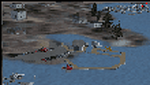
This airport was made using Airport Facilitator X, and Instant Scenery 2. Victoria Inner Harbor Airport is a water airport located in southern Victoria, British Columbia, Canada. The airlines that fly there are Harbor Air, West Coast Air, Kenmore Air, and Whistler Air. This is an airport that flight simulator does not have. I put docks for seaplanes with two seaplanes. I even made it so that you can start off at the dock. I made the small terminal and a parking lot with cars and light poles. I also put the surrounding docks with many boats. There is also a small heliport 0.73 miles away from Victoria Inner Harbor called Shoal Point Heliport. I have made this heliport because it too is another one flight simulator forgot. This was all based on Google Earth and Bing Maps. Please read the read me for instructions on how to install. This is for Flight Simulator X only. By Tyler Lawrence.
| Filename: | Victoria_Inner_Harbor_Airport_CYWH.zip |
| License: | Freeware |
| Added: | 16th January 2012, 23:53:12 |
| Downloads: | 1,488 |
| Author: | Tyler Lawrence |
| Size: | 9.98 MB |
| Category: Flight Simulator 2004 - Scenery | |
| NTGK Kaukura, French Polynesia |
|
File Description:
Googly scenery for NTGK Kaukura, a small airport on Motu Panao island of Kaukura
atoll, part of the Tuamotu group in French Polynesia. The airport, opened in 1994,
is served just a couple of times per week by ATR turboprop aircraft of Air Tahiti.
Flight Simulator 2004 has only provided a runway at this airport and this scenery
seeks to redress the situation so that you and your "AI" traffic can use the
airport.
The scenery does not purport to be ultra-accurate. Based on high quality
satellite imagery from Google Earth, the layout is proportionally correct but the
added airport features, such as buildings, are built from default Microsoft objects
and add-on libraries so will not look exactly like the real thing.
You are not obliged to download and install any additional scenery libraries,
but to enjoy this scenery in its entirety, you may wish to. It will work fine,
with or without.
| Filename: | NTGK_Kaukura_French_Polynesia.zip |
| License: | Freeware |
| Added: | 19th April 2008, 20:34:24 |
| Downloads: | 1,572 |
| Author: | John Hinson |
| Size: | 70.52 KB |
| Category: Flight Simulator X - Scenery | |
| A85 - Kwigillingok Airport - Alaska, USA |
|
Images related to this file:
File Description:
Kwigillingok Airport (IATA: KWK, ICAO: PAGG, FAA LID: GGV, formerly A85) is owned by the Native Village of Kwigillingok and is a public-use airport located one mile (two kilometres) northwest of the central business district of Kwigillingok, in the Bethel Census Area of the U.S. state of Alaska. There is also a nearby seaplane landing area known as Kwigillingok Seaplane Base (FAA LID: KWK).Runway 15/33 was increased from 1,835 feet and 40 feet wide to 3,300 feet and 60 feet wide. Runway 4/22 was added along with custom models. All changes were made based on the 2014 construction plans.
Created with Airport Design Editor 9x by ScruffyDuck Software using current FAA documentation and Google Earth measurements, this package offers a replacement for FSX's stock airport. All these enhancements are as close to the real airport as I can get with stock library objects and custom buildings.
| Filename: | A85__Kwigillingok_Airport__Alaska_USA.zip |
| License: | Freeware |
| Added: | 5th January 2015, 00:26:44 |
| Downloads: | 708 |
| Author: | Wayne Roberts |
| Size: | 358.61 KB |
| Category: Flight Simulator X - AFCAD Files | |
| MHRO - Juan Manuel Galvez International Airport / Roatan, Honduras (version 1.1) |
|
Images related to this file:
File Description:

MHRO - Juan Manuel Galvez International Airport / Roatan, Honduras (version 1.1)
This airport update was made with the latest version of ADE (Airport Design Editor) and made for FSX as a replacement for the stock (default) airport. I found that most stock airports in FSX lack a decent amount of character and realism and this area in particular was dreadful! The stock airport file for Roatan was completely devoid of any life. There were absolutely no parking spots for commercial aircraft and no terminal buildings; the nearby areas of Colonia/Loma Linda were completely barren. I've done major reworking to this airport and added the small terminal building as well as renumbered the runway to the correct designation and length. The nearby town has been rendered complete with a variety of vessels small and large in the ocean. I hope you enjoy. Below is a list of changes/additions. All these enchancements are as close to the real airport as I can get with stock library objects. I've used satellite images, terminal photos and maps throughout the whole process so building locations are as accurate as possible. Happy landings in Honduras!
Features:
*Expanded parking apron
*Terminal building with parking for commercial traffic (Delta and United fly to Roatan from the US with regular service)
*Renumbered runways to correct designations and modified runway length and lighting accurately
*Nearby neighborhoods modeled complete with marinas and cruise ship port (cruise ship parked at the pier visible on approach)
*Diving, fishing, cargo and recreational vessels visible in the ocean surrounding the airport v1.1
*Several hotels dotting the area near the airport as well as West End/Gibson Bight
*Roads with static vehicles near the airport
*Corrected taxiway signs v1.1
| Filename: | MHRO__Juan_Manuel_Galvez_International_Airport__Ro.zip |
| License: | Freeware |
| Added: | 15th July 2012, 06:47:04 |
| Downloads: | 686 |
| Author: | Jaison Diaz |
| Size: | 6.85 KB |
| Category: Flight Simulator 2004 - Aircraft Repaints, Textures and Modifications | |
| Regia Aeronautica, Bristol Blenheim MkIV |
|
File Description:
A Bristol Blenheim MkIV was captured by the Italians after a mistaken landing in Pantelleria airport.
After a while the Blenheim, based on Guidonia's Airport and with 'Regia Aeronautica's insignas (Royal Italian Air Force), was flown only for comparative tests during the period 1940/41. This aircraft was also used for propagandistic flights and appeared almost in a movie. Texture sets only. You must have installed the beautyful 'ALPHASIM Bristol Blenheim' payware package for FS2004/FSX. Repaint by Manuele Villa, February 2008.
| Filename: | Regia_Aeronautica_Bristol_Blenheim_MkIV.zip |
| License: | Freeware |
| Added: | 26th February 2008, 09:04:17 |
| Downloads: | 206 |
| Author: | Manuele Villa |
| Size: | 1.84 MB |
| Category: Flight Simulator X - Scenery | |
| CCS6 - Courtenay (Smit Field) |
|
File Description:
Courtenay Airport is located 2.5 Nm west of Courtenay on the beautiful Vancouver island, BC
It is actually a private airfield. It has been enhanced to accomodate up to 3 lights aircrafts. It is a short grass airfield and VFR conditions a must, specifically when inbound for Rwy 04 due to the ground layout.
I have added some visual reference you may use when inbound ;)...don't worry, you can't miss it! LOL
Hope youll have a good time in Courtenay Airport.
| Filename: | CCS6__Courtenay_Smit_Field.zip |
| License: | Freeware |
| Added: | 10th April 2009, 01:43:48 |
| Downloads: | 736 |
| Author: | Daniel Louvet |
| Size: | 3.03 MB |
| Category: Flight Simulator 2004 - Utilities | |
| Port_Parse.exe |
|
File Description:
For users of TTools, Port_Parse checks a selected airport (ICAO code) during a selected day of the week every half hour for the parking places used for AI traffic. The number of occupied parking spaces as well as the title of the aircrafts on these spaces is displayed and written to a text file. The program makes use of an airport file, an aircraft file and a flightplans file, all in TTools format. Port_Parse does not alter any FS or TTools files.
| Filename: | Port_Parseexe.zip |
| License: | Freeware |
| Added: | 16th August 2005, 23:58:09 |
| Downloads: | 1,071 |
| Author: | Gerhard Berendt |
| Size: | 1.12 MB |
| Category: Flight Simulator 2004 - AFCAD Files | |
| Nashville Intl crosswind Runway (KBNA) Tennessee |
|
File Description:
This file is for the default airport and activates the crosswind rwy all 4 rwy's now used for takeoff/landings, rwy lengths corrected and a helipad added with night lighting, as MS did not give this airport a control tower i have added a tower viewpiont in the position of the real tower (well somewhere near it) a big thanks to Jim Vile and Reggie Fields for their hard work in activating crosswind rwy's fully tested with Ultimate Traffic but not required
| Filename: | Nashville_Intl_crosswind_Runway_KBNA_Tennessee.zip |
| License: | Freeware |
| Added: | 7th February 2005, 22:29:07 |
| Downloads: | 1,352 |
| Author: | Ray Smith |
| Size: | 12.27 KB |
| Category: Flight Simulator X - Scenery | |
| ENNM - Namsos Airport - Namsos, Norway |
|
Images related to this file:
File Description:
This detailed Namsos scenery corresponds to the current airport layout of ENNM. The near surroundings are designed based on a satellite photo so that VFR flights and VFR orientation should be very easy. The second bridge "Namsos Bridge" a bit far west of the airport is included, also the City of Namsos, a cruise ship dock and the marina south of the Namsos Bridge and much more.
We have a photo background which fits all four seasons and an additional night texture.
| Filename: | ENNM__Namsos_Airport__Namsos_Norway.zip |
| License: | Freeware |
| Added: | 15th May 2015, 00:08:02 |
| Downloads: | 1,747 |
| Author: | Wolfgang Allers |
| Size: | 31.78 MB |


© 2001-2026 AVSIM Online
All Rights Reserved
Privacy Policy |