
Where Flight Simulation Enthusiasts Gather from Around the World!
AVSIM Library - Search Results

| Category: Flight Simulator X - Scenery | |
| PAKO - Nikolski Air Station - Alaska, USA |

|
File Description:
Nikolski Air Station (IATA: IKO, ICAO: PAKO, FAA LID: IKO) is an unattended airport located in Nikolski on Umnak Island in the Aleutians West Census Area of the U.S. state of Alaska. This former military airport is now owned by the Aleut Corporation. Scheduled commercial airline passenger service is subsidized by the Essential Air Service program. Current service to Nikolski is provided by PenAir using a Grumman Goose G-21A.
This airport has one runway 8/26 which is 3,512 feet long and 135 feet wide with a gravel surface. Custom models were added.
| Filename: | PAKO__Nikolski_Air_Station__Alaska_USA.zip |
| License: | Freeware |
| Added: | 28th August 2013, 12:12:38 |
| Downloads: | 995 |
| Author: | Wayne Roberts |
| Size: | 147.64 KB |
| Category: Flight Simulator X - Scenery | |
| KPIA - General Downing - Peoria International Airport - Peoria, Illinois, USA |
|
Images related to this file:
File Description:
This Photo Real scenery is a complete rebuild for the FSX Default KPIA airport using the latest version of ADE, SBuilderX scenery design tool, & Google SketchUp. This scenery includes completely rebuilt terminal buildings, FedEx Hub buildings, National Guard buildings, realistic area Google Earth buildings, night lighting, and photo real ground textures that give the airport a more realistic feeling. I constructed this scenery using some FSX textures and imported Google Earth Buildings via Google SketchUp. The runways and airport aprons are aligned to match Google & Yahoo satellite imagery.
| Filename: | KPIA__General_Downing__Peoria_International_Airpor.zip |
| License: | Freeware |
| Added: | 12th December 2014, 10:38:32 |
| Downloads: | 1,299 |
| Author: | Glenn Johnson |
| Size: | 56.55 MB |
| Category: Flight Simulator X - Scenery | |
| FSX - Augusta State Airport KAUG |
|
Images related to this file:
File Description:
FSX Scenery - Augusta State Airport (IATA: AUG, ICAO: KAUG, FAA LID: AUG) is a public use airport located one nautical mile (2 km) northwest of the central business district of the state capital of Augusta, a city in Kennebec County, Maine, United States. The airport is owned by the state of Maine, but managed and operated by the city of Augusta. It is served by one commercial airline, with scheduled passenger service subsidized by the Essential Air Service program. For your flying pleasure by John B. Loney, Jr.
| Filename: | FSX__Augusta_State_Airport_KAUG.zip |
| License: | Freeware, limited distribution |
| Added: | 7th October 2016, 19:33:16 |
| Downloads: | 925 |
| Author: | John B. Loney, Jr. |
| Size: | 69.41 MB |
| Category: Prepar3D V1-4 - Scenery | |
| KPDX - Portland Intl Airport - Portland, OR, USA |
|
File Description:
KPDX - Portland Intl Airport - Portland, OR, USA version 1.0 by Jason Boche
This is an update of the default P3Dv4.5 airport.
Enhancements include:
-Adjusted all runways to actual lengths
-Added/adjusted displaced thresholds
-Added blastpads
-Moved LOC antennas and associated ILS transmitter buildings
-Taxiways A, K, T and related signs on the north and east side of the airport were a hot mess - Fixed all of those.
-Added taxiways V, A1
-Added/adjusted hold short lines
-Added asphalt around K, T, E intersections
-Added exclusion areas near extended runways
-Adjusted fencing
| Filename: | KPDX__Portland_Intl_Airport__Portland_OR_USA.zip |
| License: | Freeware |
| Added: | 20th June 2020, 18:34:18 |
| Downloads: | 474 |
| Author: | Jason Boche |
| Size: | 25.79 KB |
| Category: Flight Simulator 2004 - Scenery | |
| Durham Tees Valley Airport |
|
File Description:
Situated in the UK, Durham Tees Valley Airport is a relatively small Regional Airport serving the North East with various European holiday destinations, Internal Domestic flights, and also has 2 General Aviation Clubs and Parking. Originally an RAF base, (as are most UK airports) It was used as an RCAF Bomber Command Station during WW2 with Lancaster's, Halifax's and Whitley's, then a Fighter Station after the war with Hunters, Javelins and English Electric Lightning’s. It was passed into civil hands in 1964 when the RAF left, Teesside Airport (as it was then know) was born.
| Filename: | Durham_Tees_Valley_Airport.zip |
| License: | Freeware, limited distribution |
| Added: | 10th June 2005, 16:56:21 |
| Downloads: | 7,077 |
| Author: | Stephen Legg |
| Size: | 8.63 MB |
| Category: Flight Simulator 2004 - AFCAD Files | |
| Seatle-Tacoma Intl (KSEA) Washington |
|
File Description:
This file is another version to try for the default airport although i have added 100 gates/parking/cargo parking, (with a big thanks to Lee Swordy's latest version of AFCAD_2 which i used here) the main object was to tidy up the concrete areas around the airport including the removal of the grass around the front of hangars also the runways/taxiways/apron lighting has been improved and i have added a helipad at each end of the airport and both have been given lighting (fully tested with Ultimate Traffic but not required)
| Filename: | SeatleTacoma_Intl_KSEA_Washington.zip |
| License: | Freeware |
| Added: | 7th December 2003, 22:00:51 |
| Downloads: | 1,801 |
| Author: | Ray Smith |
| Size: | 15.49 KB |
| Category: Flight Simulator 2002 - Scenery | |
| Lanai Airport, Lanai City, Hawaii |
|
File Description:
This scenery is a remake of my original Lanai scenery for FS2002, which was way to overdone for this sleepy little airport. It now contains a very quaint, rustic Hawaiian styled airport situated on the original FS tarmac and runways, so there is no longer heading problems. It also corrects the bouncing aircraft problem in the first scenery. Since there are no taxiways, I have included adequate turnouts at each end of the runway. This airport now fits the area, and is my second upgrade to my Pacific Island series.
| Filename: | Lanai_Airport_Lanai_City_Hawaii.zip |
| License: | Freeware |
| Added: | 2nd May 2003, 12:29:27 |
| Downloads: | 1,831 |
| Author: | Bill Melichar |
| Size: | 1.75 MB |
| Category: Flight Simulator 2004 - Scenery | |
| Telluride Regional Airport v3 ( KTEX ) |
|
File Description:
FS2004 Scenery - Telluride Regional Airport (IATA: TEX, ICAO: KTEX) is a public airport located 5 miles (8 km) west of Telluride, in San Miguel County, Colorado, USA. It is the highest commercial airport in North America, at an elevation of 9,078 feet (2767 m) above sea level. Located on a plateau, the airport's single runway literally dips slightly in the centre. This is version 3. Unlike versions 1 and 2, this scenery had the advantage of Google Earth's satellite image. Created using Instant Scenery by John B. Loney, Jr.
| Filename: | Telluride_Regional_Airport_v3__KTEX_.zip |
| License: | Freeware, limited distribution |
| Added: | 25th March 2008, 15:55:10 |
| Downloads: | 2,801 |
| Author: | John B. Loney, Jr. |
| Size: | 17.23 MB |
| Category: Flight Simulator X - Scenery | |
| EDDB BBI Berlin Brandenburg International |
|
Images related to this file:
File Description:
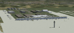
This is a FS-X conversion of my FS2004 freeware scenery for EDDB, BBI (former Berlin Schoenefeld after its extension to Berlin Brandenburg International). It is made by photos and maps from drafts and pictures of an exhibition and is therefore a fictional airport which not yet exists! The airport should be ready to use in 2011 and replayce SXF/EDDB, THF/EDDI and TXL/EDDT. Parts based on ga_eddb1 by Georg Aubele with his kind permission. Cleared to land - before the airport is built! 2006-08-07/2010-01-10 by Gernot Zander
| Filename: | EDDB_BBI_Berlin_Brandenburg_International.zip |
| License: | Freeware |
| Added: | 11th January 2010, 10:42:16 |
| Downloads: | 3,961 |
| Author: | Gernot Zander |
| Size: | 2.99 MB |
| Category: Prepar3D V1-4 - Scenery | |
| KDAL - Dallas Love - Dallas, TX - P3DV4 - airac 2008 |
|
File Description:
this is an updated version of the default p3d airport:
*airac 2008*
-verified runway dimensions/markings/lighting configurations
-completely rebuilt taxiways and signage
-new terminal and gates
due to the aerial imagery being in a state of transition, some areas were estimated according
to the airport diagram. should be reasonably accurate.
my intent is to have a functional and current airport, not eye candy. the idea is to pretty much
match the real charts for online use (vatsim, etc). not tested with any type of AI traffic or atc.
| Filename: | KDAL__Dallas_Love__Dallas_TX__P3DV4__airac_2008.zip |
| License: | Freeware |
| Added: | 20th July 2020, 19:16:37 |
| Downloads: | 570 |
| Author: | Mike Teague |
| Size: | 451.87 KB |


© 2001-2026 AVSIM Online
All Rights Reserved
Privacy Policy |