
Where Flight Simulation Enthusiasts Gather from Around the World!
AVSIM Library - Search Results

| Category: Flight Simulator 2004 - Scenery | |
| Bay Bridge Airport (W29) - Stevensville, Maryland, USA |

|
File Description:
This file updates Bay Bridge Airport (W29) with some enhanced scenery. Bay Bridge is a smaller airport at the base of the Chasapeake Bay bridge. The approach to this airport gives an amazing view of the bridge and the bay. One interesting note about this airport is that it lies within the Washington Air Defense Identification Zone (ADIZ). This means that special procedures are required departing and landing at this airport in real life. Of course, in FS2004, it doesn't matter, but try to follow the proper procedures as much as possible in the game for a challenge. This file includes a custom afcad and optional static aircraft.
| Filename: | Bay_Bridge_Airport_W29__Stevensville_Maryland_USA.zip |
| License: | Freeware, limited distribution |
| Added: | 22nd April 2006, 19:14:12 |
| Downloads: | 1,159 |
| Author: | Craig Swartzlander |
| Size: | 6.83 KB |
| Category: Flight Simulator X - Scenery | |
| PFCL - Clarks Point Airport - Alaska, USA |
|
Images related to this file:
File Description:
Clarks Point Airport (IATA: CLP, ICAO: PFCL, FAA LID: CLP) is a state-owned public-use airport located in Clarks Point, a city in the Dillingham Census Area of the U.S. state of Alaska.
Increased runway length from 2,600 feet to 3,200 feet and renumbered runway to 18/36. Changes were made based on 2004 construction plans.
Created with Airport Design Editor 9x by Scruffy Duck Software using current FAA documentation and Google Earth measurements, this package offers a replacement for FSX's stock airport. All these enhancements are as close to the real airport as I can get with stock library objects and addition of custom models.
| Filename: | PFCL__Clarks_Point_Airport__Alaska_USA.zip |
| License: | Freeware |
| Added: | 18th October 2014, 23:47:21 |
| Downloads: | 632 |
| Author: | Wayne Roberts |
| Size: | 207.9 KB |
| Category: Prepar3D V1-4 - Scenery | |
| KJQD, Ohio County Airport Hartford, KY USA |
|
Images related to this file:
File Description:
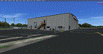
KJQD is a public use, one runway airport located 3 miles NE of Hartford KY.
Runway 3/21 is an asphalt runway 5000x75 feet long. 100LL and Jet-A are available at this airport.
I added an area of photo real about a mile square around the airport. It blends best with Orbx Global and LC North America. All the airport objects such as hangers, fences, fuel tanks, signs, etc. are all custom made objects based on pictures obtained on-site. The runways, taxiways and aprons are all custom textures as well as runway and taxiway lights. This is an authentic recreation of the real world airport.
| Filename: | KJQD_Ohio_County_Airport_Hartford_KY_USA.zip |
| License: | Freeware |
| Added: | 22nd January 2018, 23:09:44 |
| Downloads: | 354 |
| Author: | Shannan G Landreth |
| Size: | 46.33 MB |
| Category: Prepar3D V1-4 - Scenery | |
| KCEY, Kyle-Oakley Field Murray KY USA (P3D) |
|
Images related to this file:
File Description:
KCEY is a public use, single runway airport located 4 miles NW of Murray KY. Runway 5/23 is an asphalt runway 6203x100 feet long. 100LL, Jet-A and MOGAS are available at this airport.
I added an area of photo real about a mile square around the airport. It blends best with Orbx Global and LC North America. All the airport objects such as hangers, fences, fuel tanks, signs, etc. are all custom made objects based on pictures obtained on-site. The runways, taxiways and aprons are all custom textures as well as runway and taxiway lights. This is an authentic recreation of the real world airport.
| Filename: | KCEY_KyleOakley_Field_Murray_KY_USA_P3D.zip |
| License: | Freeware |
| Added: | 12th March 2018, 22:15:59 |
| Downloads: | 204 |
| Author: | Shannan G Landreth |
| Size: | 66.74 MB |
| Category: Flight Simulator X - Scenery | |
| Avalon Airport |
|
File Description:
Avalon airport is an airport in Victoria Australia it is only about a 15 minute flight from Melbourne International airport it is one of the hubs for Low cost airline Jetstar. In FSX its scenery is very sparse considering it is the location of the Australian international Air show. I have created this scenery with Abacus Scenery editor and it adds an environment which represents an Air Show it also adds a terminal (not exact to the real one) and a few other enhancements to the Airport environment.
Note, uses default AFCAD
| Filename: | Avalon_Airport.zip |
| License: | Freeware, limited distribution |
| Added: | 27th February 2007, 02:43:58 |
| Downloads: | 2,053 |
| Author: | Scott Hickey |
| Size: | 444.98 KB |
| Category: Flight Simulator 2004 - AI Aircraft | |
| Chanchangi Airlines Boeing 737-200 (5N-BIF) Nigeria |
|
Images related to this file:
File Description:

Chanchangi Airlines Nigeria Limited is a privately owned and operated airline with the Administrative Head Office in Kaduna in Nigeria. It operates scheduled domestic passenger services, as well as a regional service to Accra, Ghana. Its main base is Kaduna Airport, with hubs at Murtala Mohammed International Airport, Lagos, Nnamdi Azikiwe International Airport, Abuja and Port Harcourt International Airport. The repaint shows 5N-BIF, a 1983 built Boeing 737-282 which had been in service with TAP, Xtra Airways, Tahoe Air and Air Laughin before. Textures only for the AI Aardvark model.
| Filename: | Chanchangi_Airlines_Boeing_737200_5NBIF_Nigeria.zip |
| License: | Freeware, limited distribution |
| Added: | 13th June 2010, 20:34:35 |
| Downloads: | 302 |
| Author: | Uwe Hoffmann |
| Size: | 556.34 KB |
| Category: Flight Simulator X - Scenery | |
| New airport AFCAD for 7AK ICAO: PAUT Akutan, Alaska, USA for FSX and Prepar3D |
|
File Description:
The airport was opened in 2012. Akutan was previously served by amphibious airplane service to Akutan Seaplane Base, located on Akutan Island, however, in 2012 operator PenAir announced that they would retire their Grumman Goose aircraft and as a result the traditional airport on Akun Island was built to serve Akutan. The new airport is connected to Akutan by a hovercraft.
Changes were made based on 2012 construction plans. Custom models have been added.
This is a reworked version originally from Wayne Roberts.
The Airport has been reoriented according the Satellite-Image.
| Filename: | New_airport_AFCAD_for_7AK_ICAO_PAUT_Akutan_Alaska_.zip |
| License: | Freeware |
| Added: | 1st December 2017, 17:22:18 |
| Downloads: | 523 |
| Author: | Wayne Roberts, Conrad F. Staeheli |
| Size: | 8.57 MB |
| Category: Prepar3D V1-4 - Scenery | |
| YDGU Degrussa Airport + Mine |
|
Images related to this file:
File Description:
Degrussa Airport is a Fly in Fly out Airport servicing the Sandfire Degrussa Copper-Gold Mine, located 900km north of Perth in Western Australia. Not only does this scenery contain the Airport, Camp site + photo imagery of the mine itself but includes the Degrussa Solar Project Covering a total area of over 20 hectares, it is the largest integrated off-grid solar and battery storage facility in Australia. The Airport is serviced by Network Aviation a subsidiary of the Qantas group using F100 from Perth International painted in Qantaslink Colours.
| Filename: | YDGU_Degrussa_Airport__Mine.zip |
| License: | Freeware |
| Added: | 11th July 2019, 17:06:15 |
| Downloads: | 635 |
| Author: | Robert Fluke |
| Size: | 33.74 MB |
| Category: Flight Simulator X - Scenery | |
| Grise fiord New 2017+A full approach and landing video+Grise Fiord village! |
|
File Description:
This is Grise Fiord a beautiful small airport in Nunavut, Canada. I hand placed every single object and re-positioned the runway, aprons and parking spaces too make it 99.9% accurate! This scenery features Grise Fiord Airport and Grise Fiord village, with a static First Air ATR-72-300. As well as that, I included a video showing you how to land at the airport without crashing (easier said than done!) I hope you have lots of fun with this airport and expect high quality freeware scenery in the future-Ols. Requires UTX Canada
| Filename: | Grise_fiord_New_2017A_full_approach_and_landing_vi.zip |
| License: | Freeware |
| Added: | 22nd December 2017, 18:09:52 |
| Downloads: | 477 |
| Author: | Ollie Seaward |
| Size: | 90.46 MB |
| Category: Flight Simulator 2004 - AFCAD Files | |
| Sucre SLSU Bolivia |
|
Images related to this file:
File Description:
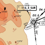
AFCAD file for FS2004 default scenery of Sucre SLSU Juanna A. De Padilla airport in Bolivia.
Brings runway to proper dimensions and adds approach (PAPI) lighting as in the real airport.
High elevation airport (9430 ft.) with surrounding terrain of the Bolivian Andes.
There is no night lighting at this airport. Approach charts included. Recommended mesh terrain: mesh_fermandois003_265585.zip
| Filename: | Sucre_SLSU_Bolivia.zip |
| License: | Freeware, limited distribution |
| Added: | 19th March 2010, 08:55:01 |
| Downloads: | 563 |
| Author: | Kyprianos Biris |
| Size: | 683.9 KB |


© 2001-2026 AVSIM Online
All Rights Reserved
Privacy Policy |