
Where Flight Simulation Enthusiasts Gather from Around the World!
AVSIM Library - Search Results

| Category: Flight Simulator X - AFCAD Files | |
| FGBT - Bata Airport - Bata, Equatorial Guinea |

|
File Description:
Bata Airport (IATA: BSG, ICAO: FGBT) is the second largest airport in Equatorial Guinea, after Malabo Airport, and is the only other paved runway. The airport is located some way north of Bata and a short way south of Utonde, it has a
2.3 km runway that operates only during the daytime and in good light. The state carrier and four other private companies make up the majority of Bata's industry, transporting passengers from Bioko's international airport or the two
800m strips on Annobon or Mongomo. The airport is large enough to accommodate a Boeing 737. Bata served 15,000 passengers in 2001. In July 2002, all staff at the airport were arrested for allowing the leader of the Popular Union, an o
pposition party, to board a flight to the Gabon. The tower frequency is 118.800 MHz (VHF).
Airport elevation and two runways were corrected also the aprons and buildinds. Airport charts cortesy of vatcaf.flyvatsimafrica.org
This work is dedicated to West Wind Airlines.
| Filename: | FGBT__Bata_Airport__Bata_Equatorial_Guinea.zip |
| License: | Freeware |
| Added: | 19th May 2013, 17:22:05 |
| Downloads: | 768 |
| Author: | Anwar Gonzalez |
| Size: | 677.55 KB |
| Category: Flight Simulator X - Scenery | |
| TABA Airport (HETB), Egypt. |
|
File Description:
FSX Scenery-- TABA Airport (HETB), Egypt. Included is a completely designed airport that comes with allocated gates and general parking , By Mohamed Salamoni
| Filename: | TABA_Airport_HETB_Egypt.zip |
| License: | Freeware |
| Added: | 16th April 2017, 17:09:30 |
| Downloads: | 882 |
| Author: | Mohamed Salamoni |
| Size: | 5.64 MB |
| Category: Flight Simulator 2004 - Scenery | |
| Airport Tiaret Bou Chekif (DAOB) Algeria |
|
Images related to this file:
File Description:
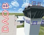
GMAX Scenery Airport Tiaret Bou Chekif Africa. Tiaret is a small regional airport in North Africa. This version is fully compatible with FS2004.
| Filename: | Airport_Tiaret_Bou_Chekif_DAOB_Algeria.zip |
| License: | Freeware |
| Added: | 8th April 2011, 11:00:37 |
| Downloads: | 2,326 |
| Author: | Mohand Ousaid Hamza |
| Size: | 7.67 MB |
| Category: Flight Simulator 2004 - Scenery | |
| Johannesburg International Airport, South Africa |
|
File Description:
Johannesburg International Airport (FAJS), South Africa. A highly detailed airport containing photorealistic ground textures, hangars and buildings. The ILS alignment is also corrected.
| Filename: | Johannesburg_International_Airport_South_Africa.zip |
| License: | Freeware, limited distribution |
| Added: | 9th March 2004, 00:32:18 |
| Downloads: | 47,272 |
| Author: | Johan van Wyk, Aeroworx |
| Size: | 2.98 MB |
| Category: Prepar3D V1-4 - Scenery | |
| ZPBS - Baoshan Yunrui Airport, Baoshan, Yunnan, China |
|
Images related to this file:
File Description:

This is a new airport for P3DV4 - no default airport exists. It may work in in P3Dv5. See the README.txt file for details.
| Filename: | ZPBS__Baoshan_Yunrui_Airport_Baoshan_Yunnan_China.zip |
| License: | Freeware, limited distribution |
| Added: | 3rd September 2020, 19:38:54 |
| Downloads: | 194 |
| Author: | David Vega |
| Size: | 142.92 KB |
| Category: Flight Simulator 2004 - Scenery | |
| Vadodara International Airport (VABO) |
|
Images related to this file:
File Description:
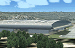
Vadodara International Airport (VABO) for FSX and FS2004.
Virtual aviation community stands basically on the grounds of what happens in the real world aviation and simulates the real thing, virtually. So that means they always have to be a step ahead and we follow. But my friend, we have a chance to make them follow us. Thats right! The proposed (final) integrated terminal at Vadodara shall have its construction commenced in mid of 2013 (the time can be altered, as real dudes define the situation). The design is finalized and here it is ..... the airport is basically " A basin kind".
Vadodara Airport or Civil Airport Harni (IATA: BDQ, ICAO: VABO) is a civilian airport located in the north-east of Vadodara, Gujarat, India in the suburb of Harni. A domestic airport until now, Vadodara Airport will become an international airport once the proposed new terminal is operational.
| Filename: | Vadodara_International_Airport_VABO.zip |
| License: | Freeware, limited distribution |
| Added: | 7th September 2010, 11:32:31 |
| Downloads: | 1,885 |
| Author: | Ashish Singh |
| Size: | 25.19 MB |
| Category: Flight Simulator 2004 - Miscellaneous Files | |
| Fix for PSS Airbus Missing ATC and Landing Gear |
|
File Description:
This is a 3rd party fix (and thus unsupported by PSS)for the PSS Airbus series. This will allow users who experienced a loss of FS ATC functions and/or were unable to raise and lower the landing gear to regain these functions. It is a simple gauge that can be closed after aircraft start up to ensure that the FS electrical system is operative. Please read the instructions carefully, as instant support cannot be garunteed.
| Filename: | Fix_for_PSS_Airbus_Missing_ATC_and_Landing_Gear.zip |
| License: | Freeware |
| Added: | 14th December 2005, 04:34:38 |
| Downloads: | 908 |
| Author: | Ian Grant |
| Size: | 4.24 KB |
| Category: Flight Simulator 2004 - Gauges | |
| FS2004 Simulated Aircraft Bubble Sextant |
|
File Description:
As travel by air developed and matured, navigation over long distances also developed and improved. In the early days, however, air navigation essentially used ship navigation techniques adapted for aircraft. Without "landmarks", the navigators used Ded Reckoning (DR) and the stars. Celestial or Astronomical Navigation provides a means of obtaining Lines of Position (LOPs) from the stars. Crossing LOPs will fix a position. It requires a chart, and a planned course on that chart, with waypoints specified by Latitude and Longitude, an assumed time of arrival at each waypoint, and stars (including the Sun, Moon, or planets) in view. In the 1940s, extensive tables of star positions were made available to air navigators to be used with sextants to obtain these LOPs. In the tables, all times involved are GMT. This data is available from the Internet in "ready to use" form. This gauge simulates the sextant, and the process by which one obtains a LOP, or crossing LOPs to obtain a position, or fix. Can be used with any FS2004 aircraft. Includes comprehensive browser-based manual and references.
| Filename: | FS2004_Simulated_Aircraft_Bubble_Sextant.zip |
| License: | Freeware |
| Added: | 6th December 2004, 19:21:14 |
| Downloads: | 4,977 |
| Author: | Dave Bitzer, Mark Beaumont |
| Size: | 989.73 KB |
| Category: Flight Simulator X - Scenery | |
| FCBB - Maya-Maya Airport - Brazzaville, Republic of the Congo |
|
File Description:
Maya-Maya Airport (IATA: BZV, ICAO: FCBB) is an airport located in Brazzaville, the capital of the Republic of the Congo. In 2004, the airport served 447,699 passengers. In 2010, a new runway 3300m long (05L/23R) and a new terminal, with 3 air bridges was opened. The older runway (05R/23L) was repaired and now is used as a taxiway. Airport runways were corrected also the jetways, aprons and buildings. Airport charts courtesy of www.ais-asecna.org/en/ad/ad2.htm
This work is dedicated to West Wind Airlines.
| Filename: | FCBB__MayaMaya_Airport__Brazzaville_Republic_of_th.zip |
| License: | Freeware |
| Added: | 2nd June 2013, 22:33:32 |
| Downloads: | 2,741 |
| Author: | Anwar Gonzalez |
| Size: | 4.03 MB |
| Category: Flight Simulator 2004 - Scenery | |
| Real Landclass Manchester Airport and surrounding area |
|
File Description:
Real Landclass Manchester Airport Area for FS2004
In FS2004 the surrounding area of Manchester Airport (EGCC) is not realistic. The Aiport is surrounded by a huge
City. Rivers, Railways and Rivers that are around the airport do not exist.In realiy Manchester Airport is surrounded by a huge area
of fields, Highways and Rivers.
With this file you get the realistic landscape that is surrounding Manchester Airport, including Highways and Railways to and from the
Terminals and even the small river that flows from the north of the airport to the south of the airport passing RWY24L underground.
| Filename: | Real_Landclass_Manchester_Airport_and_surrounding_.zip |
| License: | Freeware |
| Added: | 30th June 2008, 23:43:59 |
| Downloads: | 4,960 |
| Author: | Dave Sheffield |
| Size: | 12.29 KB |


© 2001-2026 AVSIM Online
All Rights Reserved
Privacy Policy |