
Where Flight Simulation Enthusiasts Gather from Around the World!
AVSIM Library - Search Results

| Category: Flight Simulator 2004 - Scenery | |
| South Albany Airport 4b0 |

|
File Description:
FS2004 Scenery-South Albany Airport (4B0) serves South Bethlehem and Albany County and is owned by South Albany Corp.. The paved runway extends for 2860 feet. The facility is at an elevation of 190 feet at a distance of about 2 miles from South Bethlehem and about 10 miles from Albany International. Created with Rwy12 and EZ Scenery. Totally redone AFCAD2 file. Includes AL traffic where there were none before. Dynamic scenery from Lago's FSE. By John B. Loney, Jr.
| Filename: | South_Albany_Airport_4b0.zip |
| License: | Freeware |
| Added: | 19th June 2006, 02:05:26 |
| Downloads: | 529 |
| Author: | John B. Loney, Jr. |
| Size: | 425.16 KB |
| Category: Flight Simulator X - Scenery | |
| Buenos Aires 2008 - Argentina |
|
File Description:
This is the scenery of "Buenos Aires", República Argentina. This Scenery was conceived from a principle with the following two objectives: 1) To achieve the best performance; 2) A real appearance of the land. The area that cover this Scenery is the following one: End of the Delta of Paraná, Coastal area from Buenos Aires, From Escobar's North, Until the South of Quilmes, Capital Federal, Area West, The routes arrive until Campana and La Plata, and much more. By Pablo Contouris.
| Filename: | Buenos_Aires_2008__Argentina.zip |
| License: | Freeware, limited distribution |
| Added: | 7th July 2008, 02:59:26 |
| Downloads: | 2,003 |
| Author: | Pablo Contouris |
| Size: | 8.72 MB |
| Category: Flight Simulator 2004 - Scenery | |
| Glenorchy Airfield, New Zealand. NZGY. |
|
File Description:
Welcome to Glenorchy, a small rural airfield, 2 nautical miles south of the small village of Glenorchy,
on the shores of the beautiful Lake Wakatipu, in the South Island of New Zealand.
Glenorchy is only a very short flight from Queenstown Airport (NZQN), at the opposite end of Lake Wakatipu.
This scenery was built to fit into Robin Corn's freeware "Queenstown area Photoreal Scenery", freely
available on avsim.com ( filename.. nzqnv1.5.zip ).
Requires some EZ Scenery object sets (see INSTALL instructions for details).
| Filename: | Glenorchy_Airfield_New_Zealand__NZGY.zip |
| License: | Freeware, limited distribution |
| Added: | 12th September 2008, 09:06:11 |
| Downloads: | 1,011 |
| Author: | Lawrie Roache |
| Size: | 2.12 MB |
| Category: Flight Simulator X - AFCAD Files | |
| KPSO - Stevens Field, Pagosa Springs, Colorado, USA - V2.0 |
|
Images related to this file:
File Description:
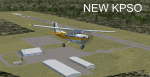
Updated scenery of Stevens Field, Pagosa Springs Airport nested in the high-altitude Rocky Mountains of Colorado. This scenery includes the airport and land class for surrounding areas to include the many small lakes, the city of Pagosa, and nearby inhabited areas. Airport features runway distance markers, new taxiways, taxiway signs, realistic parking, scenery objects, hangars, and FBO. How is your high-altitude flying? Enjoy! Version 2 includes updated taxiway structure circa 2013, signage, major roads added, and land class tweaks.
| Filename: | KPSO__Stevens_Field_Pagosa_Springs_Colorado_USA__V.zip |
| License: | Freeware |
| Added: | 30th May 2013, 06:10:06 |
| Downloads: | 536 |
| Author: | AJ Cook |
| Size: | 17.21 KB |
| Category: Flight Simulator 2004 - Scenery | |
| Townsville NQ Australia |
|
File Description:
QUEENSLAND COASTAL REVAMP FROM TOWNSVILLE TO CAIRNS FOR FS2004
This package contains 3 zip files covering:
1. Revamped coast, towns, islands, rivers & roads for the coastal strip of Queensland from the Burdekin River just south of Townsville to meet up with my Cairns scenery near Babinda in North Queensland.
2. Also includes a minor fix for a water flatten for the Mulgrave River.
3. Landclass files which upgrade my previously posted SE Qld Coast & Landclass scenery to accomodate the above new scenery.
| Filename: | Townsville__NQ_Australia.zip |
| License: | Freeware |
| Added: | 1st April 2004, 16:29:23 |
| Downloads: | 2,691 |
| Author: | Ross Casey |
| Size: | 202.91 KB |
| Category: Flight Simulator X - Scenery | |
| UK Farmstrips Part 2 |
|
File Description:
England and Wales, are still compatible with that scenery, in FSX, and should be compatible with the more recent UK photo sceneries. For use in FSX, all of the farms are combined in one scenery volume. Because of the size, it has been split into 3 downloads, all of which are essential. Part 1 is Library Objects, Part 2 is Textures, Part 3 is Farm Strips.
| Filename: | UK_Farmstrips_Part_2.zip |
| License: | Freeware |
| Added: | 31st January 2007, 15:36:28 |
| Downloads: | 3,097 |
| Author: | Gerry Winskill |
| Size: | 19.11 MB |
| Category: Flight Simulator X - Scenery | |
| Kasane (FBKE), Botswana V2 |
|
File Description:
Elevation fix, corrected airport layout, scenery enhancements and GA AI traffic.
New in Version 2:
I try to learn modeling and FSX Materials to build my own airport buildings. I hope it's acceptable for the first try.
Furthermore, heading of the windsocks has been corrected, tower view has been corrected, minor improvements to the scenery and i made a freeway traffic exclude for the airport area.
| Filename: | Kasane_FBKE_Botswana_V2.zip |
| License: | Freeware |
| Added: | 18th January 2009, 17:46:56 |
| Downloads: | 1,876 |
| Author: | Nils Besemer |
| Size: | 4.14 MB |
| Category: Flight Simulator 2004 - Scenery | |
| Richmond Municipal Airport KRID |
|
Images related to this file:
File Description:
FS2004 Scenery - Richmond Municipal Airport (KRID), Richmond, IN serves Richmond and Wayne County and is owned by Richmond Boac. The airport has more than one runway. The longest is a paved runway extending 5200 feet. The facility is at an elevation of 1140 feet at a distance of about 5 miles from Richmond. Created for your flying pleasure with Instant Scenery 2 by John B. Loney, Jr.
| Filename: | Richmond_Municipal_Airport_KRID.zip |
| License: | Freeware, limited distribution |
| Added: | 3rd August 2010, 22:22:45 |
| Downloads: | 396 |
| Author: | John B. Loney, Jr. |
| Size: | 5.09 MB |
| Category: Flight Simulator X - Scenery | |
| Richmond Municipal Airport KRID |
|
Images related to this file:
File Description:
FSX Scenery - Richmond Municipal Airport (KRID), Richmond, IN serves Richmond and Wayne County and is owned by Richmond Boac. The airport has more than one runway. The longest is a paved runway extending 5200 feet. The facility is at an elevation of 1140 feet at a distance of about 5 miles from Richmond. Created for your flying pleasure with Instant Scenery 2 by John B. Loney, Jr.
| Filename: | Richmond_Municipal_Airport_KRID.zip |
| License: | Freeware, limited distribution |
| Added: | 3rd August 2010, 22:22:55 |
| Downloads: | 675 |
| Author: | John B. Loney, Jr. |
| Size: | 5.1 MB |
| Category: Flight Simulator 2004 - Scenery | |
| Phoenix Sky Harbor - KPHX |
|
File Description:
This is my first release of Phoenix Sky Harbor for FS2004. It completely re-works terminals 3 and 4, the major portions of the airport. Terminal 2 and the cargo areas are default. The scenery includes all gates on those terminals. Gates have airline logos and pushback vehicles. AFCAD file is included with the scenery. For FS2004 only, will not work with earlier versions.
| Filename: | Phoenix_Sky_Harbor__KPHX.zip |
| License: | Freeware, limited distribution |
| Added: | 29th December 2003, 02:53:59 |
| Downloads: | 24,870 |
| Author: | Gary Widup |
| Size: | 1.21 MB |


© 2001-2026 AVSIM Online
All Rights Reserved
Privacy Policy |