
Where Flight Simulation Enthusiasts Gather from Around the World!
AVSIM Library - Search Results

| Category: Flight Simulator X - Scenery Design | |
| Core Library Vol 2 |

|
Images related to this file:
File Description:
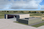
A wide variety of FSX (only) models created
in Google Sketchup and placeable with most
scenery tools (e.g. Instant Scenery).
Includes buildings (ice cream cone factory,
warehouses, hotels, churches, houses, etc),
rail equipment (for enhancing your rail
lines), and other objects.Vol 2 replaces Vol 1
with added buildings and vehicles.
By Dan French.
| Filename: | Core_Library_Vol_2.zip |
| License: | Freeware, limited distribution |
| Added: | 12th August 2012, 05:37:33 |
| Downloads: | 5,010 |
| Author: | Dan French |
| Size: | 14.14 MB |
| Category: X-Plane - Scenery | |
| BR RJ SBJR - Jacarepagua Airport v1.0.0 |
|
Images related to this file:
File Description:
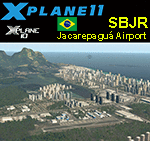
This is an X-Plane 11 and X-Plane 10 scenery package for Jacarepagua–Roberto Marinho Airport (ICAO: SBJR), which is an airport in the neighborhood of Barra da Tijuca, in the city of Rio de Janeiro, RJ - Brazil. It includes corrected aprons, ramps, gates, taxiways, lighting system, city buildings (Rio de Janeiro's Barra da Tijuca area), ortho-photoscenery for the airfield area, and (XP11 only) airport ground services (like push back). This scenery was tested and is operational (as of May 27, 2017) in "X-Plane 11 1.02b1 64 bit", Windows 10 Home. It was also tested and is also operational (as of May 27, 2017) in "X-Plane 10.51 64 bit", Windows 10 Home. Only the default X-Plane 11 libraries, by Laminar Research, are needed. No third party libraries are used.
| Filename: | BR_RJ_SBJR__Jacarepagua_Airport_v100.zip |
| License: | Freeware |
| Added: | 27th May 2017, 19:19:36 |
| Downloads: | 123 |
| Author: | Rui Mesquita |
| Size: | 19.06 MB |
| Category: Flight Simulator 2004 - AFCAD Files | |
| GQNN - Nouakchott-Mauritania Airport |
|
File Description:
GQNN - Nouakchott-Mauritania Airport for default FS2004 scenery. Improvement for this airport with a few gates added: 1 heavy, 1 medium, 1 cargo, small and 2 gates for the national airline: Air Mauritanie (MRT).
| Filename: | GQNN__NouakchottMauritania_Airport.zip |
| License: | Freeware |
| Added: | 27th April 2009, 12:10:50 |
| Downloads: | 506 |
| Author: | Ian Audisio |
| Size: | 16.51 KB |
| Category: Flight Simulator 2002 - AFCAD Files | |
| Orly Afcad for Airport 2000 vol 3 version 1.1 |
|
File Description:
Paris 2nd intenational airport,Orly with 95 gates and 2 active runways(one for landing and one for take off).
require Airport 2000 vol 3 scenery by Wilco (payware) and AFCAD by Lee Swordy.
| Filename: | Orly_Afcad_for_Airport_2000_vol_3_version_11.zip |
| License: | Freeware |
| Added: | 16th October 2002, 11:50:35 |
| Downloads: | 543 |
| Author: | Frederic Kabalu |
| Size: | 16.51 KB |
| Category: Flight Simulator X - Scenery | |
| SKVC (FR36998) |
|
File Description:
SKVC
San Vicente De Chucuri airport is located at San Vicente De Chucuri, Santander, Colombia.
This is an aiport that was not present on FSX; it is a small airport that is used by small aircraft even thought is not listed on the airport charts at the Areonautica Civil de Colombia it is still use an it code is FR36998.
| Filename: | SKVC_FR36998.zip |
| License: | Freeware |
| Added: | 26th February 2011, 22:39:25 |
| Downloads: | 680 |
| Author: | Anwar Gonzalez |
| Size: | 2.72 KB |
| Category: Flight Simulator X - Miscellaneous Files | |
| Piloten Post 21 |
|
Images related to this file:
File Description:

Pilotenpost 21 a free - freeware magazine for Dutch Flightsim pilots. Totally Dutch, hardly any English.
This month: 2x freeware [757 Freemium & PT: Tu154M.]
Landen in de sneeuw, VCRain, verkeerde regendruppel in vliegtuigen.
Nieuwe generatie CPU's. Stukje met een knipoog.
De zip PDF in deze zip bevat de PilotenPost.
VCRain is een oorspronkelijk Microsoft bestand, lees eerst het FSweetje voor het gebruik.
| Filename: | Piloten_Post_21.zip |
| License: | Freeware, limited distribution |
| Added: | 17th December 2011, 01:07:30 |
| Downloads: | 680 |
| Author: | Joost Visser |
| Size: | 3.29 MB |
| Category: Flight Simulator 2004 - Aircraft Repaints, Textures and Modifications | |
| FLandre Air B1900D PMDG |
|
File Description:
Hi all
here are the textures for the B1900D from PMDG in Flandre Air colors F-GLNE for all french pilot....
Original files are from PMDG
textures only included in the ZIP.
Voici le Beech de PMDG aux couleures de Flandre Air, Le F-GLNE qui je pense ne vole plus de nos jours...
Bon vols a tous
Enjoy
Regards
| Filename: | FLandre_Air_B1900D_PMDG.zip |
| License: | Freeware |
| Added: | 2nd October 2004, 17:12:15 |
| Downloads: | 720 |
| Author: | GERAIN Rémy / PMDG |
| Size: | 3.02 MB |
| Category: Flight Simulator 2004 - Scenery | |
| New Terrain Mesh of the Province of Quebec in LOD09 (2/4) |
|
File Description:
The files in this package contain terrain mesh files of the province of Quebec (N45 to N53) to be used with my Quebec enhanced sceneries for FS2004 (Scenes_du_Quebec_2k4.zip). The public data sources are the Shuttle Radar Topography Mission (SRTM-3, 90m) and the Canadian Digital Elevation Data (CDED - 0.75s/arc - 23m). (QC09_2k4a.zip to QC09_2k4d.zip - 4 parts)
***********************
Les fichiers de ces archives contiennent les donnees d'elevation de terrain (mesh files - lod09), pour FS2004, du territoire de la province de Quebec sous le 53ieme degre de latitude nord. Ils ont ete crees pour etre utilises avec mes nouvelles scenes du Quebec contenues dans Scenes_du_Quebec_2k4.zip. Les donnees sources sont du domaine public et proviennent de la Shuttle Radar Topography Mission (SRTM-3, 90m) et des donnees numerique d'elevation du Canada (DNEC - 0.75s/arc -23 m). (QC09_2k4a.zip to QC09_2k4d.zip - 4 parties)
| Filename: | New_Terrain_Mesh_of_the_Province_of_Quebec_in_LOD0.zip |
| License: | Freeware, limited distribution |
| Added: | 1st November 2009, 06:47:09 |
| Downloads: | 4,632 |
| Author: | Gilles Gauthier |
| Size: | 27.78 MB |
| Category: Flight Simulator 2004 - Scenery | |
| New Terrain Mesh of the Province of Quebec in LOD09 (1/4) |
|
File Description:
The files in this package contain terrain mesh files of the province of Quebec (N45 to N53) to be used with my Quebec enhanced sceneries for FS2004 (Scenes_du_Quebec_2k4.zip). The public data sources are the Shuttle Radar Topography Mission (SRTM-3, 90m) and the Canadian Digital Elevation Data (CDED - 0.75s/arc - 23m). (QC09_2k4a.zip to QC09_2k4d.zip - 4 parts)
***********************
Les fichiers de ces archives contiennent les donnees d'elevation de terrain (mesh files - lod09), pour FS2004, du territoire de la province de Quebec sous le 53ieme degre de latitude nord. Ils ont ete crees pour etre utilises avec mes nouvelles scenes du Quebec contenues dans Scenes_du_Quebec_2k4.zip. Les donnees sources sont du domaine public et proviennent de la Shuttle Radar Topography Mission (SRTM-3, 90m) et des donnees numerique d'elevation du Canada (DNEC - 0.75s/arc -23 m). (QC09_2k4a.zip to QC09_2k4d.zip - 4 parties)
| Filename: | New_Terrain_Mesh_of_the_Province_of_Quebec_in_LOD09_14.zip |
| License: | Freeware, limited distribution |
| Added: | 27th January 2010, 18:10:18 |
| Downloads: | 8,920 |
| Author: | Gilles Gauthier |
| Size: | 23.76 MB |
| Category: Flight Simulator 2004 - Scenery | |
| New Terrain Mesh of the Province of Quebec in LOD09 (3/4) |
|
File Description:
The files in this package contain terrain mesh files of the province of Quebec (N45 to N53) to be used with my Quebec enhanced sceneries for FS2004 (Scenes_du_Quebec_2k4.zip). The public data sources are the Shuttle Radar Topography Mission (SRTM-3, 90m) and the Canadian Digital Elevation Data (CDED - 0.75s/arc - 23m). (QC09_2k4a.zip to QC09_2k4d.zip - 4 parts)
***********************
Les fichiers de ces archives contiennent les donnees d'elevation de terrain (mesh files - lod09), pour FS2004, du territoire de la province de Quebec sous le 53ieme degre de latitude nord. Ils ont ete crees pour etre utilises avec mes nouvelles scenes du Quebec contenues dans Scenes_du_Quebec_2k4.zip. Les donnees sources sont du domaine public et proviennent de la Shuttle Radar Topography Mission (SRTM-3, 90m) et des donnees numerique d'elevation du Canada (DNEC - 0.75s/arc -23 m). (QC09_2k4a.zip to QC09_2k4d.zip - 4 parties)
| Filename: | New_Terrain_Mesh_of_the_Province_of_Quebec_in_LOD0.zip |
| License: | Freeware, limited distribution |
| Added: | 27th January 2010, 18:15:12 |
| Downloads: | 7,500 |
| Author: | Gilles Gauthier |
| Size: | 29.35 MB |


© 2001-2026 AVSIM Online
All Rights Reserved
Privacy Policy |