
Where Flight Simulation Enthusiasts Gather from Around the World!
AVSIM Library - Search Results

| Category: Flight Simulator 2002 - Aircraft Repaints, Textures and Modifications | |
| Ravenair, Liverpool Flying School, APB Leasing PA-38 Tomahawk |

|
File Description:
This is a repaint of the FS2000 PA-38 Tomahawk By Marcelo Cànovas.
Designed to be used with Liverpool John Lennon Scenery (EGGP) also by DerboSoft.
Ten aircraft are repesented in total. However, I've had to guess the details for the APB Leasing aircaft as I did not have sufficient information.
If anybody can provide better detail I'll try and include it!
To use these textures you will also need to download the full aircraft zip files "ptomuaca.zip" and "ptomuaca2.zip" from www.avsim.com.
| Filename: | Ravenair_Liverpool_Flying_School_APB_Leasing_PA38_.zip |
| License: | Freeware |
| Added: | 25th January 2004, 01:20:12 |
| Downloads: | 344 |
| Author: | Paul Derbyshire |
| Size: | 1.69 MB |
| Category: Flight Simulator X - Scenery | |
| SeaTac Area Airports |
|
Images related to this file:
File Description:
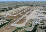
This scenery is a revision of the default Seattle-Tacoma (SeaTac), Boeing Field, Renton and Paine Field airports to work with MegaScenery Earth. The artificial plateau that Seatac is built on has been expanded and the new 3rd runway added. Runways, taxiways and various structures have been revised and/or relocated to match MegaScenery Earth ground textures. Default objects have been used in many cases to minimize FPS impact. MegaScenery Earth Washington-001 (KSEA, KBFI, KRNT) and -002 (KPAE) are required.
| Filename: | SeaTac_Area_Airports.zip |
| License: | Freeware |
| Added: | 11th December 2009, 09:51:46 |
| Downloads: | 5,565 |
| Author: | Al Wheeler |
| Size: | 2.48 MB |
| Category: Flight Simulator X - Scenery | |
| Project OTHH - Hamad International Airport (New Doha), Qatar |
|
Images related to this file:
File Description:
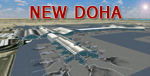
Hamad International Airport (New Doha). Ground surrounding is photoreal captured with FS Earth Tiles. It includes GMAX Main terminal, Concourses A, B, C, Tower, biggest hangars. All additional objects have been placed with Instant Scenery 2 from (Flight 1). Airport ground textures are made with SBuilderX & FS Earth Tiles. Dedicated AFCAD is set to "OTBD" ICAO to use actual AI Flightplans. Include official OTHH ATC frequencies, rwy lightning, runway settings, ILS, and approaches and many other surprises... Visit my web site www.christophebouville.com
| Filename: | Project_OTHH__Hamad_International_Airport_New_Doha.zip |
| License: | Freeware, limited distribution |
| Added: | 5th October 2013, 18:28:56 |
| Downloads: | 42,717 |
| Author: | Christophe Bouville |
| Size: | 54.41 MB |
| Category: Flight Simulator 2004 - Scenery | |
| Zion National Park South, Hurricane (1L8), Colorado City (KAZC), Utah/Arizona, Photo-Scenery (FS9 & FSX) |
|
Images related to this file:
File Description:
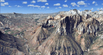
Covers the southern part of Zion National Park extends south along the cities of Hurricane and Colorado City. Zion National Park is another place where erosion of the Colorado Plateau formed the most beautiful colorful stone formations of unique and wonderful shapes. There are nine different layers of stone visible in the park. Most of them consist of sandstone. But there is also limestone, gypsum, siltstone, shale, clay and mudstone. The Virgin River cut a spectacular and famous canyon thru Zion Park that is as narrow as 20ft and up to 2000ft tall.
High resolution versions of this scenery for FS9 and FSX (much sharper, but larger and multiple downloads)
are available at www.blueskyscenery.com/CNY_South3West5.html . The screenies are taken from the high-res versions,
so expect this version to be slightly more blurry. Thanks to Joop Mak for providing custom AFCADs that
correct airport layouts so that they align with the photo-textures! They are available at www.blueskyscenery.com/AFCADs.html . YourDonation@Work: Dedicated to Jerry, Ralph J. and Lance.
| Filename: | Zion_National_Park_South_Hurricane_1L8_Colorado_Ci.zip |
| License: | Freeware, limited distribution |
| Added: | 20th March 2010, 23:26:42 |
| Downloads: | 1,787 |
| Author: | Gottfried Razek - blueskyscenery.com |
| Size: | 95.39 MB |
| Category: Flight Simulator 2004 - Scenery | |
| High-resolution 76-m (LOD9) Terrain Mesh and Scenery Enhancements for the Southern Canadian Rockies |
|
File Description:
Not simply an add-on mesh, these files include many scenery enhancements for the southern Rockies of British Columbia and Alberta. Coverage extends from Cranbrook to Calgary, and Hinton to Edmonton (N48.9-53.4 W112.3-116.3). The mesh source data are 3-arcsec (~90-m) Shuttle Radar (SRTM) files, compiled at LOD9 (76-m) resolution. All lake elevations (!) have been adjusted to eliminate the problems with the default lake data and to better fit the new terrain mesh. In addition, the Transcanada Highway/Icefields Parkway corridor in Banff National Park, from Canmore to the Hwy 11 junction, has been completely re-made, with dozens of alpine lakes (including Lake Louise, Moraine Lake, and Lake O'Hara), accurate transportation network, and landclass/waterclass updates based on satellite imagery. Due to significant changes in FS2004 to vector layering and autogen features, the special scenery enhancements cannot be used with FS2002. However, terrain mesh, lake corrections and landclass replacements will work well in FS2002.
| Filename: | Highresolution_76m_LOD9_Terrain_Mesh_and_Scenery_E.zip |
| License: | Freeware, limited distribution |
| Added: | 29th October 2003, 03:01:22 |
| Downloads: | 15,468 |
| Author: | Holger Sandmann |
| Size: | 21.81 MB |
| Category: Flight Simulator 2004 - Scenery | |
| FS2004 Scenery-UB0Z (UB13/UDKS)-Stepanakert-Khangedi AB and civil - Russian BKS in Nagorni-Karabach |
|
File Description:
FS2004 Scenery-UB0Z (UB13/UDKS)-Stepanakert-Khangedi AB and civil - Russian BKS in Nagorni-Karabach
Based on open photos available and Ultimate Terrain Europe. Please see Install notes for necessary object files and enjoy.
| Filename: | FS2004_SceneryUB0Z_UB13UDKSStepanakertKhangedi_AB_.zip |
| License: | Freeware |
| Added: | 17th June 2023, 17:07:36 |
| Downloads: | 46 |
| Author: | Bernd Barsch |
| Size: | 5.63 MB |
| Category: Flight Simulator X - AFCAD Files | |
| Mount Pleasant Landing Strip Airport (67NJ), NJ |
|
File Description:
Located 01 miles S of Hainesburg, New Jersey on 192 acres of land, Mount Pleasant Landing Strip Airport is a private turf field. The strip itself is 2100 feet in length over fairly level ground. There is no hard-surfaced grass runway in place, so setting your mesh to the highest resolution is recommended as you will be landing on bare terrain. Next to Runway 06 is a path through the trees you can taxi along to get to a hangar - although it is not available for transient aircraft and is closed. Collision with the trees along the path near the hangar and the static aircraft parked near it is disabled to make it easier to move through this relatively tight area. Immediately beyond the hangar is a clearing with ample room to turn around to taxi back out. You can also start parked in front of the hangar. The windsock is located a few feet west of the hangar and is not lit. The runway also has no edge lighting so daytime VFR operations only are recommended for this airfield.
Scenery constructed with use of satellite images/streetview/aerial photos - the author has not been there in person.
This scenery is meant to be used in conjunction with MegaScenery Earth New York 007. It is not required, but apron use is minimized to allow satellite scenery to show through as much as possible, and objects are placed based on the MSE textures - lack of it may make scenery look out of place.
| Filename: | Mount_Pleasant_Landing_Strip_Airport_67NJ_NJ.zip |
| License: | Freeware |
| Added: | 7th February 2011, 23:49:26 |
| Downloads: | 198 |
| Author: | Drew Sikora |
| Size: | 468.64 KB |
| Category: Flight Simulator X - AFCAD Files | |
| Greenwood Lake Airport (4N1), NJ |
|
File Description:
Located 01 miles E of West Milford, New Jersey on 150 acres of land, Greenwood Lake Airport is a public asphalt strip that services small to medium GA air traffic. The second runway that used to be there has been re-paved and now serves as extra aircraft parking. You can park anywhere on the closed runway, along the edge of the main tarmac where the terminal building is, or between any two white cones (50 foot max wingspan) that mark tie-down locations in the middle of the main tarmac. A helicopter start is provided as well. For parking, Small GA spaces are for craft with wingspans of less than 50 feet; Medium GA spaces are for craft with wingspans from 50-60 feet. The glide slope for Runway 24 has been adjusted up from 3.5 degrees to 4 degrees as in real life the runway sits higher than the ground the trees grow from so this will give you proper clearance on approach. Fuel is available by stopping near the tank on the main tarmac. Scenery constructed with use of satellite images/streetview/aerial photos - the author has not been there in person. This scenery is meant to be used in conjunction with MegaScenery Earth New York 005. It is not required, but apron use is minimized to allow satellite scenery to show through as much as possible, and objects are placed based on the MSE textures - lack of it may make scenery look out of place.
| Filename: | Greenwood_Lake_Airport_4N1_NJ.zip |
| License: | Freeware |
| Added: | 22nd July 2011, 03:59:26 |
| Downloads: | 479 |
| Author: | Drew Sikora |
| Size: | 1.98 MB |
| Category: Flight Simulator X - AFCAD Files | |
| Salem Airfield Airport (NJ74), NJ |
|
File Description:
Located 01 miles E of Salem, New Jersey on 14 acres of land, Salem Airfield is a private turf strip 2200' in length. The hard surface runway has been removed so have your mesh settings as high as possible to get the most out of landing/taking off on actual terrain. The surrounding area has been highly detailed with as much forestation as possible included to block out the horizon as much as possible considering the many open spaces surrounding the airport. Tie downs are located next to the middle of the runway, look for the marker cones or start in any RAMP_GA_SMALL parking locations. A hangar is available as well, and attendant is on call on NAV2 to open the door. You can start inside the hangar in the DOCK_GA parking spot or outside the hangar in the RAMP_GA parking spot. All parking is for aircraft with wingspans no greater than 40 feet. There is no fuel available. The field is lit for night use, but the windsock is not so check your weather before flying in!
Scenery constructed with use of satellite images/streetview/aerial photos - the author has not been there in person.
This scenery is meant to be used in conjunction with MegaScenery Earth New Jersey/Delaware 004. It is not required, but apron use is minimized to allow satellite scenery to show through as much as possible, and objects are placed based on the MSE textures - lack of it may make scenery look out of place.
| Filename: | Salem_Airfield_Airport_NJ74_NJ.zip |
| License: | Freeware |
| Added: | 10th August 2011, 02:05:51 |
| Downloads: | 176 |
| Author: | Drew Sikora |
| Size: | 910.96 KB |
| Category: Dovetail Games Flight Sim World - Scenery | |
| NEW YORK AIRPORTS X V2 DEMO |
|
Images related to this file:
File Description:
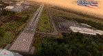
NEW YORK AIRPORTS X V2 DEMO is a package containing 6 airports located in New York metropolitan areas - KJFK Kennedy, KEWR Newark and KLGA LaGuardia + 3 business & general aviation airports - KTEB Teterboro, KCDW Essex County and KLDJ Linden.
This package is fully compatible with FSX/FSX:SE/P3Dv1/P3Dv2/P3Dv3/P3Dv4/FSW and with New York City X by Drzewiecki Design (v2.3 and higher), Manhattan X by Aerosoft, all ORBX products, all PILOT’S products and all Megascenery products.
This is a fully functional freeware scenery, perfectly aligned with the full payware version. This ensures no problems with online (VATSIM, IVAO and multiplayer) flying in case some users have the payware scenery and some don't. The demo gives you all the terminals with low resolution textures and non-animated jetways plus a 4.8m/pix resolution photoreal ground for all 6 airports.
John F. Kennedy International Airport (JFK/KJFK) - the busiest international air passenger gateway in the United States. Newark Liberty International Airport (EWR/KEWR) was the first major airport in the United States. LaGuardia Airport (LGA/KLGA) is a hub for Delta Air Lines and a focus city for American Airlines and regional affiliate American Eagle.
It's equipped with an automatic installer, which means that the scenery will be automatically added to the Flight Simulator Scenery Library.
Please uninstall all previous versions of the airports you may have installed before. Please make also sure that no duplicated AFCAD files are installed.
Enjoy your virtual flying with Drzewiecki Design!
| Filename: | NEW_YORK_AIRPORTS_X_V2_DEMO.zip |
| License: | Freeware, limited distribution |
| Added: | 21st February 2018, 23:30:26 |
| Downloads: | 218 |
| Author: | Drzewiecki Design |
| Size: | 39.35 MB |


© 2001-2026 AVSIM Online
All Rights Reserved
Privacy Policy |