
Where Flight Simulation Enthusiasts Gather from Around the World!
AVSIM Library - Search Results

| Category: Fly! II - Scenery | |
| Biber's Fly2 AllModels Pack |

|
File Description:
This pack is intended to provide much needed models for populating airport sceneries. The pack contains a total of 230 static models which may exist in a flightsim scenery. Fly scenery editor is very user-friendly and you can very easily populate your airport using static models. But I would rather suggest you to use my models as a companion to Allen Kriesman's wonderful TerraModels program with which you can create stunning airports in only a few hours.
| Filename: | Bibers_Fly2_AllModels_Pack.zip |
| License: | Freeware |
| Added: | 21st May 2010, 01:54:41 |
| Downloads: | 251 |
| Author: | Biber Salsa |
| Size: | 7.17 MB |
| Category: Flight Simulator X - Scenery | |
| Soaring in Catalonia |
|
File Description:
Adaptation of my previous scenery of Catalonia for Fs2004 published in 2008
This scenery contains the territory of Catalonia, but I have put special emphasis in the region of the mountain range of the Pyrenees where it exist the aerodromes LECE and LFNQ that are starting point to carry out flights in glider. Microsoft has very well gotten the behavior of the glider GD808S To my almost real approach. To see readme for more you detail
| Filename: | Soaring_in_Catalonia.zip |
| License: | Freeware |
| Added: | 28th August 2010, 19:33:50 |
| Downloads: | 1,043 |
| Author: | Toni Agramont |
| Size: | 73.87 MB |
| Category: Flight Simulator X - Scenery | |
| Cuatro Vientos LECU |
|
Images related to this file:
File Description:
Este escenario intenta recrear lo mas fielmente posible el aeropuerto de Cuatro vientos LECU en Madrid en FSX.
Este escenario esta realizado con ADE, Airport desing editor, basandome en las cartas de navegaci�³n de AENA y imagenes de Google Earth.
This Scenery recreate as closely as possible the Cuatro Vientos airport LECU from Madrid in FSX.
This scenery is made with ADE, Airport desing editor, based on navigational charts from AENA and images of Google Earth.
| Filename: | Cuatro_Vientos_LECU.zip |
| License: | Freeware, limited distribution |
| Added: | 30th November 2010, 23:43:54 |
| Downloads: | 2,151 |
| Author: | Luis LÃÂpez |
| Size: | 9.92 KB |
| Category: Flight Simulator X - Scenery | |
| Jacksonville, FL - Jacksonville International Airport (KJAX) |
|
Images related to this file:
File Description:
After a long wait for imagery to become available on the internet for the new terminal at KJAX, this airport scenery has been completed. Major airline gate assignments are real. Generic floating buildings have been replaced with custom and library objects. Landclass changes, roads, rework of runways, taxiways and aprons, placement of library objects and a library of new airport buildings are included. Scenery in this package is based on Virtual Earth (Bing) and Google Earth imagery.
| Filename: | Jacksonville_FL__Jacksonville_International_Airport_KJAX.zip |
| License: | Freeware |
| Added: | 24th September 2011, 02:01:06 |
| Downloads: | 5,742 |
| Author: | Art Poole |
| Size: | 2.42 MB |
| Category: Flight Simulator X - Scenery | |
| Bethel, Alaska, city and airport (PABE) Upgrades |
|
Images related to this file:
File Description:
This scenery upgrades the city of Bethel with a regional hospital w/landable helipad, a few fast food places, sport boat and fishing boat docks and piers and water treatment facitlities. This scenery also upgrades the airport (PABE) with taxiways and airport roads, airport buildings and hangers, aircraft and ground vehicles, a helipad w/start point, people and many eye candies throughout the airport. Please read the text file for installation instructions. Please enjoy, by Savageale.
| Filename: | Bethel_Alaska_city_and_airport_PABE_Upgrades.zip |
| License: | Freeware |
| Added: | 29th November 2011, 09:01:35 |
| Downloads: | 5,509 |
| Author: | Tim Durham |
| Size: | 837.87 KB |
| Category: Flight Simulator X - Scenery | |
| Matekane Airfield V2 (FXME) Part 2 [Fixed] |
|
Images related to this file:
File Description:
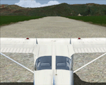
This file fixes an error in Maledives (VRMM). Please delete the file Matekane Airfield V2 (FXME) Part 2 and download the file Matekane Airfield V2 (FXME) Part 2 fix.
Matekane airfield is a very small airfield and is located in South Africa in Lesotho. You could to say a dangerous airfield- This Scenery is designed for FSX Sp2/Acc + DX10. This Scenery has Grass animation, animals and sounds. An video can find by youtube: /watch?v=9K4fOxgMfYk Have Fun =)
| Filename: | Matekane_Airfield_V2_FXME_Part_2_Fixed.zip |
| License: | Freeware |
| Added: | 20th January 2012, 00:49:14 |
| Downloads: | 2,360 |
| Author: | Ulukan Zafer |
| Size: | 126.37 MB |
| Category: Flight Simulator 2004 - Scenery | |
| LPFA - Ferreira do Alentejo, Portugal |
|
Images related to this file:
File Description: LPFA - Ferreira do Alentejo prived certified general and ULM aviation
airfield. This freeware scenery was created using pictures from internet as well
as real measures by Google Earth and official information at http://www.nav.pt/ais/VFRs/ferreira%20do%20alentejo.pdf
(it is supposed you download the file and read it carefully).
This scenery is to be used EXCLUSIVELY with Portugal Terrain from PTSIM
(http://www.ptsim.com). Freeware. For Microsoft FS2004. NOT tested for FSX.
| Filename: | LPFA__Ferreira_do_Alentejo_Portugal.zip |
| License: | Freeware |
| Added: | 13th June 2013, 13:38:05 |
| Downloads: | 291 |
| Author: | Joao A. Graca Ferreira |
| Size: | 5.02 MB |
| Category: Flight Simulator X - Scenery | |
| Sardinia Photoreal 9/14 - Baronia and Ogliastra (4/4) |
|
Images related to this file:
File Description:
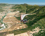
Baronia and Ogliastra are two provinces in eastern Sardinia. In Ogliastra is placed Arbatax - Tortoli airport (LIET). The package Baronia and Ogliastra 1/4, 2/4, 3/4 and 4/4 coverage photoreal scenery of Barbagia area, Posada, Gulf of Orosei, Calagonone, Nuoro, Arbatax, Perdasdefogu, until Villasimius. This file is part 4 of 4 for the scenery (baronia_ogliastra_1.4.zip, baronia_ogliastra_2.4.zip and baronia_ogliastra_3.4.zip are required).
Credits: Aerial photos summer 2012 courtesy of Microsoft Virtual Earth.
| Filename: | Sardinia_Photoreal_914__Baronia_and_Ogliastra_44.zip |
| License: | Freeware |
| Added: | 17th June 2013, 09:51:10 |
| Downloads: | 2,462 |
| Author: | Diego PAPARELLA |
| Size: | 73.48 MB |
| Category: Flight Simulator X - Scenery | |
| RJTC - Tachikawa Airfield - Tachikawa, Tokyo, Japan |
|
File Description:
This scenery represents Tachikawa AB, Japan (for use with the Vietnam War Project scenery by Xavier Carre, Jacques Godfrin and Jose Guenaizia)
during the early 1960's. It is made with ADEX ver. 1.55.
And now a little history on this installation. Tachikawa was home of the 1503d Air Transport Wing (Air Transport Wing)
and was the host unit until it's closure in 1970. Attached unils were the 21st (C-123), 35th (C-118),
41st (C-124) ATS.
| Filename: | RJTC__Tachikawa_Airfield__Tachikawa_Tokyo_Japan.zip |
| License: | Freeware |
| Added: | 10th August 2013, 21:51:26 |
| Downloads: | 593 |
| Author: | Larry Steinborn |
| Size: | 650.28 KB |
| Category: Flight Simulator X - Scenery | |
| W29 - Bay Bridge Airport - Stevensville, Maryland - USA |
|
Images related to this file:
File Description:
FSX Scenery - Bay Bridge Airport (FAA LID: W29) is a county-owned public-use airport located in Stevensville, Maryland.The airport is named for the nearby Chesapeake Bay Bridge and is mostly used for general aviation. Bay Bridge Airport covers an area of 72 acres (29 ha) and contains one asphalt runway (11/29) measuring 2,903 x 60 ft (885 x 18 m). Non-default AI repaints/traffic available by John Burford. Scenery created by John B. Loney, Jr.
| Filename: | W29__Bay_Bridge_Airport__Stevensville_Maryland__US.zip |
| License: | Freeware, limited distribution |
| Added: | 18th November 2014, 14:54:33 |
| Downloads: | 474 |
| Author: | John B. Loney, Jr. |
| Size: | 8.2 MB |


© 2001-2026 AVSIM Online
All Rights Reserved
Privacy Policy |