
Where Flight Simulation Enthusiasts Gather from Around the World!
AVSIM Library - Search Results

| Category: Flight Simulator 2004 - AFCAD Files | |
| EGBB - Birmingham International, UK - UK 2000 scenery |

|
File Description:
This is part of the fourth round of Afcads issued by Alpha India Group. AIG Ground aims to create high quality Afcads for both FS2004 and for FSX default and Add On Scenery airports. Our Afcads are created drawing on a number of resources and aim to simulate the real world airport as closely as possible but also to take account of FS constraints and to ensure good levels of traffic and realistic traffic parking and flow around the airport.
Please read and follow installation instructions in the Readme file carefully, as these do vary.
Visit us at www.alpha-india.net for more information.
| Filename: | EGBB__Birmingham_International_UK__UK_2000_scenery.zip |
| License: | Freeware |
| Added: | 24th April 2009, 20:12:21 |
| Downloads: | 947 |
| Author: | Mariano Bonaccorso & Alpha India Group |
| Size: | 585.92 KB |
| Category: Flight Simulator X - Scenery | |
| Quebec Scenery - Lakes and Rivers (3/5) |
|
File Description:
Lakes, shorelines and rivers of the province of Quebec, Canada. (range : N45�°-N52�°, W55�°-W80�°).
| Filename: | Quebec_Scenery__Lakes_and_Rivers_35.zip |
| License: | Freeware, limited distribution |
| Added: | 17th December 2009, 23:13:20 |
| Downloads: | 7,288 |
| Author: | Gilles Gauthier |
| Size: | 23.76 MB |
| Category: Flight Simulator X - Scenery | |
| Quebec Scenery - Lakes and Rivers (5/5) |
|
File Description:
Lakes, shorelines and rivers of the province of Quebec, Canada. (range : N45�°-N52�°, W55�°-W80�°).
| Filename: | Quebec_Scenery__Lakes_and_Rivers_55.zip |
| License: | Freeware, limited distribution |
| Added: | 17th December 2009, 23:14:54 |
| Downloads: | 7,916 |
| Author: | Gilles Gauthier |
| Size: | 28.5 MB |
| Category: Flight Simulator 2004 - Scenery | |
| Park County, Colorado, Photo-Scenery (FS9 & FSX) |
|
Images related to this file:
File Description:
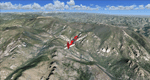
Covers the gap between my Leadville and Colorado Springs North sceneries and provides you with continuous coverage for longer cross country flights. High resolution versions of this scenery for FS9 and FSX (much sharper, but larger and multiple downloads) are available at www.blueskyscenery.com/GNB_South2.html . The screenies are taken from the high-res versions, so expect this version to be slightly more blurry. YourDonation@Work: Dedicated to Arthur and Pierre-Alain.
| Filename: | Park_County_Colorado_PhotoScenery_FS9__FSX.zip |
| License: | Freeware, limited distribution |
| Added: | 3rd February 2010, 22:19:58 |
| Downloads: | 1,423 |
| Author: | Gottfried Razek - blueskyscenery.com |
| Size: | 89.49 MB |
| Category: Flight Simulator 2004 - Scenery | |
| Colorado Springs South (KCOS), Colorado, Photo-Scenery |
|
Images related to this file:
File Description:
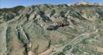
Colorado Springs South (KCOS), Colorado, Photo-Scenery (FS9 & FSX)
This region covers the area of Colorado Springs. Just west of the city you can fly around Pikes Peak. At 14.115ft it is the easternmost of Colorado's 54 fourteeners. Northwest of the city lies the Garden Of Gods with its many vertical rock formations. They are made of sedimentary beds red and white sandstones, conclomerates and limestone that were deposited horizontally but have been tilted vertically and faulted by the immense mountain building forces caused by the uplift of the Pikes Peak massiv. Deep within Chayenne Mountain is the North American Aerospace Defense Command's (NORAD) main technical facility which collects and evaluates data from a worldwide system of satellites, radars and other sensors.
High resolution versions of this scenery for FS9 and FSX (much sharper, but larger and multiple downloads) are available at www.blueskyscenery.com/GNB_South3East.html . The screenies are taken from the high-res versions, so expect this version to be slightly more blurry. YourDonation@Work: Dedicated to Veit and Hector.
| Filename: | Colorado_Springs_South_KCOS_Colorado_PhotoScenery.zip |
| License: | Freeware, limited distribution |
| Added: | 5th February 2010, 16:30:42 |
| Downloads: | 1,983 |
| Author: | Gottfried Razek, blueskyscenery.com |
| Size: | 95.63 MB |
| Category: Flight Simulator 2004 - Scenery | |
| Kremmling, Mc Elroy (20V), Colorado, Photo-Scenery |
|
Images related to this file:
File Description:
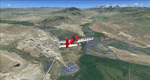
Kremmling, Mc Elroy (20V), Colorado, Photo-Scenery (FS9 & FSX)
Ever wanted to know how the scenery looks like around Kremmling VOR? Now you got the chance! This region covers the area around Kremmling and the northern part of the Gore Range. At Kremmling the Colorado River meets both the Blue River and the Muddy Creek. West of Kremmling you can see Gore Canyon. This rugged and steep canyon is almost 1000ft deep and was carved by the Colorado River on its way thru the Gore Range.
To explore the scenery depart from Mc Elroy Airfield (20V) in Kremmling and head north. High resolution versions of this scenery for FS9 and FSX (much sharper, but larger and multiple downloads) are available at www.blueskyscenery.com/GNB_West.html . The screenies are taken from the high-res versions, so expect this version to be slightly more blurry. Thanks to Joop Mak for providing custom AFCADs that correct airport layouts so that they align with the photo-textures! They are available at www.blueskyscenery.com/AFCADs.html . YourDonation@Work: Dedicated to Michael.
| Filename: | Kremmling_Mc_Elroy_20V_Colorado_PhotoScenery.zip |
| License: | Freeware, limited distribution |
| Added: | 21st April 2010, 17:39:09 |
| Downloads: | 1,141 |
| Author: | Gottfried Razek, blueskyscenery.com |
| Size: | 91.2 MB |
| Category: Flight Simulator 2004 - Scenery | |
| Google Earth Scenery Database for New Zealand |
|
Images related to this file:
File Description:
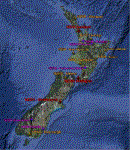
This is a .kmz file showing most of the amazing FS9 sceneries available for NZ (75 or so).
Just double-click on the file and they should show up in GE. Airports are categorised, so you can accurately filter by airport type. Download links are provided for each, as well as a link to a screenshot.
Makes planning a flight a little easier, and perhaps more interesting, as you can often zoom down to street view in GE, and see what the airport looks like!
| Filename: | Google_Earth_Scenery_Database_for_New_Zealand.zip |
| License: | Freeware |
| Added: | 30th March 2011, 01:09:13 |
| Downloads: | 374 |
| Author: | Charl du Toit |
| Size: | 17.54 KB |
| Category: Flight Simulator X - Scenery | |
| Duxford Airfield Scenery for FSX SP2/Acceleration |
|
Images related to this file:
File Description:

Scenery for Duxford Airfield, Cambridgeshire, UK, home of Imperial War Museum Duxford. This scenery includes almost all of the buildings, and ample parking for AI. It also includes flightplans to set up two resident dragon rapide aircraft and museum aircraft on the ramp. Many thanks to David Garwood for his help, and the use of his custom buildings. Further downloads are required-please see readme for details. Designed for the default scenery, feedback when it is used with products like UTX Europe, Justflight VFR or Genx would be appreciated.
| Filename: | Duxford_Airfield_Scenery_for_FSX_SP2Acceleration.zip |
| License: | Freeware, limited distribution |
| Added: | 11th April 2011, 05:49:28 |
| Downloads: | 1,478 |
| Author: | Tom Arnold |
| Size: | 933.86 KB |
| Category: Flight Simulator X - Scenery | |
| Scenery And Landclass For Molokai (HI) Hawaii |
|
Images related to this file:
File Description:
This is a detailed landclass and scenery redesign for all of the Island of Molokai. Because Molokai has so many farms and country houses almost every house and building had to be added by hand. The houses and buildings and other objects are in their exact locations for most of the this island making VFR flying more enjoyable. The airports have been corrected for errors and reflect the real look of Molokai airports.
| Filename: | Scenery_And_Landclass_For_Molokai_HI_Hawaii.zip |
| License: | Freeware |
| Added: | 9th November 2011, 00:20:31 |
| Downloads: | 2,726 |
| Author: | Charles Reid |
| Size: | 8.48 MB |
| Category: Flight Simulator X - Scenery | |
| AFCAD Update for KSAN Photo Real Scenery |
|
Images related to this file:
File Description:
This AFCAD is an update to my KSAN Photo Real scenery,(ksan_rr_v1.zip) using the latest version of ADE. It updates RWY 9's ILS Frequency to the real world frequency of 111.55. This BGL file updates the vehicle paths to keep the ground vehicles off of the taxiways. It also updates some of the
parking spots and I changed the palm trees to the reflect real life ones you see at KSAN. Note: This update requires the "ksan_rr_v1.zip" scenery file installation before installing this update.
| Filename: | AFCAD_Update_for_KSAN_Photo_Real_Scenery.zip |
| License: | Freeware |
| Added: | 18th March 2012, 00:47:29 |
| Downloads: | 4,428 |
| Author: | Glenn Johnson |
| Size: | 906.09 KB |


© 2001-2026 AVSIM Online
All Rights Reserved
Privacy Policy |