
Where Flight Simulation Enthusiasts Gather from Around the World!
AVSIM Library - Search Results

| Category: Flight Simulator X - AFCAD Files | |
| ZSGS - Zhuhai Janwan Airport - Zhuhai, China |

|
File Description:
The Zhuhai Sanzao airport (ZGSD/ZUH, China), close to Macao, was built on request of someone who found it included in the FMC of PMDGs 737NGX, but missed in FSX. I used ADE and the Google based old version 2 of Plan-G (thanks to both authors) and some charts being available in the internet. However, it is equipped with standard buildings which are roughly adapted to the real dimensions well. Lighting, windsocks, taxisigns and moving jetways. Of course I added both ILS as well. There is a big exhibition apron on the airport which is modeled but blocked for AI traffic. You will see the lines of the taxiways nevertheless. The latest temporary chart (Nov 2012) shows a third apron which is not realised and I'm not planning to do so (obviously the whole site is still under construction).
As being built on a FSX island (which is now a peninsula) and default coast lines not fitting to the real position of the airport (Rwy05 was hanging in the water) I decided to compromise in a way that I corrected the area in the vicinity of the airport but respected the remaining part as it was in the default scenery. The attached pictures should give an impression even if I'm not using the pure default scenery. Therefore this little patch should be compatible to advanced mesh sceneries.
| Filename: | ZSGS___Zhuhai_Janwan_Airport__Zhuhai_China.zip |
| License: | Freeware |
| Added: | 2nd May 2013, 07:56:18 |
| Downloads: | 688 |
| Author: | Axel Birsul |
| Size: | 614.11 KB |
| Category: Flight Simulator 2004 - Scenery | |
| Homer PaHO in Alaska US |
|
Images related to this file:
File Description:
Homer is a mainly GA airfield with rows of open air parking, but it also has scheduled flights, a terminal building, a long (for GA) runway of just under 6,700 feet that is 150 feet wide and aligned 03-21 with VASI on both ends and ILS on 03. So I think we can refer to it as an airport. Plus, at the time of this scenery (around 2010) there were three newly completed hangars on the north apron that I was told were for three companies, Bald Mountain Air service, Maritime Helicopters, and Pathfinder Aviation. I do not know which was for whom, but all three companies are in the helicopter and/or plane charter business. The south apron has a number of hangars and other buildings along it's length, starting at the western end with Smokey Bay Air that has an old control tower on the roof, then the Fire Station, and then Homer Air. I am not aware of who owns what after those first three, except that at the far eastern end there are several garages etc for the airport maintenance equipment. Next to the airport at that end there are a number of boat maintenance companies with boats pulled out of the water; this could not be well replicated due to the airport elevation above the sea level and a misplaced road. The nearby Beluga Lake 5BL float base is also included here, with some AI. The lake height above sea level has been adjusted to cope with too many cliffs intruding into the water; this is an annoying FS9 habit. The Homer scenery is as close to the actual airport as I could make it, while coping with inaccurate coast lines and roads, and grassed areas that could not all be modified for reasons that I will not bore you with. The Spit is a major scenery feature next to the airport, and I have added to this to provide some boats, docks, and nearby buildings etc. Small planes use the adjacent gravel taxi path instead of the runway when back-tracking to take off on runway 21. They only go as far as the path takes them and then u-turn onto the runway and take off. By the way, this airport's AI will function at its best if the prevailing wind makes 03 the runway in use. And I will eventually stop writing 03 and just call it 3, as the US, alone in the world, does not put a zero in front of 01, 02, 03, 04 etc. Just one other thing to note is that all access to the runway is from taxiways A and B; there was (in 2010) no access to the extreme western end of the runway as the taxiway there is marked as out of service pending a needed resurfacing.
If you find an error email me please, and note that my email address has been changed to rogwens at Gmail dot com.
| Filename: | Homer_PaHO_in_Alaska_US.zip |
| License: | Freeware, limited distribution |
| Added: | 28th July 2021, 03:31:04 |
| Downloads: | 129 |
| Author: | Roger Wensley |
| Size: | 11.86 MB |
| Category: X-Plane - Original Aircraft | |
| China Clipper Martin M-130 for X-Plane 6.40/6.51 |
|
File Description:
China Clipper or Martin M130 for X-Plane 6.40/6.51 - Built by the Martin Company for Pan American Airlines, they were known by the company as Martin Ocean Transports. Only three of these aircraft were built, the China Clipper, the Philippine Clipper and the Hawaii Clipper. To the public, China Clipper became a generic name and originally was applied to all three of the Martin M-130's in Pan Am's fleet and, later, even to the Boeing B-314's which came later. With 4-950 HP radial engines giving a cruising speed of 163 mph and with a range in excess of 3200 miles the "Clippers" were used in the pacific by Pan Am. The "China Clipper" on November 22, 1935 inaugurated the first trans-pacific postal service with 111,000 letters; it returned to San Francisco on December 6, 1935. In 1936 the Hawaii Clipper and Philippine Clipper inaugurated paying passenger service to the Philippines and Hong Kong respectively. These were the original "Clippers" for those including the Boeing B134 to follow. Look for the B134 soon for X-Plane. Just a note : since landing gear skids are used for the wing braces X-Plane thinks that the plane has landing gear and will actually place it on the ground at the airport you select, choose an airport near water and then request a seaplane takeoff or pick a location and altitude on the regional or planet map.
| Filename: | China_Clipper_Martin_M130_for_XPlane_640651.zip |
| License: | Freeware, limited distribution |
| Added: | 11th February 2003, 05:51:20 |
| Downloads: | 1,327 |
| Author: | Robert App |
| Size: | 1.13 MB |
| Category: Flight Simulator 2004 - Scenery | |
| Hana Heli-Obstacle Course v2.0 |
|
Images related to this file:
File Description:
Hana Airport is a regional airport of the State of Hawaii on the east shore of the island of Maui, 3 NM northwest of the unincorporated town of Hana. The airport covers 119 acres and has one runway. It is primarily a commuter facility used by unscheduled air taxis and general aviation. This scenery is intended as a single/multiplayer helicopter obstacle course where heli pilots can meet to compete, show off, and share their helo skills. Since birdseye (Timm Turner) already did a neat scenery called Hana_Scenery_PHHN (search for "hana" in the HoverControl Downloads), we decided to convert PHHN to a full helicopter training area. Makes a great place for helo pilots to gather to practice and perfect their skills, and challenge other pilots! And keep an eye-out for that Hot Air Balloon, cruising around an altitude of 3000 feet (don't forget to wave at them!). Another unique thing about this scenery is the neighboring islands (Honolulu Intl/Hickam AFB, Bellows AFB, Lanai City, Kahului, Molokai, etc). If you get frustrated during your heli obstacle course training, just take a heading of 275 degrees, and relax at one of the neighboring islands. We also added an Easter Egg - If you set your FS calendar to July 21st, you'll see a large ridge fire up in the hills. Load Jordan Moore's Erickson S64E (http://www.hovercontrol.com/) & try your skills at water bombing!
| Filename: | Hana_HeliObstacle_Course_v20.zip |
| License: | Freeware |
| Added: | 7th December 2010, 03:28:47 |
| Downloads: | 475 |
| Author: | Greg Spellmen & Bob Ferguson |
| Size: | 58.56 MB |
| Category: Flight Simulator 2004 - Scenery | |
| VFR of Lario - Como lake, Italy |
|
Images related to this file:
File Description:
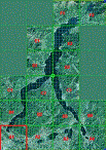
This is the first of the expected seventeen sceneries in the "VFR of Lario" project, that will include the full view of the Como Lake, made with photorealistic terrain (multiseason & night) and with 3D GMax realistic objects, including some motions. Further the Como seaplane airport, the project will include some other virtual ones, and all the piers of NLC (Navigation Lake Como). The project will be completed with a related AI seaplane traffic.
The "VFR of Lario" project REQUEST the installation of the scenery "Itcoast2.zip" & the related "ITAC2_P1.zip", both available for free download from different libraries.
Information: Como is the main and beautifull city on the namesake lake (called Lario), placed in the north of Italy, closed to the Helvetic border. It includes the AeroClub Como seaplanes international airport, with his own flight school. Como has the headseat of NLC, the fleet management for connection of forty Lario's piers. This first scenery covers approximately an area of 7.5x6 kmt.
Contents: airport water track with hangar and static seaplanes; breackwater and stadium lake front, war memorial monument, Volta's temple and lighthouse, main Cathedral, Social theater, city old towers and wall, villa Olmo, square Cavour's buildings, NLC main pier and some minor others, Como-Brunate's funicolar connection (animated), lake fountain, Tavernola shipyard, Baradello's castle, Valduce hospital; motor ships (animated), steamer, hydrofoils and other minor boats; several other buildings (GenericBuilding system), trees and lights widespread all over the scenery.
| Filename: | VFR_of_Lario__Como_lake_Italy.zip |
| License: | Freeware |
| Added: | 22nd December 2011, 23:30:47 |
| Downloads: | 3,550 |
| Author: | Aldo Della Vedova, Daniele Lanfranchi, Diego Caligiuri |
| Size: | 25.33 MB |
| Category: Flight Simulator 2004 - Scenery | |
| Graskop Airfield, South Africa |
|
Images related to this file:
File Description:
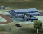
Graskop Airfield does not appear in the default FS2004, neither is the town included which is a pity as the airfield lies right on the edge of a gorge where bungee jumping and even a Gorge-lift (elevator) or a slide across the gorge can be enjoyed by the adrenaline junkies. Added to this, the airfield (and town of Graskop) is merely 10km from the world famous God's Window (also featured in the film, "The Gods must be Crazy").
This package will add a custom (Gmax & Sketchup) made Graskop Airfield, Mpumalanga, South Africa with photoreal textures and ground textures. The included Landclass file will also add the town.
The small airfield has been recreated with custom true to life models and photoreal textures. While being a very small airfield with only one hangar and a large antenna tower, the importance of the airfield far outweighs its size. The airfield plays a vital role in the fight against wildfires as there are water bombers based at the airfield during critical times. In real life the runway is quite challenging, being sloped quite significantly and very narrow, with a one-way-in one-way-out landing and takeoff procedure. Due to the limits within flightsim, the slope could not be replicated but all the other challenges are there.
The asphalt runway is aligned 15/33 and only 800m long by 8.5m wide and sits at an elevation of 4 854ft.
| Filename: | Graskop_Airfield_South_Africa.zip |
| License: | Freeware, limited distribution |
| Added: | 3rd September 2021, 00:55:30 |
| Downloads: | 161 |
| Author: | Kobus van Wyk & Morne van Wyk |
| Size: | 4.13 MB |
| Category: Flight Simulator 2004 - Scenery | |
| Carrier Division Two off Cape Cod |
|
File Description:
This scenery places the two Yorktown-class aircraft carriers of the pre-WW2 U.S. Navy with a screen of four cruisers at sea 100 miles due east of Provincetown, Massachusetts, on the tip of Cape Cod. The ships are the Virtual Navy's Task Force 16 relocated and with the Hornet posing as the Yorktown. This package contains the carriers, cruisers, ship wakes, AFCAD files for all six ships and Arrestor Cables catch zones for the carriers. It provides start points on both carriers, on the catapults of all four cruisers, and in the water between the carriers for seaplanes. Also included are flight starts for Paul Clawson's Curtiss SOC Seagull on the catapults of the cruisers and for the plane of your choice on the carriers, and authentic repaints of the SOC for aircraft assigned to the cruisers plus one for the personal aircraft of the Admiral commanding CarDiv2. There is also a selection of Golden Wings splash screens featuring the ships and planes of CarDiv2. Carrier Division 2 is being released in celebration of Golden Wings 3, but works just as well in a standard FS9 installation. Catapult floatplane operations require the Carrier Operations Gauge Package and Paul Clawson's Curtiss SOC Seagull or another catapult floatplane. Ships and wake effects by The Virtual Navy, modified AFCAD files, SOC repaints, flights and ship placement by Mick Morrissey. A big Thank you to the Virtual Navy for allowing this use of their ships!
| Filename: | Carrier_Division_Two_off_Cape_Cod.zip |
| License: | Freeware, limited distribution |
| Added: | 17th September 2005, 12:50:26 |
| Downloads: | 3,290 |
| Author: | Mick Morrissey |
| Size: | 5.19 MB |
| Category: Flight Simulator 2004 - Scenery | |
| Hana Heli-Obstacle Course v3.0 |
|
File Description:
Hana Airport is a regional airport of the State of Hawaii on the east shore of the island of Maui, 3 NM northwest of the unincorporated town of Hana. The airport covers 119 acres and has one runway. It is primarily a commuter facility used by unscheduled air taxis and general aviation. This scenery is intended as a single/multiplayer helicopter obstacle course where heli pilots can meet to compete, show off, and share their helo skills. Since birdseye (Timm Turner) already did a neat scenery called Hana_Scenery_PHHN (search for "hana" in the HoverControl Downloads), we decided to convert PHHN to a full helicopter training area. Makes a great place for helo pilots to gather to practice and perfect their skills, and challenge other pilots! And keep an eye-out for that Hot Air Balloon, cruising around an altitude of 3000 feet (don't forget to wave at them!).
Another unique thing about this scenery is the neighboring islands (Honolulu Intl/Hickam AFB, Bellows AFB, Lanai City, Kahului, Molokai, etc). If you get frustrated during your heli obstacle course training, just take a heading of 275 degrees, and relax at one of the neighboring islands. We also added an Easter Egg - If you set your FS calendar to July 21st, you'll see a large ridge fire up in the hills. Load Jordan Moore's Erickson S64E (http://www.hovercontrol.com/) & try your skills at water bombing!
| Filename: | Hana_HeliObstacle_Course_v30.zip |
| License: | Freeware |
| Added: | 28th August 2011, 17:53:18 |
| Downloads: | 468 |
| Author: | Greg Spellmen, Bob Ferguson |
| Size: | 95.52 MB |
| Category: Flight Simulator X - Aircraft Repaints, Textures and Modifications | |
| B-24 USAAF 376th BG "Lady be Good" |
|
File Description:
Following an April 4, 1943 bombing raid on Naples, Italy, conducted by the 376th Bomb Group, the Lady Be Good of the 514th Bomb Squadron failed to return to base. After attempts to locate the plane, its nine crewmen were classified as MIA, and presumed dead, believed to have perished after crashing in the Mediterranean.
Almost 16 years later on Nov. 9, 1958, several British geologists were flying over the desolate, sun-baked Libyan Desert. At approximately 400 miles south of Soluch, they spotted an aircraft on the sand. A ground party that reached the site in March 1959 discovered the plane to be a B-24D. The "Lady Be Good" had been found.
Evidence at the site indicated that the crew had become lost in the dark on return from Naples and had flown over their base and southward into the desert. As their fuel supply became depleted, the nine men aboard had bailed out but had disappeared while attempting to walk northward to civilization.
Intensive searches were made for clues as to the fate of the crew, and in 1960 the remains of eight were found, one near the plane and the other seven far to the north. Five had trekked 78 miles across the tortuous sand before perishing and one had gone an amazing 109 miles. In addition, they had lived eight days rather than only two expected of men in this area with little or no water. The body of the ninth man was never found.
Repaint for the Alphasim B-24 by Jan Kees Blom.
| Filename: | B24_USAAF_376th_BG_Lady_be_Good.zip |
| License: | Freeware |
| Added: | 11th October 2008, 13:11:09 |
| Downloads: | 386 |
| Author: | Jan Kees Blom |
| Size: | 7.61 MB |
| Category: Flight Simulator 2004 - Scenery | |
| Zion National Park North, Cedar Breaks National Monument, Cedar City (KCDC), Utah, Photo-Scenery (FS9 & FSX) |
|
Images related to this file:
File Description:
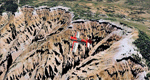
Cedar Breaks National Monument is a large amphitheater cliff in bright colors of red, orange and purple.
It lies east of Cedar City in the northern region of the scenery. The cliff was formed by erosion thru wind,
water and ice. Today erosion continues with a pace of about 2 inches every 5 years. Although it is called
Cedar Breaks, there are no cedars growing there but juniper trees. For a scenic flight to Cedar Breaks
National Monument best depart from Cedar City Regional Airport (KCDC) and head east. The scenery extends
south to Zion National Park and covers a large part of Zion Canyon and the Kolob Canyons area.
Zion National Park is another place where erosion of the Colorado Plateau formed the most beautiful colorful
stone formations of unique and wonderful shapes. There are nine different layers of stone visible in the park.
Most of them consist of sandstone. But there is also limestone, gypsum, siltstone, shale, clay and mudstone.
The Virgin River cut a spectacular and famous canyon thru Zion Park that is as narrow as 20ft and up to 2000ft tall.
High resolution versions of this scenery for FS9 and FSX (much sharper, but larger and multiple downloads)
are available at www.blueskyscenery.com/CNY_South2West5.html . The screenies are taken from the high-res versions,
so expect this version to be slightly more blurry.
Thanks to Joop Mak for providing a custom AFCADs that correct airport layouts so that they align with the photo-textures!
They are available here: www.blueskyscenery.com/AFCADs.html . YourDonation@Work: Dedicated to Richard, P.J. and Felix.
| Filename: | Zion_National_Park_North_Cedar_Breaks_National_Mon.zip |
| License: | Freeware, limited distribution |
| Added: | 14th March 2010, 00:30:28 |
| Downloads: | 1,564 |
| Author: | Gottfried Razek - blueskyscenery.com |
| Size: | 97.13 MB |


© 2001-2026 AVSIM Online
All Rights Reserved
Privacy Policy |