
Where Flight Simulation Enthusiasts Gather from Around the World!
AVSIM Library - Search Results

| Category: Flight Simulator X - Scenery | |
| Grand Forks Int'l Airport v1.1 |

|
Images related to this file:
File Description:
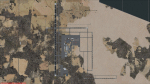
This scenery addon updates Grand Forks International Airport (KGFK) for FSX only. This is an updated version of the original scenery addon KGFK10 that contained the newly constructed runway. This update includes several bug fixes, such as removal of duplicate taxiway signs and other objects. It also includes updated local scenery to more closely match the actual airport. Local bodies of water used as visual checkpoints have also been added. All instrument approaches have been updated for currency, to include correct waypoint names and procedures. Several missing instrument approaches have also been added. The airport was updated using Airport Design Editor. By Raymond Mills.
| Filename: | Grand_Forks_Intl_Airport_v11.zip |
| License: | Freeware |
| Added: | 20th October 2010, 22:34:31 |
| Downloads: | 996 |
| Author: | Raymond Mills |
| Size: | 15.85 KB |
| Category: Flight Simulator X - Scenery | |
| The Dry Tortugas Photo Scenery |
|
Images related to this file:
File Description:
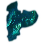
Where are the Dry Tortugas? Should you be wondering, at the western end of the Florida Keys. Located 68 miles west of Key West, they are accessible only by boat and of course via your favorite seaplane.
Source Data: National Agriculture Imagery Program (NAIP) Orthoimagery, 1 meter per pixel resolution. The scenery package also corrects the MS-FSX Island and Lighthouse position errors overlooked by UTX-USA and UTX-TAC.
For your finest virtual experience it is highly recommended you download, install and use with: South Florida and The Bahamas Water Class scenery. (S-FL_Bahamas_WC.zip)
Enjoy your flight and don't forget your Scuba Gear or the sunscreen! - Wally-Bob
| Filename: | The_Dry_Tortugas_Photo_Scenery.zip |
| License: | Freeware, limited distribution |
| Added: | 23rd August 2014, 11:08:17 |
| Downloads: | 918 |
| Author: | Walter Roberts |
| Size: | 50.9 MB |
| Category: Flight Simulator 2004 - Scenery | |
| Pitcairn Islands - Complete Scenery |
|
File Description:
This project is a complete & much more accurate scenery rendition of the Pitcairn Islands archipelago than the default scenery in FS2004.
The scenery includes all 4 islands redesigned, with detailed coastlines, Landclass with the only settlement, Adamstown represented, and accurate Waterclass representing the shallow reef banks bright colors.
A fictional AFCAD for each island was also made, with all 4 having a water landing area either along the coast or inside the lagoons. Ducie Island has a small sand strip as well.
Some scenery objects were added, mostly on Pitcairn Island, to recreate both the island's jetty & the Old Radio/Weather station.
Enjoy everyone!
| Filename: | Pitcairn_Islands__Complete_Scenery.zip |
| License: | Freeware, limited distribution |
| Added: | 5th August 2019, 06:36:31 |
| Downloads: | 285 |
| Author: | Leonardo Santos |
| Size: | 12.15 MB |
| Category: Flight Simulator X - Scenery | |
| Aerodromo de Tela - MHTE |
|
Images related to this file:
File Description:
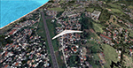
Tela Airport (Spanish: Aeropuerto de Tela) (IATA: TEA, ICAO: MHTE) is an airport serving Tela, a town in the Atlántida Department on the northern coast of Honduras. In 2009, plans were laid to lengthen the runway from 1,346 metres (4,416 ft) to 1,600 metres (5,200 ft) and possibly to construct a new terminal building. There are hills southeast of the runway. Northeast approach and departure are over the water. The La Mesa VOR-DME (Ident: LMS) is located 31.0 nautical miles (57.4 km) southwest of the airport. The Bonito VOR-DME (Ident: BTO)is located 35.4 nautical miles (65.6 km) east of the airport.
| Filename: | Aerodromo_de_Tela__MHTE.zip |
| License: | Freeware |
| Added: | 25th January 2021, 02:29:26 |
| Downloads: | 210 |
| Author: | Luis Flores |
| Size: | 87.71 MB |
| Category: Flight Simulator 2004 - Scenery Design | |
| Bird Collection, a Rwy12 Object Placer Library |
|
File Description:
For users of Rwy12 Object Placer only. The 5 static birds, in
20 different shapes and formations, are all done in 3D with
gmax and in a low polygon count for frame rate efficiency.
The idea to make the static birds came from the "AI Canada
Geese" by Joe Binka (many thanks to him), but contrary to his
V formation that moves as AI traffic, the static birds
give you a sense of movement by flying by at low speed. The
birds are crash sensitive, so don't try to hunt them with your
aircraft. Some of the birds can be placed on the ground or water
and others in the air.
| Filename: | Bird_Collection_a_Rwy12_Object_Placer_Library.zip |
| License: | Freeware |
| Added: | 31st January 2005, 14:25:29 |
| Downloads: | 7,467 |
| Author: | Seev Kahn |
| Size: | 1.56 MB |
| Category: Flight Simulator 2002 - Scenery Design | |
| Fuel Barge |
|
File Description:
Fuel Barge. This is actually inspired from an Email I got from Curt Jardey who described this barge and well I hope it is somewhat close anyway ;-). It's a fuel Island of sorts that sits out in the water a bit so you can pull up from all directions to fuel. There is an Avgas and Jp fuel pump with retractable hose's at opposite ends of the barge. It lights at night. Curt kind of figured it was fed thru an underground line for the fuel and electricity. He has actually seen these fuel barges before. Hey, See what you can do with it!
| Filename: | Fuel_Barge.zip |
| License: | Freeware |
| Added: | 3rd December 2002, 01:38:34 |
| Downloads: | 465 |
| Author: | Frank Betts |
| Size: | 218.21 KB |
| Category: Flight Simulator 2002 - Scenery | |
| Holger Lake,British Columbia |
|
File Description:
Located in the higher elevations of British Columbia, Canada lies Holger Lake, a very popular, but secluded and discreet tourist spot. Only one way in…..by plane (or helicopter!). Featuring a modest, lighted, dirt runway as well as covered plane ports and a covered water hanger with tie downs and storage. A large full service guesthouse with a porch for relaxing and viewing the northern lights (when in season). Daily scheduled sightseeing trips are also provided by various local charters. Drop in, sit back and stay awhile!
Thanks to Holger Sandmann for his wonderful new mesh (you can find it at AVSIM) and for finding this area!
| Filename: | Holger_LakeBritish_Columbia.zip |
| License: | Freeware |
| Added: | 19th February 2003, 12:41:48 |
| Downloads: | 2,115 |
| Author: | Michael Carr - MCDesigns 2003 |
| Size: | 4.22 MB |
| Category: Flight Simulator 2002 - Flight Plans | |
| Historic: Flight 19, the 'Lost Patrol' |
|
File Description:
December 5th 1945: The war in the Pacific made the topography of the Bahamas with its unlimited landmarks, ideal for advanced over water navigation exercises. Like all others training daily out of Fort Lauderdale, Florida, Flight 19 was to perform a fairly simple navigation problem. At 14:10 that afternoon 5 Avenger Torpedo Bombers departed the Station and never made it back. File includes aircraft (CFS2 default AI Avenger converted for Fs2002 and packaged to fit the flight), flight weather(local-global) based on descriptions and map of navigation problem No1 available to pilot at all times from panel via SWIFT+3. By the Fs-Icarus Crew.
| Filename: | Historic_Flight_19_the_Lost_Patrol.zip |
| License: | Freeware |
| Added: | 27th October 2002, 18:25:17 |
| Downloads: | 894 |
| Author: | Fs-Icarus Crew |
| Size: | 1.59 MB |
| Category: Microsoft Train Simulator - Miscellaneous Files | |
| MSTS Route - Albula Line 2 |
|
File Description:
MSTS Route - Albula Line 2.
A highly detailed protypical Swiss mountain route.
This revision almost doubles to 40km the modeled portion of the
real-life Albula Line, and adds 10km of a branch line to Davos.
It uses more prototypical third-party add-ons for viaducts,
stations, gantries, etc., offers multiple reversal and helicoidal
tunnels, the 6 km Albula Tunnel, and 12 new environments
(new weather and water, incompatible with Sky! Conductor).
The 20-odd activities require a separate set of
rolling stock, available in file RhBpack.zip.
Uses default MSTS tracks. Includes several maps.
(Previous version had over 17000 downloads at different sites.)
Freeware by Michael Vone.
| Filename: | MSTS_Route__Albula_Line_2.zip |
| License: | Freeware, limited distribution |
| Added: | 10th January 2003, 06:04:48 |
| Downloads: | 10,030 |
| Author: | Michael Vone |
| Size: | 17.83 MB |
| Category: Orbiter - Miscellaneous Files | |
| Mars Atmosphere Enhancement for Orbiter |
|
File Description:
This is a cloud texture and new Mars.Cfg (must be renamed) to give Mars dynamic clouds. While Mars does not have any water for clouds, it is known that severe dust storms on the planet can send dust into the atmosphere for days. The original Mars in Orbiter does not have any dust clouds, but this enhancement simulates the dust in the atmosphere. Since they are dynamic, you can have clear skys one day, and a dust cloud passing overhead the next.
When you land or launch from Mars, you now get the feeling that you are passing through an "atmosphere". It's a pretty neat view.
| Filename: | Mars_Atmosphere_Enhancement_for_Orbiter.zip |
| License: | Freeware |
| Added: | 3rd April 2003, 01:13:56 |
| Downloads: | 1,525 |
| Author: | Jim Williams |
| Size: | 1.11 MB |


© 2001-2026 AVSIM Online
All Rights Reserved
Privacy Policy |