
Where Flight Simulation Enthusiasts Gather from Around the World!
AVSIM Library - Search Results

| Category: Flight Simulator 2004 - Scenery Design | |
| SBuilder 2.02 |

|
File Description:
SBuilder is a scenery creation tool for FS2004. SBuilder can import data in several formats and can read LWM and VTP BGL files.
With SBuilder you can make the following type of scenery: Mesh Scenery; Land and Water Class Scenery; Photo Scenery; LWM masks and Flattens; VTP polygons and VTP lines; Exclude Regions; Exclusion Rectangles; Objects and Macros.
Scenery Builder (SBuilder) is copyright © 2004 Luis Sá & PTSim.
Some features are only enabled on registered licenses. Registration cost is Euros 9.95 for non-commercial use.
| Filename: | SBuilder_202.zip |
| License: | Shareware, limited functionality |
| Added: | 30th September 2004, 17:36:23 |
| Downloads: | 4,248 |
| Author: | Luis Sá |
| Size: | 2.34 MB |
| Category: Flight Simulator X - Scenery | |
| SOUTH WEST ISLANDS OF JAPAN SCENERY (SWIJX) |
|
Images related to this file:
File Description:
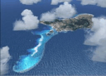
This scenery improves specific area( South West Islands of Japan )of FSX.
South West Islands are located around Okinawa: N31 E131 to N24 E123.
I released Tuamotu Archipelago Scenery( fpta-xa.zip & fpta-xb.zip ) before.
Almost islands of Tuamotu consist of the beautiful atoll.
On the other hand, in South West Islands, most consist of the islands
where the neighborhood was surrounded with beautiful shallow-water reef.
And there are also islands with steep mountains.
Fly over each island! You'd be able to see the very beautiful scenery.
| Filename: | SOUTH_WEST_ISLANDS_OF_JAPAN_SCENERY_SWIJX.zip |
| License: | Freeware, limited distribution |
| Added: | 24th December 2016, 18:12:15 |
| Downloads: | 976 |
| Author: | Kazuo Kawamura |
| Size: | 73.84 MB |
| Category: Flight Simulator X - Scenery | |
| FSIA - Seychelles Intl Airport - Seychelles |
|
File Description:
FSIA - GPS-accurate update to the default airport.
Seychelles International airport, a tropical earthly paradise located in the Indian Ocean, east of Madagascar, with beautiful scenery and an amazing approach.
The airport has been edited using ADEX, with the runway re-positioned on top of a google map to allow pilots to accurately execute the amazing RNAV RNP approach into runway 13.
The water class is also reworked since the default island is completely wrong.
You will certainly love your landings at this airport!
| Filename: | FSIA__Seychelles_Intl_Airport__Seychelles.zip |
| License: | Freeware, limited distribution |
| Added: | 10th November 2016, 18:12:19 |
| Downloads: | 2,038 |
| Author: | Ahmed Abdessalam |
| Size: | 8.26 KB |
| Category: Flight Simulator 2004 - Flight Plans | |
| VFR World Tour Lo' & Slo' along the coasts |
|
File Description:
VFR world tour along the coasts of all continents (except Antarctica). Start close to 0 degrees longitude, from London City Airport, and follow the coastlines of all countries and states that have one (sorry for Switzerland, Nepal, Chad, Paraguay and Kansas). The 300 flights take you over a distance of 259.000 Km / 140.000 nM at an average altitude of 4.700 ft. Obviously, you fly with prop planes (GA, classics, amphibians, water planes, flying boats, etc.). The flights are designed with default FS2004 scenery and the default Lockheed Vega 5B. (re-upload)
| Filename: | VFR_World_Tour_Lo__Slo_along_the_coasts.zip |
| License: | Freeware |
| Added: | 25th May 2010, 02:57:59 |
| Downloads: | 625 |
| Author: | Nis Verkijk |
| Size: | 182.69 KB |
| Category: Flight Simulator 2004 - Aircraft Repaints, Textures and Modifications | |
| Vision Airlines Boeing 767-300 |
|
Images related to this file:
File Description:
Level-D Vision Airlines Boeing 767-300. formerly Vision Air, is an airline headquartered in North Las Vegas, Nevada, United States. The airline operates flights for their tour business of the Grand Canyon, Marble Canyon, Hoover Dam, and Monument Valley out of North Las Vegas airport utilizing Dornier 228 and Dornier 328 aircraft. In addition, during the summer months, Vision Airlines transports white water rafters to various destinations along the Colorado River.
Vision Airlines also operates a charter division that utilizes Boeing 737, Boeing 767, Dornier 228 and Dornier 328 aircraft.
| Filename: | Vision_Airlines_Boeing_767300.zip |
| License: | Freeware |
| Added: | 2nd June 2010, 01:58:53 |
| Downloads: | 303 |
| Author: | Ernesto Alvarez |
| Size: | 3.65 MB |
| Category: Flight Simulator X - Scenery | |
| EGKH Headcorn/Lashenden |
|
File Description:
This package adds the apron & Hangars & the local road has been added to allow road access to the airfield.
I have also included the village/town of nearby Headcorn
It also provides lots of parking spots using FSX Panner and ATC interaction along with some AI traffic.
All additional Buildings were placed using default objects.
AI traffic uses default aircraft which was scheduled by hand using the TrafficDatabaseBuilder from the SDK tools provided by FSX Deluxe.
Any additional roads and modified Landclass & water features were created using FSX-KML.
| Filename: | EGKH_HeadcornLashenden.zip |
| License: | Freeware, limited distribution |
| Added: | 6th October 2007, 16:41:35 |
| Downloads: | 1,345 |
| Author: | Len Hickman |
| Size: | 15.38 KB |
| Category: Flight Simulator 2004 - Scenery | |
| Laconia, New Hampshire - KLCI - lake elevation correction |
|
File Description:
Runway 8 at the Laconia, New Hampshire - KLCI - is situated quite close to a lake. The elevation of the lake in FS2004 is such that it presents a "cliff" of water in the default setting. (see "before" screenshot). This package contains a simple flatten file which brings the lake down to the elevation of the airport and corrects a floating building issue also (see "after" screenshot). Please unzip to a temporary folder and follow the very simple installation instructions. Created with Steve Greenwood's FSTflatten program by David "Opa" Marshall for your flying enjoyment.
| Filename: | Laconia_New_Hampshire__KLCI__lake_elevation_correc.zip |
| License: | Freeware |
| Added: | 20th November 2008, 02:27:08 |
| Downloads: | 593 |
| Author: | David "Opa" Marshall |
| Size: | 116.12 KB |
| Category: Flight Simulator X - Scenery | |
| Okanagan Lake, British Columbia, Canada Upgrades |
|
Images related to this file:
File Description:
A scenery upgrade to Okanagan Lake, BC, Canada. This scenery continues the upgrades to the Kelowna area near CYLW. South of the airport the lake received marinas and docks and a marina entrance station located near the bridge. As per Google Earth both sides of the lake at the bridge have several marinas, docks and small piers, lot's of boats and some added fictitious objects including a landable water helipad. This scenery is stand-alone. Nothing else is required. Read the text file for instructions and please enjoy. By Savageale.
| Filename: | Okanagan_Lake_British_Columbia_Canada_Upgrades.zip |
| License: | Freeware |
| Added: | 4th December 2011, 08:08:34 |
| Downloads: | 992 |
| Author: | Tim Durham |
| Size: | 1.58 MB |
| Category: Flight Simulator 2002 - Scenery | |
| Davison Army Air Field (KDAA) V1.0 |
|
File Description:
This package contains a fictional representation of Davison Army Air Field, Alabama, a small auxillary airfield used by Ft Belvior, Virgina, near Washington, D.C. The airfield has hangars, fuel pits, vehicles, water, radar, and radio towers, administration and living quarters. There is a snack bar with picnic tables near the tower to grab a bite, and a couple of jet training aircraft stopping off on a cross country flight. Watch out for construction on the field as well as wildlife.
Third in the US Army Virtual series by Kyle Ramsey, tested in FS2002 only.
| Filename: | Davison_Army_Air_Field_KDAA_V10.zip |
| License: | Freeware, limited distribution |
| Added: | 14th November 2002, 01:53:19 |
| Downloads: | 469 |
| Author: | Kyle Ramsey |
| Size: | 1.74 MB |
| Category: Fly! II - Scenery | |
| D200160 Gxx.trn Files |
|
File Description:
This Fly!2 upload contains four edited gxx.trn files which flatten the bodies of water in globe tile D200160. Globe tile D200160 includes Bradford (KBFD) to the northwest and Lockhaven (KLHV) to the southeast. The edited gxx.trn files flatten the W. Branch of the Susquehanna R., its branches, and other streams. Important: the globe tile was rendered with options set for subdivideDensity=8 and subdivideTolerance=500. Border areas were not edited to avoid compatibility problems with bordering globe tiles. The flattening is imperfect in spots and involves some compromises.
| Filename: | D200160_Gxxtrn_Files.zip |
| License: | Freeware |
| Added: | 8th December 2002, 19:31:43 |
| Downloads: | 96 |
| Author: | Mark Steinmetz |
| Size: | 156.32 KB |


© 2001-2026 AVSIM Online
All Rights Reserved
Privacy Policy |