
Where Flight Simulation Enthusiasts Gather from Around the World!
AVSIM Library - Search Results

| Category: Prepar3D V1-4 - Scenery | |
| ENRA - Mo I Rana Rossvoll Airport - Nordland, Norway |

|
Images related to this file:
File Description: The Mo i Rana airport, Rossvoll is a North Norwegian airport in the county of Nordland. It is located about ten kilometers northeast of the city Mo i Rana. Operator of the airport is the Norwegian state-owned company Avinor. The Mo i Rana Airport is currently served only by the Norwegian regional airline Wideroe. Scheduled flights go to an from Bodo, Bronnoysund, Mosjoen, Rorvik, Sandnessjoen and Trondheim. The P3D scenery is a partly rework of my FSX-ENRA scenery: Especially the apron lights are made completely new.
The environment of the airport is adapted by new landclasses. The airport has a photo background in two variants, covering all four seasons of spring,summer, autumn and winter. The buildings in this scenery come from the fantastic XPlane scenery of Bert alias "almosquito" who kindly gave me the permission to convert them for my FSX /P3D scenery. But there are also some objects taken from two very popular freeware libraries. If these libraries are not installed, several objects are not visible! Please have a look to the readme_enra.txt. The screenshots are taken from the FSX version. But the P3D version looks quite similar.
| Filename: | ENRA__Mo_I_Rana_Rossvoll_Airport__Nordland_Norway.zip |
| License: | Freeware |
| Added: | 2nd April 2019, 18:48:29 |
| Downloads: | 544 |
| Author: | Wolfgang Allers |
| Size: | 155.53 MB |
| Category: Flight Simulator X - Scenery | |
| KMSN - Madison Wisconsin Dane County Airport - Wisconsin, USA |
|
Images related to this file:
File Description:
Madison Wisconsin Dane County Regional Airport for FSX. Several improvements have been made to the default airport. The default terminal buildings have been replaced with buildings created in FSDS; aircraft gates have been correctly coded using Airport Design Editor 1.67.5684; a new airport vehicle network has been built; extra fuel trucks have been added throughout the airport; the tower view has been changed to display from the roof of the control tower; a static FedEX truck in two different color schemes has been placed in the cargo area; a missing taxiway has been added, and all taxiway designators are correctly placed and named; there is the option to open all three runways to AI traffic; the 115th Fighter Wing of the Wisconsin Air National Guard is represented, and the parking spaces for the military AI aircraft there are coded to work with the MAIW GLANG1 flight plans; optionally, a set of GA flight plans made using AI flight Planner using all FSX default aircraft is included to liven up the GA area; another option included is to display moving road traffic outside the airport; and Jim Dhaenen's excellent ramp lights are also included. Please read the README FIRST.txt and installation.txt files to insure proper installation of all files.
| Filename: | KMSN__Madison_Wisconsin_Dane_County_Airport__Wisco.zip |
| License: | Freeware, limited distribution |
| Added: | 10th April 2016, 19:55:42 |
| Downloads: | 1,284 |
| Author: | Patrick Finch |
| Size: | 2.1 MB |
| Category: Flight Simulator X - Scenery | |
| SBSN - Santarem, Brazil Photo Real |
|
File Description:
The International Airport of Santarem - Maestro Wilson Fonseca ( IATA : STS , ICAO : SBSN ) is the airport serving the city of Santarem and region . Its name is a tribute to the great poet , musician and composer Santareno , Wilson Dias da Fonseca . Currently , it is the fifth busiest airport in the northern region of Brazil . Has great important role in strengthening the bonds of Brazil with the world , due to its geographical location, between Belem and Manaus and is an alternative for international flights . It is located 15 km away from the city center and has easy access by Highway Fernando Guilhon . In its surroundings , a special landscape ornamentation shows markedly the gateway to the region , known as " The Pearl of the Tapajos ." It opened in March 1977 under the administration of the Air Force Command 31 and transferred to the administration Infraero on March 31, 1980.
The airport is currently undergoing reform and the first step is already completed , which is the construction of a new building to house the airport administration . The reform provides for doubling the airport arrivals hall , doubling the departure lounge , increase parking capacity and the overall revitalization of the electrical system and cooling . For all the changes should be needed about £ 2.700.000,00.2
| Filename: | SBSN__Santarem_Brazil__Photo_Real.zip |
| License: | Freeware |
| Added: | 5th February 2014, 09:45:35 |
| Downloads: | 2,630 |
| Author: | Alexandre Lima |
| Size: | 20.16 MB |
| Category: Flight Simulator X - AFCAD Files | |
| EHAM - Amsterdam Airport Schiphol - Amsterdam, The Netherlands |
|
Images related to this file:
File Description:
Amsterdam Airport Schiphol is the Netherlands' main international airport, located 20 minutes (9.1 km; 5.6 mi) southwest of Amsterdam, in the municipality of Haarlemmermeer.
The airport is the primary hub for KLM as well as for Arkefly, Corendon Dutch Airlines, Martinair and Transavia. The airport also serves as a European hub for Delta Air Lines and as a base for Vueling. Schiphol is considered to be an Airport City.
Using ADEx 1.50, aeronautical maps and Google Earth the default AFCAD has been completely reworked to reflect today's situation including gate assignments.
Schiphol has a complex runway lay-out and usage and FSX may assign a runway that in real life is not used as such. I have implemented Jim Vile's crosswind runway technique to open all runways. Now the pilot can decide which runway to use but AI aircraft may show unrealistic behaviour. Only tailored AFCADs taking into account different wind directions will solve this but that is beyond the scope of this project.
Jetways appear based on your 'scenery complexity' settings.
| Filename: | EHAM__Amsterdam_Airport_Schiphol__Amsterdam_The_Ne.zip |
| License: | Freeware |
| Added: | 2nd November 2012, 19:54:24 |
| Downloads: | 2,202 |
| Author: | Menno C. Robert |
| Size: | 3.86 MB |
| Category: Flight Simulator X - AFCAD Files | |
| PAOT - Wien Meml - Kotzebue, Alaska |
|
Images related to this file:
File Description:
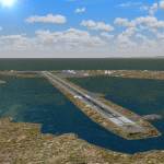
This AFCAD of the airport Wien Meml - Kotzebue (PAOT), Alaska, fixes some issues for Scenery Solution's UTX Alaska users who want to use mesh and texture resolutions better than 38 m and 1 m, respectively. Unfortunately this discloses some additional problems with lagoons surrounding runway 09/27. Some of the ponds had been elevated over apron level, the fence Microsoft had drawn around the airport ran through (elevated) water and so on. Runway 27 has no direct connection to the mainland like it is realized by UTX and furthermore a lot of water polygons (including the lagoons) had 'forgotten' shore line vectors. Included corrections are: fixed main waterpolygons around the airport (according to Google Maps), fixed airport layout, including aprons, GA parking, additional airport buildings (default FSX objects), fixed Runway designators (now 09/27 resp. 18/36 instead of 08/26 and 17/37, Nov. 2013), added shoreline vectors (compatible to UTX textures) and some more.
Again, THIS AFCAD IS INTENDED FOR USERS OF UTX ALASKA ONLY and will likely look horrible in other environments as it partially amends missing features only.
| Filename: | PAOT__Wien_Meml__Kotzebue_Alaska.zip |
| License: | Freeware, limited distribution |
| Added: | 3rd February 2014, 14:30:10 |
| Downloads: | 410 |
| Author: | Axel Birsul |
| Size: | 1.09 MB |
| Category: Flight Simulator X - Scenery | |
| Bornholm Island X DEMO |
|
Images related to this file:
File Description:
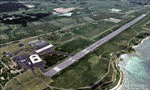
BORNHOLM ISLAND X DEMO features an extremely detailed scenery of Bornholm Island with EKRN Ronne airport in Denmark, fully compatible with both FSX and P3Dv1.
It's a fully functional DEMO version of the commercial payware product. It features same airport layout as in the full version but with limited 3D objects and low resolution textures. Using this free demo ensures no problems with online (VATSIM, IVAO, multiplayer etc.) flying in case some users use the payware scenery and some don't.
Bornholm is an island located in the Baltic Sea 37 km south of Sweden and the north of Poland. Bornholm Airport (RNN / EKRN) is a Danish airport located 2.7 nautical miles (5 km) southeast of Ronne.
This product is equipped with an automatic installer, which means that the scenery will be automatically added to the Flight Simulator Scenery Library.
Please uninstall all previous versions of this airport you may have installed before. Please make also sure that no duplicated AFCAD files are installed. Enjoy your virtual flying with Drzewiecki Design!
| Filename: | Bornholm_Island_X_DEMO.zip |
| License: | Commercial demo |
| Added: | 2nd September 2015, 21:47:52 |
| Downloads: | 1,788 |
| Author: | Drzewiecki Design |
| Size: | 15.39 MB |
| Category: Flight Simulator 2004 - Scenery | |
| Bornholm Island 2011 DEMO |
|
Images related to this file:
File Description:

BORNHOLM ISLAND 2011 DEMO features an extremely detailed scenery of Bornholm Island and EKRN Ronne airport in Denmark, fully compatible with FS2004.
It's a fully functional DEMO version of the commercial payware product. It features same airport layout as in the full version but with limited 3D objects and low resolution textures. Using this free demo ensures no problems with online (VATSIM, IVAO, multiplayer etc.) flying in case some users use the payware scenery and some don't.
Bornholm is an island located in the Baltic Sea 37 km south of Sweden and the north of Poland. Bornholm Airport (RNN / EKRN) is a Danish airport located 2.7 nautical miles (5 km) southeast of Ronne.
It's equipped with an automatic installer, which means that the scenery will be automatically added to the Flight Simulator Scenery Library.
Please uninstall all previous versions of this airport you may have installed before. Please make also sure that no duplicated AFCAD files are installed.
Enjoy your virtual flying with Drzewiecki Design!
| Filename: | Bornholm_Island_2011_DEMO.zip |
| License: | Commercial demo |
| Added: | 5th September 2015, 01:09:19 |
| Downloads: | 3,607 |
| Author: | Drzewiecki Design |
| Size: | 12.75 MB |
| Category: Flight Simulator X - AFCAD Files | |
| RPVM - Mactan Cebu International, Lapu Lapu, Philippines |
|
File Description:
This Afcad for RPVM - Mactan, Cebu International Airport in Lapu-Lapu City, Mactan, Cebu Philippines was made with ADE V1.35 and is for the default RPVM airport in FSX. The civil/military dual use airport was changed primarily based on Google Earth images.
Mactan Cebu International currently receives flights from Cathay Pacific, Asiana, Korean, Malaysian, Mandarin, Qatar Airways, Silkair and Fedex, in addition to the domestic flights of PAL, Cebu Pacific, Air Philippines and South East Asian Airlines. Cebu Pacific also operate international flights from here and the airport is home to much of the Philippines Air Force C130 fleet.
The aprons and taxiways have been re-designed, jetways added, gates and parking spaces coded for the airlines and aircraft types visiting - including the addition of MIL_CARGO spaces for the C130's. The default airport lacks coding and the radius of gates is inadequate for the larger commercial jets coming to RPVM, so use of this file significantly increases traffic. Tested with WOAI, MAIW Exotic Alberts Philippines package and custom AI.
| Filename: | RPVM__Mactan_Cebu_International_Lapu_Lapu_Philippi.zip |
| License: | Freeware |
| Added: | 28th July 2008, 17:49:49 |
| Downloads: | 2,575 |
| Author: | Matthew Brooks |
| Size: | 10.79 KB |
| Category: Prepar3D V1-4 - Scenery | |
| LGLR military base (P3D4) |
|
File Description:
Hi there !!
My name is Dimitri.
This is my FIRST EVER creation for flight simulation. And i like to share it with you all.
It's my hometown airport LGLR military base, Larissa city, here in central Greece.
When microsoft released FSX, i noticed that THIS airport was COMPLETLY ruined, empty .. and completly
misplaced at the wrong place on the map !! I tried for years, to find a good add-on but ....
nothing good so far ... Then lockheed martin toke over the code from microsoft and created P3D.
But still, this airport remained as it was before, nothing changed... I was SO mad, that i thought
I should do something about it my self.. so, here we are, i fixed it.
This airport was created with "Airport design editor version.177" and SbuilderX v.315
I was using ORBX base pack, with ORBX Europe LC and ORBX vector during the creation.
Keep in mind that i am using some small ORBX library objects like, grass, bushes and so on...
If you don't have ORBX installed, i don't know if this is gonna work.
| Filename: | LGLR_military_base_P3D4.zip |
| License: | Freeware |
| Added: | 4th August 2019, 17:25:21 |
| Downloads: | 702 |
| Author: | Dimitris P. Mylonas |
| Size: | 12.24 MB |
| Category: Prepar3D V1-4 - Scenery | |
| KMKL - Mc Kellar-Sipes Regional Airport, Jackson, Tennessee, USA |
|
Images related to this file:
File Description:

A "Better Than Default" scenery for P3D of Mc Kellar-Sipes Regional Airport (KMKL/MKL). See the README.txt file for details.
| Filename: | KMKL__Mc_KellarSipes_Regional_Airport_Jackson_Tenn.zip |
| License: | Freeware |
| Added: | 7th August 2019, 02:12:07 |
| Downloads: | 190 |
| Author: | David Vega |
| Size: | 553.89 KB |


© 2001-2026 AVSIM Online
All Rights Reserved
Privacy Policy |