
Where Flight Simulation Enthusiasts Gather from Around the World!
AVSIM Library - Search Results

| Category: Flight Simulator 2004 - Scenery | |
| EDKV Dahlemer Binz |

|
File Description:
Small airport in Germany.
Based on google earth picture. It is a significant improvement over my previous versions (4geapts.zip or 5geapts.zip). It now more closely represents the actual airport and the use of rwy12 objects make it much more framerate friendly then with macros. The runway has also been extended since the first versions and the airport now has night lighting.
| Filename: | EDKV_Dahlemer_Binz.zip |
| License: | Freeware |
| Added: | 25th April 2008, 08:16:02 |
| Downloads: | 945 |
| Author: | Detlev J. Rohmer |
| Size: | 1.24 MB |
| Category: Flight Simulator X - AFCAD Files | |
| NSTU - Pago Pago International Airport - Pago Pago, American Samoa |
|
File Description:
Pago Pago International Airport (IATA: PPG, ICAO: NSTU), also known as Tafuna Airport, is a commercial airport located 7 miles southwest of the central business district of Pago Pago on the island of Tutuila in American Samoa. It is an unincorporated territory of the United States.
This scenery was designed to be used with the default FSX scenery.
| Filename: | NSTU__Pago_Pago_International_Airport__Pago_Pago_A.zip |
| License: | Freeware |
| Added: | 13th August 2014, 20:41:30 |
| Downloads: | 759 |
| Author: | Bill Bridges |
| Size: | 10.13 KB |
| Category: Prepar3D V5 - Scenery | |
| VOGO_P3Dv5 |
|
File Description:
Dabolim Airport (IATA: GOI, ICAO: VOGO) is the sole international airport in Goa. It is operated by the Airports Authority of India as a civil enclave in an Indian Navy naval airbase named INS Hansa. The airport is located in Dabolim, 4 kilometers from the nearest city Vasco da Gama, 23 kilometers from Margao, and about 30 kilometers from the state capital Panjim.
| Filename: | VOGO_P3Dv5.zip |
| License: | Freeware |
| Added: | 20th October 2020, 23:08:39 |
| Downloads: | 673 |
| Author: | Abhishek Banerjee |
| Size: | 16.2 MB |
| Category: Flight Simulator 2004 - Scenery | |
| Ontario International Airport (KONT) V2 |
|
Images related to this file:
File Description:
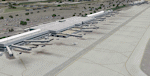
Detailed scenery of Ontario International Airport, California, USA. The airport is one of the major Southern California basin airports feeding travelers into east Los Angeles and beyond.
This is version 2 of the Ontario Airport scenery previously released in 2006 but is a standalone almost complete reconstruction of the scenery and is recommended as a new scenery install. See readme for details.
| Filename: | Ontario_International_Airport_KONT_V2.zip |
| License: | Freeware, limited distribution |
| Added: | 19th May 2012, 17:07:35 |
| Downloads: | 3,846 |
| Author: | Shehryar Ansari |
| Size: | 37.82 MB |
| Category: Flight Simulator X - AFCAD Files | |
| DAUH - Oued Irara-Krim Belkacem Airport / Hassi Messaoud, Algeria |
|
Images related to this file:
File Description:

Features:
*Expanded parking apron
*Main terminal building added
*Runway numbering changed to 18/36 to reflect recent changes
*Parking spots for commercial traffic
*Seperate parking areaa for GA traffic
*Misc airport buildings added
*Airport vehicles and objects throughout the airport
*Fuel service vehicles
*Misc vegetation
*ILS properly aligned
*A few buildings on the north side of the military base added
| Filename: | DAUH__Oued_IraraKrim_Belkacem_Airport__Hassi_Messa.zip |
| License: | Freeware |
| Added: | 22nd June 2013, 21:17:02 |
| Downloads: | 503 |
| Author: | Jaison Diaz / Endeavour ai |
| Size: | 460.64 KB |
| Category: Flight Simulator 2004 - Miscellaneous Files | |
| ILS Cheat Sheet |
|
File Description:
Quick excel spreadsheet with ILS information, almost every major US airport is included with some others that I most commonly fly, feel free to edit or add to the spreadsheet. The information included is as follows; Availible ILS runway(s) to that airport, the runway(s) frequency, the runway(s) heading,and finally NDB/VOR inputs important to that airport....Have Fun
| Filename: | ILS_Cheat_Sheet.zip |
| License: | Freeware |
| Added: | 24th December 2006, 11:46:33 |
| Downloads: | 1,512 |
| Author: | Adam Neider |
| Size: | 8.07 KB |
| Category: Flight Simulator X - Scenery | |
| MSLP - El Salvador International Airport - San Salvador, El Salvador |
|
File Description:
El Salvador International Airport (IATA: SAL, ICAO: MSLP) is a joint use Militrary and Public airport located approximately 50 km from San Salavador. It is the third busiest airport in Central America. The scenery includes relocated taxiways, new and enlarged aprons, rebuilt terminals and air-bridges, and other buildings.
This scenery was designed to be used with the default FSX scenery.
| Filename: | MSLP__El_Salvador_International_Airport__San_Salva.zip |
| License: | Freeware |
| Added: | 21st March 2016, 09:46:53 |
| Downloads: | 1,503 |
| Author: | Bill Bridges |
| Size: | 16.25 KB |
| Category: Flight Simulator X - AFCAD Files | |
| Gran Canaria Airport - GCLP - Gran Canaria, Spain |
|
File Description:
This airport was designed with the latest version of ADE and made only for the FSX default airport: assigned parking with extra parking, taxiways and taxi signs updated/corrected, extra fuel trucks, helipad, support vehicle roads rebuilt and many other improvements, airport views are from the roof of the control tower (when in tower view) please view the readme before installation
| Filename: | Gran_Canaria_Airport__GCLP__Gran_Canaria_Spain.zip |
| License: | Freeware |
| Added: | 10th December 2010, 02:39:42 |
| Downloads: | 2,216 |
| Author: | Ray Smith |
| Size: | 20.21 KB |
| Category: Flight Simulator X - Scenery | |
| LFBP - Pau Pyrenees |
|
Images related to this file:
File Description:

Pau Pyrenees Airport (French: Aeroport Pau Pyrenees) (IATA: PUF, ICAO: LFBP) is an airport serving Pau, France. It is located 10 km (6 miles) northwest of Pau in Uzein, a commune of the departement of Pyrenees-Atlantiques (named for the Pyr mountains and the Atlantic Ocean).
The airport has been enhanced with Heli activity, Cargo area and much more...
Blue Sky!
| Filename: | LFBP__Pau_Pyrenees.zip |
| License: | Freeware |
| Added: | 4th July 2010, 21:55:44 |
| Downloads: | 6,212 |
| Author: | VFR Short Fields X |
| Size: | 146.48 KB |
| Category: Flight Simulator X - Scenery | |
| SKRG |
|
File Description:
SKRG
Jose Maria Cordova International Airport (IATA: MDE, ICAO: SKRG) is the main airport serving the Colombian city of MedellÃ�ÂÂn and its surrounding metropolitan area and it si located in Antioquia department of Colombia.
This file has the right coordenates, with the apron and characteristics of the airport. The runways were resized the gates placed on correct location and number.
| Filename: | SKRG.zip |
| License: | Freeware |
| Added: | 14th February 2011, 10:24:10 |
| Downloads: | 5,239 |
| Author: | Anwar Gonzalez |
| Size: | 33.16 KB |


© 2001-2026 AVSIM Online
All Rights Reserved
Privacy Policy |