
Where Flight Simulation Enthusiasts Gather from Around the World!
AVSIM Library - Search Results

| Category: Flight Simulator X - Scenery | |
| KFRG Republic Farmingdale Airport |

|
Images related to this file:
File Description:
Located in the heart of Long Island's vibrant Nassau/Suffolk bi-county area, about 30 miles east of New York City. Republic Airport is mainly for general aviation, designated as a reliever airport. There are two main Charter companies, Atlantic aviation and SheltAir aviation, along with 10 flight schools. Republic airport includes, phototexture, with accurately depicted taxiways and aprons, including the buildings and hangars. Snow texture have been added during the winter months. Autogen placed in specific areas and numerous static aircraft on airfield, overall, filled with details. Happy landings!
| Filename: | KFRG_Republic_Farmingdale_Airport.zip |
| License: | Freeware |
| Added: | 18th March 2011, 05:35:04 |
| Downloads: | 1,170 |
| Author: | Eric McCloud |
| Size: | 28.96 MB |
| Category: Flight Simulator X - AFCAD Files | |
| Winchelsea Airport (8NJ0), NJ |
|
File Description:
Located 01 miles W of Port Republic, New Jersey, Winchelsea Airport is a private turf strip. Pay very, very close attention to the published length of this grass runway: 980'. This is in addition to 50ft tree obstacles at either end of the runway. Double-check your aircraft's takeoff and landing distances before visiting this airfield!! A strong headwind is suggested for operations out of this location. Also take note the traffic patterns vary for each runway. There are no transient services offered and the airport is not lit at night so daytime VFR use only is suggested. There is no hard surface runway so set your terrain mesh slider as high as you can for the best effect of landing on terrain.
Scenery constructed with use of satellite images/streetview/aerial photos - the author has not been there in person.
This scenery is meant to be used in conjunction with MegaScenery Earth New Jersey/Delaware 003. It is not required, but apron use is minimized to allow satellite scenery to show through as much as possible, and objects are placed based on the MSE textures - lack of it may make scenery look out of place.
| Filename: | Winchelsea_Airport_8NJ0_NJ.zip |
| License: | Freeware |
| Added: | 24th March 2011, 19:28:46 |
| Downloads: | 162 |
| Author: | Drew Sikora |
| Size: | 396.23 KB |
| Category: Flight Simulator X - AFCAD Files | |
| Stallone Airport (9NJ5), NJ |
|
File Description:
Located 01 miles SE of Harrisonville, New Jersey, Stallone Airport is a private turf strip 1350' in length. However it should be noted that the actual length from the road to the trees on the opposite end of the runway is actually only around 900'. It is tightly hemmed in by trees so if you are landing on Runway 29 you may want to use Slew to turn your plane around to remove the risk of bumping into a tree instead. If you land on Runway 11 you can cross the road to turn around in the field opposite the runway. The windsock can be seen from both runways. Power lines run along the heights of the trees as well for the Runway 29 approach, on the same side as the trees though so not really any additional worry there. No transient services are available. There is no hard surface runway so make sure your terrain mesh slider is set as high as possible for a suitably bumpy ground experience.
Scenery constructed with use of satellite images/streetview/aerial photos - the author has not been there in person.
This scenery is meant to be used in conjunction with MegaScenery Earth New Jersey/Delaware 004. It is not required, but apron use is minimized to allow satellite scenery to show through as much as possible, and objects are placed based on the MSE textures - lack of it may make scenery look out of place.
| Filename: | Stallone_Airport_9NJ5_NJ.zip |
| License: | Freeware |
| Added: | 5th April 2011, 07:34:54 |
| Downloads: | 170 |
| Author: | Drew Sikora |
| Size: | 332.91 KB |
| Category: Flight Simulator 2004 - AFCAD Files | |
| El Fasher Airport Sudan |
|
Images related to this file:
File Description:
Hi every one,this my ADE project for el fasher airport in sudan , i hope you like it
| Filename: | El_Fasher_Airport_Sudan.zip |
| License: | Freeware |
| Added: | 15th April 2011, 00:40:36 |
| Downloads: | 185 |
| Author: | Hosam Gubara |
| Size: | 100.31 KB |
| Category: Flight Simulator X - Scenery | |
| Moshoeshoe International Airport (FXMM) |
|
Images related to this file:
File Description:
This is Moshoeshoe International Airport in Lesotho Africa the mountain kingdom. It is completely custom designed with Custom terminals, hangars and admin buildings. It also has a custom AFCAD file a photoreal background that changes with the seasons. FSX Acceleration will give the best results.(Also SP2 compatible). Acceleration users will have more eye candy!
| Filename: | Moshoeshoe_International_Airport_FXMM.zip |
| License: | Freeware |
| Added: | 29th April 2011, 16:26:35 |
| Downloads: | 1,712 |
| Author: | Jacques Botha, Frits Beyer |
| Size: | 4.99 MB |
| Category: Flight Simulator 2004 - AFCAD Files | |
| KMEM, Memphis International Airport |
|
Images related to this file:
File Description:
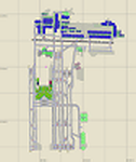
This is a revised AFCAD for KMEM. To be used with the Payware Blue Print Scenery of KMEM for FS9/FS2004. It edits the FedEx gates and allows parking for correct aircraft types and ensures no wings overlap and the nose of aircraft are not lodged into the terminal.
| Filename: | KMEM_Memphis_International_Airport.zip |
| License: | Freeware |
| Added: | 30th April 2011, 11:38:20 |
| Downloads: | 740 |
| Author: | Dale Delaroza |
| Size: | 62.12 KB |
| Category: Flight Simulator 2004 - Scenery | |
| Washington-Dulles International Airport |
|
Images related to this file:
File Description:
The Washington-Dulles International Airport scenery was designed to add in the new runway 1L/19R as well as the taxiways associated with it. It also corrects the incorrect placement of the various taxiways and buildings that existed in the default scenery as well as adds additional gates with the correct airline gate assignments. In addition, all runways were corrected to add in the proper approach lights as specified by AirNav.com.
| Filename: | WashingtonDulles_International_Airport.zip |
| License: | Freeware, limited distribution |
| Added: | 30th April 2011, 20:00:46 |
| Downloads: | 772 |
| Author: | Kevin Yang |
| Size: | 28.25 KB |
| Category: Flight Simulator X - Scenery | |
| TLPL Hewanorra International Airport |
|
File Description:
Hewanorra International Airport (IATA: UVF, ICAO: TLPL), near Vieux Fort Quarter, Saint Lucia, in the Caribbean, is the larger of the country's two airports and is managed by the Saint Lucia Air and Seaports Authority (SLASPA). The airport is a Fire Category 9 airport that handles 500,000 passengers a year and has the capability to handle the Boeing 747, Airbus A330, Airbus A340, Boeing 777 and other similar aircraft. Aircraft maintenance there is carried out by Caribbean Dispatch Services. George F. L. Charles Airport is located in Castries and handles inter-Caribbean flights.
This file has the right coordinates, with the apron and characteristics of the airport. The runways were re-sized the gates placed on correct location and number.
| Filename: | TLPL_Hewanorra_International_Airport.zip |
| License: | Freeware |
| Added: | 7th May 2011, 20:50:24 |
| Downloads: | 1,837 |
| Author: | Anwar Gonzalez |
| Size: | 9.13 KB |
| Category: Miscellaneous Files - Miscellaneous Files | |
| Airport Distance Calculator V1.0 |
|
File Description:
This application calculates the distance from and to any real world airport (by ICAO). Calculations are in the following units of measure: kilometers, nautical miles, miles.
This is a Microsoft Access 2007 based application and is not tested in any earlier versions.
| Filename: | Airport_Distance_Calculator_V10.zip |
| License: | Freeware |
| Added: | 9th May 2011, 01:35:40 |
| Downloads: | 543 |
| Author: | Ryno Bower |
| Size: | 1.63 MB |
| Category: Flight Simulator X - AFCAD Files | |
| Sussex Airport (KFWN), NJ |
|
File Description:
Located 01 miles SW of Sussex, New Jersey on 96 acres of land, Sussex Airport is a public asphalt strip 3515' in length. The airport is not in the best of condition and there are no markings on the taxiways. The taxiway south of the hangar towards the end of Runway 03 is closed indefinitely due to disrepair. You will have to back-taxi on the runway if you need more room to take off. Hangars and tiedowns are both available to aircraft with wingspans of 40' or less. Anything bigger will have to find a spot in the large empty area of the tarmac and make sure if you're starting out with something larger you start on the runway or in the one MEDIUM_GA parking spot. Hangar parking is identified by DOCK parking types. North Parking is located in the grass tiedown area and regular Parking is located on the main tarmac. South Parking is the one hangar towards the end of Runway 03. Jet-A fuel is available from parking in front of the fuel truck by the terminal building or in either of the hangar spots. Collision is disabled with all static aircraft to make it easier to park between them if you choose a tiedown instead of a hangar. REIL and approach lighting for Runway 03/12 are out of service indefinitely as is the approach lighting for Runway 03. The traffic pattern height has been changed to 1220' MSL (heavy aircraft use 1420').
Scenery constructed with use of satellite images/streetview/aerial photos - the author has not been there in person.
This scenery is meant to be used in conjunction with MegaScenery Earth New York 006. It is not required, but apron use is minimized to allow satellite scenery to show through as much as possible, and objects are placed based on the MSE textures - lack of it may make scenery look out of place.
| Filename: | Sussex_Airport_KFWN_NJ.zip |
| License: | Freeware |
| Added: | 9th May 2011, 09:02:01 |
| Downloads: | 319 |
| Author: | Drew Sikora |
| Size: | 1.09 MB |


© 2001-2026 AVSIM Online
All Rights Reserved
Privacy Policy |