
Where Flight Simulation Enthusiasts Gather from Around the World!
AVSIM Library - Search Results

| Category: Flight Simulator 2004 - Scenery | |
| Murray Field KEKA |

|
Images related to this file:
File Description:
FS2004 Scenery - Murray Field (IATA: EKA, ICAO: KEKA, FAA LID: EKA) is a county-owned public-use airport in Humboldt County, California, United States. Murray Field Airport serves Eureka and Humboldt County. The airport has more than one runway. The longest is a paved runway extending 3000 feet. The facility is at an elevation of 7 feet at a distance of about 3 miles from Eureka. The airport is primarily used for general aviation. Also FedEx Express utilizes the small airport as a stop for package delivery from and to Humboldt County. Murray Field was first established in 1919 by pilot Dayton Murray, and was later renamed in his honor. It has a restaurant and a charter service, Northern Air, as well as a Civil Air Patrol office. Created by John B. Loney, Jr.
| Filename: | Murray_Field_KEKA.zip |
| License: | Freeware, limited distribution |
| Added: | 20th March 2012, 01:35:39 |
| Downloads: | 346 |
| Author: | John B. Loney, Jr. |
| Size: | 5.92 MB |
| Category: Flight Simulator X - Scenery | |
| Rio Vista Municipal Airport, California (O88) |
|
Images related to this file:
File Description:
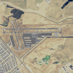
Rio Vista Municipal Airport, is located on the western edge of the city of Rio Vista in the heart of California's San Joaquin River Delta, about 260 mile northeast of San Francisco. Rio Vista Municipal Airport has an 4,200-foot long, 75-foot wide primary runway. There is also a 2,200-foot long, 60-foot wide secondary runway and a helipad. This is a major overhaul of the default airport, dramatically improving accuracy of taxiways, runways, aprons, structures and other scenery details. Designed so that anyone familiar with the actual airport will experience immediate recognition, the project includes several custom buildings and many custom scenery objects modeled on the actual airport. The surrounding area has been extensively modeled. Including, 324 accurately place wind turbines, 3690 houses, and a total count of 4740 scenery objects.
| Filename: | Rio_Vista_Municipal_Airport_California_O88.zip |
| License: | Freeware |
| Added: | 5th December 2011, 21:26:45 |
| Downloads: | 944 |
| Author: | John Hottel |
| Size: | 19.21 MB |
| Category: Prepar3D V1-4 - Scenery | |
| KMCI - Kansas City Missouri USA International Airport For Prepar3Dv4 |
|
Images related to this file:
File Description:
This is an enhancement of the default P3Dv4 airport. Aircraft gates have been correctly coded using Airport Design Editor 1.76.6715, according to the latest terminal map information (due to space constraints some gates could not be included); a new airport vehicle network has been built; extra fuel trucks have been added throughout the airport; the tower view has been changed to display from the roof of the control tower; all taxiway designators are correct and all taxiway signs are correctly placed and named; there is the option to open all runways to AI traffic; and cargo ramps for UPS and FedEx are displayed. This airport has only been tested in P3Dv4, and is not guaranteed to work in earlier versions. Please refer to the README FIRST.txt file to insure proper installation of all files.
| Filename: | KMCI__Kansas_City_Missouri_USA_International_Airpo.zip |
| License: | Freeware, limited distribution |
| Added: | 1st September 2018, 00:47:37 |
| Downloads: | 923 |
| Author: | Patrick Finch |
| Size: | 3.94 MB |
| Category: Prepar3D V1-4 - Scenery | |
| LTFE - Milas Bodrum Airport - Turkey |
|
Images related to this file:
File Description:
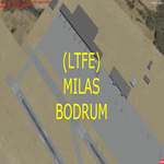
LTFE - Accurate positioning according to the latest charts, google map coordinates and the Navigraph runway coordinates data.
Upon planning a flight from Istanbul to Bodrum, I realized that the airport has been developed with the addition of the international terminal, and the conversion of the old taxiway A into a runway (10R - 28L), and thus decided to quickly make this update.
Milas–Bodrum Airport (IATA: BJV, ICAO: LTFE) is an international airport that serves the Turkish towns of Bodrum and Milas. The airport is situated 36 km northeast of the town of Bodrum, and 16 km south of Milas.
The airport is surrounded by beautiful scenery of hills, with a steep approach of 3.90 degrees due to the surrounding terrain.
Please read the included README file for the simple install instructions.
| Filename: | LTFE__Milas_Bodrum_Airport__Turkey.zip |
| License: | Freeware, limited distribution |
| Added: | 5th July 2017, 17:46:12 |
| Downloads: | 767 |
| Author: | Ahmed Abdessalam |
| Size: | 945.88 KB |
| Category: Prepar3D V1-4 - Scenery | |
| The atolls of the Maldives Asia |
|
File Description:
The atolls of the Maldives are numerous and some atolls are also uninhabited. The most famous atolls are: The Male Atoll and Baros N4.18.26 E73.20.91 with the VRMM airport, the Gan atoll N0.41.36 E73.9.27with the VRMG airport, Hanimardhoo Atoll N 6.44.56 E73.10.06 with the VRMH airport, the Kaadedhahoo atoll N0.29.21 E72.59.41 with the VRMT airport and the Kadhdhoo N1.51.30 E73.31.15 with the VRMK airport. The aforementioned airports have been improved and the most important resorts have been created on the islands of Baros, Gan, Hanimaadhoo, Kaadedhahoo and Kadhdhoo, and small ports have been created with ships and boats. I remember that all the islands can be easily visited by seaplanes in their respective tiny ports. Good VFR flight. Within the downloaded package you will find readme files for scenery installation. Good fly VFR. Pasquale Marrulli.
| Filename: | The_atolls_of_the_Maldives_Asia.zip |
| License: | Freeware |
| Added: | 12th March 2018, 22:07:58 |
| Downloads: | 506 |
| Author: | Pasquale Marrulli |
| Size: | 8.56 KB |
| Category: X-Plane - Scenery | |
| BR MG SNNU - Nanuque Airport v1.0.0 |
|
Images related to this file:
File Description:
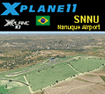
This is an X-Plane 11 and X-Plane 10 scenery package for Jorge Schieber Airport, (IATA: NNU, ICAO: SNNU), which is the airport servicing the city of Airport, Minas Gerais, in Brazil.
It includes corrected aprons, ramps, gates, taxiways, lighting system, city buildings, ortho-photoscenery for the airfield area, and (XP11 only) airport ground services (like push back).
Jorge Schieber Airport has already owned regular flights from/to Belo Horizonte/SBBH and to Salvador/SBSV, in the past, but it is now general aviation dedicated only.
This scenery was tested and is operational (as of January 16, 2018) in "X-Plane 11.11 64 bit", Windows 10 Home. It was also tested and is also operational (as of January 16, 2018) in "X-Plane 10.51 64 bit", Windows 10 Home.
| Filename: | BR_MG_SNNU__Nanuque_Airport_v100.zip |
| License: | Freeware |
| Added: | 2nd February 2018, 00:12:49 |
| Downloads: | 50 |
| Author: | Rui Mesquita |
| Size: | 8.1 MB |
| Category: X-Plane - Scenery | |
| BR MA SNOZ - Paco do Lumiar Airport v1.0.0 |
|
Images related to this file:
File Description:
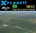
This is an X-Plane 11 and X-Plane 10 scenery package for Coronel Alexandre Raposo Airport (ICAO: SNOZ, no IATA code), which is a private airport located in Paço do Lumiar, metropolitan area of São LuÃs, Maranhão, in Brazil.
It includes corrected aprons, ramps, gates, taxiways, lighting system, ortho-photoscenery for the airfield area, and (XP11 only) airport ground services (like push back).
This is a private airport located at Sao Luis Island, 14km (7.5nm) NE of São LuÃs' International Airport (SBSL/SLZ).
This scenery was tested and is operational (as of January 16, 2018) in "X-Plane 11.11 64 bit", Windows 10 Home. It was also tested and is also operational (as of January 16, 2018) in "X-Plane 10.51 64 bit", Windows 10 Home.
| Filename: | BR_MA_SNOZ__Paco_do_Lumiar_Airport_v100.zip |
| License: | Freeware |
| Added: | 2nd February 2018, 00:13:00 |
| Downloads: | 46 |
| Author: | Rui Mesquita |
| Size: | 7.49 MB |
| Category: X-Plane - Scenery | |
| BR PB SNTS - Patos Airport v1.0.0 |
|
Images related to this file:
File Description:
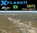
This is an X-Plane 11 and X-Plane 10 scenery package for Brigadeiro Firmino Ayres Airport (ICAO: SNTS, no IATA code), whici is the airport serving Patos, ParaÃba, in Brazil.
It includes corrected aprons, ramps, gates, taxiways, lighting system, city buildings, ortho-photoscenery for the airfield area, and (XP11 only) airport ground services (like push back).
The airport is located 12 km from the city center and 30 km north from Rio Grande do Norte (same distance south of Pernambuco). The city of Patos is strategically located to house an airport.
This scenery was tested and is operational (as of January 17, 2018) in "X-Plane 11.11 64 bit", Windows 10 Home. It was also tested and is also operational (as of January 17, 2018) in "X-Plane 10.51 64 bit", Windows 10 Home.
| Filename: | BR_PB_SNTS__Patos_Airport_v100.zip |
| License: | Freeware |
| Added: | 2nd February 2018, 00:13:22 |
| Downloads: | 49 |
| Author: | Rui Mesquita |
| Size: | 8.36 MB |
| Category: Flight Simulator 2004 - Scenery | |
| Marsa Alam Int. Airport (Iata: RMF, Icao: HEMA) |
|
Images related to this file:
File Description:
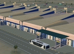
This FS2004 project reproduce the egyptian "Marsa Alam International Airport" (Iata: RMF, Icao: HEMA) located on the Red Sea coast. If you are a holiday-flights pilot, this airport is a “must have†!
In the scenery you'll find all buildings (airport, close surroundings and Port Ghalib resorts), hundred of custom made detailed objects, static and animated vehicles and a photoreal airport background. Each scenery part and object (frame-rate friendly thanks to the low poly design) has photoreal textures and everything is placed in the right position (which has been seen on summer 2016 at the real airport).English extended handbook is included. Watch the screenshot and the demo video on the Albysim youtube channel and enjoy all scenery features (in this free/demo edition some features are limited).
| Filename: | Marsa_Alam_Int_Airport_Iata_RMF_Icao_HEMA.zip |
| License: | Check within download |
| Added: | 29th October 2016, 21:26:52 |
| Downloads: | 1,011 |
| Author: | Albysim Scenery Design / Alberto Di Bolzano |
| Size: | 33.46 MB |
| Category: Flight Simulator 2004 - AFCAD Files | |
| FS2004 Chicago O'Hare Intl 2020 AFCAD |
|
Images related to this file:
File Description:
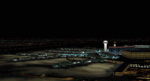
Chicago O'Hare Intl 2020 upgrade for FS2004 default scenery
Realized with ADE 1.76, this scenery updates the default airport to November 2020 configuration.
Features:
-7 active runways: 9L/27R, 9R/27L, 10L/28R, 10C/28C, 10R/28L, 4L/22R, 4R/22L
-Footprint of runway 9C/27C under construction
-All runways include instrumental approach procedures (for proper ATC/AI), ILS and light system as documented
-All taxiways are precisely defined and labelled according to latest airport documentations
-Proper taxiway signs throughout the whole airport
-Updated parking locations in the two main aprons, GA ramp and 4 Cargo Ramps (NE, SC, SW and SE)
-Jetways added for all gates in the two main aprons
-Gate numbering trying to respect (as far as possible) the real airport
-Several library 3D objects throughout the airport
-Night lights on aprons
| Filename: | FS2004_Chicago_OHare_Intl_2020_AFCAD.zip |
| License: | Freeware, limited distribution |
| Added: | 19th November 2020, 19:40:00 |
| Downloads: | 560 |
| Author: | Antonio Arreghini |
| Size: | 234.3 KB |


© 2001-2026 AVSIM Online
All Rights Reserved
Privacy Policy |