
Where Flight Simulation Enthusiasts Gather from Around the World!
AVSIM Library - Search Results

| Category: Flight Simulator X - Scenery | |
| KSBD, San Bernardino International Airport |

|
Images related to this file:
File Description:
Complete new setup with default scenery objects. Will fit in perfectly into photoreal scenery. The San Bernardino Airport is currently mainly operating as a general aviation and cargo airport.
| Filename: | KSBD_San_Bernardino_International_Airport.zip |
| License: | Freeware |
| Added: | 10th February 2018, 01:14:33 |
| Downloads: | 814 |
| Author: | Tim van Ringen |
| Size: | 2.97 MB |
| Category: Microsoft Flight Simulator (2020) - Scenery | |
| LRTR-Timisoara-v1 |
|
File Description:
This scenery is an attempt to correct the runway profile, the taxiways, the aircraft parking and the airport lights.
It also adds the tower and vehicles to the airport.
| Filename: | LRTRTimisoarav1.zip |
| License: | Freeware |
| Added: | 15th September 2020, 23:55:27 |
| Downloads: | 207 |
| Author: | Ciprian Nistor |
| Size: | 5.04 MB |
| Category: Flight Simulator X - Scenery | |
| WMKP, Penang International Airport, Malaysia |
|
Images related to this file:
File Description:
New setup with thanks to Google Maps. Penang International Airport is a medium size airport and one of the busiest airports in Malaysia. It is the oldest in Malaysia.
| Filename: | WMKP_Penang_International_Airport_Malaysia.zip |
| License: | Freeware |
| Added: | 22nd October 2018, 19:36:18 |
| Downloads: | 2,912 |
| Author: | Tim van Ringen |
| Size: | 2.56 MB |
| Category: Flight Simulator 2004 - Scenery | |
| KSNA, John Wayne-Orange County Airport |
|
Images related to this file:
File Description:

John Wayne Airport (IATA: SNA, ICAO: KSNA, FAA LID: SNA) is an airport in an unincorporated area in Orange County, California, with its mailing address in the city of Santa Ana, which is also the county seat, hence the International Air Transport Association (IATA) airport code. The main entrance to the airport is off of MacArthur Blvd in Irvine, the city that abuts the airport from the north and east. Newport Beach and Costa Mesa form the southern and western boundaries, respectively, together with a small unincorporated area along the Corona del Mar (73) Freeway. Santa Ana lies just north, not actually touching the airport directly. Originally named Orange County Airport, the county Board of Supervisors renamed it in 1979 to honor the actor John Wayne, who resided in neighboring Newport Beach and died that year. It also became the first airport to be named after an entertainer.
The main runway, at 5,701 feet (1,738 m), is one of the shortest of any major airport in the United States, resulting in most passenger aircraft operating from the airport to be no larger than the Boeing 757. However, some larger cargo aircraft, such as the FedEx A310/300, fly from SNA. Some gates are built to handle planes up to the size of a Boeing 767, which can operate with payload/fuel load restrictions. No wide-body passenger aircraft are currently in scheduled service at the airport.
| Filename: | KSNA_John_WayneOrange_County_Airport.zip |
| License: | Freeware, limited distribution |
| Added: | 11th October 2011, 04:03:32 |
| Downloads: | 4,876 |
| Author: | Mateusz Stabryla MK-Studios |
| Size: | 59.73 MB |
| Category: Flight Simulator X - Scenery | |
| KSNA, John Wayne-Orange County Airport |
|
Images related to this file:
File Description:

John Wayne Airport (IATA: SNA, ICAO: KSNA, FAA LID: SNA) is an airport in an unincorporated area in Orange County, California, with its mailing address in the city of Santa Ana, which is also the county seat, hence the International Air Transport Association (IATA) airport code. The main entrance to the airport is off of MacArthur Blvd in Irvine, the city that abuts the airport from the north and east. Newport Beach and Costa Mesa form the southern and western boundaries, respectively, together with a small unincorporated area along the Corona del Mar (73) Freeway. Santa Ana lies just north, not actually touching the airport directly. Originally named Orange County Airport, the county Board of Supervisors renamed it in 1979 to honor the actor John Wayne, who resided in neighboring Newport Beach and died that year. It also became the first airport to be named after an entertainer.
The main runway, at 5,701 feet (1,738 m), is one of the shortest of any major airport in the United States, resulting in most passenger aircraft operating from the airport to be no larger than the Boeing 757. However, some larger cargo aircraft, such as the FedEx A310/300, fly from SNA. Some gates are built to handle planes up to the size of a Boeing 767, which can operate with payload/fuel load restrictions. No wide-body passenger aircraft are currently in scheduled service at the airport.
| Filename: | KSNA_John_WayneOrange_County_Airport.zip |
| License: | Freeware, limited distribution |
| Added: | 11th October 2011, 08:25:20 |
| Downloads: | 11,004 |
| Author: | Mateusz Stabryla MK-Studios |
| Size: | 66.92 MB |
| Category: X-Plane - Scenery | |
| BR AM SWHT - Humaita Airport v1.0.0 |
|
Images related to this file:
File Description:
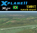
This is an X-Plane 11 and X-Plane 10 scenery package for Francisco Correa da Cruz Airport (IATA: HUW, ICAO: SWHT), which is the airport serving Humaitá, Amazonas, in Brazil.
It includes corrected aprons, ramps, gates, taxiways, lighting system, city buildings, ortho-photoscenery for the airfield area, and (XP11 only) airport ground services (like push back).
The airport is located 6 km (4 mi) from downtown Humaitá. The airport is dedicated to general aviation. No scheduled flights operate at this airport.
This scenery was tested and is operational (as of January 23, 2018) in "X-Plane 11.11 64 bit", Windows 10 Home. It was also tested and is also operational (as of January 23, 2018) in "X-Plane 10.51 64 bit", Windows 10 Home.
| Filename: | BR_AM_SWHT__Humaita_Airport_v100.zip |
| License: | Freeware |
| Added: | 2nd February 2018, 00:20:21 |
| Downloads: | 55 |
| Author: | Rui Mesquita |
| Size: | 8.4 MB |
| Category: X-Plane - Scenery | |
| BR AM SBMY - Manicore Airport v1.0.0 |
|
Images related to this file:
File Description:
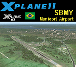
This is an X-Plane 11 and X-Plane 10 scenery package for Manicoré Airport (IATA: MNX, ICAO: SBMY), which is the airport serving Manicoré, Amazonas, in Brazil.
It includes corrected aprons, ramps, gates, taxiways, lighting system, city buildings, ortho-photoscenery for the airfield area, and (XP11 only) airport ground services (like push back).
The airport is located 4 km (2 mi) from downtown Manicoré. No scheduled flights operate at this airport. The airport is dedicated to general aviation.
This scenery was tested and is operational (as of January 23, 2018) in "X-Plane 11.11 64 bit", Windows 10 Home. It was also tested and is also operational (as of January 23, 2018) in "X-Plane 10.51 64 bit", Windows 10 Home.
| Filename: | BR_AM_SBMY__Manicore_Airport_v100.zip |
| License: | Freeware |
| Added: | 2nd February 2018, 00:20:41 |
| Downloads: | 74 |
| Author: | Rui Mesquita |
| Size: | 7.99 MB |
| Category: X-Plane - Scenery | |
| BR GO SBIT - Itumbiara Airport v1.0.0 |
|
Images related to this file:
File Description:
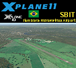
This is an X-Plane 11 and X-Plane 10 scenery package for Francisco Vilela do Amaral Airport (IATA: ITR, ICAO: SBIT), which is the airport serving Itumbiara, Goiás, in Brazil.
It includes corrected aprons, ramps, gates, taxiways, city buildings, lighting system, ortho-photoscenery for the airfield area, and (XP11 only) airport ground services (like push back).
The airport is dedicated to general aviation. No scheduled flights operate at this airport. The airport is located 7 km (4 mi) from downtown Itumbiara.
This scenery was tested and is operational (as of January 19, 2018) in "X-Plane 11.11 64 bit", Windows 10 Home. It was also tested and is also operational (as of January 19, 2018) in "X-Plane 10.51 64 bit", Windows 10 Home.
| Filename: | BR_GO_SBIT__Itumbiara_Airport_v100.zip |
| License: | Freeware |
| Added: | 2nd February 2018, 00:17:51 |
| Downloads: | 42 |
| Author: | Rui Mesquita |
| Size: | 15.04 MB |
| Category: Flight Simulator X - AFCAD Files | |
| SPECIAL EDITION Van Nuys Airport (KVNY) |
|
File Description:
Smith Graphics proudly presents the all new SPECIAL EDITION Van Nuys Airport (KVNY) AFCAD. Opened in 1928, Van Nuys Airport is now the world's third busiest 'general aviation' airport and the 25th busiest airport (in terms of takeoffs and landings) in the world. Van Nuys Airport handled 448,681 aircraft movements in 2005, averaging over 1,200 operations per day. More than 100 businesses are located on the 730 acre airport, and is also home to four major fixed-base operators and numerous aviation service companies. This AFCAD has been carefully re-worked to function with maximum traffic capacity and efficiency, as well as Day & Night visual enhancement. This has not been tested in FS2004, but you are free to test it if you wish. http://en.wikipedia.org/wiki/Van_Nuys_Airport
| Filename: | SPECIAL_EDITION_Van_Nuys_Airport_KVNY.zip |
| License: | Freeware |
| Added: | 6th October 2008, 10:47:08 |
| Downloads: | 1,559 |
| Author: | Dakota Smith / Smith Graphics |
| Size: | 105.47 KB |
| Category: Fly! II - Scenery | |
| Wiley Post-Will Rogers Memorial Airport (PABR) and Sea Plane Base |
|
File Description:
TerraModels Scenery Development System by Allen Kriesman and Biber Salsa models were used to create the scenery for Wiley Post-Will Rogers Memorial Airport (PABR) - Barrow, Alaska. The FlyII designator for this airport is BRW. The taxiways were added using the program by Peter Jacobson. No custom models were created for this airport.
| Filename: | Wiley_PostWill_Rogers_Memorial_Airport_PABR_and_Se.zip |
| License: | Freeware |
| Added: | 29th October 2003, 06:13:12 |
| Downloads: | 121 |
| Author: | Wayne Roberts |
| Size: | 48.31 KB |


© 2001-2026 AVSIM Online
All Rights Reserved
Privacy Policy |