
Where Flight Simulation Enthusiasts Gather from Around the World!
AVSIM Library - Search Results

| Category: Flight Simulator X - Scenery | |
| KHLX - Twin County Airport - Virginia, USA |

|
File Description:
Twin County Airport is located in the heart of the beautiful Blue Ridge mountains of southwest Virginia, adjacent to Interstate 77 near exit 19. We are 6 miles west of Hillsville and 11 miles northeast of Galax
This is a complete re-work of the airport based on Google Maps. Created with Airport Design Editor by ScruffyDuck Software using current FAA documentation and Google Earth measurements, this package offers a replacement for FSX's stock airport. All these enhancements are as close to the real airport as I can get with stock library objects and custom buildings.
| Filename: | KHLX__Twin_County_Airport__Virginia_USA.zip |
| License: | Freeware |
| Added: | 11th October 2014, 01:02:53 |
| Downloads: | 259 |
| Author: | Wayne Roberts |
| Size: | 196.49 KB |
| Category: Flight Simulator X - AFCAD Files | |
| KCJR - Culpeper Regional Airport - Virginia, USA |
|
Images related to this file:
File Description:
Culpeper Regional Airport (ICAO: KCJR, FAA LID: CJR) is a county-owned public-use airport located seven nautical miles (13 km) northeast of the central business district of Culpeper, a city in Culpeper County, Virginia, United States.Located in Brandy Station, Virginia, the airport opened in 1968. The runway originally measured 3200 ft. by 75 ft. In 1983, the runway was lengthened to 4000 ft. In 2004, the runway was expanded to 5000 ft. by 100 ft. It can handle corporate size jets and large twin engine aircraft. The airport has an airfest every October since 1998, with performances such as aerobatics.
Created with Airport Design Editor by ScruffyDuck Software using current FAA documentation and Google Earth measurements, this package offers a replacement for FSX's stock airport. All these enhancements are as close to the real airport as I can get with stock library objects.
| Filename: | KCJR__Culpeper_Regional_Airport__Virginia_USA.zip |
| License: | Freeware |
| Added: | 19th September 2014, 00:13:38 |
| Downloads: | 175 |
| Author: | Wayne Roberts |
| Size: | 6.82 KB |
| Category: Prepar3D V1-4 - Scenery | |
| KLVN - Airlake Airport - Lakeville, MN, USA |
|
File Description:
KLVN - Airlake Airport beta version .4 - by Jason Boche
This is an update of the default P3Dv4.5 KLVN airport. Aside from the original 12/30 runway, everything else at this airport has been completely ripped and replaced.
Enhancements include:
-Extended runway on each end to depict current configuration
-Accurate taxiways including Hamburg Ave. and buildings representing the current general aviation hangars
-Added navigational equipment on the field
-Added a few asphault and dirt service roads
-Added FBO and other buildings as close as I could match them
-Added some general aviation aircraft, civilians, vehicles at the FBO and hangars, and two fuel trucks
-Moved fuel station to where I believe it is currently according to Google maps with 100LL fuel trigger functional
-Moved the windsock to accurate location
-Moved the beacon to accurate location
-Moved GA parking spots
-Added trees around FBO and beacon
-Added utility poles
-Added a few square miles of Lakeville city, farm, and residential land class and autogen according to Google maps. This is probably the biggest improvement. It now looks like people live, work, and shop north/northwest of KLVN.
-Reworked the runway 12/30 blast pads to what I believe is the "proper" method. Instead of freehand polygon asphault, they are now actual runway extensions on both ends with yellow chevron markings
-Reworked the land class on the southwest end of the airport where I believe hangar expansion is intended. Prior to this, there was a sharp contrast between where the KLVN airport boundary ended and where generic farm landclass began which was right in the middle of the southwest taxiways and it looked bad. Now that whole region is grass and looks to be part of the airport parcel.
-Minor building adjustments west of the FBO to better match actual placement.
-Fixed a gap on the southeast end of Hamburg ave taxiway where it rounds the corner for the rwy 30 hold short line
-Randomized the directional facing of some of the cars parked at GA hangars
-Renumbered the parking spots 1-4 with #5 being the refueling spot
-Reversed the start direction of parking spots 1-3.
-Pulled the refueling parking "start" spot back because on start the engine cowling & prop were too far forward inside the fuel pump equipment
-Added an autogen exclusion to the rwy 12 short final due to trees popping up on short final path.
-KLVN tower viewpoint 25 meters above FBO.
-Removed the perimeter fence around the entire field
| Filename: | KLVN__Airlake_Airport__Lakeville_MN_USA.zip |
| License: | Freeware |
| Added: | 13th May 2020, 17:18:40 |
| Downloads: | 84 |
| Author: | Jason Boche |
| Size: | 14.81 KB |
| Category: Prepar3D V1-4 - Scenery | |
| Kirksville Regional Airport, Kirksville, Missouri, USA |
|
Images related to this file:
File Description:

A "Better Than Default" scenery for P3D of the Kirksville Regional Airport (KIRK/IRK). See the README.txt file for details.
| Filename: | Kirksville_Regional_Airport_Kirksville_Missouri_US.zip |
| License: | Freeware |
| Added: | 8th July 2019, 17:23:10 |
| Downloads: | 184 |
| Author: | David Vega |
| Size: | 566.91 KB |
| Category: Flight Simulator 2004 - Scenery | |
| WV71 - Lieving Airport - West Virginia, USA |
|
Images related to this file:
File Description:
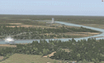
Racine Locks & Dam is a local vfr landmark for transits across the lower Allegheny Plateau. Included files are xml autogen, ezlandclass and custom bgl files with textures. I've named the files so that they are self explainable. This scenery is made to blend with autogen scenery (default) for FS9 and my Central Appalachia Land Class project. I've added the lower Big Sandy Valley project, too. It corrects a few default mistakes and adds bridges like at I-64 and in the Ashland Kentucky and Huntington WV area.
| Filename: | WV71__Lieving_Airport__West_Virginia_USA.zip |
| License: | Freeware |
| Added: | 9th July 2015, 17:29:21 |
| Downloads: | 213 |
| Author: | Rick Connolly |
| Size: | 5.64 MB |
| Category: Flight Simulator X - AFCAD Files | |
| 9G3 - Akron Airport - New York, USA |
|
File Description:
A more detailed version of my home airport, 9G3, Akron NY. For FSX.
| Filename: | 9G3__Akron_Airport__New_York_USA.zip |
| License: | Freeware |
| Added: | 4th September 2015, 16:37:33 |
| Downloads: | 117 |
| Author: | Brian Zaenglein |
| Size: | 5.98 KB |
| Category: Flight Simulator X - AFCAD Files | |
| KSBS - Steamboat Springs airport - Colorado, USA |
|
File Description:
Slightly better version of SBS.
I recommend you use Steamboat Mega Pack with this.
| Filename: | KSBS__Steamboat_Springs_airport__Colorado_USA.zip |
| License: | Freeware |
| Added: | 6th September 2015, 00:40:14 |
| Downloads: | 148 |
| Author: | Nick Mathews |
| Size: | 6.87 KB |
| Category: Flight Simulator 2004 - Scenery | |
| K6S0 - Big Timber Airport - Montana, USA |
|
File Description:
The fire tanker of BAe 146 flies every once a while in Big Timber area. The default is not enough detail so I created more improvement.
| Filename: | K6S0__Big_Timber_Airport__Montana_USA.zip |
| License: | Freeware |
| Added: | 5th November 2015, 21:54:24 |
| Downloads: | 123 |
| Author: | Stuart J Gilbert II |
| Size: | 2.36 MB |
| Category: Flight Simulator X - Scenery | |
| KMKJ - Mountain Empire Airport - Virginia, USA |
|
Images related to this file:
File Description:
Mountain Empire Airport (ICAO: KMKJ, FAA LID: MKJ) is a public use airport in Smyth County, Virginia, United States.[1] It located nine nautical miles (10 mi, 17 km) northeast of the central business district of Marion (in Smyth County)[1] and 13 nautical miles (15 mi, 24 km) west of Wytheville (in Wythe County).[2] The airport is situated between Interstate 81 and U.S. Route 11 (Lee Highway), near Groseclose. It is owned by Smyth Wythe Airport Commission.
This is a complete re-work of the airport. Added taxiway, additional parking aprons and custom buildings.
Created with Airport Design Editor by ScruffyDuck Software using current FAA documentation and Google Earth measurements, this package offers a replacement for FSX's stock airport. All these enhancements are as close to the real airport as I can get with stock library objects and custom buildings.
| Filename: | KMKJ__Mountain_Empire_Airport__Virginia_USA.zip |
| License: | Freeware |
| Added: | 25th January 2015, 15:55:52 |
| Downloads: | 308 |
| Author: | Wayne Roberts |
| Size: | 339.5 KB |
| Category: Flight Simulator X - Scenery | |
| 6I2 - Lebanon-Springfield Airport - Kentucky, USA |
|
Images related to this file:
File Description:
Lebanon-Springfield Airport (FAA LID: 6I2), a public use airport in Washington County, Kentucky (KY), USA. It is located three nautical miles (6 km) south of Springfield in Washington County) and north of Lebanon (in Marion County). The airport is owned by Marion and Washington Counties. The scenery contains seasonal ground textures for winter, spring, summer, autumn and night; autogen and default scenery objects of FSX plus a modified AFCAD file. Tested with FSX: SE on Windows 10. Version 1.1 contains fixes for the terrain aswell as corrected scenery objects.
** Do not use this version with FreeMesh X - USA; use 6I2_FMX.zip instead **
By Peregrine Simulations
| Filename: | 6I2__LebanonSpringfield_Airport__Kentucky_USA.zip |
| License: | Freeware, limited distribution |
| Added: | 21st February 2018, 23:36:38 |
| Downloads: | 250 |
| Author: | Peregrine Simulations |
| Size: | 104.1 MB |
© 2001-2026 AVSIM Online
All Rights Reserved
Privacy Policy |