
Where Flight Simulation Enthusiasts Gather from Around the World!
AVSIM Library - Search Results

| Category: Flight Simulator 2004 - Scenery | |
| Sulphur Creek Ranch ID74 private airfield in Idaho USA |

|
Images related to this file:
File Description:
This airfield is in the mountains of Idaho, around 30 miles south of Johnson Creek 3U2 which was the third in the series to be posted. Sulphur Creek Ranch is a privately owned airfield, serving the "Ranch", which translates into "restaurant-bar-lodge-and-holiday-cabins". The field is at 5,744 feet ASL, and the runway is 2,920 feet long and aligned 10-28. It is a single-ended runway, with 28 used for landing and 10 for take offs; this is down to a large chunk of mountain occupying the sky at the western end of the runway. The AI planes comply with this single runway concept and the only snag is that you cannot announce a landing as there is no runway offered for you to select for landing in the AI procedure. When taking off runway 10 is offered and you can announce take off. The land used by the ranch is mostly flat, and with a slant approach on finals and a late turn it is fairly straightforward. The largest landark is the man-made lake. Morgan Ranch 02ID is nearby and the grass area has been modified down in size as per reality. The buildings have been omitted as they are not adjacent to the runway and not visible, and I have no information on them.
| Filename: | Sulphur_Creek_Ranch_ID74_private_airfield_in_Idaho.zip |
| License: | Freeware, limited distribution |
| Added: | 25th May 2017, 17:54:33 |
| Downloads: | 164 |
| Author: | Roger Wensley |
| Size: | 6.21 MB |
| Category: Flight Simulator X - AFCAD Files | |
| KORD - Chicago O'hare Intl - Chicago, USA - RWY 10C/28C |
|
File Description:
Update to the default KORD airport to include the new runway 10C-28C that opened October 2013. Corrected the existing runway numbering and taxiways to reflect how they exist as of the Oct 17-Nov 14 2013 AIRAC Aiport Diagram. Used the existing default buildings and library objects as they appeared in the default KORD file (unless a new runway or taxiway went "through" the existing building...in that case I deleted the building rather than move it). Yes, I added taxiways JJ and RR. Created using ADE9X and I included approaches that appear in the default GPS Approach list. Scenery Density for any objects was not changed. Whatever appeared in your existing FSX density setting will appear here.
| Filename: | KORD__Chicago_Ohare_Intl__Chicago_USA__RWY_10C28C.zip |
| License: | Freeware |
| Added: | 22nd October 2013, 22:30:55 |
| Downloads: | 637 |
| Author: | Randy Tyndall |
| Size: | 68.9 KB |
| Category: Flight Simulator 2004 - Scenery | |
| Monument Valley UT25 and Oljato 05UT in Utah USA |
|
Images related to this file:
File Description:
Monument Valley is an impressive sight in south Utah but not, unfortunately, in FS9. Unless you invest in a detailed terrain mesh there are no stacks of rocks reaching for the sky and the lasting overall impression is just of a desert. But I had already downloaded the land textures so I ended up making the Monument Valley UT25 airfield and the nearby Oljato 05UT, which has no buildings of any sort. Maybe I was bored. There is a lodge close to the field with dozens of cabins, but I had insufficient information so this is for the airfield only. The 4,000 feet of new tarmac is aligned 16-34 and is single ended with a large chunk of rock at the southern end; 16 is only used for landing and 34 is only for take off. The runway is not lit. Do not be surprised when you ask to select a runway for take off and FS9 only gives you 16 as a choice, even though you know this is the wrong one. When you accept it FS9 will quickly switch it to 34; apart from a possible sense of humour I have no idea why it does this. Nothing much to say about Oljato. What do you need? You actually don't need Ultimate Terrain as there are other land textures used here, so you will definitely need to have downloaded and installed the land textures "cny_south3west_2010 lr" and "cny_south3west2_2010 lr" by Gottfried Razek, as these land textures showed the runways in the correct positions. Look in the scenery library here or at the other place. A note here about my scenery making. There will not be many more to follow this (unless you count 4 as many) as I am almost at the end of the photos I either took or found for scenery purposes, plus I expect to move on from FS9 at some point during next year.
| Filename: | Monument_Valley_UT25_and_Oljato_05UT_in_Utah_USA.zip |
| License: | Freeware, limited distribution |
| Added: | 22nd January 2020, 20:13:54 |
| Downloads: | 218 |
| Author: | Roger Wensley |
| Size: | 2.91 MB |
| Category: Flight Simulator X - Scenery | |
| KRND - Randolph Air Force Base - San Antonio, Texas (USA) |
|
Images related to this file:
File Description:
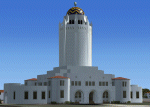
Randolph Air Force Base, San Antonio, Texas. Fifth version for MSFS - incredibly detailed, with night and seasonal ground textures. Nearly all major buildings, including housing, are in the package. All structures custom made. Complete package includes AI aircraft doing touch-and-gos in
the pattern.
| Filename: | KRND__Randolph_Air_Force_Base__San_Antonio_Texas_U.zip |
| License: | Freeware |
| Added: | 12th April 2013, 17:02:35 |
| Downloads: | 1,701 |
| Author: | James Shaddox |
| Size: | 62.07 MB |
| Category: Flight Simulator X - AFCAD Files | |
| KIAH - Houston/George Bush Intercontinental - Houston, Texas - USA ** UPDATE ** |
|
Images related to this file:
File Description:

Updated AFCAD for FSDreamTeam's KIAH Scenery. Adds Air New Zealand, and optimizes other gates. Moving Jetways removed to make way for the new SODE Jetways.
| Filename: | KIAH__HoustonGeorge_Bush_Intercontinental__Houston.zip |
| License: | Freeware |
| Added: | 23rd October 2016, 18:50:49 |
| Downloads: | 1,833 |
| Author: | FSDreamTeam, Kevin Boydston |
| Size: | 31.03 KB |
| Category: Flight Simulator X - AFCAD Files | |
| KGSB - Seymour Johnson AFB - Goldsboro, North Carolina USA v2.0 |
|
Images related to this file:
File Description:
This is an update of my 1.2 release of 2011-12-22. It contains infrastructure enhancements, new land masks, additional signage, and provides expanded parking for MAIW's B-52H AI models.
| Filename: | KGSB__Seymour_Johnson_AFB__Goldsboro_North_Carolin.zip |
| License: | Freeware |
| Added: | 25th January 2014, 11:53:48 |
| Downloads: | 1,119 |
| Author: | Allen Laughmiller |
| Size: | 26.94 KB |
| Category: Flight Simulator 2004 - Scenery | |
| Nikolski (IKO), Nelson Lagoon (Z73), & Perryville (AK5) - Alaska, USA |
|
Images related to this file:
File Description:
These are villages in Alaska, spread out east and west of Dutch Harbor in the Aleutians and the peninsula, served by Grant Aviation regional flights from Dutch Harbor, Cold Bay, or King Salmon.
Nikolski is 115 miles west of Dutch Harbor at the western end of Umnak Island, which is just west of Unalaska, the large island adjacent to Dutch Harbor. Nikolski is small, with a population of perhaps only 20 now, and the main claim to fame is the wrecked Reeve Aleutian DC3 at the end of the runway. The runway is 3,500 feet of gravel aligned 08-26. Nelson Lagoon is on the north shore of the peninsula, 55 miles north of Sand Point and on a long spit of land that curves around to make the lagoon. There is no access except by boat or plane for the population of around 50. The airfield is a mile east of the village with a gravel runway 08-26, 4,000 feet long. Perryville is on the south shore of the peninsula, 65 miles east of Sand Point. The population is around 115, and the airfield is southwest of the town with the 3,500 feet of gravel runway aligned 02-20 beside the shore. There is a hangar on the apron, but no terminal building.
| Filename: | Nikolski_IKO_Nelson_Lagoon_Z73__Perryville_AK5__Al.zip |
| License: | Freeware, limited distribution |
| Added: | 14th March 2015, 13:27:53 |
| Downloads: | 257 |
| Author: | Roger Wensley |
| Size: | 11.45 MB |
| Category: Flight Simulator 2004 - Scenery | |
| Chignik Lake A79 and Port Heiden PAPH - Alaska, USA |
|
Images related to this file:
File Description:
These are two villages in Alaska, in the peninsula that is the start of the Aleutians. Both are east of Perryville, Chignik Lake by 30 miles on the south side of the peninsula and Port Heiden by 75 miles on the north coast. Both are served by Grant Aviation government-subsidised regional flights from King Salmon. Chignik Lake has a population of around 70. There are two buildings on the airfield, but passengers still wait in their car for the plane to arrive as there is no terminal building as such. The runway is 3,300 feet of gravel aligned 08-26, as are so many in this area. Port Heiden is on the north shore of the peninsula, and the population is around 100. FS9 showed the town as being large enough to house 10,000; the new landclass here reduces this to the actual 40 or so houses, one and a half miles south of the airport. The roads are still the FS9 originals, which are approximately in the right place but are brightly lit at night as I was too lazy. The main occupation is fishing. There are buildings on the airfield (mostly old, except for a garage building) but passengers again wait in their cars for the plane to arrive. The two runways are both gravel, and are 05-23 of 6,200 feet, and 13-31 of 4,400 feet.
| Filename: | Chignik_Lake_A79_and_Port_Heiden_PAPH__Alaska_USA.zip |
| License: | Freeware, limited distribution |
| Added: | 30th March 2015, 20:28:47 |
| Downloads: | 294 |
| Author: | Roger Wensley |
| Size: | 5.1 MB |
| Category: Flight Simulator X - AFCAD Files | |
| KSAV - Savannah-Hilton Head Intl - Savannah, GA, USA v2.2 |
|
Images related to this file:
File Description:
This release features new approach scenery with visual clues that make marginal VFR runway acquisition easier. Airport signage now meets ICAO standards. All other features of version 2.0 are retained: scale runways, ramps, and taxiways, expanded 15-gate main terminal complex, enhanced general aviation parking with east and west FBOs, detailed Georgia Air National Guard (C-130) and CRTC ramps, detailed Gulfstream Aerospace north and south facilities, new control tower, FedEx cargo ramp, and fire station. Parking for over 150 aircraft.
| Filename: | KSAV__SavannahHilton_Head_Intl__Savannah_GA_USA_v2.zip |
| License: | Freeware |
| Added: | 25th May 2013, 00:51:59 |
| Downloads: | 1,755 |
| Author: | Allen Laughmiller |
| Size: | 35.64 KB |
| Category: Flight Simulator X - Scenery | |
| FSX Scenery KSGF Springfield and Branson Area Missouri USA |
|
Images related to this file:
File Description:

Complete new airports for KSGF Springfield National, KBBG Branson, KPLK Clark Downtown Branson,
and KFWB Branson West airports. Custom built hangars, terminals, buildings with interiors and
transparent glass in some. An AI traffic file is included to help populate the new airports.
Includes approaches. Some scenery libraries required.
By Dan French.
| Filename: | FSX_Scenery_KSGF_Springfield_and_Branson_Area_Miss.zip |
| License: | Freeware, limited distribution |
| Added: | 14th July 2023, 01:28:07 |
| Downloads: | 200 |
| Author: | Dan French |
| Size: | 21.7 MB |


© 2001-2026 AVSIM Online
All Rights Reserved
Privacy Policy |