
Where Flight Simulation Enthusiasts Gather from Around the World!
AVSIM Library - Search Results

| Category: Flight Simulator X - AFCAD Files | |
| Knoxville-McGhee Tyson Airport, Knoxville, Tennessee USA (KTYS) v2.1 |

|
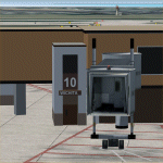
Images related to this file:
File Description:
Completely rebuilt ramps, taxiways, and service roads with enhanced general aviation parking, Tennessee Air National Guard ramp, Tennessee Army National Guard ramp, and detailed cargo ramp. Includes civilian and military fire stations.
| Filename: | KnoxvilleMcGhee_Tyson_Airport_Knoxville_Tennessee_.zip |
| License: | Freeware |
| Added: | 16th January 2012, 04:21:51 |
| Downloads: | 1,222 |
| Author: | Allen Laughmiller |
| Size: | 30.57 KB |
| Category: Flight Simulator X - Scenery | |
| KOKC - Will Rogers World Airport - Oklahoma City, OK, USA |
|
File Description:
Will Rogers World Airport (IATA: OKC, ICAO: KOKC)is a joint use Civilian-Military airfield located in the southern part of Oklahoma City. The airport covers approximately 8,100 acres. The main terminal currently has 17 gates which supports 6 major airlines. The Federal Aviation Administration's Mike Monroney Aeronautical Center is located on the west side of the airport.
The scenery includes relocated taxiways, new and enlarged aprons, rebuilt terminals and air-bridges, and other buildings.
This scenery was designed to be used with the default FSX scenery.
| Filename: | KOKC__Will_Rogers_World_Airport__Oklahoma_City_OK_.zip |
| License: | Freeware |
| Added: | 30th January 2016, 12:28:00 |
| Downloads: | 1,185 |
| Author: | Bill Bridges |
| Size: | 28.38 KB |
| Category: Flight Simulator X - Scenery | |
| KMSN - Madison Wisconsin Dane County Airport - Wisconsin, USA *Update* |
|
File Description:
Here are some files which were supposed to be included in my original upload kmsn_fsx.zip, but which I forgot to include. My apologies for this. Included are installation instructions.
| Filename: | KMSN__Madison_Wisconsin_Dane_County_Airport__Wisco.zip |
| License: | Freeware, limited distribution |
| Added: | 8th May 2016, 22:47:10 |
| Downloads: | 749 |
| Author: | Patrick Finch |
| Size: | 950.46 KB |
| Category: Flight Simulator X - Scenery | |
| KCAE - Columbia South Carolina Metropolitan Airport - South Carolina, USA |
|
Images related to this file:
File Description:
Columbia South Carolina Metropolitan Airport for FSX. Several improvements have been made to the default airport, including replacing the default terminal with new buildings modelled in FSDS, correctly numbering and coding gates using Airport Design Editor 1.67.5684, creating a new vehicle network, adding ample GA parking, changing the tower view to the roof of the control tower, adding a new static UPS truck modelled in FSDS in three different color schemes, placing static aircraft created using Static Aircraft Model Maker, and including the option of having all runways open to AI traffic.
Also included are Jim Dhaenen's excellent ramp lights and a set of GA flight plans made using AI flight Planner using all FSX default aircraft to liven up the GA area. Please read the README FIRST.txt and installation.txt files to insure proper installation of all files.
| Filename: | KCAE__Columbia_South_Carolina_Metropolitan_Airport.zip |
| License: | Freeware |
| Added: | 20th December 2015, 16:35:16 |
| Downloads: | 1,357 |
| Author: | Patrick Finch |
| Size: | 3.72 MB |
| Category: Flight Simulator X - Scenery | |
| KSLC - Salt Lake City Intl Airport 2020, Utah, USA |
|
Images related to this file:
File Description:
I have been asked many times could i do an update for SLC, knowing there were going to be major changes there I held off until now when someone sent me a plan for the new terminal layout and its taxiways, so here is my interpretation of what it may look like in 2020.
This is a version of Salt Lake City Intl Airport with two optional files and made only for FSX, do not use in P3D: There is one version with the Crosswind runway 14/32 operating where all 4 runways will be used for takeoff/landing and one version as the default airport runway operation, The new south terminal A and north concourse B have been designed similar to the plan i have, i also had to take a guess at which airlines will park where so may not be accurate on opening day, as a Delta hub they are only assigned to terminal A, most other airlines are assigned to the north concourse B, transient parking is retained in the same place, the north cargo ramp and buildings updated, runway 17/35 is now parallel with 16L/34R which is also part of the upgrade plan, and the approaches for it aligned with the new position, all other approaches and frequencies updated to the latest charts where needed, extra fuel trucks, Helipads/start locations now in their correct positions, De-icing pads added, support vehicle roads rebuilt and many other scenery improvements and objects added, airport views are from the roof of the control tower (when in tower view) please view the readme before installation,
| Filename: | KSLC__Salt_Lake_City_Intl_Airport_2020_Utah_USA.zip |
| License: | Freeware, limited distribution |
| Added: | 6th March 2018, 04:23:35 |
| Downloads: | 44,420 |
| Author: | Ray Smith |
| Size: | 4.91 MB |
| Category: Flight Simulator X - Scenery | |
| KICT - Wichita Mid-Continent Airport - Wichita, Kansas - USA ***Updated*** |
|
Images related to this file:
File Description:
Update to ICT_FSX100.zip. Added Doubletree Hotel, UPS Freight Hangar, more GA hangars plus a few other tweaks. Works best with Megascenery 2.0 Kansas.
| Filename: | KICT__Wichita_MidContinent_Airport__Wichita_Kansas.zip |
| License: | Freeware, limited distribution |
| Added: | 26th July 2014, 02:17:30 |
| Downloads: | 2,526 |
| Author: | Mike Eppright |
| Size: | 15.04 MB |
| Category: Prepar3D V1-4 - Scenery | |
| St Louis Regional Airport, Alton/St Louis, Illinois, USA |
|
Images related to this file:
File Description:

A "Better Than Default" scenery for P3D of St Louis Regional Airport (KALN/ALN). See the README.txt file for details.
| Filename: | St_Louis_Regional_Airport_AltonSt_Louis_Illinois_U.zip |
| License: | Freeware |
| Added: | 8th April 2019, 05:13:17 |
| Downloads: | 305 |
| Author: | David Vega |
| Size: | 2.12 MB |
| Category: Flight Simulator 2004 - Scenery | |
| KSNA, John Wayne-Orange County Airport |
|
Images related to this file:
File Description:

John Wayne Airport (IATA: SNA, ICAO: KSNA, FAA LID: SNA) is an airport in an unincorporated area in Orange County, California, with its mailing address in the city of Santa Ana, which is also the county seat, hence the International Air Transport Association (IATA) airport code. The main entrance to the airport is off of MacArthur Blvd in Irvine, the city that abuts the airport from the north and east. Newport Beach and Costa Mesa form the southern and western boundaries, respectively, together with a small unincorporated area along the Corona del Mar (73) Freeway. Santa Ana lies just north, not actually touching the airport directly. Originally named Orange County Airport, the county Board of Supervisors renamed it in 1979 to honor the actor John Wayne, who resided in neighboring Newport Beach and died that year. It also became the first airport to be named after an entertainer.
The main runway, at 5,701 feet (1,738 m), is one of the shortest of any major airport in the United States, resulting in most passenger aircraft operating from the airport to be no larger than the Boeing 757. However, some larger cargo aircraft, such as the FedEx A310/300, fly from SNA. Some gates are built to handle planes up to the size of a Boeing 767, which can operate with payload/fuel load restrictions. No wide-body passenger aircraft are currently in scheduled service at the airport.
| Filename: | KSNA_John_WayneOrange_County_Airport.zip |
| License: | Freeware, limited distribution |
| Added: | 11th October 2011, 04:03:32 |
| Downloads: | 4,874 |
| Author: | Mateusz Stabryla MK-Studios |
| Size: | 59.73 MB |
| Category: Flight Simulator X - Scenery | |
| KSNA, John Wayne-Orange County Airport |
|
Images related to this file:
File Description:

John Wayne Airport (IATA: SNA, ICAO: KSNA, FAA LID: SNA) is an airport in an unincorporated area in Orange County, California, with its mailing address in the city of Santa Ana, which is also the county seat, hence the International Air Transport Association (IATA) airport code. The main entrance to the airport is off of MacArthur Blvd in Irvine, the city that abuts the airport from the north and east. Newport Beach and Costa Mesa form the southern and western boundaries, respectively, together with a small unincorporated area along the Corona del Mar (73) Freeway. Santa Ana lies just north, not actually touching the airport directly. Originally named Orange County Airport, the county Board of Supervisors renamed it in 1979 to honor the actor John Wayne, who resided in neighboring Newport Beach and died that year. It also became the first airport to be named after an entertainer.
The main runway, at 5,701 feet (1,738 m), is one of the shortest of any major airport in the United States, resulting in most passenger aircraft operating from the airport to be no larger than the Boeing 757. However, some larger cargo aircraft, such as the FedEx A310/300, fly from SNA. Some gates are built to handle planes up to the size of a Boeing 767, which can operate with payload/fuel load restrictions. No wide-body passenger aircraft are currently in scheduled service at the airport.
| Filename: | KSNA_John_WayneOrange_County_Airport.zip |
| License: | Freeware, limited distribution |
| Added: | 11th October 2011, 08:25:20 |
| Downloads: | 11,002 |
| Author: | Mateusz Stabryla MK-Studios |
| Size: | 66.92 MB |
| Category: Flight Simulator 2004 - Scenery | |
| Joplin Regional Airport |
|
Images related to this file:
File Description:
FS9 Scenery - Joplin Regional Airport (IATA: JLN, ICAO: KJLN) is a public airport located four miles (6 km) north of the central business district (CBD) of Joplin, a city in Jasper County, Missouri, USA. The airport covers 970 acres (393 ha) and has three runways. It offers commercial airline service subsidized by the Essential Air Service program. Joplin Regional Airport is owned by the City Of Joplin. The longest runway is a paved runway extending 6503 feet. The facility is at an elevation of 981 feet. This scenery was created using Instant Scenery by John B. Loney, Jr.
| Filename: | Joplin_Regional_Airport.zip |
| License: | Freeware, limited distribution |
| Added: | 30th December 2009, 21:53:28 |
| Downloads: | 618 |
| Author: | John B. Loney, Jr. |
| Size: | 1019.39 KB |
© 2001-2026 AVSIM Online
All Rights Reserved
Privacy Policy |