
Where Flight Simulation Enthusiasts Gather from Around the World!
AVSIM Library - Search Results

| Category: Flight Simulator X - Scenery | |
| KHND - Henderson Executive Airport - Henderson, Nevada, USA |

|
File Description:
KHND Airport for FSX.
Not tested on P3D but should work.
| Filename: | KHND__Henderson_Executive_Airport__Henderson_Nevad.zip |
| License: | Freeware |
| Added: | 22nd February 2015, 14:42:56 |
| Downloads: | 1,420 |
| Author: | Niv Tesler |
| Size: | 106.96 MB |
| Category: Flight Simulator X - Scenery | |
| W29 - Bay Bridge Airport - Stevensville, Maryland - USA |
|
Images related to this file:
File Description:
FSX Scenery - Bay Bridge Airport (FAA LID: W29) is a county-owned public-use airport located in Stevensville, Maryland.The airport is named for the nearby Chesapeake Bay Bridge and is mostly used for general aviation. Bay Bridge Airport covers an area of 72 acres (29 ha) and contains one asphalt runway (11/29) measuring 2,903 x 60 ft (885 x 18 m). Non-default AI repaints/traffic available by John Burford. Scenery created by John B. Loney, Jr.
| Filename: | W29__Bay_Bridge_Airport__Stevensville_Maryland__US.zip |
| License: | Freeware, limited distribution |
| Added: | 18th November 2014, 14:54:33 |
| Downloads: | 473 |
| Author: | John B. Loney, Jr. |
| Size: | 8.2 MB |
| Category: Flight Simulator 2004 - Scenery | |
| PAAK - Atka Airport - Aleutian Islands, Alaska, USA |
|
Images related to this file:
File Description:
Atka is near the western end of the Aleutian chain of islands in Alaska, around 100 miles east of Adak and 330 miles west of Dutch Harbor. The small town (population around 60 now, down from 90 only 5 years ago; so quickly?) is reliant on fishing. The airport is a mile or so north of the town on the east coast of the island, with a single runway of 4,500 feet of asphalt, and there are scheduled flights by Grant Aviation from Dutch Harbor (included in the AI posted with Adak).
| Filename: | PAAK__Atka_Airport__Aleutian_Islands_Alaska_USA.zip |
| License: | Freeware, limited distribution |
| Added: | 17th January 2015, 19:08:38 |
| Downloads: | 267 |
| Author: | Roger Wensley |
| Size: | 2.55 MB |
| Category: Flight Simulator 2004 - Scenery | |
| KGEG - Spokane Intl Airport - Washington, USA *Update* |
|
Images related to this file:
File Description:
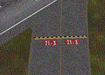
This is the first Update for the Spokane International Airport (KGEG) scenery. It contain's a new
AFCAD file (by using ADE) with correct aligned taxiway signs, new runway marks, updated parking
marks and approach lights.
| Filename: | KGEG__Spokane_Intl_Airport__Washington_USA_Update.zip |
| License: | Freeware |
| Added: | 7th May 2016, 21:12:58 |
| Downloads: | 853 |
| Author: | David Kolas |
| Size: | 917.85 KB |
| Category: Flight Simulator 2004 - Scenery | |
| KPVG - Hampton Roads Executive Airport - Virginia, USA |
|
Images related to this file:
File Description:
FS2004 Scenery - Hampton Roads Executive Airport (ICAO: KPVG, FAA LID: PVG) is a public-use airport
located seven miles (11 km) southwest of the central business district of Norfolk and northwest of Chesapeake, both independent cities in the U.S. state of Virginia. It is privately owned by Virginia Aviation Associates, L.L.C. Although most U.S. airports use the same three-letter location identifier for the FAA and IATA, Hampton Roads Executive Airport is assigned PVG by the FAA but has no designation from the IATA (which assigned PVG to Pudong International Airport in Shanghai, China). All buildings are custom made. AI traffic contains default aircraft. Created for your flight simming pleasure by John B. Loney, Jr.
| Filename: | KPVG__Hampton_Roads_Executive_Airport__Virginia_US.zip |
| License: | Freeware, limited distribution |
| Added: | 7th September 2014, 23:06:07 |
| Downloads: | 527 |
| Author: | John B. Loney, Jr. |
| Size: | 18.79 MB |
| Category: Flight Simulator X - Scenery | |
| KPVG - Hampton Roads Executive Airport - Virginia, USA |
|
Images related to this file:
File Description:
FSX Scenery - Hampton Roads Executive Airport (ICAO: KPVG, FAA LID: PVG) is a public-use airport located seven miles (11 km) southwest of the central business district of Norfolk and northwest of Chesapeake, both independent cities in the U.S. state of Virginia. It is privately owned by Virginia Aviation Associates, L.L.C. Although most U.S. airports use the same three-letter location identifier for the FAA and IATA, Hampton Roads Executive Airport is assigned PVG by the FAA but has no designation from the IATA (which assigned PVG to Pudong International Airport in Shanghai, China). All buildings are custom made. AI traffic contains default aircraft. Created for your flight simming pleasure by John B. Loney, Jr.
| Filename: | KPVG__Hampton_Roads_Executive_Airport__Virginia_US.zip |
| License: | Freeware, limited distribution |
| Added: | 7th September 2014, 23:05:56 |
| Downloads: | 846 |
| Author: | John B. Loney, Jr. |
| Size: | 18.89 MB |
| Category: Flight Simulator X - Scenery | |
| KCHO - Charlottesville-Albemarle Airport - Virginia, USA - BETA |
|
Images related to this file:
File Description:
FSX Scenery--Charlottesville-Albemarle Airport, VA. Beta Ver. Located in Albemarle County, Virginia, the Charlottesville-Albemarle Airport (KCHO) is a regional airport served regularly by American Eagle, Delta, United, and U.S. Airways. The airport also is home of Pegasus, an extension of the Department of Emergency Medicine at the University of Virginia Health System. General Aviation services are handled by Landmark Aviation, while aircraft charter is provided by the Meridian Air Group.
----------------
This 'beta' version of CHO is being released early to provide a destination for the upcoming 'Tom Allensworth Memorial Flight'. As such there are many unfinished features, additions and textures I had hoped to include. It is a Work In Progress. Please see the 'readme' for additional generic and freeware scenery .bgls needed. The finished version will include more accurate terminal, tower/firehouse, and FBO.
| Filename: | KCHO__CharlottesvilleAlbemarle_Airport__Virginia_U.zip |
| License: | Freeware |
| Added: | 27th April 2015, 13:00:48 |
| Downloads: | 906 |
| Author: | Joe Bowers |
| Size: | 9.62 MB |
| Category: Flight Simulator X - Scenery | |
| KCXE - Chase City Municipal Airport - Virginia - USA |
|
Images related to this file:
File Description:
This public airport is located two miles west of Chase City, Virginia.
Created with Airport Design Editor by ScruffyDuck Software using current FAA documentation and Google Earth measurements, this package offers a replacement for FSX's stock airport. All these enhancements are as close to the real airport as I can get with stock library objects and custom models.
| Filename: | KCXE__Chase_City_Municipal_Airport__Virginia__USA.zip |
| License: | Freeware |
| Added: | 13th August 2014, 20:51:37 |
| Downloads: | 299 |
| Author: | Wayne Roberts |
| Size: | 301.88 KB |
| Category: Prepar3D V1-4 - Scenery | |
| KBOS - Boston/Logan Intl Airport, Massachusetts, USA |
|
File Description:
This is Ray Smith's 'fsx_kbos_rs' file made for FSX. Ray has given me permission modify his file and make it available for Prepar3Dv4. My file may or may not be compatible with other versions of the Prepar Sim. This is an accurate and up-to-date version of Boston/Logan Intl airport with two optional files, one version with the Crosswind runways activated where all 6 runways will be used for takeoff/landing and one version as the default runway operation: assigned parking as per their website with extra parking including a gate for the A380, the expansion for Terminal B added and assigned for United Airlines, a new control tower, taxiways and taxi signs updated to the latest charts, extra fuel trucks, lighted helipad, support vehicle roads rebuilt and many other scenery improvements and objects added, airport views are from the roof of the control tower.
| Filename: | KBOS__BostonLogan_Intl_Airport_Massachusetts_USA.zip |
| License: | Freeware |
| Added: | 9th January 2018, 21:50:34 |
| Downloads: | 23,704 |
| Author: | Robert Catherall |
| Size: | 3.52 MB |
| Category: Flight Simulator 2004 - AFCAD Files | |
| KBBG - Branson Airport - Branson, Missouri, (USA) v0513 |
|
Images related to this file:
File Description:

KBBGv0513 zip contains 3 bgl's (1 afcad, 1 for building placement and 1 for the updated approaches).
This upload replaces my KBBGv0512.
I used Google Earth for measurements, the current airport diagram,
and info from the KBBG website for current gate assignments.
Created with AFX and ISv2 for FS9 ONLY
Have Fun, Joe
| Filename: | KBBG__Branson_Airport__Branson_Missouri_USA_v0513.zip |
| License: | Freeware |
| Added: | 19th May 2013, 17:14:05 |
| Downloads: | 208 |
| Author: | Joe Bourgeois |
| Size: | 6.75 KB |
© 2001-2026 AVSIM Online
All Rights Reserved
Privacy Policy |