
Where Flight Simulation Enthusiasts Gather from Around the World!
AVSIM Library - Search Results

| Category: Flight Simulator 2004 - Scenery | |
| RPLL Version 8 (Ninoy Aquino Internal Airport, Villamor Airbase, Sangley Airbase and Metro Manila) |

|
Images related to this file:
File Description:
Welcome to the latest version of the RPLL and Metro Manila scenery for FS9. This scenery is a a total rework of my previous scenery and contains a more accurate depiction of the entire metropolis. Over 4 years in the making and is the last upgrade for FS9.
This release coincides the first release sometime August of 2006. This scenery covers an area of around 1,400 sq. km. which includes major cities around Metro Manila: from Taytay in the east to Sangley in the west; from Alabang in the south to Novaliches/Caloocan-Bulacan boundaries in the north.
Sangley (RPLS) Airbase has also been redesigned (only the runway and taxiways). The entire Manila Bay coastline from Sangley to Novaliches has been recreated, adding fish-farms, correct coastal shape, breakwaters, reclaimed areas and marine ports. All major roads and river/water systems are also covered in this scenery.
The RPLL airport scenery contains 90 percent of the existing structures plus noticeable buildings around the vicinity including the new Newport City, Libingan ng mga Bayani, Fedex HQ and MIAA offices; and warehouse around rwys 06 and 24. 80 percent of the structures are individually textured. Also included in the package is Nestor d'Angelos Metro Manila buildings.
| Filename: | RPLL_Version_8_Ninoy_Aquino_Internal_Airport_Villa.zip |
| License: | Freeware, limited distribution |
| Added: | 4th August 2010, 03:48:52 |
| Downloads: | 4,620 |
| Author: | Lowil fred Espada |
| Size: | 25.37 MB |
| Category: Flight Simulator X - Panels | |
| F-111 Aardvark HUD - Navigation/Situation awareness cockpit with RADAR |
|
Images related to this file:
File Description:
FSX Alphasim F-111 Aardvark HUD. Navigation/Situation awareness cockpit.
REVISION 4. UPGRADE. COMPLETE PACKAGE. Adds upgraded dual role air-to-air ground mapping RADAR with target lock up and script on radar and HUD to enable precise intercepts in all weather day or night and new Sound. Massive amount of digital data.
Must have ALPHASIM F-111 Aardvark to build up this complete and separate F-111. Exceptional capability cockpit Comprising:
-Pilot, WSO and virtual panels;
-3 MFD with 19 selectable pages of data;
-NEW RADAR and 3 GPS type moving maps;
-16 Nearest airports page with full Citynames and ICAO entry capable displays in HUD;
-Clipboard, autopilot;
-Autothrottle and TFR;
-Enhanced HUD is selectable in all views including 10 camera views;
-All data clearly readable size;
-Aircraft carrier capable;
-Effects: bombs, missiles, flares, dump and burn, exhaust trail;
-Detailed REVISED 48 pge Flight Manual plus docs folder.
Configuration ensures crisp and extremely precise controlled flight even down to
10 ft AGL. This panel will set a new benchmark of the amount and type of
data provided and its presentation. Possibly the best pilots' aircraft ever.
Simple Panel replacement if previous version already installed.
By Karol Chlebowski.
| Filename: | F111_Aardvark_HUD__NavigationSituation_awareness_c.zip |
| License: | Check within download |
| Added: | 31st December 2009, 03:09:04 |
| Downloads: | 1,073 |
| Author: | Karol Chlebowski |
| Size: | 35.61 MB |
| Category: Flight Simulator 2004 - Scenery | |
| FoxPine AirPark, New Zealand. NZFP. |
|
File Description:
Welcome to FoxPine Airpark ,NZFP.
FoxPine AirPark is situated by the small provincial town of Foxton on the South West coast of New Zealand’s North Island.
This Private Airfield set in park-like grounds is sited on a broad coastal plain of mixed farming and forestry bounded by sweeping beaches,
a meandering river, and off to the East, rugged bush-clad ranges, all great places to fly.
FoxPine is also where the "Jabiru" light aircraft is assembled, sold and serviced.
This scenery contains a bonus custom AI package, comprising of seven Jabiru-2's, a Cessna 172, and a Maule M6, and a traffic file for the aircraft. (AI Aircraft are complete with all files).
The AI aircraft, and the traffic file are fully compatible with GNZLAP traffic. Scenery requires some EZ Scenery Object Sets (see INSTALL instructions for details).
| Filename: | FoxPine_AirPark_New_Zealand__NZFP.zip |
| License: | Freeware, limited distribution |
| Added: | 14th August 2008, 21:27:16 |
| Downloads: | 930 |
| Author: | Lawrie Roache |
| Size: | 5.98 MB |
| Category: Flight Simulator X - Original Aircraft | |
| ARX-6 Roadrunner - Version 2 |
|
Images related to this file:
File Description:
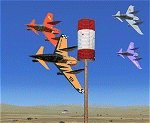
The ARX-6 is a single-place Formula One pylon racing aircraft and is built to the specs of the International Formula 1 Air Racing association. Like all Formula One race planes, it is built around the Continental O-200. This is the same 100hp engine that barely powers a Cessna 150 to 100kts but on the small extremely lightweight and aerodynamic airframes of formula one racers the top aircraft can push 300mph. With very few instruments, and less than average ground handling, Formula One aircraft are very clean "no frills" machines that serve only one purpose - flying low, flying fast, and turning left. This all-new package created specifically for FSX includes 14 different schemes, custom sounds and panel. Aircraft and panel by Jason L. Terry. Sounds by Joseph Thompson. Additional schemes by Joshua B. Nyhus, Brady Duros and Mike Vivaldi
| Filename: | ARX6_Roadrunner__Version_2.zip |
| License: | Freeware |
| Added: | 30th August 2012, 08:36:51 |
| Downloads: | 889 |
| Author: | Jason L Terry, Mike Vivaldi, Josh Nyhus, Brady Duros, and Joseph Thompson |
| Size: | 38.36 MB |
| Category: Flight Simulator 2004 - Miscellaneous Files | |
| Flight Assistant Profile fa172 v1.0 |
|
File Description:
This package is only for use with the Flight Assistant program by Timm Linder located here in the library or at his website:
Download Main Flight Assistant & Other Required Files Here
This Profile was created by Joseph Ranos, (Sonar5) & includes 256 Voice Commands that can be executed with a voice response.
Approximately 190+ voice Commands will Execute a MSFS2004 Key command as well as a Voice response. (voice response may be limited if you do not have all programs installed according to main Flight Assistant website). Approximately 60+ have a response but do not execute a key command. These are used for Cabin Crew Calls, Jokes, and optimized with Cessna 172 Checklists to show you the possibility of what the program is capable of.
| Filename: | Flight_Assistant_Profile_fa172_v10.zip |
| License: | Freeware, limited distribution |
| Added: | 20th December 2004, 02:49:48 |
| Downloads: | 1,679 |
| Author: | Joseph Ranos |
| Size: | 363.24 KB |
| Category: Flight Simulator X - Miscellaneous Files | |
| Reducing FSX Ground Vehicle Traffic speed - an Illustrated tutorial |
|
Images related to this file:
File Description:

Reducing FSX Traffic speed - an Illustrated tutorial
One of the more "interesting" enhancements which Microsoft introduced in FSX is the vehicle traffic which can be seen on the highways around larger cities and airports. However many simmers feel the speed at which these vehicles travel is considerably too fast and therefore quite unrealistic. One simmer has even commented that he cannot overtake many vehicles when flying low and slow in the default Cessna.
It is quite easy to edit the speeds of such vehicles and the process has been documented in at least one forum post. However I thought it might be useful - especially for those not accustomed to working with command line interfaces - to have a tutorial available which illustrates each step.
Compiled in .DOC and .PDF formats for your flying enjoyment by David "Opa" Marshall.
| Filename: | Reducing_FSX_Ground_Vehicle_Traffic_speed__an_Illu.zip |
| License: | Freeware |
| Added: | 11th June 2010, 09:42:50 |
| Downloads: | 2,621 |
| Author: | David "Opa" Marshall |
| Size: | 623.12 KB |
| Category: Flight Simulator 2002 - Adventures | |
| AVSIM Adventure Flights |
|
File Description:
As part of the AVSIM "Bush Flying in FS2002" feature, these 12 bush flying adventures (plus a bonus Antarctica adventure) can be downloaded and installed, allowing you to not only read about bush flying in FS2002, but you can experience it as well. These 12 adventure flights were developed with all levels (experience) of flight simmers in mind, as each flight is rated as to difficulty, from "easy" to "very difficult" and the aircraft used include: default Cessna Caravan (amphibian and wheeled Caravan), default Bell 206 helicopter, Bob Wening-Yannick Lavigne Supercub (redcub), Bob Wening-Ron Ackerley "Wilderness Outfitters" Supercub on floats, Yannick Lavigne-Fred Banting DHC-2 Beavers, and Steven Grant's de Havilland DHC-6 Twin Otter "Argentine Air Force Arctic"! The readme file includes detailed descriptions of each individual adventure and helpful hints for their successful completion.
| Filename: | AVSIM_Adventure_Flights.zip |
| License: | Freeware |
| Added: | 4th November 2002, 19:23:53 |
| Downloads: | 6,790 |
| Author: | Steve (Bear) Cartwright |
| Size: | 287.18 KB |
| Category: Flight Simulator X - Aircraft Repaints, Textures and Modifications | |
| Modification of the power table for the CONTINENTA GTSIO-520-N Cessna C421 Golden Eagle of ALABEO. |
|
Images related to this file:
File Description:

New update of flight dynamics settings.
Corrected the indicated speed error (KIAS) vs the true speed (KTAS) according to the data suggested in the pilot's operating manual (POH).
In some cases the position of the center of gravity unladen weight is corrected for a better weight and balance of the airplane.
Actual direct references from Pilot Operations Manual (POH) for specific details, Power,
Nose or pitch position and weight and balance settings, airplane geometry, piston or turbine engine data,
propeller and everything that refers to references, also the real references of the manufacturers of sea engines whatever the specific case.
| Filename: | Modification_of_the_power_table_for_the_CONTINENTA.zip |
| License: | Freeware |
| Added: | 15th April 2020, 18:46:31 |
| Downloads: | 211 |
| Author: | Rafael Ledezma |
| Size: | 463.3 KB |
| Category: Flight Simulator X - Scenery Design | |
| (Version 2.0) KEFD -Ellington 2025 Refresh FSX (Circa 2006-2010)- Johnson Space Center Houston |
|
Images related to this file:
File Description:
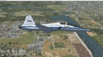
Version 2.0 covers landclass across the entire greater Houston area, with a large increase in LOD. This version significantly tightens up and improves the landclass from version 1.0, and adds a vast amount of scenery objects that brings the Bay Area-KEFD area into the modern era. This improves and adds a highly accurate runway 17 approach with accurate placement of buildings and scenery around the year 2011-modern day. In addition, includes several new files including a new airport/helipad via Houston Clear lake regional airport, T41 La Porte Municipal and surrounding shipping ports, Kemah Boardwalk, and a giant improvement to Johnson Space Center Houston. Rundway 35 and Runway 22 landclass is significantly increased, and more accurate as well. You can fly an accurate VFR approach or set up an ILS for any one of KEFD's runways with ease with this improvement.List of Version 2.0 additions and changes: - I added a ton of scenery objects and tightened up the landclass at Johnson Space Center Houston- NASA Control Center--- Added Talon Park with T38s (via static objects)--- Added Gemeni V rocket and 747 for the shuttle transporter--- And a whole bunch of vegetation, new buildings, and tour buses.- Added Kemah boardwalk and several boat docks- Removed a TON of highrise textures and replaced with medium and large city suburb landclass.- Added Clear Lake regional Hospital with helipad and surrounding scenery by Walter Reed Park- Added El Jardin or "Bayport Container port" with several scenery objects and significantly tightened up landclass.-- Looks great when setting up ILS approach for RWY 22- Tightened up Bay Area BLVD landclass, "adding" University of Houston Clear Lake"-- UHCL was semi already present, just made it more pronounced.- Made Red Bluff road landclass super recognizable!-- Red Bluff road is used to set up VFR approach and or field break for RWY 22 and RWY 17 R.----- Its common to see private jets and the USAF doing a break along Red Bluff road.- Added First Baptist Church, and water tower to Pasadena Convention center- Made Fairmont Parkway pronounced with landclass- Added Houston Port Authority at Morgan's Point--- Another Landmark for the RWY 22 ILS approach, NASA religiously uses this to line up the 10 mile ILS.- Tightened up landclass at Village Grove East and along Fairmont Parkway- Added a TON of scenery objects and landclass corrections for approach of RWY 17 L and 17 R.---- Added Home Depot, Lowes, Walmart Super center, Guitar center etc.---- added South Main Baptist Church--- Bondy Jr High, Turner Elementary, and Pasadena Memorial High School--- Added Saint Luke's Hospital--- Added Hampton Inn Suites and HCA rehab hospital--- Added a ton to the container facility behind best buy and storage facility--- Added smaller churches on RWY 17 approach--- Added a ton of scenery at the base of RWY 17 R, i.e., concrete plant, containers, trucks-- Added gas stations on the corner of beltway 8 and genoa red bluff-- Significantly changed and tightened up landclass at the base of RWY 22 and RWY 17 L and 17 R-- Made several roads and Beltway pronounced------ This decision looks AWESOME at night, really adds demarcation to the roads.**All of this makes the RWY 17 approach super recognizable** RWY 22 approach landclass is much more accurate.- Significantly changed and tightened up landclass near southbelt ellington and interstate 45.- Added Grace Church-- I wanted to do San Jacinto College south, but seemed over kill at that point.- SIGNIFICANTLY tightened up landclass for RWY 35 approach and near baybrook mall.-- Along I45- Added TDECU stadium at the University of Houston Main Campus---- So you can practice flybys for Cougar games!- Added the Battleship at San Jacinto Monument- I also "borrowed" T41 La Porte Municipal's tower camera to make a SWEET view of KEFD.- I included landclass for Sealy Texas this time, as well as my significant enhancements of Austin, Texas greater area as well (optional, but recommended!)---------------------------------------------------------------------------Version 1.0 originally added:- Added the Johnson Space Center Houston, which is now greatly enhanced and blended.- San Jacinto Community College-Central- Pasadena Convention Center- Pasadena Water Treatment Facility- NASA Bouncy Lab- Pasadena Shopping center, now greatly enhanced and blended.- Baybrook Mall and other shopping spots.- Significant Landclass improvements across the entire greater Houston Area File also includes landclass and scenery improvements for the greater Austin, Texas Area (optional), KIAH, KDWH, and Sealy, Texas. Each of these projects combined covers roughly 15,000 square miles of landclass improvement. Allowing you to fly entirely from Houston to Austin, or Houston to San Antonio in accurate landclass. -Enjoy!DJN
| Filename: | Version_20_KEFD_Ellington_2025_Refresh_FSX_Circa_2.zip |
| License: | Freeware |
| Added: | 12th October 2025, 16:15:47 |
| Downloads: | 72 |
| Author: | Dan Nelson |
| Size: | 277.28 MB |
| Category: Civil Flight Simulators - Looking Glass Flight Unlimited 3 | |
| FU3 Outer Terrain GTL Tile Editor v2.0 |
|
Images related to this file:
File Description:
This spreadsheet allows you to view, edit and save changes to the outer terrain's GTL tiles. Tiles are loaded into a 256x256 grid and the 13 default terrain textures are represented by cell background colours, i.e. the Mesa texture is represented by a reddish-brown background colour. The controls for loading and saving tiles are deliberately located on a separate worksheet. When loading and saving tiles I recommend that you do NOT select the main FU3 GTL Editor worksheet until a message box informs you that the load/save has finished. Otherwise, load/saves times (approx. 30 seconds for an average tile) will increase dramatically if you watch the tile while it is being populated or saved.
This 2.0 version also allows you to load a tile's terrain elevation. This is useful because the rules-based approach to modifying the OT was based on altitude constraints and it helps to be able to view the elevation (on the same scale as the tile itself) when modifying the terrain. However, in order to load the elevation you must first load the corresponding GTL tile. There is no provision to modify or save the elevation, because we already have Andre's excellent tools for that.
A complete map of the outer terrain's 2296 GTL files (plus Andre's 164 tile extension to the north) is provided in a separate worksheet. This includes a search facility you can use to identify tiles based on FU3 world co-ordinates.
| Filename: | FU3_Outer_Terrain_GTL_Tile_Editor_v20.zip |
| License: | Freeware |
| Added: | 26th December 2009, 02:11:13 |
| Downloads: | 49 |
| Author: | Jonathan Stonehouse |
| Size: | 103.36 KB |


© 2001-2026 AVSIM Online
All Rights Reserved
Privacy Policy |