
Where Flight Simulation Enthusiasts Gather from Around the World!
AVSIM Library - Search Results

| Category: Flight Simulator 2004 - Scenery | |
| Boundary Bay CZBB in British Columbia, Canada |

|
Images related to this file:
File Description:
Boundary Bay is south of Vancouver in British Columbia, close to the US/Canada border. It is the 5th busiest airfield in Canada measured in terms of take offs and landings as there are several training companies based there. The airfield was purchased by Alpha Aviation in 2009 and and modernised for the 2010 Winter Olympics, the main addition being a new terminal. This is an ex-military training base which was built in 1941, and one of the original hangars still survives. The two runways in use now (07/25 5,600' and 12/30 2,750', both of them 100' wide) are reduced asphalted areas of the original runways; the third runway is now an apron for GA parking and has had hangars built along it. There is JetA and 100LL available. The large building at the east end of the north apron is a HQ and maintenance facility for a helicopter company, Heli-one. All of the north apron buildings on the field have been modelled specifically for this scenery, plus the nearby huge greenhouse farm structures which are visible from further away than the airfield is. AI for Boundary Bay will be posted later this week.
| Filename: | Boundary_Bay_CZBB_in_British_Columbia_Canada.zip |
| License: | Freeware, limited distribution |
| Added: | 12th May 2011, 13:30:18 |
| Downloads: | 855 |
| Author: | Roger Wensley |
| Size: | 4.4 MB |
| Category: Flight Simulator 2004 - Scenery | |
| Carp CYRP in Ontario Canada (updated October 2011) |
|
Images related to this file:
File Description:
This version further updates the post of 2006 and the 2009 update with more bespoke buildings for the west GA apron plus the revised fuelling area, and corrected surroundings with large forested areas and a modified airfield grass shape. This is a stand-alone version and does not require you to have downloaded and installed the previous posts; this REPLACES those versions. Carp airfield is fifteen miles west of Ottawa and two miles south of the town of Carp. There are two runways, 10/28 which is asphalt and almost 4,000 feet long and 100 feet wide, and 04/22 which is gravel and 2,000 feet long. The airfield has a fairly large population of general aviation residents and is slowly expanding under new ownership. This version models the large hangar beside the terminal, the "Touch'n Go" aviation warehouse that has opened more recently, and the ramshackle collection of hangars and sheds that make up Westair, the maintenance facility. The nearby pagoda-roof flight school building has in fact now been demolished, but I like it too much to do that, at least until something else has been built on that space.
| Filename: | Carp_CYRP_in_Ontario_Canada__updated_October_2011.zip |
| License: | Freeware, limited distribution |
| Added: | 25th November 2011, 09:25:34 |
| Downloads: | 588 |
| Author: | Roger Wensley |
| Size: | 7.59 MB |
| Category: Flight Simulator X - AFCAD Files | |
| OMAA - Abu Dhabi International Airport - Abu Dhabi, United Arab Emirates |
|
Images related to this file:
File Description:
Abu Dhabi International Airport is an airport in Abu Dhabi, the capital of the United Arab Emirates. The airport is one of the fastest growing airports in the world in terms of passengers, new airline operators and infrastructural development. The airport is now undergoing a US$6.8 billion expansion. As of January 2012, 53 airlines offered service to 85 destinations in 49 countries.
The airport is the second largest in the UAE, serving over 10 million passengers in 2010. It has three operational passenger terminals. Its terminal spaces are dominated by Etihad Airways, which is the United Arab Emirates' second largest air carrier after Emirates.
The new Terminal 3, a US$270 million interim facility, was designed to allow for the airport's passenger growth before the planned opening of the new Midfield Terminal in 2014. Used predominantly by Etihad Airways, the terminal boosted the airport's seven million passenger per year capacity to 12 million. It also added 10 new gates, two of which are Airbus A380 compatible.
Using ADEx 1.51, aeronautical maps and Google Earth this AFCAD is now on par with today's situation.
| Filename: | OMAA__Abu_Dhabi_International_Airport__Abu_Dhabi_U.zip |
| License: | Freeware |
| Added: | 12th January 2013, 22:09:29 |
| Downloads: | 1,695 |
| Author: | Menno C. Robert |
| Size: | 3.62 MB |
| Category: Flight Simulator X - Scenery | |
| RAF Balderton |
|
File Description:
RAF Balderton is a former Royal Air Force station located 2.0 miles (3.2 km) south of Newark-on-Trent, sandwiched between the now extinct Great Northern Railway (GNR) Bottesford-Newark line and the A1 road in Nottinghamshire, England.
Opened in 1942, it was used by both the Royal Air Force and United States Army Air Forces. During the war it was used primarily as a troop carrier transport airfield and after for munitions storage before it was closed in 1957.
With the facility released from military control, Balderton was returned to agriculture, the runway concrete disappearing as hardcore under the AI road improvements of the 1960s. At that time, the developed Al was routed west of the original road, over the eastern perimeter track of the airfield, before coming back to the east to bypass Balderton village and Newark.
Gypsum open-pit mining has also taken its toll where quarrying has completely obliterated the airfield, with single track roads all that remain of the runway and perimeter track, and the occasional concrete runway end or pile of rubble.
Today the remains of the airfield are located on private property being used as agricultural fields.
| Filename: | RAF_Balderton.zip |
| License: | Freeware |
| Added: | 17th February 2016, 23:32:44 |
| Downloads: | 233 |
| Author: | Terry Boissel |
| Size: | 759.04 KB |
| Category: X-Plane - Scenery | |
| BR SP SBGP - Gaviao Peixoto Embraer Airport v1.0.0 |
|
Images related to this file:
File Description:
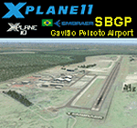
This is an X-Plane 11 and X-Plane 10 scenery package for Embraer Unidade Gavião Peixoto Airport (ICAO: SBGP, no IATA code) is a private airport located in a rural area near Gavião Peixoto and Araraquara, in Brazil. It is owned and operated by Embraer and used as for testing civil and military aircraft. Additionally, this scenery also includes a grass airstrip (SJAW Fazenda Citrica Airfield), a rural citrical farm facility for agricultural aviation. You can try landing there with your favorite prop aircraft. It's located around 1nm or 2nm northeast of SBGP airport. It includes corrected aprons, ramps, gates, taxiways, lighting system, Araraquara city buildings, ortho-photoscenery for the airfield area, and (XP11 only) airport ground services (like push back). This scenery was tested and is operational (as of March 18, 2017) in "X-Plane 11 Public Beta #15 64 bit", Windows 10 Home. It was also tested and is also operational (as of March 18, 2017) in "X-Plane 10.51 64 bit", Windows 10 Home. Only the default X-Plane 11 libraries, by Laminar Research, are needed. No third party libraries are used.
| Filename: | BR_SP_SBGP__Gaviao_Peixoto_Embraer_Airport_v100.zip |
| License: | Freeware |
| Added: | 19th March 2017, 08:13:27 |
| Downloads: | 95 |
| Author: | Rui Mesquita |
| Size: | 21.63 MB |
| Category: Flight Simulator 2002 - AFCAD Files | |
| Denver International Airport KDEN with WestWind Terminal Overlay |
|
File Description:
This is a 4 part (base and 3 overlays) FS2002 facility file for KDEN. This file can be used with the WestWind Training Center scenery file available from http://www.flywestwind.com/Scenery/denverterm.htm. The base file is named KDEN1BB.txt, is for non-express/non-regional commercial aircraft,
not of the WestWind livery, uses runways 35L for departures and 35R for arrivals, and has 8 heavy gates, 14 medium gates, and 20 small gates. The first overlay is named KDEN2BB.txt, is for express/regional commercial aircraft, not of the WestWind livery, uses runway 26 for departures and arrivals, and has 19 small gates. The second overlay is named KDEN3BB.txt, is for general aviation aircraft, uses runway 7 for departures and arrivals, and has 7 parking spaces. The third overlay is named KDEN4BB.txt, is for all commercial aircraft of the WestWind livery only, uses runway 16 for departures and arrivals, and has 1 heavy gate and 13 small gates. You do not have to utilize the WestWind overlay if you do not want to, it will not affact the scenery and the remainder of the airport will work fine if you simply ignore it.
| Filename: | Denver_International_Airport_KDEN_with_WestWind_Te.zip |
| License: | Freeware |
| Added: | 18th November 2002, 00:15:30 |
| Downloads: | 458 |
| Author: | Boyd Barker |
| Size: | 78.13 KB |
| Category: Flight Simulator 2004 - Scenery | |
| Frazier Lake Airpark (1C9) California Scenery |
|
File Description:
This is a scenery upgrade for Frazier Lake, California (1C9). This is part Eight of a series of small airstrip and minor airfield scenery enhancements which are based on real world data from Google Earth. The scenery mainly reflects the appearance of the airpark from directly above. If you are familiar with the place when on the ground, due to the limited number of buildings available it probably looks quite different. There is now however, a water strip for float planes which was missing from the default. It is proper FS9 water so you may land on it. Also, a few images from the net show that the ground varies from green grass to bare earth so I have made four .bgl files for the base texture. Note, I am using Flight1 Ground Environment; the default fields will look different. You must have rwy12 and EZ scenery libraries installed for the buildings to show. Both libraries of objects are free. EZ Library is available at http://www.abacuspub.com/pub/AbacusEZLibraries.exe. Rwy12 and additional EZ Custom libraries from Avsim. Search under Scenery design.
| Filename: | Frazier_Lake_Airpark_1C9_California_Scenery.zip |
| License: | Freeware |
| Added: | 31st March 2006, 01:00:25 |
| Downloads: | 501 |
| Author: | Kim Gowney |
| Size: | 400.27 KB |
| Category: Flight Simulator X - Panels | |
| General Dynamics F-111 PIG HUD PROJECT |
|
Images related to this file:
File Description:
FSX F-111 PIG HUD PROJECT - Navigation/Situation awareness cockpit.
REVISION 6.UPGRADE. MUST already have fxpiggb5.zip installed.
New features:In cockpit Pave Tack Display with full control allows views
in all directions, pitch,zoom and altitude, Terrain shading added to 2 GPS
displays, Virtual Cockpit layout improved, Flt Pln leg toggle SW,Precision
airspeed capable,Revised 56 pge Flight Manual includes new TFR procedures.
Adds to what is already an extreme capability panel and package packed
with custom instruments and concepts not available in other aircraft.
All instruments and text are sized to be clearly and easily readable.
Includes enhanced HUD, multiple radars,GPS units,MFDs,and effects,TFR,
autopilot/autothrottle, is Carrier and Air to Air capable,ICAO entry and
day/night/IFR/VFR navigation with constant current position awareness.
HUD available in all views including the 10 Camera views. This package sets
the benchmark for the amount, type of data provided and its presentation.
Possibly the best pilot friendly military aircraft available.
By Karol Chlebowski.
| Filename: | General_Dynamics_F111_PIG_HUD_PROJECT.zip |
| License: | Check within download |
| Added: | 17th September 2010, 23:53:26 |
| Downloads: | 410 |
| Author: | Karol Chlebowski |
| Size: | 14.7 MB |
| Category: Flight Simulator X - AFCAD Files | |
| CYDF - Deer Lake Regional Airport / Deer Lake, Newfoundland and Labrador, Canada (v1.1) |
|
Images related to this file:
File Description:
CYDF - Deer Lake Regional Airport / Deer Lake, Newfoundland and Labrador, Canada (v1.1)
This airport update was made with the latest version of ADE (Airport Design Editor) and made for FSX as a replacement for the stock (default) airport. I've made several changes to the airport which are listed below. All these enchancements are as close to the real airport as I can get with stock library objects. I've used satellite images, terminal photos and maps throughout the whole process so building locations are as accurate as possible. Happy landings in the beautiful Canada!
Features:
*Expanded parking apron
*Main terminal building with commercial aircraft parking
*Seperate parking aprons for GA traffic
*Hangars and other airport buildings
*Airport vehicles and objects throughout the airport
*Parking lot with static vehicles
*Airport fire station with fire truck
*De-icing vehicle/runway plow
*Helipads
*Fuel tanks
*Runway lengthened to 8,000ft as per recent upgrade (v1.1)
*Vehicle paths corrected (v1.1)
(For more information on Endeavourai please visit our site at endeavourai.com or our forums at http://endeavourai.boards.net/)
| Filename: | CYDF__Deer_Lake_Regional_Airport__Deer_Lake_Newfou.zip |
| License: | Freeware |
| Added: | 9th August 2012, 17:15:43 |
| Downloads: | 627 |
| Author: | Jaison Diaz / Endeavour ai |
| Size: | 66.97 KB |
| Category: Flight Simulator 2004 - Gauges | |
| VTOL/Hover gauge for Adam Preece' GR7 Harrier, V1.1 |
|
File Description:
If you use the previous version (RCBhcb10.zip): this version corrects a problem where the gauge gave problems when transitioning from hover to normal flight if you had loaded the aircraft in SpotPlane view. Plus some minor improvements.
See README for upgrade instructions.
This freeware gauge adds a whole new flightmodel and new VTOL & Hover featuresto Adam Preece' freeware Harrier.
Besides true vertical takeoff&landing, it allows you to fly forward, backward, sideways and turn, while in a hover.
This solution is based on overriding the normal FS flightdynamics while in a
hover, simular to the implementation of catapult launch / cable arrest in my
Carrier Operation Package; in short, it's a VTOL&Hover FDE coded in a gauge.
Special thanks to Doug Dawson, who created a gauge that provides for overriding FS2004 variables from an XML gauge.
Besides a VTOL controller, it also contains an effects controller plus visual
effects, for things like wingtip vortex, directional engine smoke and a cannon.
Requires FSUIPC (registered or unregistered).
The README includes extensive installation and flying instructions.
By Rob Barendregt.
| Filename: | VTOLHover_gauge_for_Adam_Preece_GR7_Harrier__V11.zip |
| License: | Freeware, limited distribution |
| Added: | 9th December 2005, 12:49:31 |
| Downloads: | 2,084 |
| Author: | Rob Barendregt |
| Size: | 88.49 KB |


© 2001-2026 AVSIM Online
All Rights Reserved
Privacy Policy |