
Where Flight Simulation Enthusiasts Gather from Around the World!
AVSIM Library - Search Results

| Category: Flight Simulator 2004 - AFCAD Files | |
| Syamsudin Noor, Banjarmarsin, Indonesia (WAOO/BDJ) |

|
File Description:
Googlyafcad A&F Data file for WRBB Banjarmasin/Syamsudin Noor/Ulin in Kalimantan, Indonesia based on Google Earth satellite data. Unfortunately, Microsoft have provided very limited facilities at this important Indonesian domestic airport, served by over twenty-five flights a day by Adam Air, Airfast, Bali International, Batavia Air, Bouraq, Garuda, Indonesia Air Transport, Lion Airlines, Mandala Airlines, Merpati Nusentara
and Sriwijaya Air jets and smaller craft. This upgrade redresses the subject by supplementing the GA parking with gates so that you, and your "AI" traffic can land, taxi, park and take off realistically. Whilst this file improves the layout of the airport, it is not a full scenery upgrade and does not attempt correct building locations, landclass, taxiway signs or those stupid over-sized filling stations that Microsoft loves to put in annoying places. Regrettably the satellite data currently available is not of sufficient quality to do so.
| Filename: | Syamsudin_Noor_Banjarmarsin_Indonesia_WAOOBDJ.zip |
| License: | Freeware |
| Added: | 17th March 2007, 11:06:39 |
| Downloads: | 1,075 |
| Author: | John Hinson |
| Size: | 59.7 KB |
| Category: Flight Simulator 2004 - Scenery | |
| Millard Municipal Airport, NE |
|
File Description:
FS2004 Scenery-Millard Airport (KMLE) serves Omaha and Douglas County and is owned by Omaha Arpt Authority. The paved runway extends for 3800 feet. The facility is at an elevation of 1050 feet at a distance of about 7 miles from Omaha. Dynamic scenery via Lago's FSE. Rwy12 and EZ Scenery along with FSDS3 also used. Textures for FSDS3 included in download. Modified AFCAD2 file and AI traffic via Traffic Tools. By John B. Loney, Jr.
| Filename: | Millard_Municipal_Airport_NE.zip |
| License: | Freeware |
| Added: | 14th March 2006, 04:04:43 |
| Downloads: | 601 |
| Author: | John B. Loney, Jr. |
| Size: | 858.51 KB |
| Category: Flight Simulator 2004 - Scenery | |
| Airborne Airpark KILN |
|
File Description:
FS2004 Scenery Airborne Airpark (KILN) Wilmington, Oh. The airport serves Wilmington and Clinton County and is owned by DHL (Was formerly owned by Airborne Express Inc.. The airport has more than one runway. The longest is a paved runway extending 10701 feet. The facility is at an elevation of 1077 feet at a distance of about 2 miles from Wilmington. Designed entirely with Rwy_12 and EZ Scenery. New AFCAD2 file and AI Traffic. By John B. Loney, Jr.
| Filename: | Airborne_Airpark_KILN.zip |
| License: | Freeware |
| Added: | 11th June 2006, 05:00:33 |
| Downloads: | 1,944 |
| Author: | John B. Loney, Jr. |
| Size: | 381.11 KB |
| Category: Flight Simulator 2004 - Scenery | |
| Alexandria Airport N85 |
|
File Description:
FS2004 Scenery - Alexandria Airport (N85) serves Pittstown and Hunterdon County in New Jersey and is owned by Leah Fritsche. The airport has more than one runway. The longest is a paved runway extending 2550 feet. The facility is at an elevation of 480 feet at a distance of about 2 miles from Pittstown. Alexandria Field is home to over 100 planes, and has an active flight school and maintenance shop. Created with EZ Scenery. EZ Scenery libraries required.
| Filename: | Alexandria_Airport_N85.zip |
| License: | Freeware, limited distribution |
| Added: | 17th June 2007, 23:39:52 |
| Downloads: | 692 |
| Author: | John B. Loney, Jr. |
| Size: | 943.55 KB |
| Category: Flight Simulator 2004 - Scenery | |
| FS2004 Scenery - Elizabeth Field 0B8 |
|
File Description:
FS2004 Scenery - Elizabeth Field Airport (0B8) serves Fishers Island and Suffolk County Long Island, N.Y. and is owned by Town Of Southold. The airport has more than one runway. The longest is a paved runway extending 2328 feet. The facility is at an elevation of 9 feet. The scenery objects were placed using Instant Scenery using the EZ Scenery libraries. Instructions for Ultimate Terrain users included. Created in collaboration with Ray Lunning by John B. Loney, Jr.
| Filename: | FS2004_Scenery__Elizabeth_Field_0B8.zip |
| License: | Freeware, limited distribution |
| Added: | 21st December 2007, 04:36:10 |
| Downloads: | 815 |
| Author: | John B. Loney, Jr. |
| Size: | 219.35 KB |
| Category: Flight Simulator 2004 - Scenery | |
| Sumter Municipal Airport KSMS |
|
Images related to this file:
File Description:
FS2004 Scenery - Sumter Municipal Airport (IATA: SMS, ICAO: KSMS, FAA LID: SMS) Sumter, South Carolina, United States, serves Sumter and Sumter County and is owned by the City & County Of Sumter. The airport has more than one runway. The longest is a paved runway extending 5500 feet. The facility is at an elevation of 183 feet at a distance of about 4 miles from Sumter. Created with Instant Scenery. For FSX version, see ksms_fsx.zip. By John B. Loney, Jr.
| Filename: | Sumter_Municipal_Airport_KSMS.zip |
| License: | Freeware, limited distribution |
| Added: | 2nd November 2009, 20:00:23 |
| Downloads: | 203 |
| Author: | John B. Loney, Jr. |
| Size: | 463.24 KB |
| Category: Flight Simulator 2004 - Aircraft Repaints, Textures and Modifications | |
| Boeing 737-200ADV, V1.31 Update |
|
Images related to this file:
File Description:
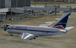
V1.31 update to the TinMouse II Boeing 737-200. Universal update for both FS9 and FSX versions.
Update only, requires install of full version 1.30 prior to installing this update. Includes fixes to all confirmed bugs from V1.30, a new .ini file facility for sound and initialization controls, and a variety of other minor improvements. Visit the TinMouse forum here on AVSIM for support and information.
| Filename: | Boeing_737200ADV_V131_Update.zip |
| License: | Freeware, limited distribution |
| Added: | 1st January 2011, 00:23:15 |
| Downloads: | 15,349 |
| Author: | Bob Scott, Richard Probst |
| Size: | 12.3 MB |
| Category: Flight Simulator X - Scenery | |
| Pocono Mountains Municipal Airport |
|
Images related to this file:
File Description:
FSX Scenery - Pocono Mountains Municipal Airport (KMPO) serves Mount Pocono and Monroe County, PA and is owned by Pocono Mtns Muni Arpt Auth. The airport has more than one runway. The longest is a paved runway extending 5001 feet. The facility is at an elevation of 1916 feet at a distance of about 2 miles from Mount Pocono. Includes the runway 13/31 which was extended to 5,001 ft x 75 ft. By John B. Loney, Jr.
| Filename: | Pocono_Mountains_Municipal_Airport.zip |
| License: | Freeware, limited distribution |
| Added: | 22nd February 2011, 23:05:51 |
| Downloads: | 594 |
| Author: | John B. Loney, Jr. |
| Size: | 738.21 KB |
| Category: Flight Simulator X - AFCAD Files | |
| KORD - Chicago O'hare - Chicago, USA - 1311 Update |
|
File Description:
1311(10C-28C)update for the default O'Hare airport.
- All ILS and RNAV approaches re-written with 1311 data
- All runway equipment correctly placed, missing equipment added, including the terribly misaligned glideslope for 14L, the missing PAPI for 22L
and many other errors corrected.
- Taxiways/signs updated
- Vector data updated over the entire facility
- Effects based apron route night lighting
- Many other fixes and enhancements, terminal height adjustment, scaled jetways based on a/c type, etc.
| Filename: | KORD__Chicago_Ohare__Chicago_USA__1311_Update.zip |
| License: | Freeware |
| Added: | 26th October 2013, 23:50:06 |
| Downloads: | 1,232 |
| Author: | Brian Doney |
| Size: | 3.96 MB |
| Category: Flight Simulator 2002 - AFCAD Files | |
| Mehrabad International. |
|
File Description:
This is a new facility file for OIII (Iran/Tehran Mahrabad Intl.).uses runways 29R for takeoffs and 29L for Landings.inclouds 11 small ramps/gates, 29 medium ramps/gates, 24 heavy ramps/gates and 4 cargo ramps(Totally 68 ramps/Gates).taxi ways and hold short nodes are modified for large traffic aircrafts and work perfectly with heavy trrafic.north medium gates are modified for 737/727/F100/TU154/A300/A310.also incloudes north VIP gate and south millitary gates.
| Filename: | Mehrabad_International.zip |
| License: | Freeware, limited distribution |
| Added: | 25th November 2002, 17:27:54 |
| Downloads: | 835 |
| Author: | Kaveh Payandeh |
| Size: | 28.52 KB |


© 2001-2026 AVSIM Online
All Rights Reserved
Privacy Policy |