
Where Flight Simulation Enthusiasts Gather from Around the World!
AVSIM Library - Search Results

| Category: Flight Simulator 2004 - Scenery | |
| Alexandria Airport N85 |

|
File Description:
FS2004 Scenery - Alexandria Airport (N85) serves Pittstown and Hunterdon County in New Jersey and is owned by Leah Fritsche. The airport has more than one runway. The longest is a paved runway extending 2550 feet. The facility is at an elevation of 480 feet at a distance of about 2 miles from Pittstown. Alexandria Field is home to over 100 planes, and has an active flight school and maintenance shop. Created with EZ Scenery. EZ Scenery libraries required.
| Filename: | Alexandria_Airport_N85.zip |
| License: | Freeware, limited distribution |
| Added: | 17th June 2007, 23:39:52 |
| Downloads: | 692 |
| Author: | John B. Loney, Jr. |
| Size: | 943.55 KB |
| Category: Flight Simulator 2004 - Scenery | |
| Sumter Municipal Airport KSMS |
|
Images related to this file:
File Description:
FS2004 Scenery - Sumter Municipal Airport (IATA: SMS, ICAO: KSMS, FAA LID: SMS) Sumter, South Carolina, United States, serves Sumter and Sumter County and is owned by the City & County Of Sumter. The airport has more than one runway. The longest is a paved runway extending 5500 feet. The facility is at an elevation of 183 feet at a distance of about 4 miles from Sumter. Created with Instant Scenery. For FSX version, see ksms_fsx.zip. By John B. Loney, Jr.
| Filename: | Sumter_Municipal_Airport_KSMS.zip |
| License: | Freeware, limited distribution |
| Added: | 2nd November 2009, 20:00:23 |
| Downloads: | 203 |
| Author: | John B. Loney, Jr. |
| Size: | 463.24 KB |
| Category: Fly! II - Development | |
| Advanced Logbook for Fly! II v1.0 |
|
File Description:
This is a Fly! II add-on that provides a usable logbook facility. Advanced
Logbook files are constructed using the XML format. However, Advanced Logbook
files are not necessarily customizable. Advanced Checklist files are extensible
and new features are planned for. This version supports logbooks that record
flights for all aircraft models into one logbook file. This version provides an
editor tool that can be used to create and edit (within very narrow constraints)
Advanced Logbook files.
| Filename: | Advanced_Logbook_for_Fly_II_v10.zip |
| License: | Freeware |
| Added: | 5th August 2002, 11:47:21 |
| Downloads: | 250 |
| Author: | Tony Crider |
| Size: | 86.91 KB |
| Category: Fly! II - Development | |
| Advanced Logbook v1.1 |
|
File Description:
This is a Fly! II add-on that provides a usable logbook facility. Advanced
Logbook files are constructed using the XML format. However, Advanced Logbook
files are not necessarily customizable. Advanced Checklist files are extensible
and new features are planned for. This version supports logbooks that record
flights for all aircraft models into one logbook file. This version provides an
editor tool that can be used to create and edit (within very narrow constraints)
Advanced Logbook files.
| Filename: | Advanced_Logbook_v11.zip |
| License: | Freeware |
| Added: | 12th August 2002, 11:51:43 |
| Downloads: | 265 |
| Author: | Tony Crider |
| Size: | 3.31 MB |
| Category: Flight Simulator X - Scenery | |
| Pocono Mountains Municipal Airport |
|
Images related to this file:
File Description:
FSX Scenery - Pocono Mountains Municipal Airport (KMPO) serves Mount Pocono and Monroe County, PA and is owned by Pocono Mtns Muni Arpt Auth. The airport has more than one runway. The longest is a paved runway extending 5001 feet. The facility is at an elevation of 1916 feet at a distance of about 2 miles from Mount Pocono. Includes the runway 13/31 which was extended to 5,001 ft x 75 ft. By John B. Loney, Jr.
| Filename: | Pocono_Mountains_Municipal_Airport.zip |
| License: | Freeware, limited distribution |
| Added: | 22nd February 2011, 23:05:51 |
| Downloads: | 594 |
| Author: | John B. Loney, Jr. |
| Size: | 738.21 KB |
| Category: Flight Simulator 2004 - Aircraft Repaints, Textures and Modifications | |
| Boeing 737-200ADV, V1.31 Update |
|
Images related to this file:
File Description:
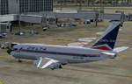
V1.31 update to the TinMouse II Boeing 737-200. Universal update for both FS9 and FSX versions.
Update only, requires install of full version 1.30 prior to installing this update. Includes fixes to all confirmed bugs from V1.30, a new .ini file facility for sound and initialization controls, and a variety of other minor improvements. Visit the TinMouse forum here on AVSIM for support and information.
| Filename: | Boeing_737200ADV_V131_Update.zip |
| License: | Freeware, limited distribution |
| Added: | 1st January 2011, 00:23:15 |
| Downloads: | 15,342 |
| Author: | Bob Scott, Richard Probst |
| Size: | 12.3 MB |
| Category: Flight Simulator 2004 - AFCAD Files | |
| Aeropuerto Internacional Ezeiza/Ministro Pistarini, Buenos Aires, Argentina (SAEZ/EZE) |
|
File Description:
AFCAD2 file for Buenos Aires - Ezeiza International for FS2004 default scenery. Correct number of gates, with realistic airline designators. There are some generic gates for overflow traffic. Terminal one is mainly for Aerolineas Argentinas and other Argetnine airlines. There is also a renovated international terminal and a brand new cargo facility. I've been through this airport many times so I have a good sense of where the gates belong. I also used satellite photos for gate placement. Enjoy!
| Filename: | Aeropuerto_Internacional_EzeizaMinistro_Pistarini_.zip |
| License: | Freeware |
| Added: | 8th November 2003, 01:30:45 |
| Downloads: | 3,978 |
| Author: | Eric Thornton |
| Size: | 5.08 KB |
| Category: Flight Simulator X - AFCAD Files | |
| KCHS - Charleston AFB / Intl - Charleston, SC, USA v3.0 |
|
Images related to this file:
File Description:
Located near Charleston, South Carolina, KCHS is a combination commercial, general aviation, and military airport. This is a complete airport rebuild with new scale runways, ramps, and taxiways. This release features a detailed main terminal complex and access roads, enhanced general aviation facilities with two FBOs, detailed Air Force C-17A flight line, detailed Boeing South Carolina 787 facility, flying club, fire station, ICAO signage, enhanced approach scenery, and parking (including hangar parking) for over 135 aircraft.
| Filename: | KCHS__Charleston_AFB__Intl__Charleston_SC_USA_v30.zip |
| License: | Freeware |
| Added: | 25th May 2013, 00:52:03 |
| Downloads: | 2,493 |
| Author: | Allen Laughmiller |
| Size: | 61.18 KB |
| Category: Flight Simulator 2004 - Scenery | |
| Airborne Airpark KILN |
|
File Description:
FS2004 Scenery Airborne Airpark (KILN) Wilmington, Oh. The airport serves Wilmington and Clinton County and is owned by DHL (Was formerly owned by Airborne Express Inc.. The airport has more than one runway. The longest is a paved runway extending 10701 feet. The facility is at an elevation of 1077 feet at a distance of about 2 miles from Wilmington. Designed entirely with Rwy_12 and EZ Scenery. New AFCAD2 file and AI Traffic. By John B. Loney, Jr.
| Filename: | Airborne_Airpark_KILN.zip |
| License: | Freeware |
| Added: | 11th June 2006, 05:00:33 |
| Downloads: | 1,936 |
| Author: | John B. Loney, Jr. |
| Size: | 381.11 KB |
| Category: Flight Simulator 2004 - Scenery | |
| FS2004 Scenery - Elizabeth Field 0B8 |
|
File Description:
FS2004 Scenery - Elizabeth Field Airport (0B8) serves Fishers Island and Suffolk County Long Island, N.Y. and is owned by Town Of Southold. The airport has more than one runway. The longest is a paved runway extending 2328 feet. The facility is at an elevation of 9 feet. The scenery objects were placed using Instant Scenery using the EZ Scenery libraries. Instructions for Ultimate Terrain users included. Created in collaboration with Ray Lunning by John B. Loney, Jr.
| Filename: | FS2004_Scenery__Elizabeth_Field_0B8.zip |
| License: | Freeware, limited distribution |
| Added: | 21st December 2007, 04:36:10 |
| Downloads: | 815 |
| Author: | John B. Loney, Jr. |
| Size: | 219.35 KB |
© 2001-2026 AVSIM Online
All Rights Reserved
Privacy Policy |