
Where Flight Simulation Enthusiasts Gather from Around the World!
AVSIM Library - Search Results

| Category: Flight Simulator 2004 - Scenery | |
| Project México Real LOD10 File 6 of 11 |

|
File Description:
File 6th of 11 of a Terrain Mesh that covers the entire Mexican Territory and related areas bordering the U.S., Guatemala and Belice areas. Part of the "Proyecto México Real" project, compiled at LOD10 (1.24 arcseconds in latitude and 1.65 arcseconds in longitude) resolution from INEGI data. Intended to enhance the virtual flying experience complementing the LOD8 and LOD9 versions compiled from the same data. Compatible backwards with Flight Simulator 2000, Flight Simulator 2002 and Combat Flight Simulator 2. Refer to the file contents about the cover area to this compressed file.
| Filename: | Project_Mxico_Real_LOD10_File_6_of_11.zip |
| License: | Check within download |
| Added: | 6th June 2006, 01:07:16 |
| Downloads: | 3,024 |
| Author: | Juan José Galván Bautista |
| Size: | 71.63 MB |
| Category: Flight Simulator 2004 - Scenery | |
| Project México Real LOD10 File 11 of 11 |
|
File Description:
File 11th of 11 of a Terrain Mesh that covers the entirety of Mexican Territory and related bordering U.S., Guatemala and Belice areas, part of the "Proyecto México Real" project, compiled at LOD10 (1.24 arcseconds in latitude and 1.65 arcseconds in longitude) resolution from INEGI data. Intended to enhance the virtual flying experience complementing the LOD8 and LOD9 versions compiled from the same data. Compatible backwards with Flight Simulator 2000, Flight Simulator 2002 and Combat Flight Simulator 2. Refer to the file contents about the cover area to this compressed file.
| Filename: | Project_Mxico_Real_LOD10_File_11_of_11.zip |
| License: | Check within download |
| Added: | 6th June 2006, 01:52:33 |
| Downloads: | 3,098 |
| Author: | Juan José Galván Bautista |
| Size: | 69.98 MB |
| Category: Prepar3D V1-4 - Scenery | |
| P3D v4.3 Aeropuerto Internacional Alejandro Velasco Astete-PERU |
|
Images related to this file:
File Description:
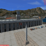
ONLY FOR P3D V4.3
REQUIRES ANY TERRAIN MESH
Alejandro Velasco Astete International Airport (IATA: CUZ, ICAO: SPZO) is an international airport located in the city of Cusco, in southeastern Peru. Cusco, a principal tourist attraction in Latin America, receives various domestic flights as well as some international flights. The runway is completely paved. It operates at limited capacity due to its precarious location near the city's center. Despite these limitations, the airport has consistently ranked as Peru's second most important air terminal, handling 3,209,153 national and international passengers in 2016, as reported by CORPAC.
| Filename: | P3D_v43_Aeropuerto_Internacional_Alejandro_Velasco.zip |
| License: | Freeware |
| Added: | 15th June 2019, 22:52:35 |
| Downloads: | 1,746 |
| Author: | Jhon Cristian |
| Size: | 115.91 MB |
| Category: Flight Simulator 2004 - Scenery | |
| Cuba Archipelago: Cayo Largo and Cayo Coco trees |
|
Images related to this file:
File Description:
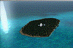
Dear Friends simmer of eternal fs 2004, with this job i want to i wanted as much as possible, increment the realism of default scenery of Cayo Largo and Cayo Coco fs 2004 using bgl of 'friend Gianluca Giovannini. I suggest to use some Cuba mesh freeware or payware. Down the lane I also Needless to say, the effect with the scenery taxi2gate (payware) is really better, but you can find a good scenery in the web.
Happy Flights and greetings from Italy, Fabio "fafoair" ferrari, Castione Presolana Bergamo.
| Filename: | Cuba_Archipelago_Cayo_Largo_and_Cayo_Coco_trees.zip |
| License: | Freeware, limited distribution |
| Added: | 14th March 2013, 04:12:34 |
| Downloads: | 909 |
| Author: | Fabio Ferrari "fafo air" |
| Size: | 4.94 MB |
| Category: X-Plane - Scenery | |
| WXPJ Susi Air Puncak Jaya Mining Airstrip v1.0.0 |
|
Images related to this file:
File Description:
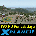
This is an X-Plane 11 scenery for Puncak Jaya Mining Airstrip (WXPJ) in the Puncak Jaya mountain region of Papua, Indonesia. This is a fictitious airfield, located in a high altitute mining location in Papua. At 4884 metres (16024 ft) above sea level, the Puncak Jaya peak, next to the mining location, is the highest mountain in Indonesia, on the island of New Guinea (which consists of the Indonesian West Papua region plus Papua New Guinea). This fictitious airfield may serve as a high altitute mining location challenge while flying the airstrips in Papua, as one of the destinations for "PT ASI Pujiastuti Aviation", operating as Susi Air, an Indonesia airlines established in late 2004 by Mrs. Susi Pudjiastuti. This scenery was tested and is operational (as of January 20, 2017) in "X-Plane 11 Public Beta #6 64 bit", Windows 10 Home. It was also tested and is partially operational (as of January 20, 2017) in "X-Plane 10.51 64 bit", Windows 10 Home. The issue with XP10 is the mesh again: there is no mine mesh, just a whole. The feel is very different from XP11, but it is still operational in XP10 to fly in and out.
| Filename: | WXPJ_Susi_Air_Puncak_Jaya_Mining_Airstrip_v100.zip |
| License: | Freeware |
| Added: | 21st January 2017, 18:42:35 |
| Downloads: | 58 |
| Author: | Rui Mesquita |
| Size: | 2.2 MB |
| Category: Flight Simulator 2004 - Scenery | |
| New York City Default Bridges and Objects v2.0 |
|
File Description:
I originally planned on "fixing" the George Washington Bridge, which was inadvertantly "sunk" by FSG's 38m mesh, and ended up repositioning and scaling a whole bunch of other default bridges and objects within about 50 miles of NYC. This addon was designed and tested for use with FS 9.1, FSG 38m mesh (available here at AVSIM), and Freeflow NE, UT/USA and USA Roads. It should also work with other road and water packages. I did not create any new scenery, I only repositioned default objects to their correct locations.
This should be the final version for a while. This version was tested with and adds compatibility for Megascenery NY and Aerosoft's Manhattan scenery. I also removed a few more objects that were placed in the water, and moved back to land a bunch of cranes around KEWR that were in the water.
Fixed stuff: All inappropriately placed NYC and Newark bridges (major, not autogen) up to Bear Mountain in the north and south to about the Verrazanno; Belmont Racing track; Shea Stadium; Meadowlands Stadium; World's Fair Tower; US Open Stadium. Added Meadowlands Race track and a few bridges around Newark, moved cranes around KEWR back to land, removed several objects in the water.
| Filename: | New_York_City_Default_Bridges_and_Objects_v20.zip |
| License: | Freeware |
| Added: | 10th November 2005, 16:48:46 |
| Downloads: | 6,557 |
| Author: | Thomas Perry |
| Size: | 558.69 KB |
| Category: Flight Simulator 2004 - Scenery | |
| Byron Bay, Cape Dyer, Cape Hooper, Dewar Lakes, and Durban Island adapted for the FSGenesis 76m North Canada Terrain Mesh |
|
Images related to this file:
File Description:
These are replacement bgl's to convert five northern Canada fields for use with the FSGenesis 76m terrain mesh for northern Canada. The five are Byron Bay CWBB, Cape Dyer CWFD, Cape Hooper CWFH, Dewar Lakes CWFL, and Durban Island CWFB. These are not stand-alone, and the presumption is that you have already downloaded and installed the previously posted sceneries. The installation consists solely of replacing the existing scenery bgl's with the new. There will be further posts of northern airfields in groups of five, alphabetically, and observations regarding the amendments and any further corrections that are required would be welcomed.
| Filename: | Byron_Bay_Cape_Dyer_Cape_Hooper_Dewar_Lakes_and_Du.zip |
| License: | Freeware, limited distribution |
| Added: | 3rd September 2017, 20:01:55 |
| Downloads: | 73 |
| Author: | Roger Wensley |
| Size: | 3.49 MB |
| Category: Flight Simulator 2004 - Scenery | |
| Edinburgh Island, FOX-2, Horton River, Igloolik, & Kimmirut, adapted for the FSGenesis 76m North Canada Terrain Mesh |
|
Images related to this file:
File Description:
These are replacement bgl's to convert five northern Canada fields for use with the FSGenesis 76m terrain mesh for northern Canada. The five are Edinburgh Island CWEI, the FOX-2 DEW line station, Horton River CWHR, Igloolik CYGT, and Kimmirut CYLC. These are not stand-alone, and the presumption is that you have already downloaded and installed the previously posted sceneries. This installation consists solely of replacing the existing scenery bgl's with the new. There will be further posts of northern airfields in groups of five, alphabetically, and observations regarding the amendments and any further corrections that are required would be welcomed.
| Filename: | Edinburgh_Island_FOX2_Horton_River_Igloolik__Kimmi.zip |
| License: | Freeware, limited distribution |
| Added: | 10th September 2017, 19:29:57 |
| Downloads: | 86 |
| Author: | Roger Wensley |
| Size: | 3.55 MB |
| Category: Flight Simulator 2004 - Scenery | |
| Private Strips - revisited |
|
File Description:
Herewith my previously uploaded collections of various Private/Extra/Grass/Microlight/Miscellaneous etc. airfields from around England and Wales, all now in one place and re-edited with parking and taxiways for the facilitation of ai aircraft.
Please note :- these sceneries have been designed for use in FS2004 with the original UK VFR Photographic scenery and mesh. They rely for details on the "usual" collections of library objects, specifically EZ-Scenery, UKVFR and Rwy12 libraries. Whilst other configurations will probably work, to a degree, you'll have to try them and see if they suit you.
See the enclosed ReadMe for further details.
| Filename: | Private_Strips__revisited.zip |
| License: | Freeware |
| Added: | 6th March 2021, 16:15:32 |
| Downloads: | 156 |
| Author: | Chris Eve |
| Size: | 2 MB |
| Category: Flight Simulator 2004 - Scenery | |
| Hauraki Gulf, v6 |
|
Images related to this file:
File Description:
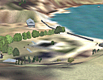
This replaces all my previous Pakatoa Island and Hauraki Gulf sceneries. You must have Christian Stock's NZ mesh in the form of "Mountains of New Zealand" and topo in the form of "Lakes and Rivers of New Zealand" (payware).
New additions...PAKIHI ISLAND: Small jetty and nearby buildings. TAKANGAROA ISLAND: House on Island. House & Jetty island north of Takangaroa Island. MOTUREKAREKA ISLAND: Wreck of the Rewa. PONUI ISLAND: Chamberlain's Bay Airstrip. Chamberlain's Donkey Farm. Third Bay Airstrip. Motunau Bay Jetty. KARAMURAMU ISLAND: Jetty and quarry. ROTOROA ISLAND: Rotoroa Jetty. MOTUIHE ISLAND: Motuihe Wharf.
| Filename: | Hauraki_Gulf_v6.zip |
| License: | Freeware |
| Added: | 17th April 2010, 16:10:12 |
| Downloads: | 218 |
| Author: | Godfrey Tier |
| Size: | 6.61 MB |


© 2001-2026 AVSIM Online
All Rights Reserved
Privacy Policy |