
Where Flight Simulation Enthusiasts Gather from Around the World!
AVSIM Library - Search Results

| Category: Flight Simulator 2004 - Scenery | |
| Society Islands, French Polynesia Mesh |

|
File Description:
High-resolution, hand edited mesh of the Society Islands (French Polynesia), LOD 10 3.75 arc second resolution. The single bgl file covers the islands of Tahiti (NTAA), Moorea (NTTM), Huahine (NTTH), Raiatea (NTTR), Bora Bora (NTTB) and Maupiti (NTTP).
| Filename: | Society_Islands_French_Polynesia_Mesh.zip |
| License: | Freeware |
| Added: | 23rd January 2004, 01:04:31 |
| Downloads: | 13,043 |
| Author: | Rolf Keibel |
| Size: | 475.57 KB |
| Category: Flight Simulator 2004 - Scenery | |
| Proyecto Mexico Real LOD8 (MESH) |
|
Images related to this file:
File Description:
Terrain Mesh that covers the entirety of Mexican Territory and related bordering U.S., Guatemala and Belize areas, part of the "Proyecto Mexico Real" project, compiled at LOD8 (4.96 arcseconds in latitude and 6.6 arcseconds in longitude) resolution from INEGI data. Intended to enhance the virtual flying experience with the more detailed LOD9 and LOD10 versions compiled from the same data. Compatible backwards with Flight Simulator 2000, Flight Simulator 2002 and Combat Flight Simulator 2. (Re-upload due to AVSIM hack)
| Filename: | Proyecto_Mexico_Real_LOD8_MESH.zip |
| License: | Check within download |
| Added: | 23rd January 2010, 11:37:33 |
| Downloads: | 3,613 |
| Author: | Juan Jose Galvan Bautista |
| Size: | 56.76 MB |
| Category: Flight Simulator 2004 - Scenery | |
| Iran SRTM Mesh : South-East |
|
File Description:
This mesh covers the south-eastern parts of Iran which weren't alreasy covered by my Baluchistan mesh. Major cities around are: Bam, Jask.
Based on SRTM Data (3 arcsec, 90m) and sampled to LOD9 resolution (76m) using Matthew Styles's program "SRTM To BGL v1.04".
Biggest SRTM "holes" (void data) were patched with SRTM 30-arcsec dataset thanks to John Child's beautiful and powerful "Blackart" utility.
| Filename: | Iran_SRTM_Mesh__SouthEast.zip |
| License: | Freeware, limited distribution |
| Added: | 18th August 2005, 16:58:55 |
| Downloads: | 2,878 |
| Author: | Yohann Baptiste |
| Size: | 18.45 MB |
| Category: Flight Simulator X - Scenery | |
| South America Mesh Scenery, MeshX_F3 |
|
File Description:
Mesh terrain scenery for the whole continental South America, based on SRTM 90m
dem geotiff files resampled to 76 meter of horizontal resolution (LOD 9).
The new files have improved the vertical resolution from 16m to 10m, resulting
in more details and accuracy over previous versions. There are 50 files, compatible
with FS9 and FS X, identified in a map by column letter and line number, covering the
contiguous countries and states. Boundaries: N = 0º 0' S; S = 5º 37.5' S;
E = 33º 45' W; W = 41º 15' W;
| Filename: | South_America_Mesh_Scenery_MeshX_F3.zip |
| License: | Freeware |
| Added: | 28th October 2006, 10:09:48 |
| Downloads: | 1,415 |
| Author: | Oséas Dourado and José Lôbo |
| Size: | 10.96 MB |
| Category: Flight Simulator 2004 - Scenery | |
| "Himalayan Peaks" LOD10 Mesh, Volume 8 - Tirich Mir and Pamir |
|
Images related to this file:
File Description:
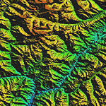
Highly detailed terrain mesh of the Tirich Mir and Pamir areas, N36-39 E71-74. The files in this package are based on Shuttle Radar (SRTM) Version 2 data but with many of the void areas, especially the most significant sections, filled with elevation data generated from topographic maps by Jonathan de Ferranti. While Jonathan's work is unrelated to flight simulation he kindly gave me permission to compile his data for use in FS. The result is a wonderful improvement in detail and accuracy over any existing mesh file, freeware or commercial, based on SRTM or DTED data alone.
Due to the large area of the Himalayas I've compiled the source data as two separate series: the "Himalayan Peaks" series covers prominent mountains and ranges in higher detail and locally overrides any existing LOD9 terrain mesh. In addition, a LOD9 "base mesh" series covering the entire Himalayas will be available for those who do not yet have an add-on terrain mesh of these beautiful mountains.
| Filename: | Himalayan_Peaks_LOD10_Mesh_Volume_8__Tirich_Mir_an.zip |
| License: | Freeware, limited distribution |
| Added: | 29th May 2010, 08:52:47 |
| Downloads: | 9,104 |
| Author: | Holger Sandmann, Jonathan de Ferranti |
| Size: | 47.94 MB |
| Category: Flight Simulator 2004 - Scenery | |
| Colombian Airports - Update |
|
File Description:
This is an update to my previous Colombian Airports upload colapts1.zip.
The update contains mainly some navaid corrections to SKFL, SKIB, and SKVP, and adds the airport SKSJ Jorge E. Gonzales of San Jose del Guaviare; this is now at the correct location and altitude and has buildings, objects, and landclass added. It is for FS9 default scenery and the Colombia freeware mesh by Raimondo Taburet. However, the scenery should also work with the default or any other mesh but I have not tested it.
However, please NOTE:
that in the default scenery without mesh the airport SKSJ will be below the rest of the surface whereas with the mesh, the airport will be at the same altitude as the rest of the scenery with the exception of the river which now runs at a higher (the default) altitude (see screenshots). For me flying without the mesh does not make any sense, so I live with that restriction. If you don't like it, you can always delete or deactivate the files starting with "SKSJ".
| Filename: | Colombian_Airports__Update.zip |
| License: | Freeware |
| Added: | 10th September 2014, 14:50:05 |
| Downloads: | 1,437 |
| Author: | Detlev J. Rohmer |
| Size: | 5.4 MB |
| Category: Flight Simulator 2004 - Scenery | |
| Ile d'Aix France Photo real |
|
File Description:
Photo scenery of "Ile d'Aix", small island between La Rochelle and Fort Boyard France.
Includes no mesh but provides customized autogen.
| Filename: | Ile_dAix_France_Photo_real.zip |
| License: | Freeware |
| Added: | 8th July 2006, 13:43:19 |
| Downloads: | 1,725 |
| Author: | Alain Nicco |
| Size: | 344.94 KB |
| Category: Flight Simulator X - Scenery | |
| Horn Of Africa Mesh, part 2/3 |
|
Images related to this file:
File Description:
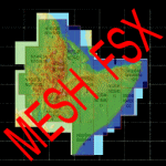
Part 2 of 3: Mesh (lod 1 to 9) of the "Horn Of Africa": Ethiopia, Erythrea, Djibouti and Somalia. (Re-upload)
| Filename: | Horn_Of_Africa_Mesh_part_23.zip |
| License: | Freeware, limited distribution |
| Added: | 10th June 2010, 08:59:50 |
| Downloads: | 2,093 |
| Author: | Marcel "Teutonique" Wislet |
| Size: | 88.72 MB |
| Category: Flight Simulator X - Scenery | |
| Horn Of Africa Mesh, part 3/3 |
|
Images related to this file:
File Description:
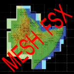
Part 3 of 3 : Mesh (lod 1 to 9) of the "Horn Of Africa": Ethiopia, Erythrea, Djibouti and Somalia. (Re-upload)
| Filename: | Horn_Of_Africa_Mesh_part_33.zip |
| License: | Freeware, limited distribution |
| Added: | 10th June 2010, 09:01:32 |
| Downloads: | 2,076 |
| Author: | Marcel "Teutonique" Wislet |
| Size: | 68.12 MB |
| Category: Flight Simulator X - Scenery | |
| Horn Of Africa Mesh, part 1/3 |
|
Images related to this file:
File Description:

Part 1 of 3: Mesh (lod 1 to 9) of the "Horn Of Africa": Ethiopia, Erythrea, Djibouti and Somalia. (Re-upload)
| Filename: | Horn_Of_Africa_Mesh_part_13.zip |
| License: | Freeware, limited distribution |
| Added: | 10th June 2010, 08:57:38 |
| Downloads: | 2,252 |
| Author: | Marcel "Teutonique" Wislet |
| Size: | 82.73 MB |


© 2001-2026 AVSIM Online
All Rights Reserved
Privacy Policy |