
Where Flight Simulation Enthusiasts Gather from Around the World!
AVSIM Library - Search Results

| Category: Flight Simulator 2004 - Scenery | |
| South West Islands, Japan and Taiwan Ver.3.0 |

|
Images related to this file:
File Description:
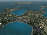
FS2004 Scenery SWIJT2004 Ver 3.0 (South West Islands, Japan and Taiwan)
These files improve specific scenerys (South West Islands of Japan and Taiwan, Asia) of FS2004. Included islands: Ohsumi Islands, Tokara Islands, Amami Islands, Okinawa lands, Kerama-Kume Islands, Miyako Islands, Yaeyama Islands and Taiwan Island.
In this scenery design, the coastline was reproduced as exactly as possible, following the specification of FS2004. Moreover, 90m mesh geographical data is reproduced by
using SRTM 3arc/sec. Correction of missing holes is perfect.
==NOTAM== I exhibited "SWIJ2k4.zip" on August 26, 2004.
However, it became clear that some of files of "SWIJ2k4" are infringing on the opyright of Microsoft. Then, I stopped public presentation of "SWIJ2k4". I apologize for having
made you trouble to those who already downloaded "SWIJ2k4.zip". New "SWIJT2k4.zip" is vast scenery which covered South West Islands, Japan and Taiwan Island. Please install new "SWIJT2k4".
By Kazuo Kawamura
| Filename: | South_West_Islands_Japan_and_Taiwan_Ver30.zip |
| License: | Freeware, limited distribution |
| Added: | 4th December 2011, 00:05:05 |
| Downloads: | 7,745 |
| Author: | Kazuo Kawamura |
| Size: | 20.5 MB |
| Category: Prepar3D V1-4 - Scenery | |
| Square Kilometre Array (MeerKAT) – South Africa |
|
Images related to this file:
File Description:

This scenery is of the MeerKAT radio telescope site (originally the Karoo Array Telescope – KAT but was changed to MeerKAT, meer=more) when the project was expanded to 64 dishes. It forms part of an international Square Kilometre Array (SKA) project. It is situated in the Karoo near the town of Carnarvon. The scenery includes the landing strip just North East of the biggest concentration of dishes. I could not find a code for this strip and called it FAKA (MeerKAT SKA), or take off from Carnarvon (FACN) and fly a heading of 320 degrees for 73 km. The scenery was designed and tested for P3D V5 to work with the ORBX Africa LC and Pilots NG2020 mesh products. I am not sure what the actual site would look like at night, but I included some night lighting to make the array visible after dark.
| Filename: | Square_Kilometre_Array_MeerKAT__South_Africa.zip |
| License: | Freeware |
| Added: | 14th August 2020, 22:53:38 |
| Downloads: | 100 |
| Author: | Johan Pienaar |
| Size: | 20.33 MB |
| Category: Flight Simulator 2004 - Scenery | |
| Tokyo Bay 2005 |
|
Images related to this file:
File Description:
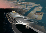
FS2004 Scenery Tokyo Bay Scenery 2005 Ver. 5.0
This add-on scenery improves specific scenerys (Tokyo Bay, Japan) of FS2004.
There are a lot of reclaimed land in Tokyo Bay.
They form an artificial peculiar coastline. This scenery reproduces these coastlines precisely.
And, this scenery reproduces the Keihin industrial area and the Keiyo industrial area in Tokyo Bay located west and east. In this scenery design, the coastline was reproduced as exactly as possible, following the specification of FS2004.
Moreover, 90m mesh geographical data is reproduced by using SRTM 3arc/sec.
The range of detailed coastline and 90m digital elevation data is as follows:
** [detailed coastline] N33:45 E138:45 to N36:55 E141:05 (included Izu Islands)
** [90m digital elevation data] N33:00 E138:00 to N37:00 E141:00 --
The Tokyo Wan AquaLine is arranged in the exact location. By Kazuo Kawamura
| Filename: | Tokyo_Bay_2005.zip |
| License: | Freeware, limited distribution |
| Added: | 3rd December 2011, 23:51:31 |
| Downloads: | 11,791 |
| Author: | Kazuo Kawamura |
| Size: | 9.74 MB |
| Category: Flight Simulator 2004 - Scenery | |
| Airstrips of Southern Germany |
|
Images related to this file:
File Description:
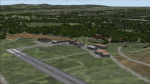
The next my Western Europe airstrips project, herewith about 170 small airfields, mostly in Baden-Wurttemberg and Bavaria, each enhanced with buildings, taxiways, parking spaces and aprons as appropriate, to further facilitate the generation of lightweight AI traffic in the area, without overloading the more major airfields.
Again, there's no photo-realism here, just a selection of basic 'generic' buildings, more or less accurately sized and placed to reflect the airfield layout as seen on on-line satellite imagery and aerial photography. These buildings have minimal effect on frame-rates, so are ideal for this kind of job. The airfields are aligned as well as possible with the roads etc. in UT Europe and the Genesis Europe mesh, but should mostly be fine in a default installation or other configuration.
Please read the rest of this "blurb" in the included text file. There may be some details of note or interest.
| Filename: | Airstrips_of_Southern_Germany.zip |
| License: | Freeware |
| Added: | 25th December 2024, 20:54:30 |
| Downloads: | 128 |
| Author: | Chris Eve |
| Size: | 2.84 MB |
| Category: Prepar3D V1-4 - Scenery | |
| Airport Kassel EDVK |
|
Images related to this file:
File Description:
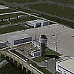
The 5th version of this Add-On for P3Dv4 approaches the reality with photo-realistic ground textures, accurate buildings, runways, taxiways and the official approaches with waypoints, localizers and glide paths. More than 1200 objects, 60 individual scenery-models, approx. 100 custom ground polygons and lines have been created. One big problem was to adopt the terrain mesh to fit the new airport. The actual state of January 2019 has been adapted to the scenery. Photorealistic ground textures have been reworked. High resolution textures you find at the aprons and the vehicle parking areas at the General Aviation and Business Terminals. Accurate Night Lighting and winter textures have been added. All buildings, Hangars and a lot of objects have been designed individually (no library objects). Even the taxiway and apron markings are hand-made. For FSX and P3Dv1 a different version can be downloaded. Works with VFR Germany and ORBX Northern Germany,
| Filename: | Airport_Kassel_EDVK.zip |
| License: | Freeware, limited distribution |
| Added: | 9th February 2019, 19:40:06 |
| Downloads: | 2,796 |
| Author: | Albert Claudi |
| Size: | 105.16 MB |
| Category: Flight Simulator X - AFCAD Files | |
| Malone Airport (NJ61), NJ |
|
File Description:
Located 02 miles E of Frenchtown, New Jersey on 45 acres of land, Malone is a private airport with two turf strips, the longest of which is 2400' in length. There are no services offered, although there is room next to the existing planes to park if you wish - collisions are disabled with the aircraft. Both runways have their hard surfaces removed so turn your mesh settings as high as possible. Both runways slope down from the hangar/house area. Airport is unlit and daytime VFR operations only are recommended.
Scenery constructed with use of satellite images/streetview/aerial photos - the author has not been there in person.
This scenery is meant to be used in conjunction with MegaScenery Earth New York 007. It is not required, but apron use is minimized to allow satellite scenery to show through as much as possible, and objects are placed based on the MSE textures - lack of it may make scenery look out of place.
| Filename: | Malone_Airport_NJ61_NJ.zip |
| License: | Freeware |
| Added: | 20th September 2011, 13:57:18 |
| Downloads: | 284 |
| Author: | Drew Sikora |
| Size: | 958.34 KB |
| Category: Flight Simulator 2004 - Scenery | |
| Airstrips east of the Alps |
|
File Description:
A collection of over 70 small airfields in Hungary, Slovakia, Slovenia and Croatia, many of which aren't featured in FS2004, each enhanced with taxiways, parking spaces, buildings etc. and aprons as appropriate, to fill in a few gaps to the north-east of Italy and to allow the generation of lightweight GA AI traffic in this area and into the adjacent countries.Again, there's no photo-realism here, just a selection of basic 'generic' buildings, more or less accurately sized and placed to reflect the airfield layout as seen on on-line satellite imagery and aerial photography. These buildings have minimal effect on frame-rates, so are ideal for this kind of job. The airfields are aligned as well as possible with the roads etc. in UT Europe, where applicable, and the Genesis Europe mesh, but should mostly be fine in a default installation or other configuration.
| Filename: | Airstrips_east_of_the_Alps.zip |
| License: | Freeware |
| Added: | 12th September 2025, 13:29:14 |
| Downloads: | 58 |
| Author: | Chris Eve |
| Size: | 785.49 KB |
| Category: Flight Simulator X - AFCAD Files | |
| Var-Sky Airport (JY08), NJ |
|
File Description:
Located 02 miles E of Woodstown, New Jersey on 38 acres of land, Var-Sky Airport is a private turf strip 1165' in length and a slightly challenging approach with trees closely bordering the sides of both runway ends. This airport has lighting on the runway however there is no beacon and the windsock (located atop the hangar) is not lit. There are no services offered for transient aircraft. There is no hard surfaced runway so having your terrain mesh settings as high as possible is recommended.
Scenery constructed with use of satellite images/streetview/aerial photos - the author has not been there in person.
This scenery is meant to be used in conjunction with MegaScenery Earth New Jersey/Delaware 004. It is not required, but apron use is minimized to allow satellite scenery to show through as much as possible, and objects are placed based on the MSE textures - lack of it may make scenery look out of place.
| Filename: | VarSky_Airport_JY08_NJ.zip |
| License: | Freeware |
| Added: | 19th April 2011, 06:21:50 |
| Downloads: | 195 |
| Author: | Drew Sikora |
| Size: | 361.96 KB |
| Category: Flight Simulator 2004 - Scenery | |
| Ontario Small Fields in Canada: #04 Stoney Point (Le Cunff) CRML V1 |
|
Images related to this file:
File Description:
This is the fourth in a series of small airfields in southern Ontario, Canada. It is Stoney Point (Le Cunff) CRML, a field near a small town (Stoney Point) close to Lake St Clair. The airfield has a grass runway of 2,250 feet, aligned 18/36; with trees around the house gardens between road and runway the south threshold is displaced by 250 feet. The markers approximately show the touchdown point north of the runway end. Le Cunff is the family name of the owners, included to differentiate between this and another Stoney Point field, CRJ2. I found the default FS9 airfield at the correct elevation of 625 feet, but sitting on a plateau, despite my Genesis Mesh. This looked so unreal that I have revised this to an incorrect lower elevation of 580. So if you find the airfield sitting in a hole in your installation you now know the reason. Let me know, with a screenshot please.
| Filename: | Ontario_Small_Fields_in_Canada_04_Stoney_Point_Le_.zip |
| License: | Freeware, limited distribution |
| Added: | 29th July 2015, 16:08:32 |
| Downloads: | 146 |
| Author: | Roger Wensley |
| Size: | 1.6 MB |
| Category: Flight Simulator 2004 - Scenery | |
| Canlaon Volcano Eruption Scenery |
|
File Description:
Canlaon Volcano is located at the center of Negros Island,Philippines.The twin-peaked massif of Canlaon Volcano (aka Mt. Kanlaon) rises 2,465 meters above the island of Negros just 40-km southwest of the capital Bacolod.This file will add the crater to Canlaon Volcano and will enhance the Landclass surrounding the crater.The crater is real with water.This also adds Visual Effects such as steam,volcanic ashes and lava that will erupt every now and then.Ash falls will fall in the vulnerable surrounding villages of Pula, Malaiba, and Lumanao.The last volcanic activity of Canlaon Volcano recorded by Phivolcs was on June 1-18,2003.
Fly from Bacolod City(RPVB)to Tagbilaran City(RPVT)or Mactan(RPVM) and pass through the highest point of the Island of Negros and behold the beauty of the Canlaon Volcano eruption.
Special steam,ash,and lava effects are visible at daytime and at nighttime.The new Philippine Mesh by Jacques Marie is recommended for achieving realistic topography.You may find it here at avsim,too.
| Filename: | Canlaon_Volcano_Eruption_Scenery.zip |
| License: | Freeware |
| Added: | 10th December 2003, 22:41:38 |
| Downloads: | 3,877 |
| Author: | Ver Walter L. Gulfan |
| Size: | 5.04 KB |


© 2001-2026 AVSIM Online
All Rights Reserved
Privacy Policy |