
Where Flight Simulation Enthusiasts Gather from Around the World!
AVSIM Library - Search Results

| Category: Flight Simulator 2004 - Aircraft Repaints, Textures and Modifications | |
| UK International Airlines Boeing 767-300 |

|
Images related to this file:
File Description:
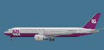
Level-D Boeing 767-300 in fictious former UK International Airlines livery. Reupload due to Avsim hack.
| Filename: | UK_International_Airlines_Boeing_767300.zip |
| License: | Freeware |
| Added: | 20th May 2010, 09:22:12 |
| Downloads: | 238 |
| Author: | John Haugaard, Level-D |
| Size: | 5.41 MB |
| Category: Flight Simulator 2004 - Aircraft Repaints, Textures and Modifications | |
| Jetairfly Boeing 767-300 |
|
File Description:
Level-D Boeing 767-300 in Jetairfly-livery. Reupload!
| Filename: | Jetairfly_Boeing_767300.zip |
| License: | Freeware |
| Added: | 16th May 2010, 23:57:42 |
| Downloads: | 515 |
| Author: | John Haugaard / Level-D |
| Size: | 4.26 MB |
| Category: Flight Simulator X - Aircraft Repaints, Textures and Modifications | |
| Air France Old Livery Collection (Airbus A332 | A342 | A342 Asie | A343) |
|
Images related to this file:
File Description:

This is a repaint collection/pack of Air France aircraft for Thomas Ruth's Airbus A332/A342/A343 series in the Old Livery. Original models created by Thomas Ruth. Repaints by John Hancock. This is a TEXTURES ONLY download, as you are required to install Thomas Ruth's original Airbus Packages before installation. This addon is only compatible with Flight Simulator X Service Pack 1 (SP1) and Service Pack 2 (SP2). Includes added Alpha Channels, fuselage dirt effects, Photoreal windows, and accurate livery details.
(This also contains the A340-200 Asie Version 2.0 and A340-300 Version 3.0 packages).
| Filename: | Air_France_Old_Livery_Collection_Airbus_A332__A342.zip |
| License: | Freeware |
| Added: | 2nd August 2011, 09:35:54 |
| Downloads: | 1,436 |
| Author: | Thomas Ruth / John Hancock |
| Size: | 14.25 MB |
| Category: Flight Simulator X - Aircraft Repaints, Textures and Modifications | |
| MyJet, Citation 510 Mustang - FIX |
|
Images related to this file:
File Description:

This is the final update for the Flight1 Cessna Citation 510 Mustang, "MyJet" livery, with registration number "I-STCB". You will need to download my original repaint file named, "myjet.zip". First of all I want to thank my friend John Sanders from Down Under. He added the final touches to this livery, which helps give it the authentic "MyJet" look, by modifying the exterior cabin exit door signs to match the original once translated in Italian. He also corrected the registration numbers on the VC panel, as well as the 2D panel to match the exterior. Please follow John's instructions for full affect.
| Filename: | MyJet_Citation_510_Mustang__FIX.zip |
| License: | Freeware |
| Added: | 15th September 2011, 14:07:50 |
| Downloads: | 595 |
| Author: | Johnny Rosario, John Sanders |
| Size: | 11.61 MB |
| Category: Flight Simulator 2004 - Scenery | |
| San Luis Valley Regl - KALS |
|
Images related to this file:
File Description:
FS2004 Scenery - San Luis Valley Regional/Bergman Field Airport serves Alamosa and Alamosa County and is owned by the City And County of Alamosa, Colorado, USA. The airport has more than one runway. The longest is a paved runway extending 8800 feet. The facility is at an elevation of 7535 feet at a distance of about 2 miles from Alamosa. The Airport (IATA: ALS, ICAO: KALS), also known as Bergman Field, is a public airport used for general aviation, but is also served by one commercial airline. Created with EZ Scenery. EZ Scenery libraries required. Scenery created over USA Roads. By John B. Loney, Jr.
| Filename: | San_Luis_Valley_Regl__KALS.zip |
| License: | Freeware, limited distribution |
| Added: | 23rd May 2010, 01:31:13 |
| Downloads: | 1,032 |
| Author: | John B. Loney, Jr. |
| Size: | 669.56 KB |
| Category: Flight Simulator 2004 - Scenery | |
| Laramie Regional KLAR |
|
Images related to this file:
File Description:
FS2004 Scenery-Laramie Regional Airport (KLAR) is located in Laramie Wyoming, home of the University of Wyoming, Wyoming Technical Institute and a number of businesses and organizations. Laramie Regional Airport was built in 1934 and was originally named Brees Field, after General Herbert Jay Brees of the US Army. The original hangar still stands today. In 1944, the runways were paved to allow hundreds of B-24 bombers to land at Laramie and bring crews for rest and recuperation to the UW recreation camp in the Snowy Range. In 1945 Summit Airways began to provide passenger service. The Brees Field Airport Board was formed in 1965 to oversee airport operations. In 1992, the airport's board changed the airport's name to Laramie Regional Airport. Created with EZ Scenery by John B. Loney, Jr.
| Filename: | Laramie_Regional_KLAR.zip |
| License: | Freeware, limited distribution |
| Added: | 23rd May 2010, 01:32:22 |
| Downloads: | 1,331 |
| Author: | John B. Loney, Jr. |
| Size: | 835.24 KB |
| Category: Flight Simulator X - Aircraft Repaints, Textures and Modifications | |
| Allegiant Airlines McDonnell Douglas MD-83 (N891GA) |
|
Images related to this file:
File Description:
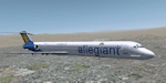
Repaint of the Flight1/Coolsky Super 80 Professional in Allegiant Airlines livery. You must own the payware Flight1/Coolsky Super 80 Professional in order to use these textures. Bump and specular files included. Installation requires the free FSX Repaint Manager from Flight1. Original Classic livery by Jeff Trozzo. Converted to Professional and uploaded with his permission.
| Filename: | Allegiant_Airlines_McDonnell_Douglas_MD83_N891GA.zip |
| License: | Freeware |
| Added: | 29th May 2010, 10:19:03 |
| Downloads: | 403 |
| Author: | Jeff Trozzo, John Patterson |
| Size: | 1.82 MB |
| Category: Flight Simulator X - Scenery | |
| NAS Sunnyvale CA (KNUQ) |
|
Images related to this file:
File Description:

In 1931, the city of Sunnyvale acquired a 1,000 acre (4 km���²) parcel of farmland bordering San Francisco Bay, then "sold" the parcel for $1 to the US government as a home base for the Navy airship USS Macon.
The location proved to be ideal for an airport, since the area is often clear while other parts of the San Francisco Bay are covered in fog. This is due to the Coast Range to the west which blocks the cold oceanic air which is the cause of San Francisco fog.
The base, originally named Airbase Sunnyvale CAL (it was thought that calling it Mountain View would cause officials to fear airships colliding with mountainsides), was accepted by the U.S. Navy on February 12, 1931 and dedicated NAS Sunnyvale on April 12, 1933. After the death of Rear Admiral William A. Moffett, in the loss of the USS Akron on April 4, 1933, the Air Field (but not the Naval Air Station) was renamed Moffett Field on September 1, 1933.
| Filename: | NAS_Sunnyvale__CA_KNUQ.zip |
| License: | Freeware |
| Added: | 6th October 2010, 00:16:16 |
| Downloads: | 769 |
| Author: | John Stinstrom & Jim Dhaenens |
| Size: | 7 MB |
| Category: Flight Simulator 2004 - Scenery | |
| St Marys Municipal KOYM |
|
Images related to this file:
File Description:
FS2004 Scenery - St. Marys Municipal Airport (IATA: STQ, ICAO: KOYM, FAA LID: OYM) is a city-owned public-use airport three miles (5 km) southeast of the central business district of St. Marys, a city in Elk County, Pennsylvania, United States..[1] This general aviation airport is located off South Michael Road in St. Marys. St. Marys Municipal Airport covers an area of 283 acres (115 ha) and contains one runway designated 10/28 with a 4,300 x 75 ft (1,311 x 23 m) asphalt pavement. For the 12-month period ending October 31, 2007, the airport had 6,730 aircraft operations, an average of 18 per day: 85% general aviation, 15% air taxi and
| Filename: | St_Marys_Municipal_KOYM.zip |
| License: | Freeware, limited distribution |
| Added: | 2nd November 2010, 01:35:14 |
| Downloads: | 310 |
| Author: | John B. Loney, Jr. |
| Size: | 947.83 KB |
| Category: Flight Simulator X - Scenery | |
| St Marys Municipal KOYM |
|
Images related to this file:
File Description:
FSX Scenery - St. Marys Municipal Airport (IATA: STQ, ICAO: KOYM, FAA LID: OYM) is a city-owned public-use airport three miles (5 km) southeast of the central business district of St. Marys, a city in Elk County, Pennsylvania, United States..[1] This general aviation airport is located off South Michael Road in St. Marys. St. Marys Municipal Airport covers an area of 283 acres (115 ha) and contains one runway designated 10/28 with a 4,300 x 75 ft (1,311 x 23 m) asphalt pavement. For the 12-month period ending October 31, 2007, the airport had 6,730 aircraft operations, an average of 18 per day: 85% general aviation, 15% air taxi and
| Filename: | St_Marys_Municipal_KOYM.zip |
| License: | Freeware, limited distribution |
| Added: | 2nd November 2010, 01:35:54 |
| Downloads: | 536 |
| Author: | John B. Loney, Jr. |
| Size: | 1.06 MB |


© 2001-2026 AVSIM Online
All Rights Reserved
Privacy Policy |